Backcountry Skiing Mount Elbert’s East Ridge, Sawatch Range, Twin Lakes, Colorado
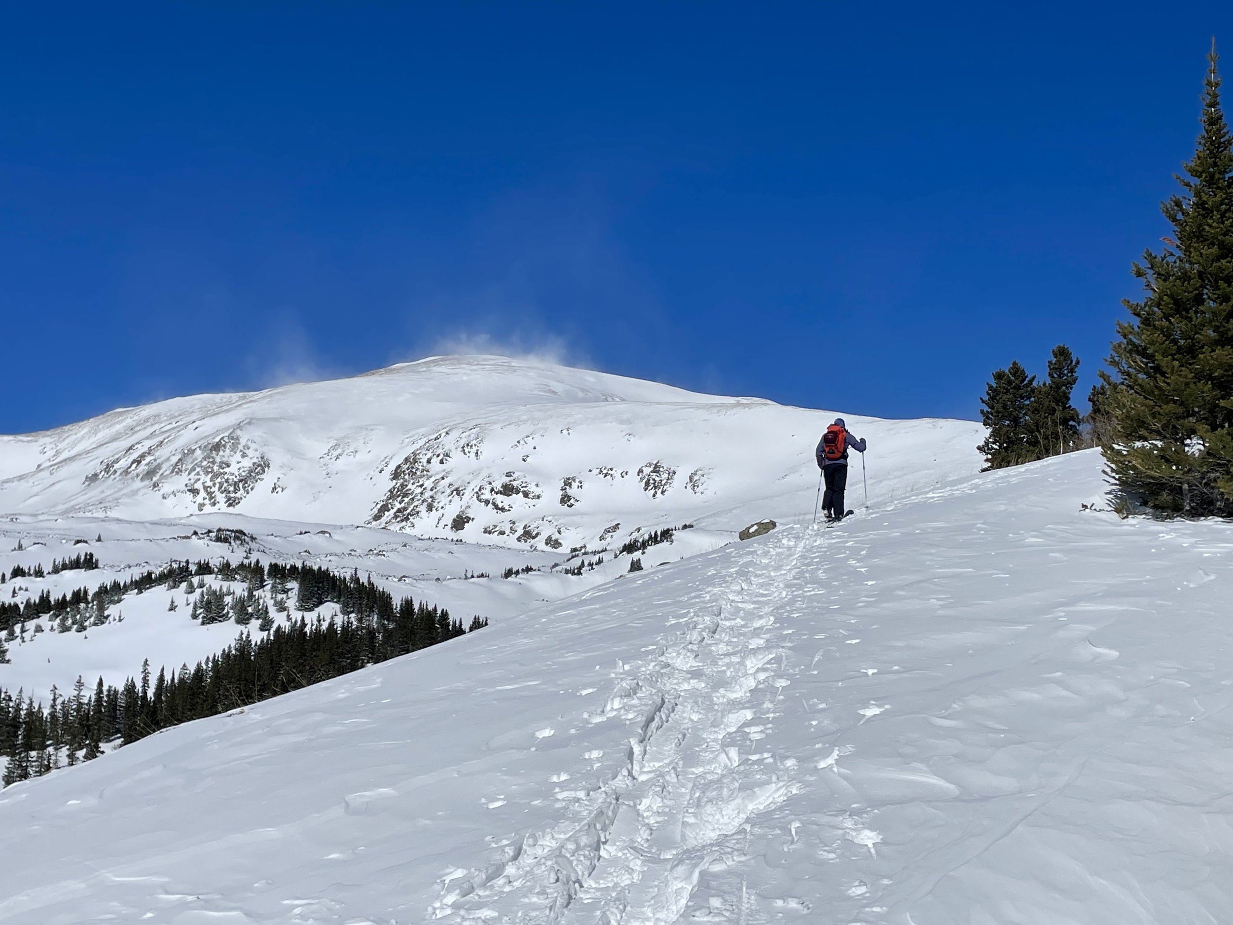
Mike approaching tree line. Strong winds can be seen moving snow along the east ridge
Mount Elbert is the tallest mountain in Colorado, topping out at an elevation of 14,438 feet. Who wouldn’t want to ski the tallest mountain in their state?! Mike and I set out on a morning in early April to try to do just that. We parked at the South Mount Elbert trailhead with the intention of following the South Mount Elbert Trail to the summit. We’d be able to see the Box Creek Couloirs on our way up and based upon the conditions we were seeing, decide if we would ski those or ski back down the way we came.
We started out skinning up a sparsely covered dirt road until we made it to the summer trailhead. From there, we hopped on the Colorado Trail for a little bit until turning off to begin our ascent of the east ridge. The day started out bluebird and calm. We were quickly sweating and were very soon down to our base layers.
As we started approaching the ridge, we could see a fair amount of snow moving from the wind. With Mount Elbert being the highest peak in the state, we were expecting some amount of wind, but we were certainly not prepared for the amount of wind we encountered.
As we got above tree line, the wind really picked up. The ridge line was totally scoured of snow for large stretches, requiring us to take off our skis and walk in our ski boots through these talus fields. Around 13,300 feet, we were finally able to put our skis back on with the hope of skinning to the summit. At this point, the wind was so strong that we would have to get low and brace ourselves when we saw a strong gust coming at us. I literally got blown over several times.
We estimate the wind speeds were somewhere around 80 mph. Frostbite and hypothermia became a serious concerns. We continued on for a little while further, but with the winds not getting any better, we ultimately decided to call it and head back down the way we came at around 13,900 feet. Skiing the Box Creek Couloirs was no longer an option due to our concerns about the amount of snow the wind was moving around and those slopes potentially being wind loaded. While disappointed we turned around ~500 vertical feet from the summit, I believe we made the right decision. Once we got to tree line on our way down, our focus was on warming up and checking that there were no signs of frostbite on exposed skin. By the time we made it back to the car, we were once again sweating. It’s amazing how big of a difference a few thousand feet of elevation can make in the weather conditions. I have a feeling we’ll be attempting Mount Elbert again next spring, perhaps on a much calmer day!
Total Stats: 10.6 miles, 4200 vert. I estimate that had we made it to the top, it would have added another ~1 mile and 500 vert.


