Hike to Columbine Lake & Two 13ers (T11 & UN 13,159), Silverton, Colorado
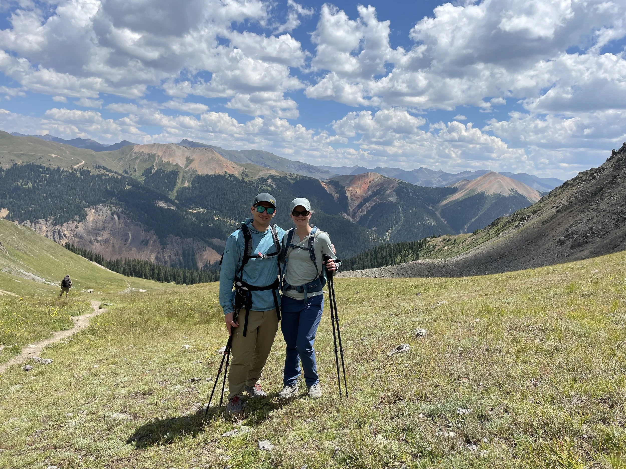
Silverton! My husband and I finally made it to Silverton after having lived in Colorado for several years. We were ready for a week off of work so we booked a last minute hotel in Silverton for the weekend (we would head to Durango from there). We got to our hotel pretty late on Friday night and crashed right away as we were getting up early to do a hike the next day. We had a friend recommend hiking to Columbine Lake so we decided to do that and would look to add on two 13ers in the area if we felt up to it.
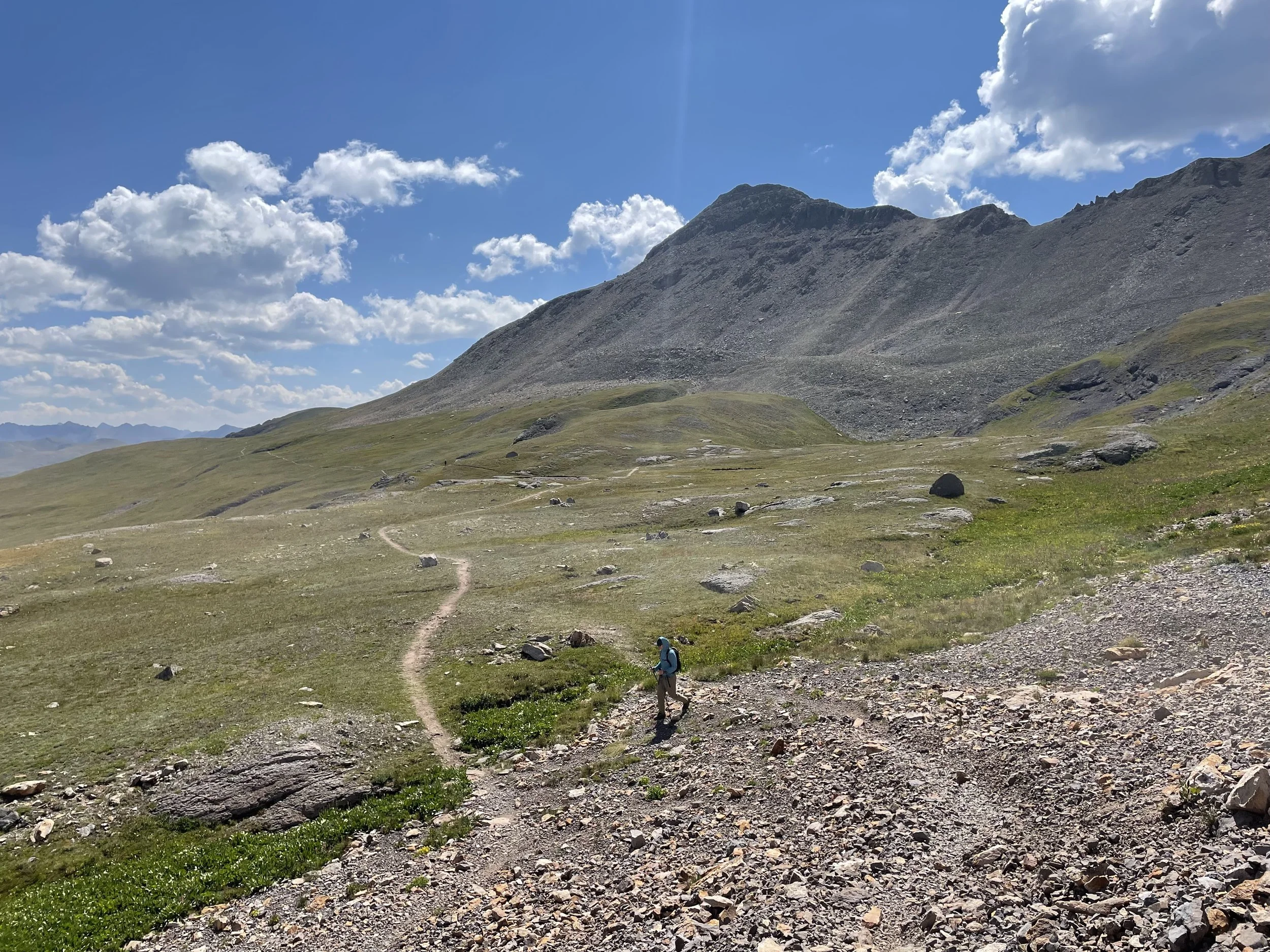
Because we were up so early, we were able to park right at the beginning of where the trail started (there is only room for a few cars). This may have been the steepest and most unrelenting first two miles of a hike I have ever encountered. We gained about 2,000 ft of elevation in those two miles so if you do this hike, come prepared with water and food! I would definitely say doing this hike is worth it though. The trail started in the trees for the first mile or so but then opened up to this beautiful grassy basin and the views from that point on just kept getting prettier. Wildfire smoke this summer has been a big issue, but we somehow got extremely lucky and had a beautiful bluebird day to take in all of the views from this hike.
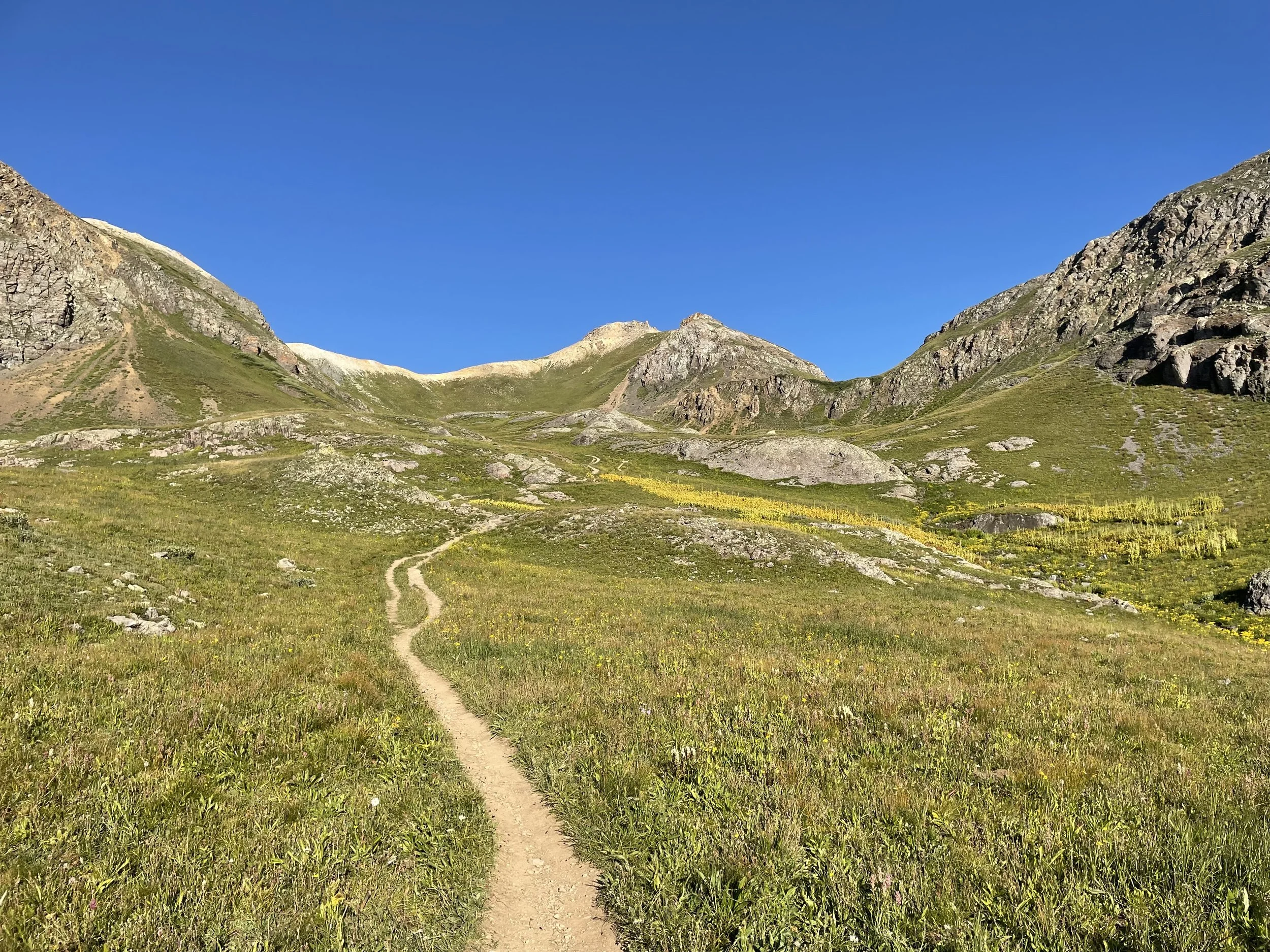
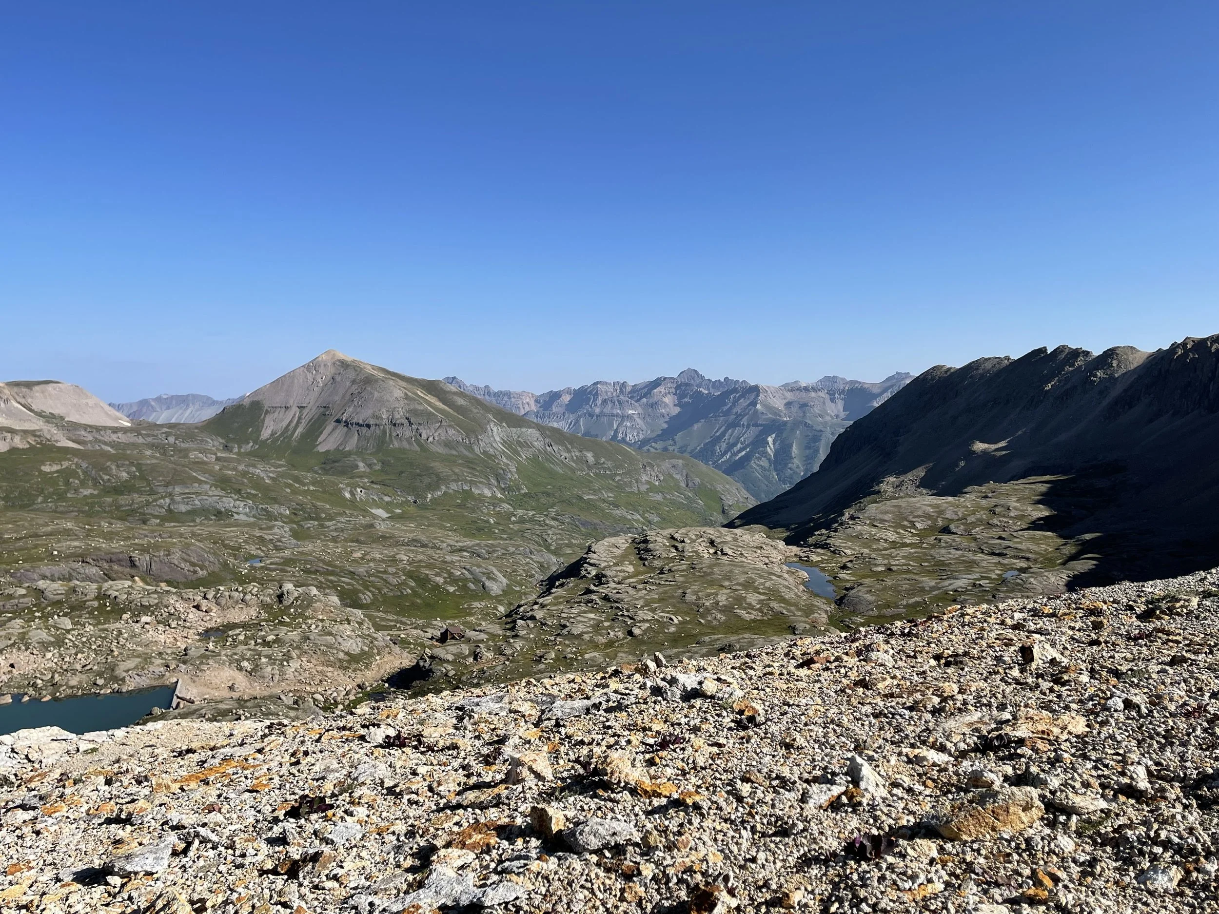
The basin once you get above tree line
Mike looking back at the way we came up
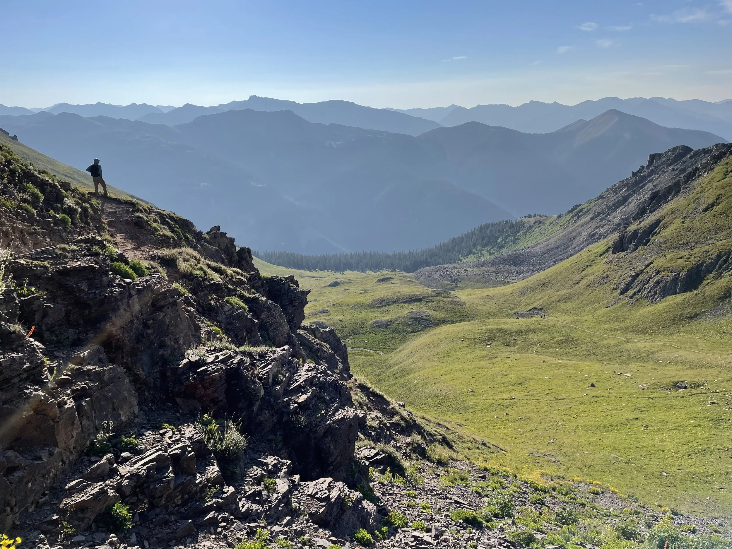
Where the trail finally started leveling out
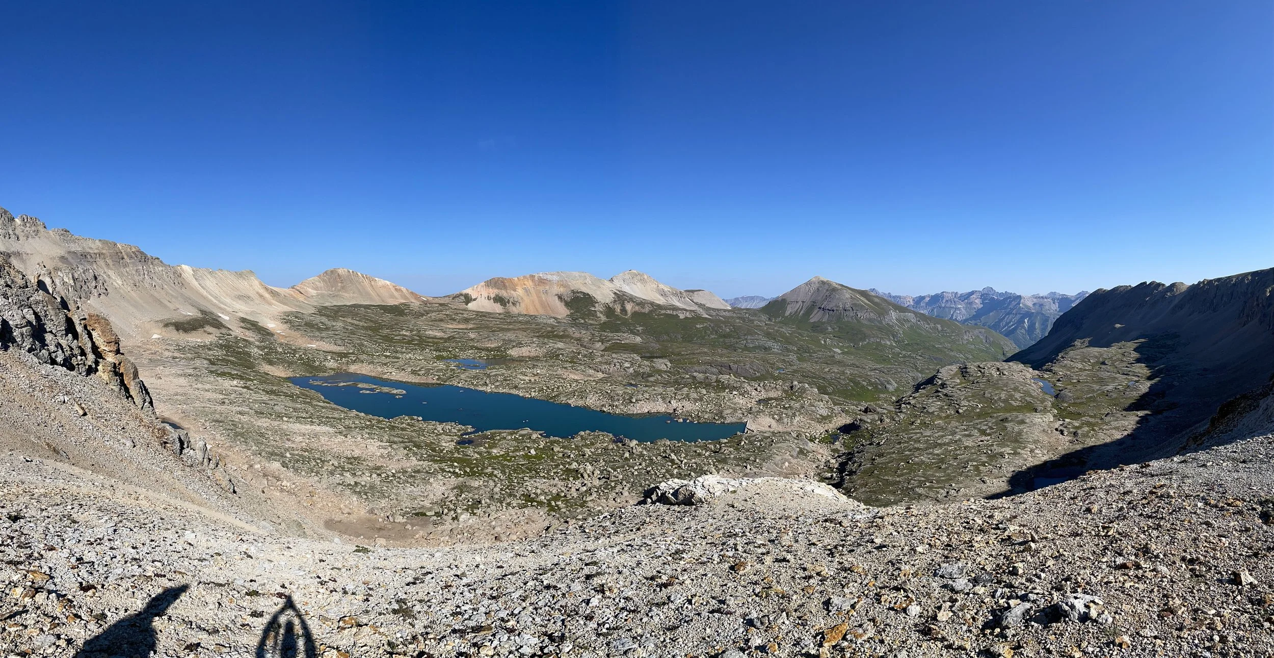
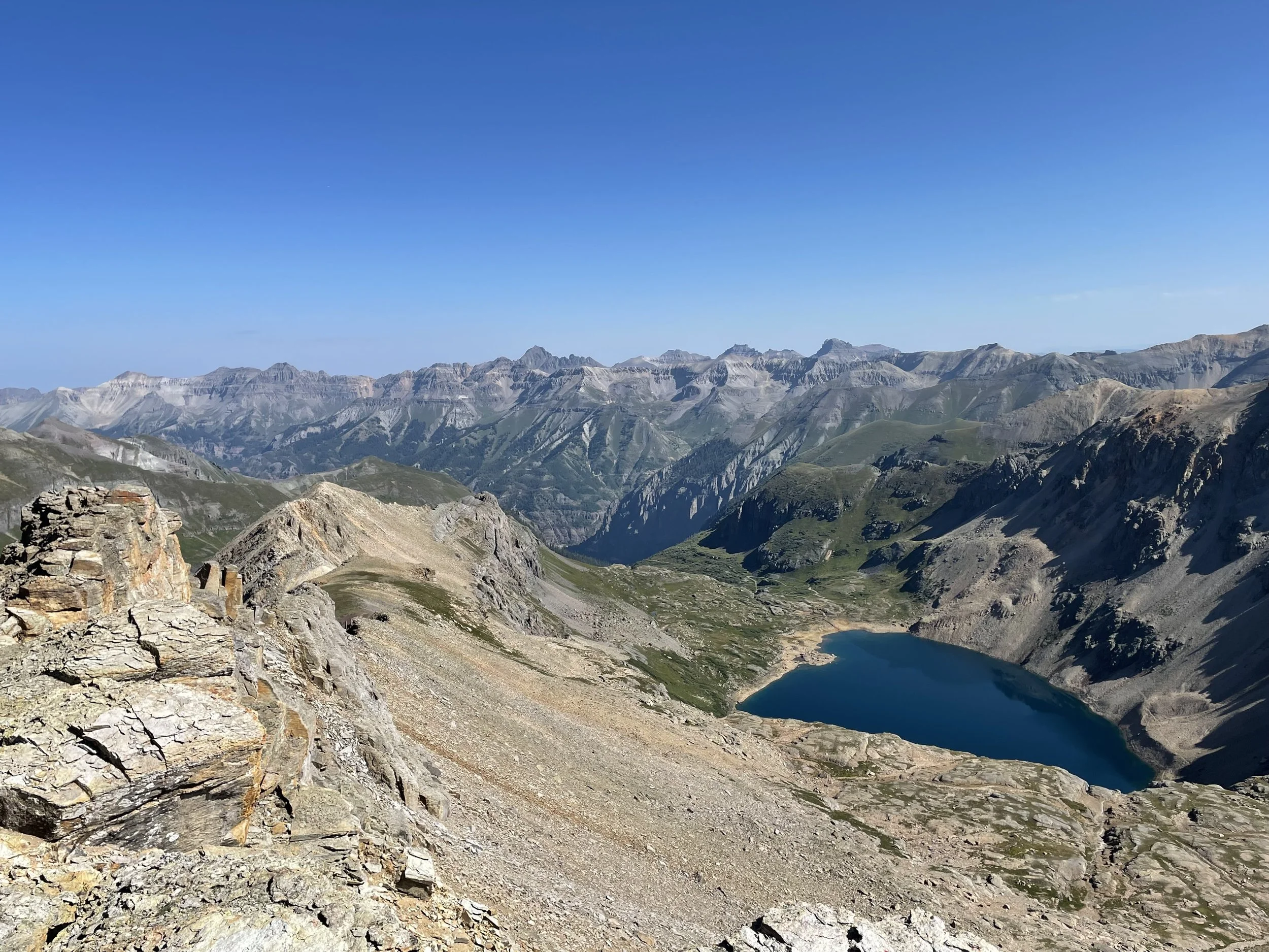
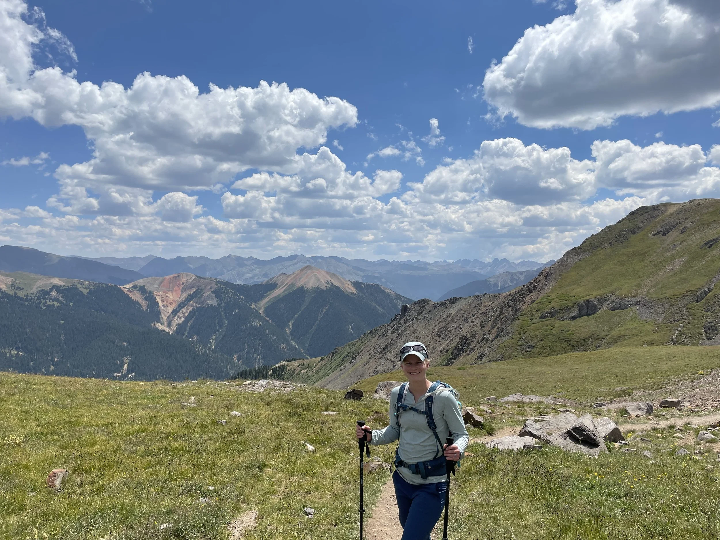
We passed one other couple on the way up, but otherwise had the trail all to ourselves. After the first two miles, the trail really leveled off and allowed us to focus on the views instead of our breathing. Eventually we came to the lake, and I am not exaggerating when I say that it is the bluest lake I have ever seen. The pictures posted on this page are unedited and taken on an iPhone.
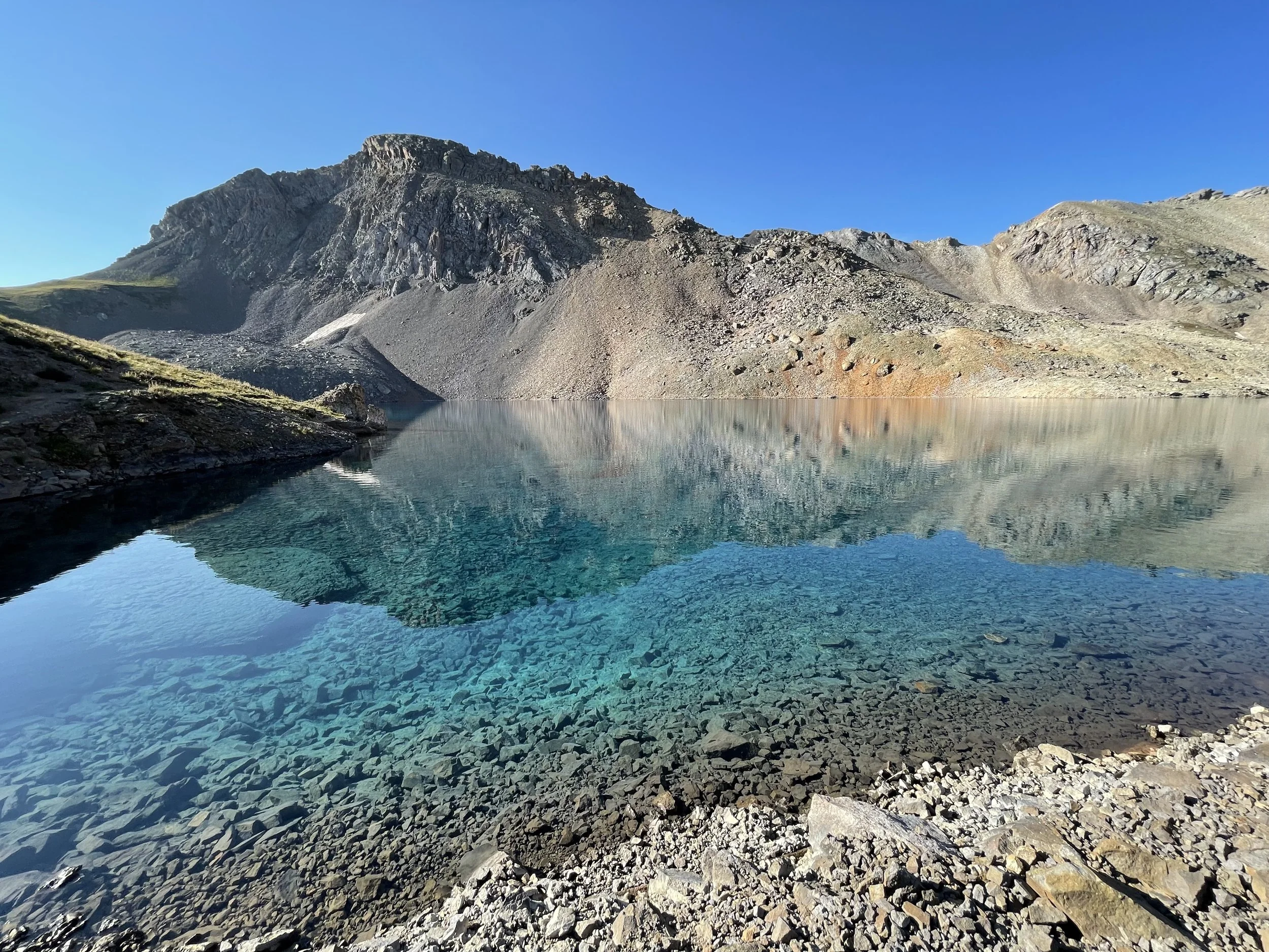
Columbine Lake
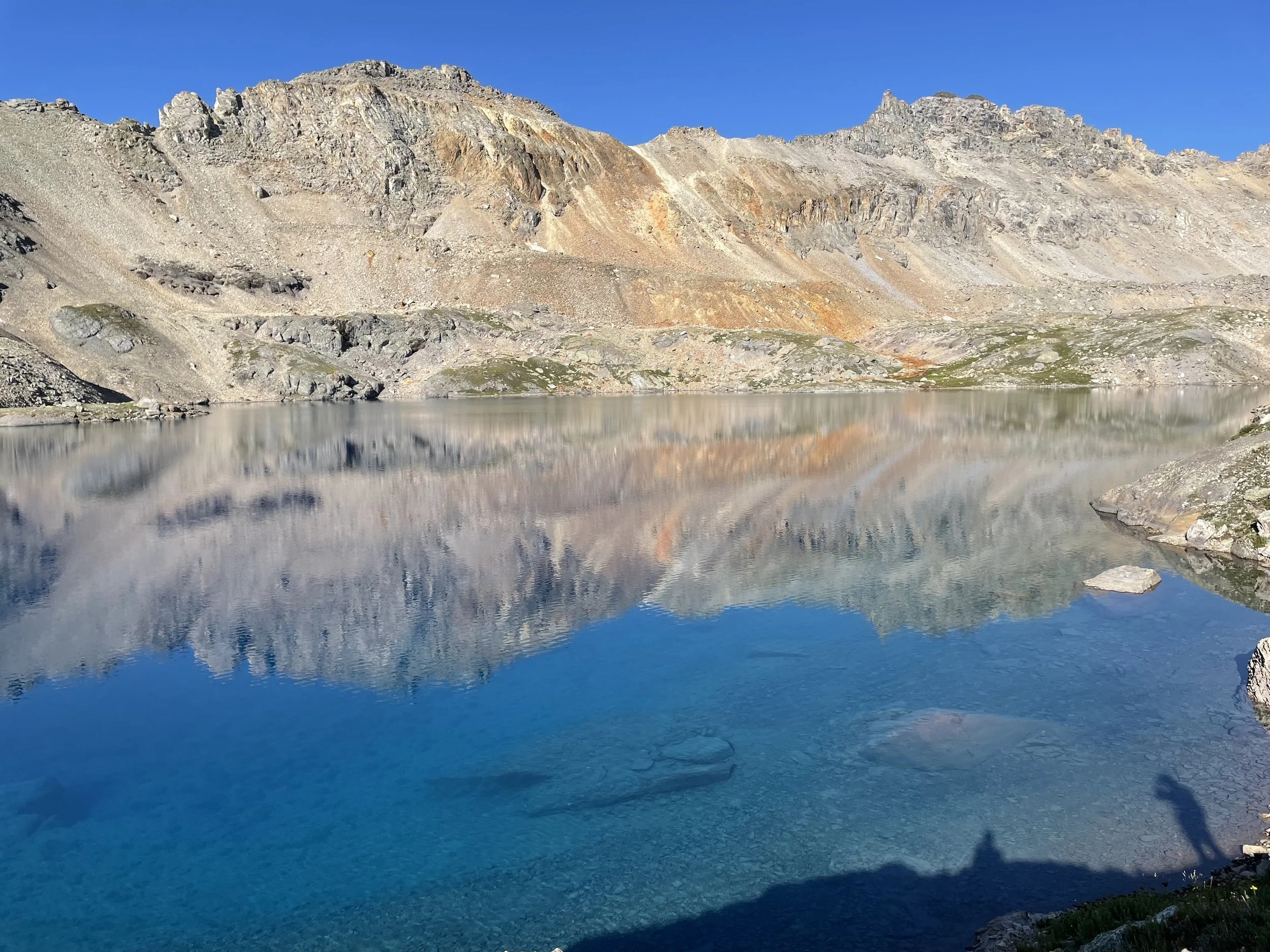
Columbine Lake
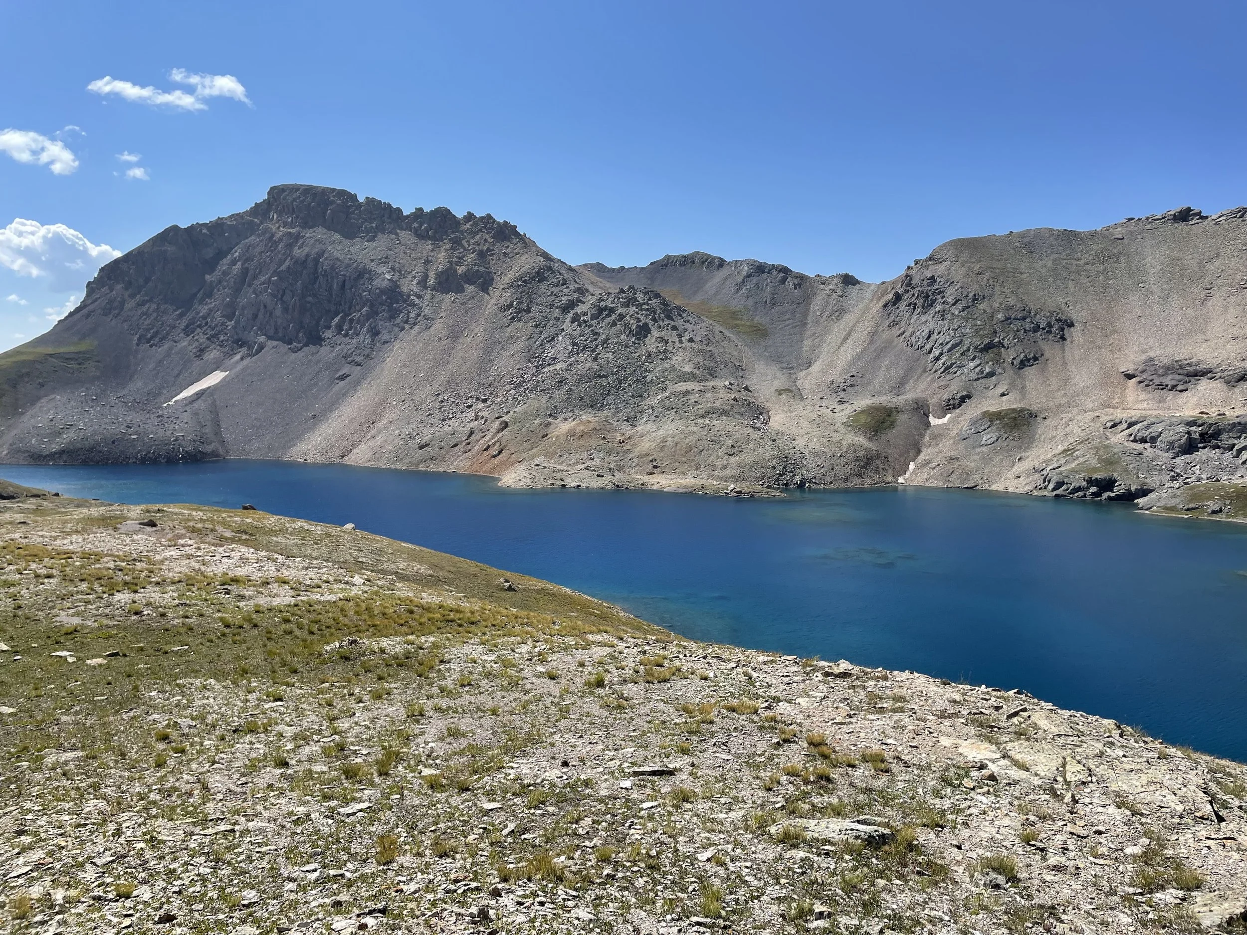
Columbine Lake
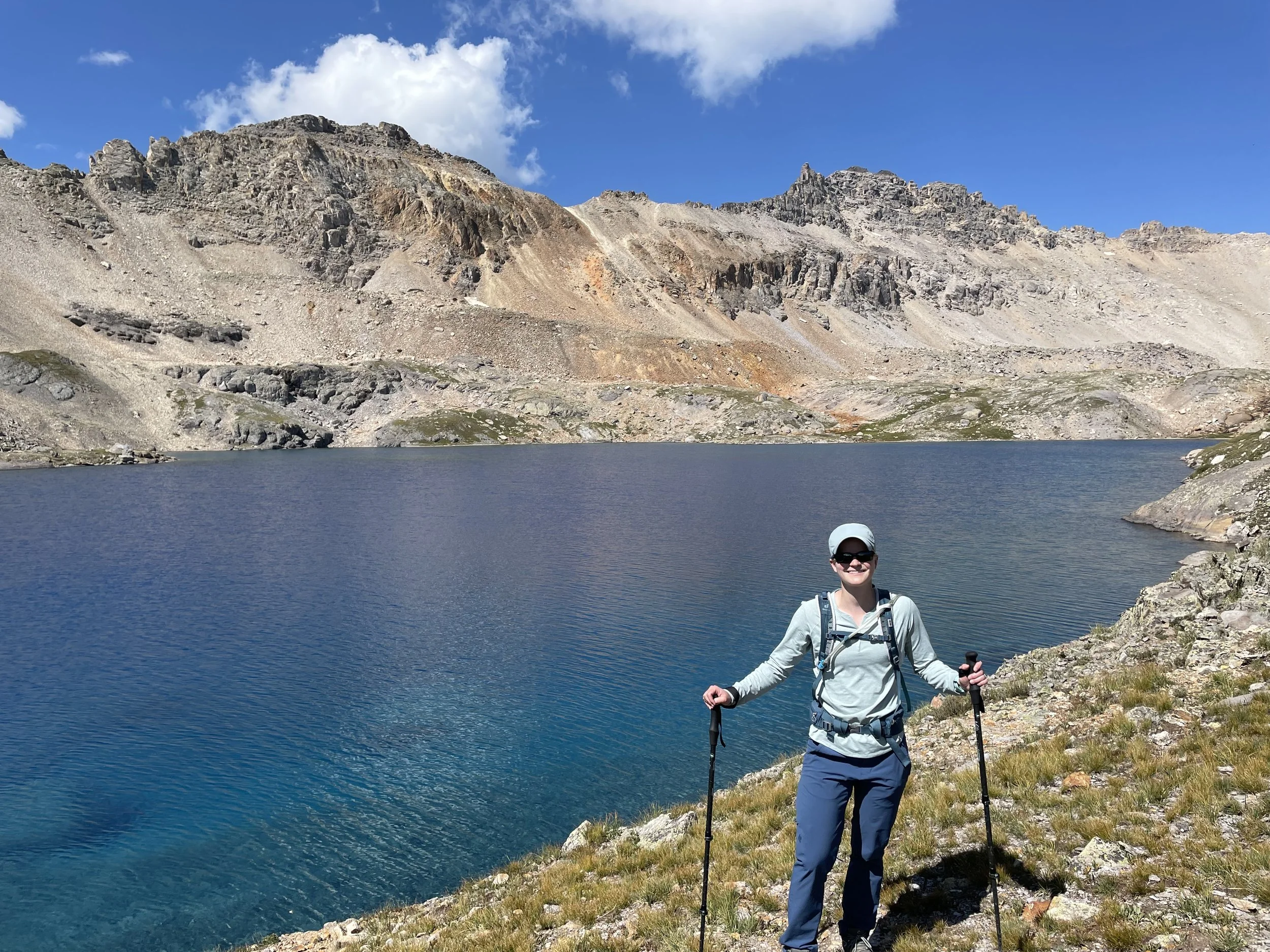
Me in front of Columbine Lake
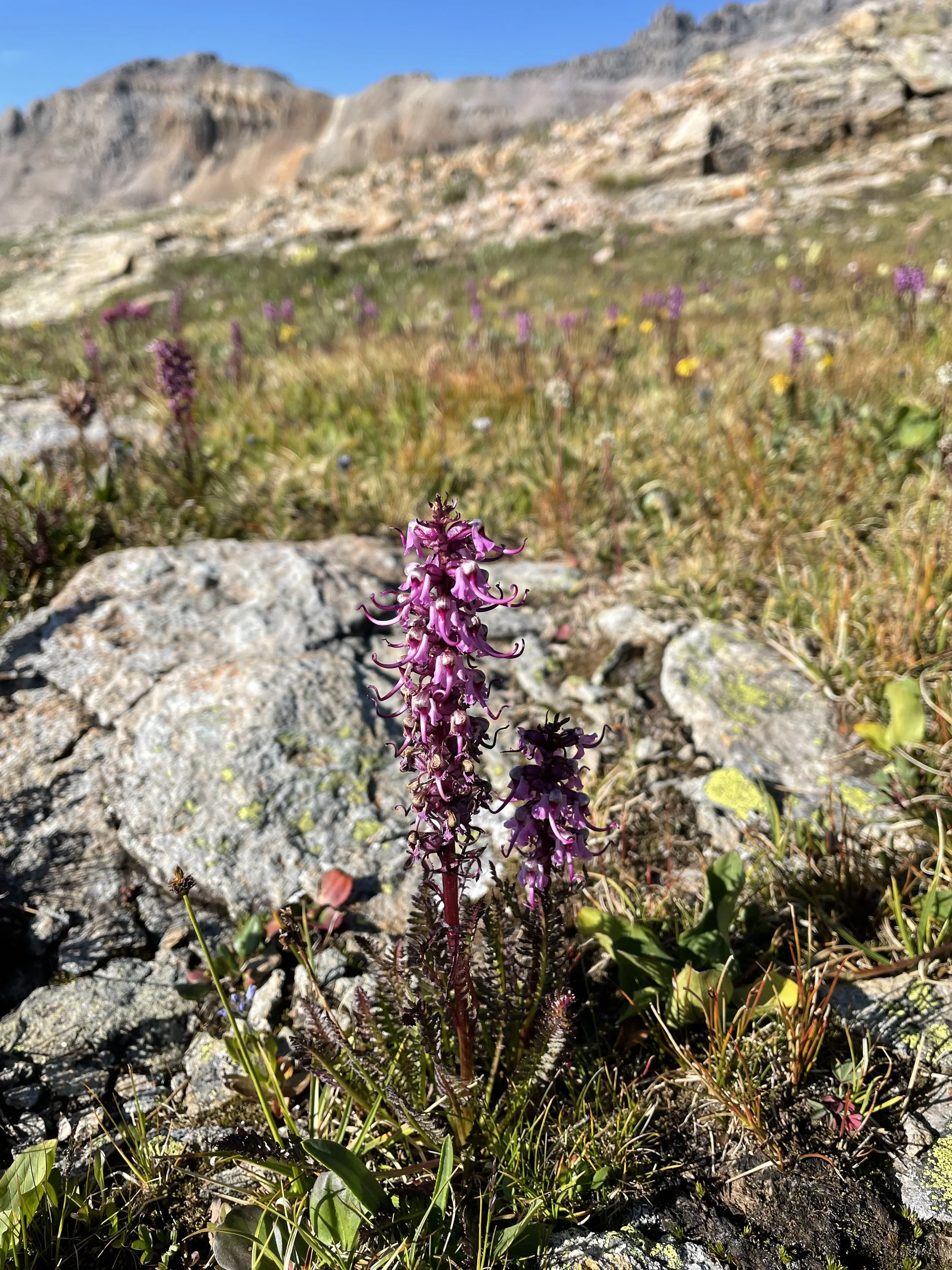
Pink elephants!
One of my favorite wildflowers.
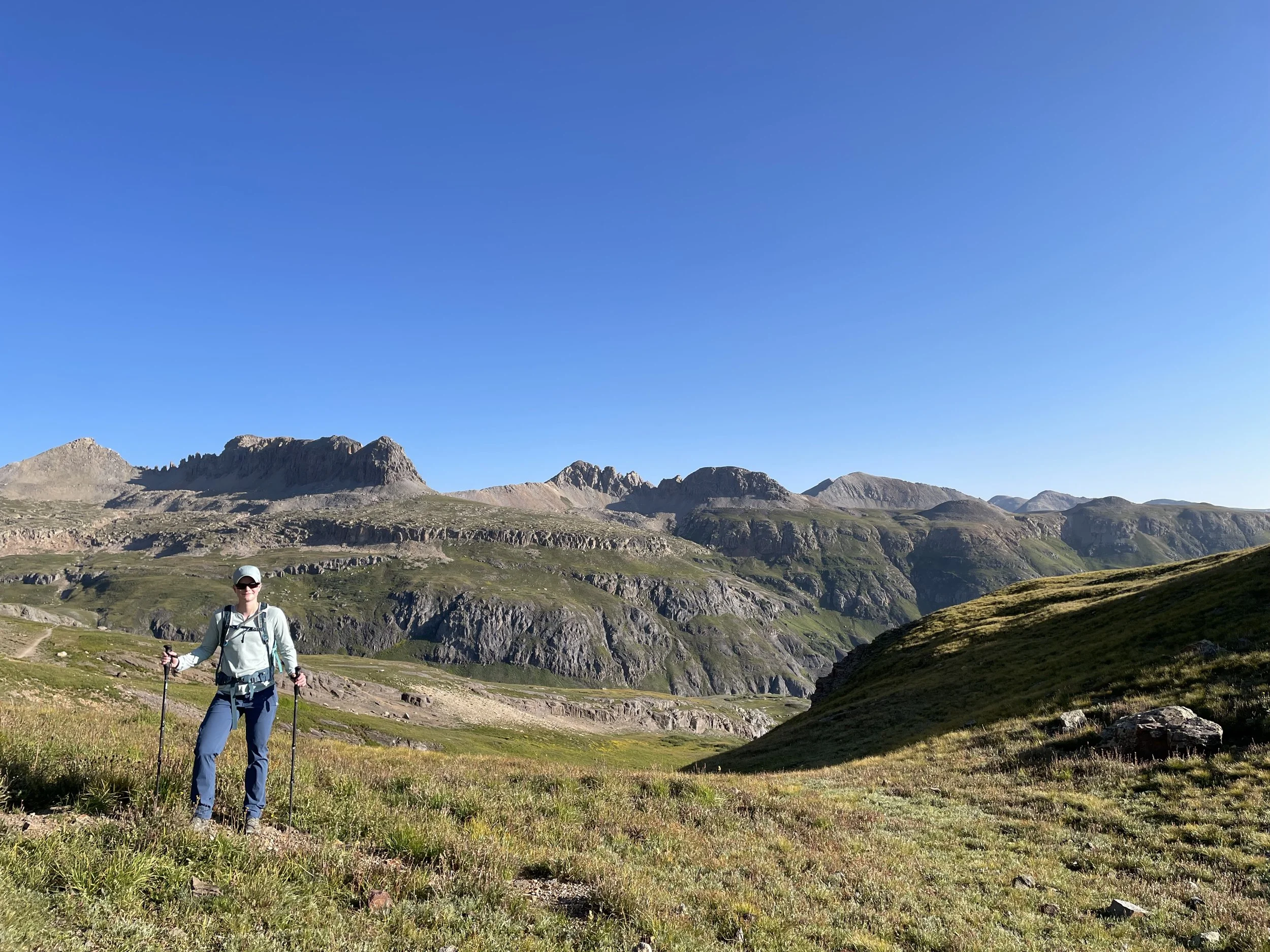
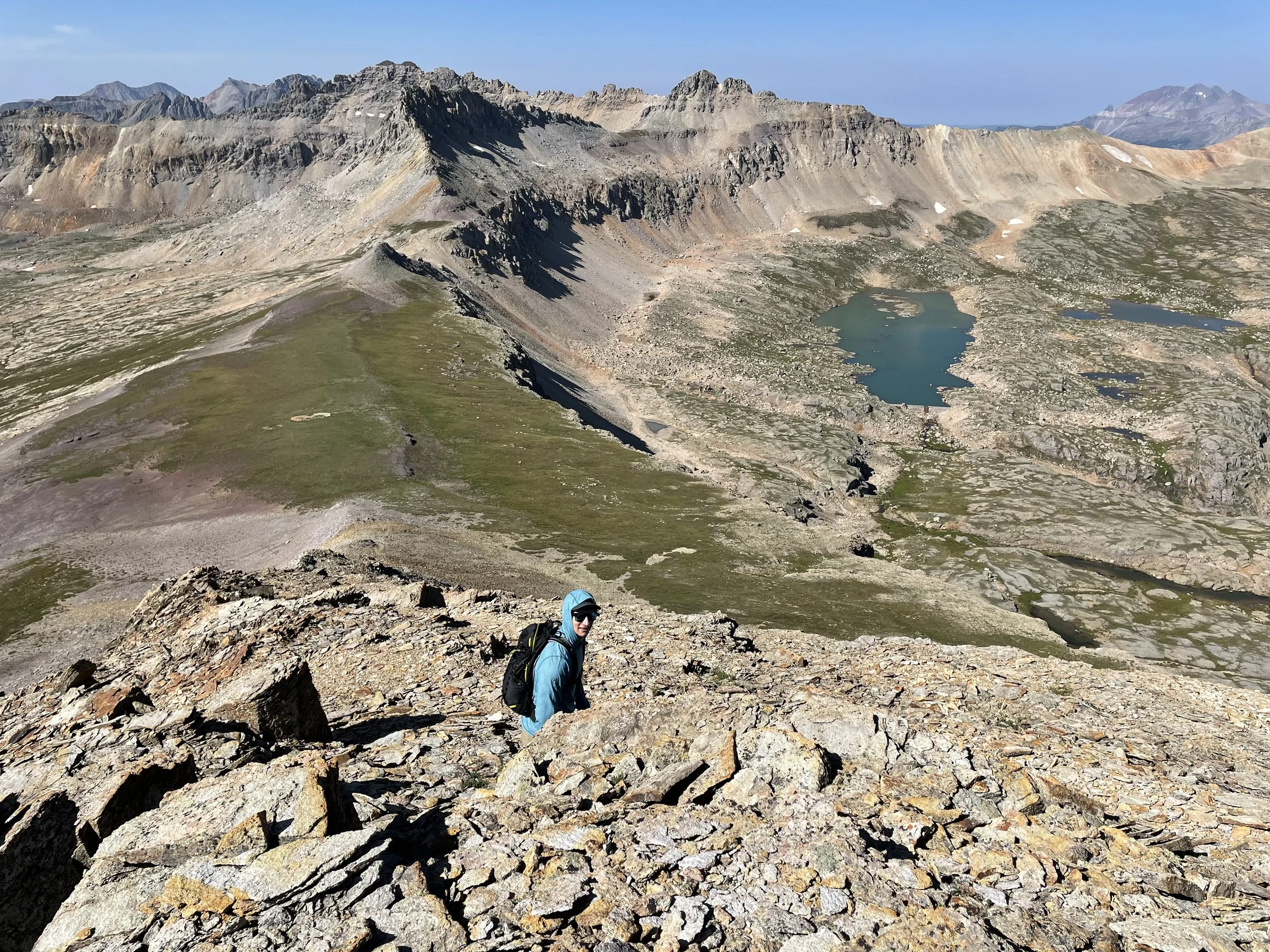
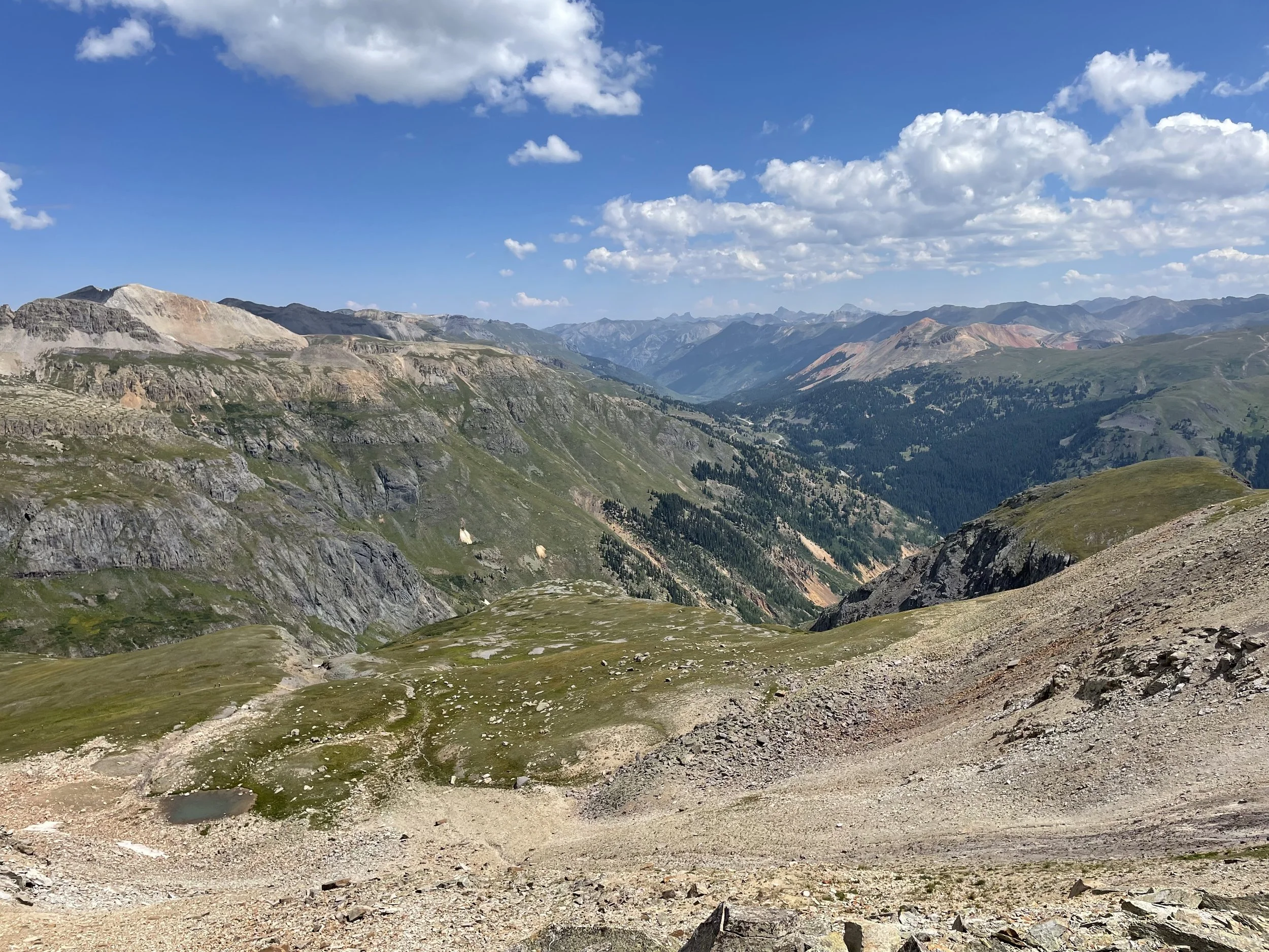
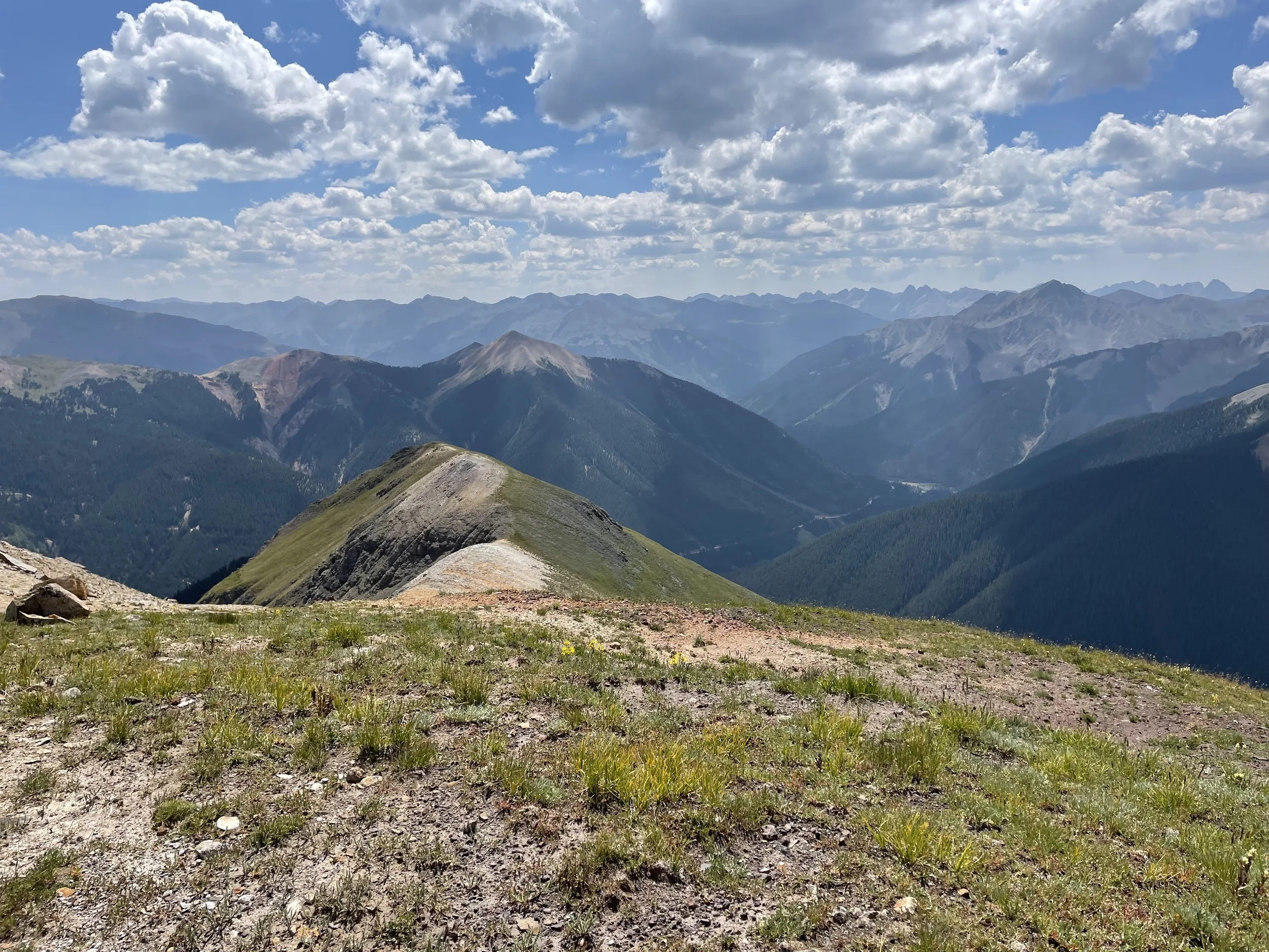
We stopped at the lake for a quick snack and since we were feeling good, we began scoping out the two 13ers we had in mind. First we headed towards T11 to the north. Because we were going off trail in delicate high alpine environment at this point, we made sure to tread lightly on the tundra and spread out from each other. We began walking towards the saddle at 13,000 feet and would turn right towards T11 from there. The views from the saddle of Bridal Veil Basin were worth stopping for and after a short break we continued along towards summiting T11.
At the saddle looking towards Bridal Veil Basin
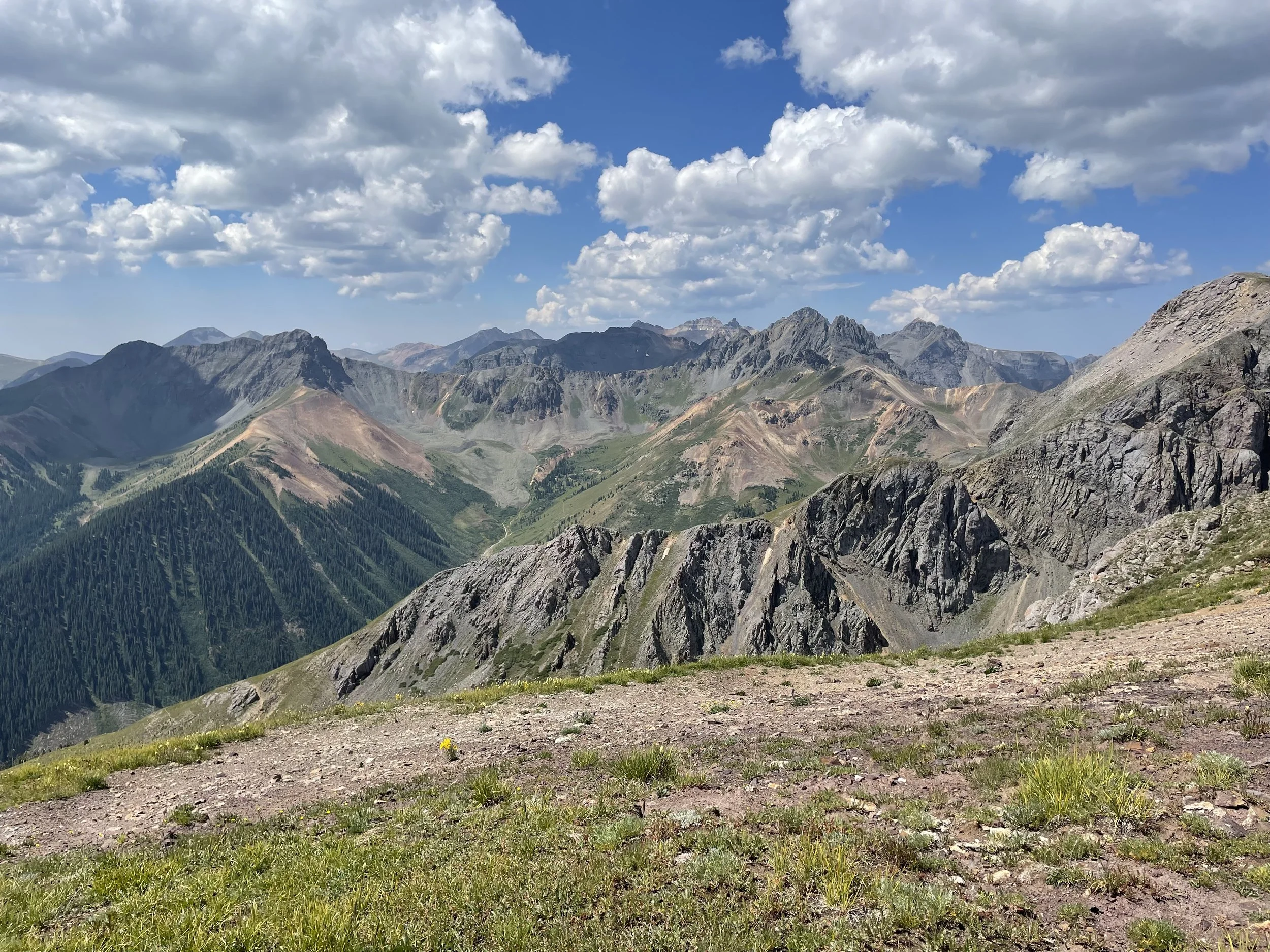
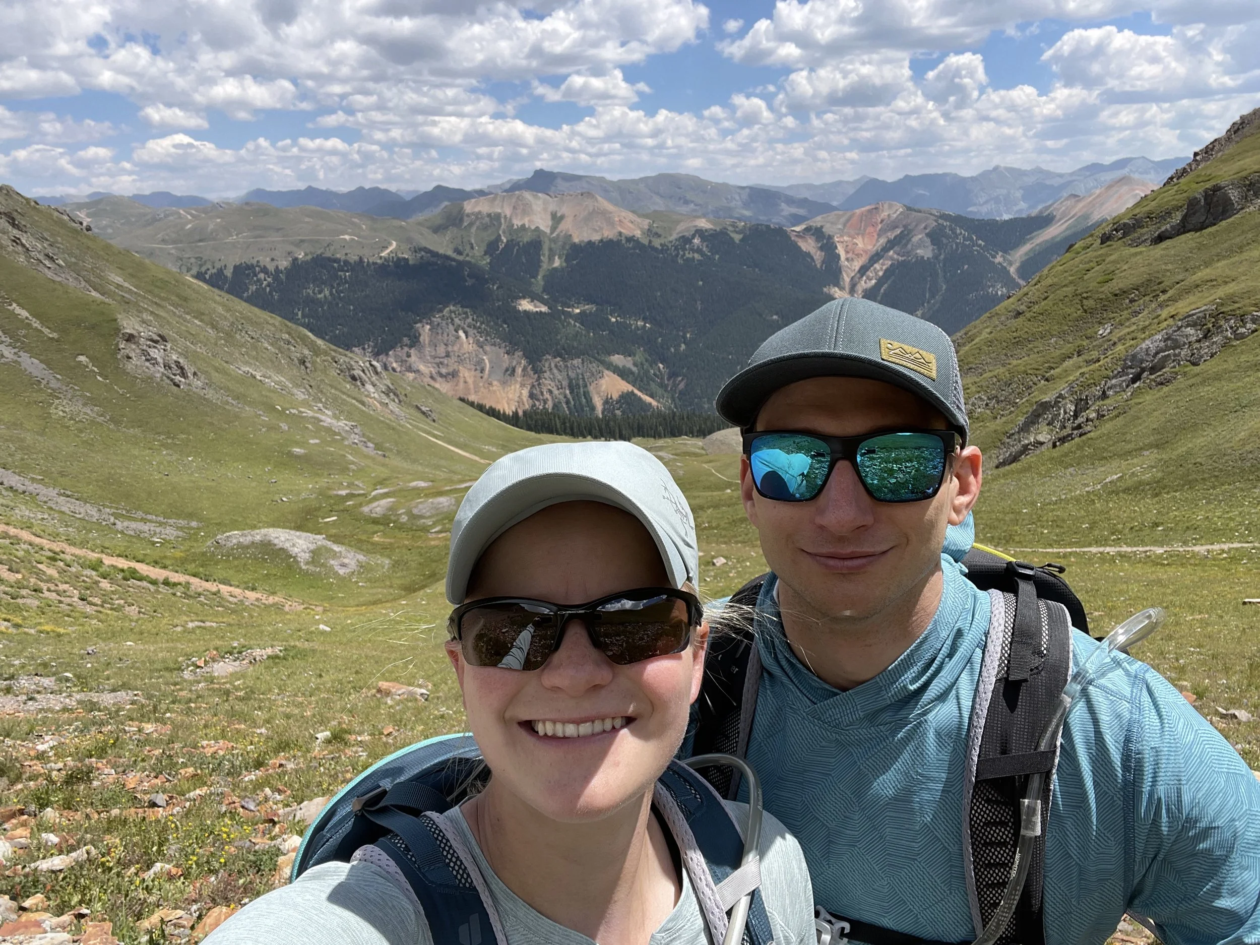
The summit of T11 had some of the most breathtaking 360 degree views I have ever seen. My favorite was looking towards Blue Lake and Mount Sneffels to the north/northeast. Last summer we summited Mount Sneffels so it was pretty neat to see it from another peak. We took a few minutes at the top to take some pictures and enjoy the views. We were greeted by a hungry chipmunk so we had to keep a close eye on our snacks.
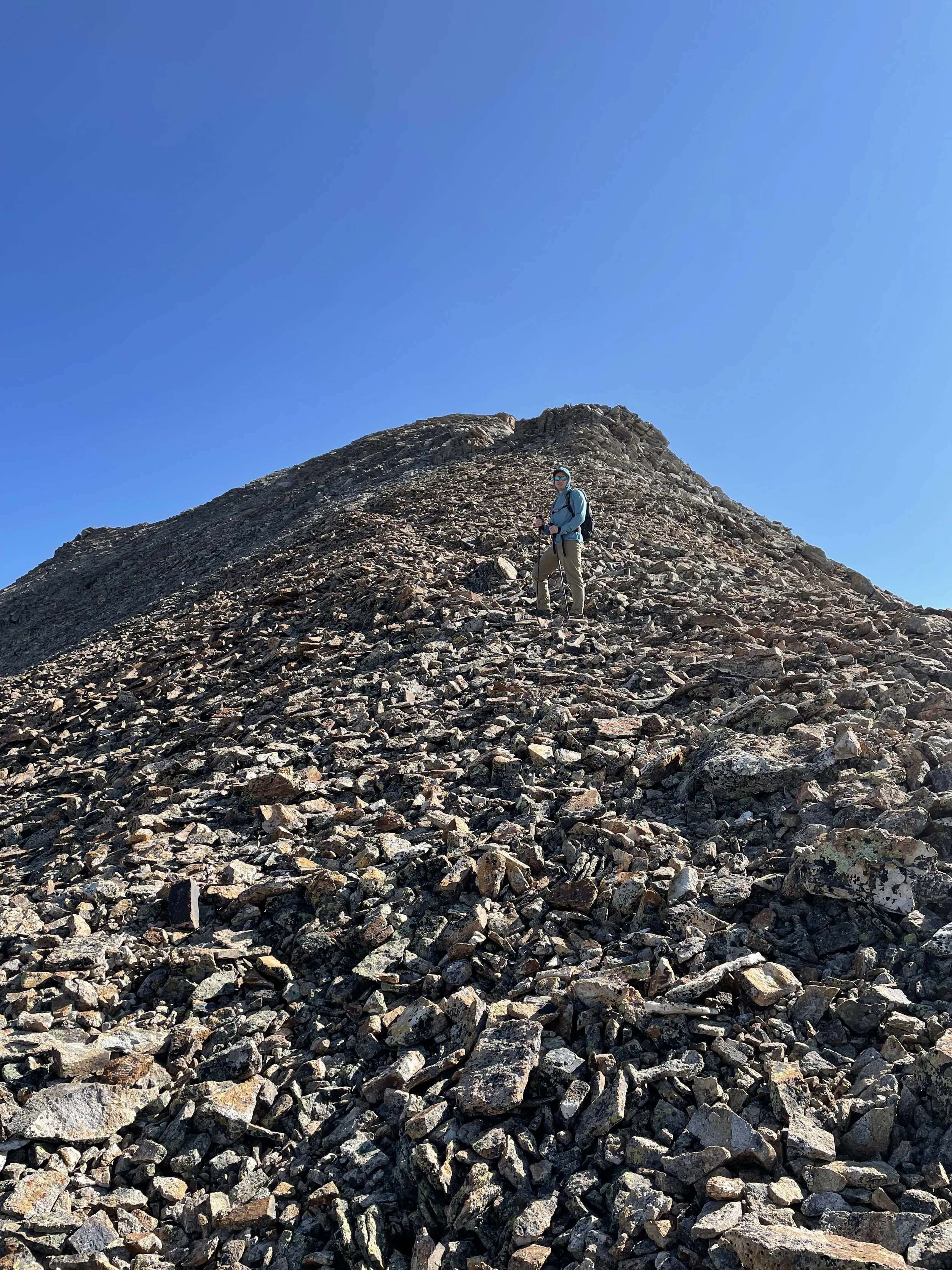
Mike headed up towards the summit of T11
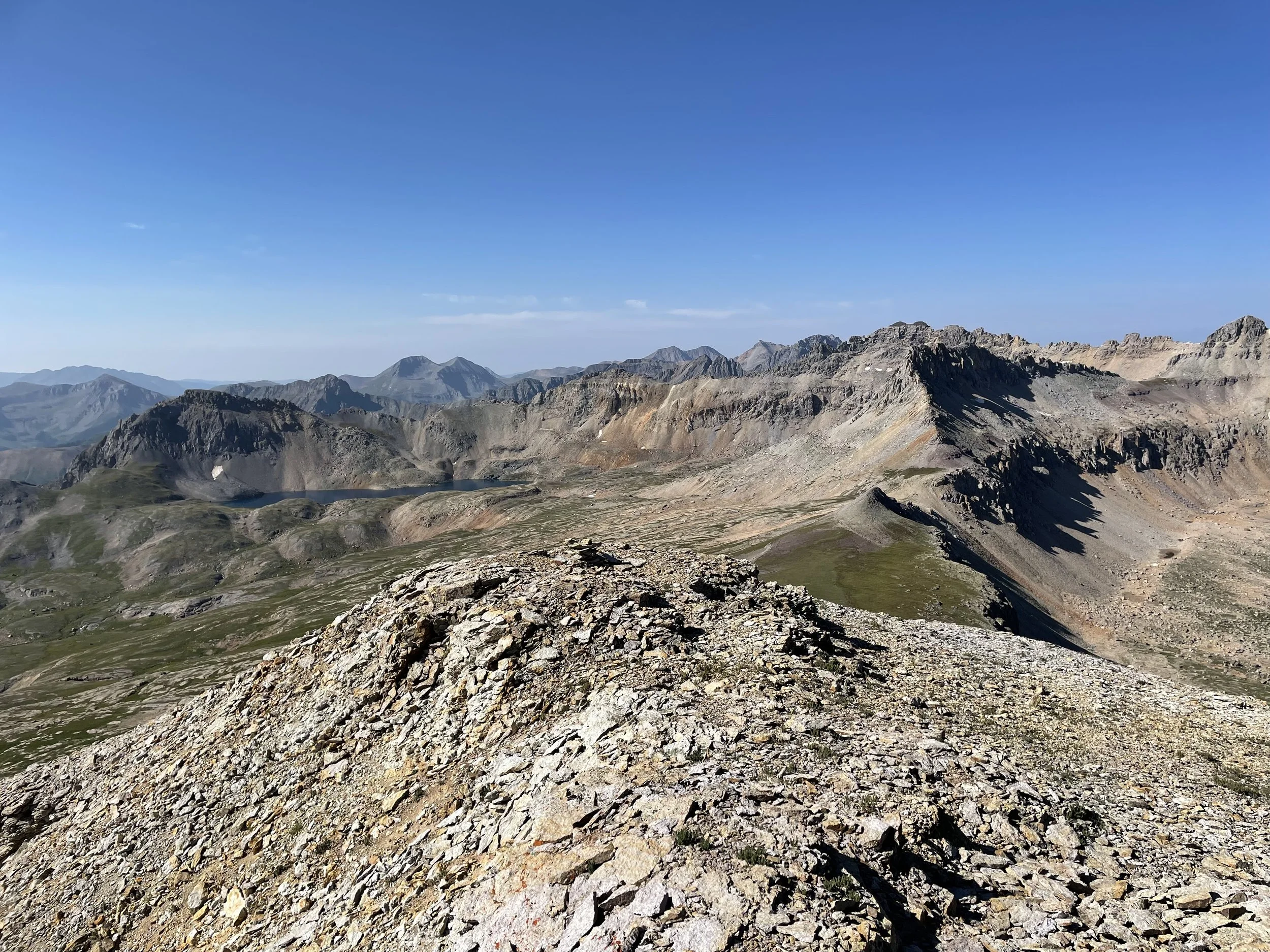
Looking back towards Columbine Lake from the summit of T11
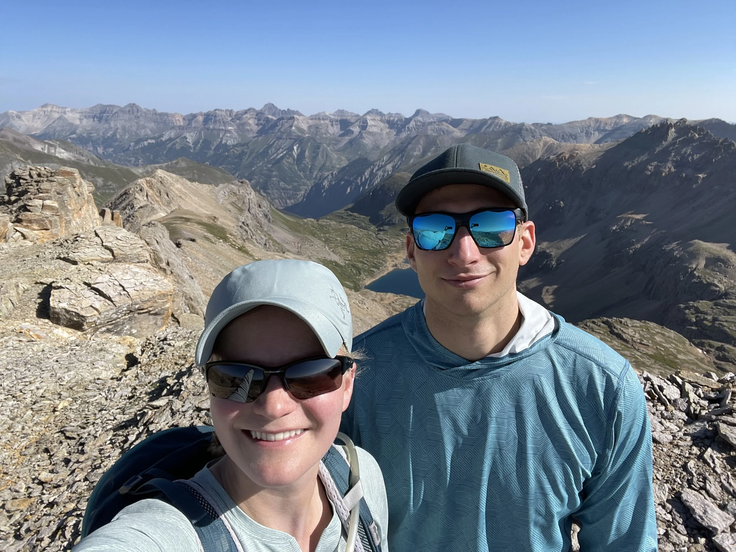
It’s hard not to smile with those views
The picture is prettier without humans ruining it :)
Heading back down
We then headed back the way we came to go back to Columbine Lake. From there, we retraced our steps to the the bottom of a gully that was just east of UN 13,159. To us this looked like the best route up to the summit. The gully was full of loose sand and rock and was a little more work than we expected. When we made it to the saddle just east of UN 13,159, we thought we were very close to the top but a few false summits made us realize we had some scrambling to do. A lot of the rock was extremely loose and on most steps you would slide down a few inches. We quickly turned around once we made it to the top of this mountain as some dark clouds were approaching, and we didn’t have any desire to get caught in a storm up there.
Mike with UN 13,159 in the background
View from the saddle on the way up to UN 13,159
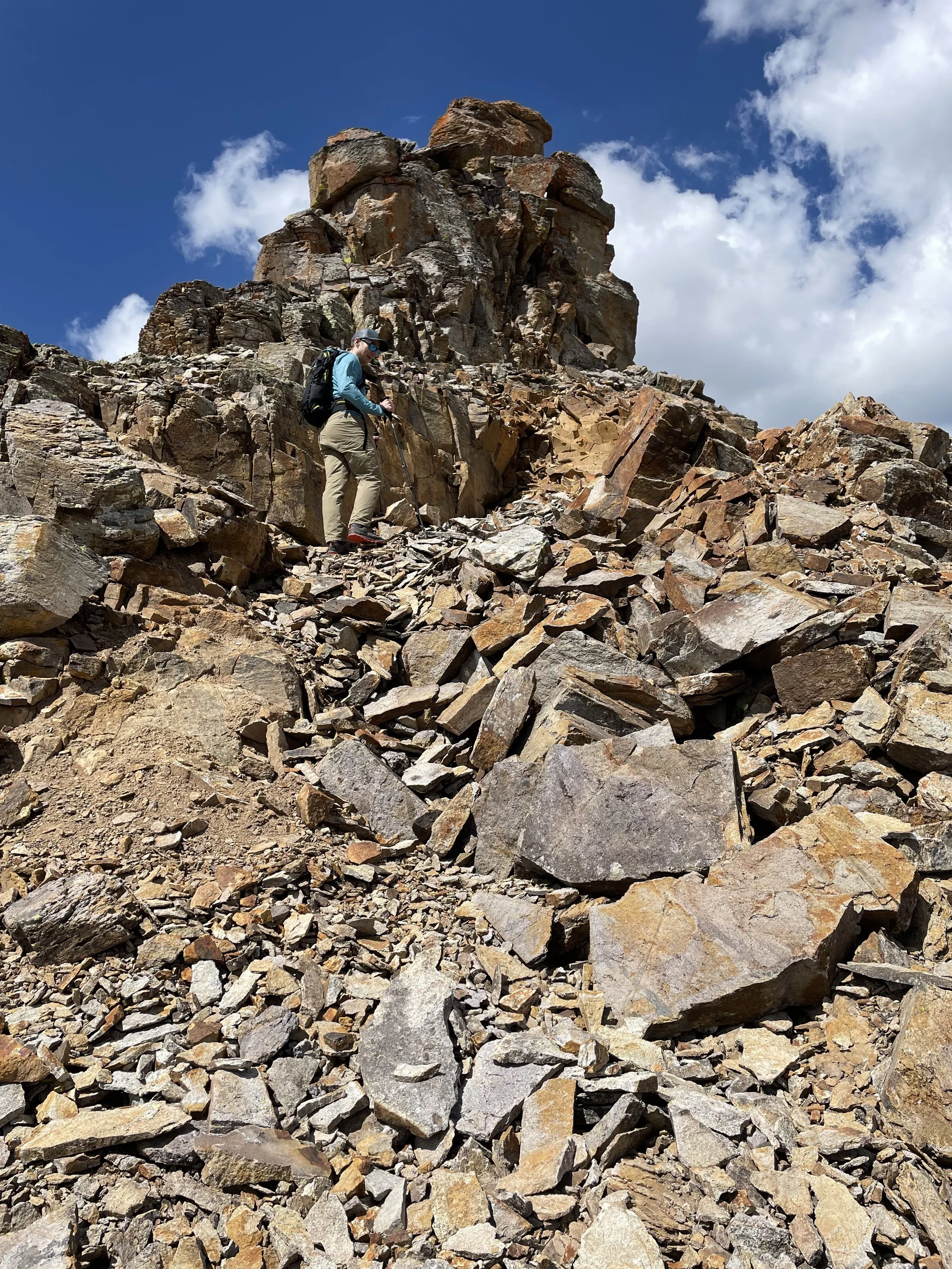
“Loose” was the word to describe UN 13,159
Looking back down the scree gully we just walked up
Heading back to the car
We went down the way we came and when we got back to the trail, headed back to the car. We made much better time on the way down than the way up. On the way down, we encountered quite a few groups of people, and we were glad we got our early start where we would have the trail to ourselves on the way up. This was a gorgeous hike, and I would 10/10 recommend doing it if you are in good shape. We ended up hiking 10.1 miles with 3,550 vert, but that includes the two extra summits we did. Had we not done these, the hike would have been under 8.5 miles with 2,900 vert.
Bridal Veil Basin with Mount Sneffels in the background
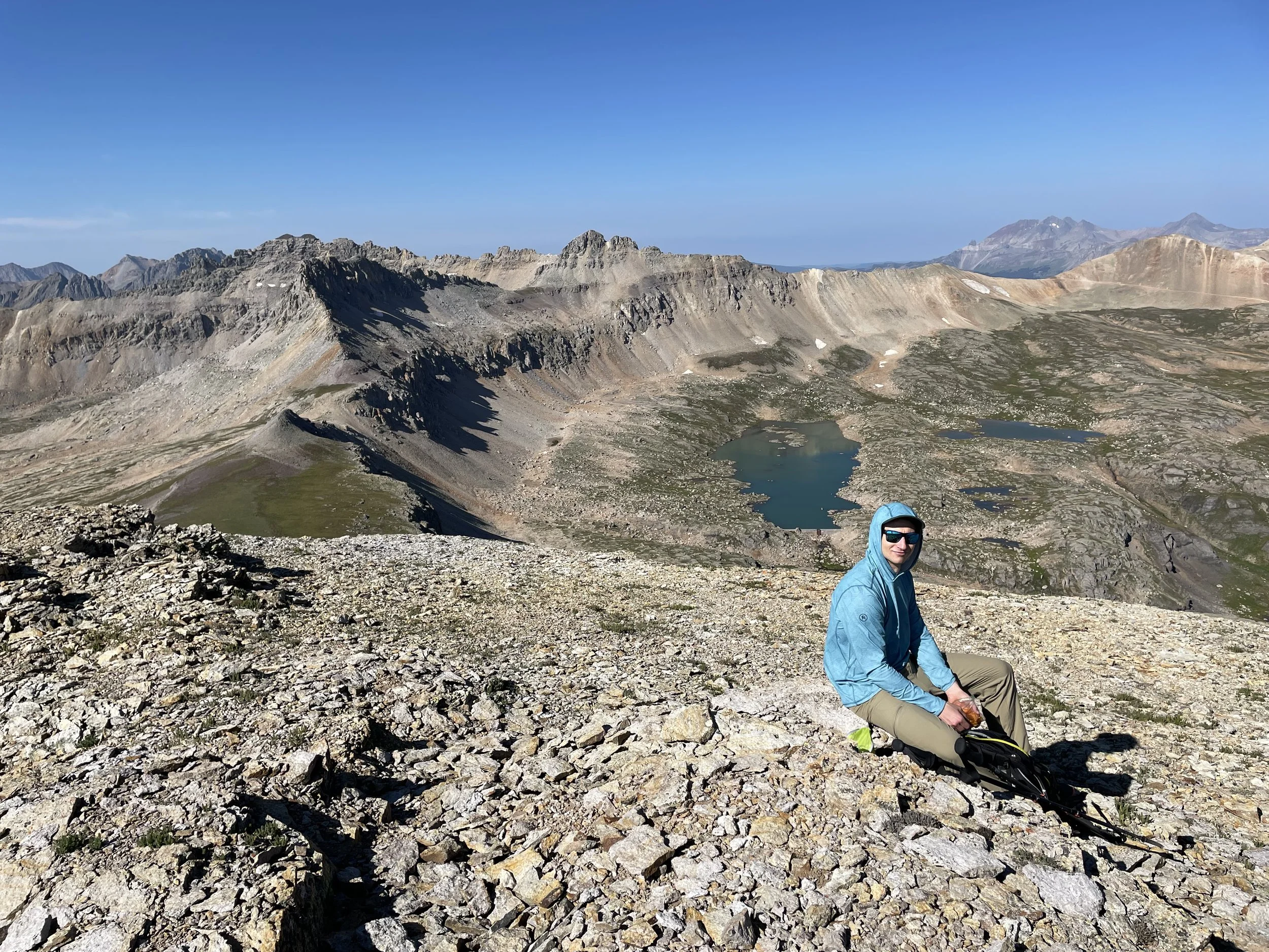
The summit of T11 was a pretty good spot for a snack break!
From the saddle of UN 13,159
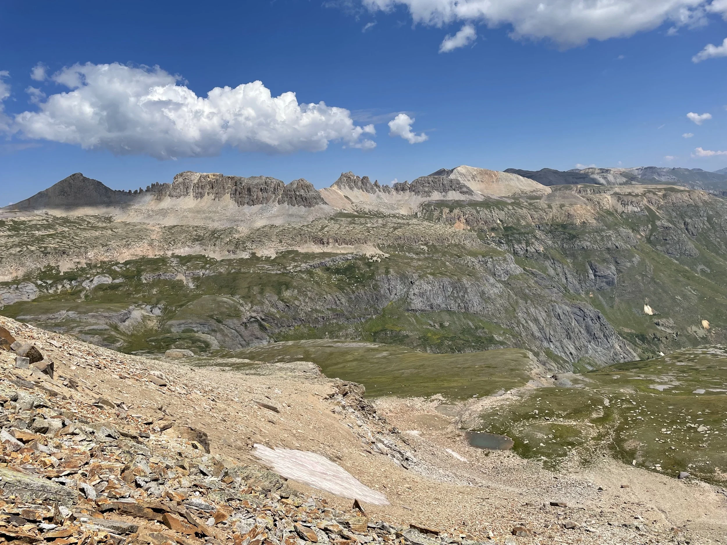
Saddle of UN 13,159 looking towards the trail to Columbine Lake
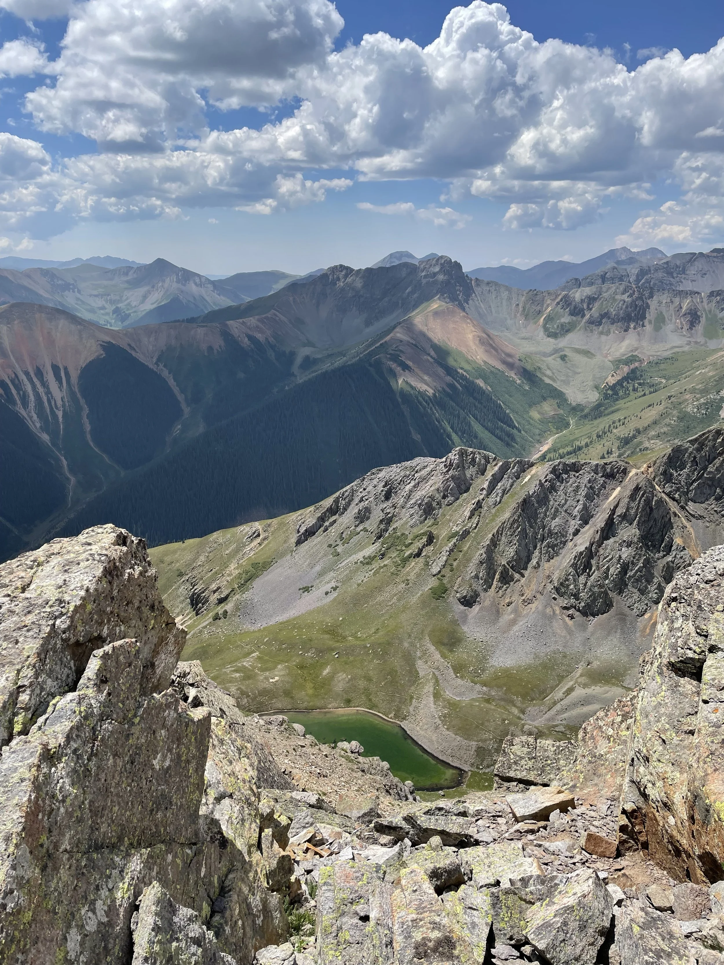
Views of an unnamed lake from UN 13,159
What a great day!