Knowles Canyon to Mee Canyon Backpacking Trip, Black Ridge Canyons Wilderness, Fruita, Colorado


After a long, cold winter of skiing, Mike and I were looking to escape to the desert for a few days. I started keeping my eye on the weather in the Grand Junction area, and it looked like a warm weather window was coming up at the end of March in that area so we decided to head out for a backpacking trip in the Black Ridge Canyon Wilderness. I had done some day hikes in the area, but had never done an overnight trip. I was hoping to do a loop hike instead of an out and back, but with no real on-trail options to do that, we realized we were going to have to figure out an option that likely involved some off-trail navigating. I found some blog posts from others that suggested a loop of Knowles Canyon and Mee Canyon would be possible if we were up for some bushwhacking, tricky navigating, and some very airy cliff exposure. Disclaimer: if you aren’t comfortable making an airy class 3 move with a backpacking pack on to get out of Mee Canyon, I wouldn’t recommend doing this trip. Climbing a short ladder is also required to get out of Mee.
Day 1
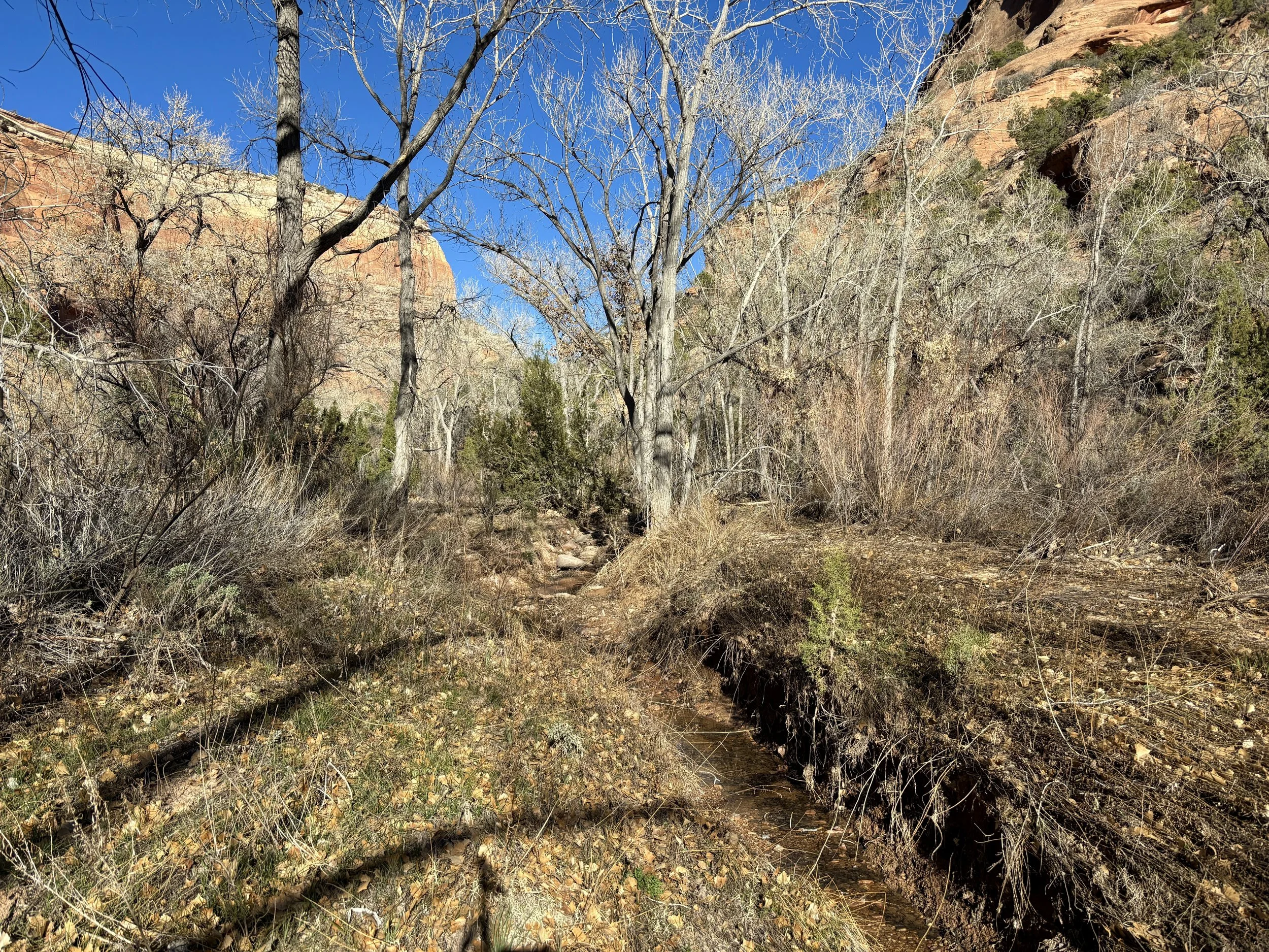
We decided we would do the loop clockwise, starting at the Knowles Canyon Trailhead. We got a fairly late start that day and didn’t begin hiking until close to 3pm. We knew we wanted to at least get down into Knowles Canyon that day so that we would have a water source, which would require at least 5 miles of hiking. We made good time and after a couple hours, found ourselves at the bottom of Knowles. I had read that where you enter the canyon is the only reliable water source in this canyon. So we decided to take a snack break and fill up several liters of water each - enough to make it through the night and potentially all the way to the Colorado River the next day. We ended up walking 3 additional miles that evening in the canyon. The upper part of the canyon had the most brush, but we would occasionally find social trails to follow that made for easier walking than expected. It also turned out that in late March, there are quite a few potholes filled with water in Knowles, and we ended up carrying more water than we needed to. I know this is not the case later in the spring so it was a welcome surprise. As we started approaching sunset, we started looking for a spot to camp. Finding a spot that didn’t disturb any cryptobiotic soil actually proved a bit harder than anticipated, but we finally came upon a smaller wash that funneled into the canyon that allowed us to camp in an old stream bed without doing any damage to the soil. It was really amazing to see how much undisturbed cryptobiotic soil there was in this canyon. The canyon also had very few established campsites, and it was nice to backpack somewhere that had very little trace of human presence. I suspect we were the only people to be camping in the whole canyon that night. We slept pretty well after a busy day of packing, driving, and hiking.


Day 2
The following morning we woke up with sunrise, ate breakfast, packed up our stuff, and were on our way. The social trails eventually faded as we wandered farther into the canyon and we found ourselves walking in the mostly dry stream bed for most of the rest of Knowles Canyon. As we approached the intersection with the Colorado River, we filtered some running water we found as we figured it would have a lot less silt than the water in the Colorado did. That assumption proved to be correct. We hit the intersection with the Colorado River a little before noon and stopped on the bank to eat an early lunch and enjoy the view. Little did we know that the trickiest and most physically and mentally exhausting part of the trip was about to start.
The first part along the river was very mellow, and we found ourselves walking on a social trail. After a little over a half mile, the meadow faded, and we found ourselves starting to go up onto some ledges above the river. These ledges started to get narrower and our pace slowed materially as navigation became paramount. We got to a section where it looked like we should continue along the ledge we were on, but we saw a cairn that led us up to a higher ledge. We decided that following the cairns would be the best choice. This did indeed turn out to be the case. The cairns led us to another “social trail” (I think it may have been a trail used by bighorn sheep) that continued to traverse along the steep cliffs above the river. We soon found ourselves on a pretty steep, loose slope above cliffs. The walking here was never worse than class 2 for us, but it was very airy and a slip could have been consequential in spots. If you find yourself on class 3+ terrain for this part, you took a harder than necessary route.
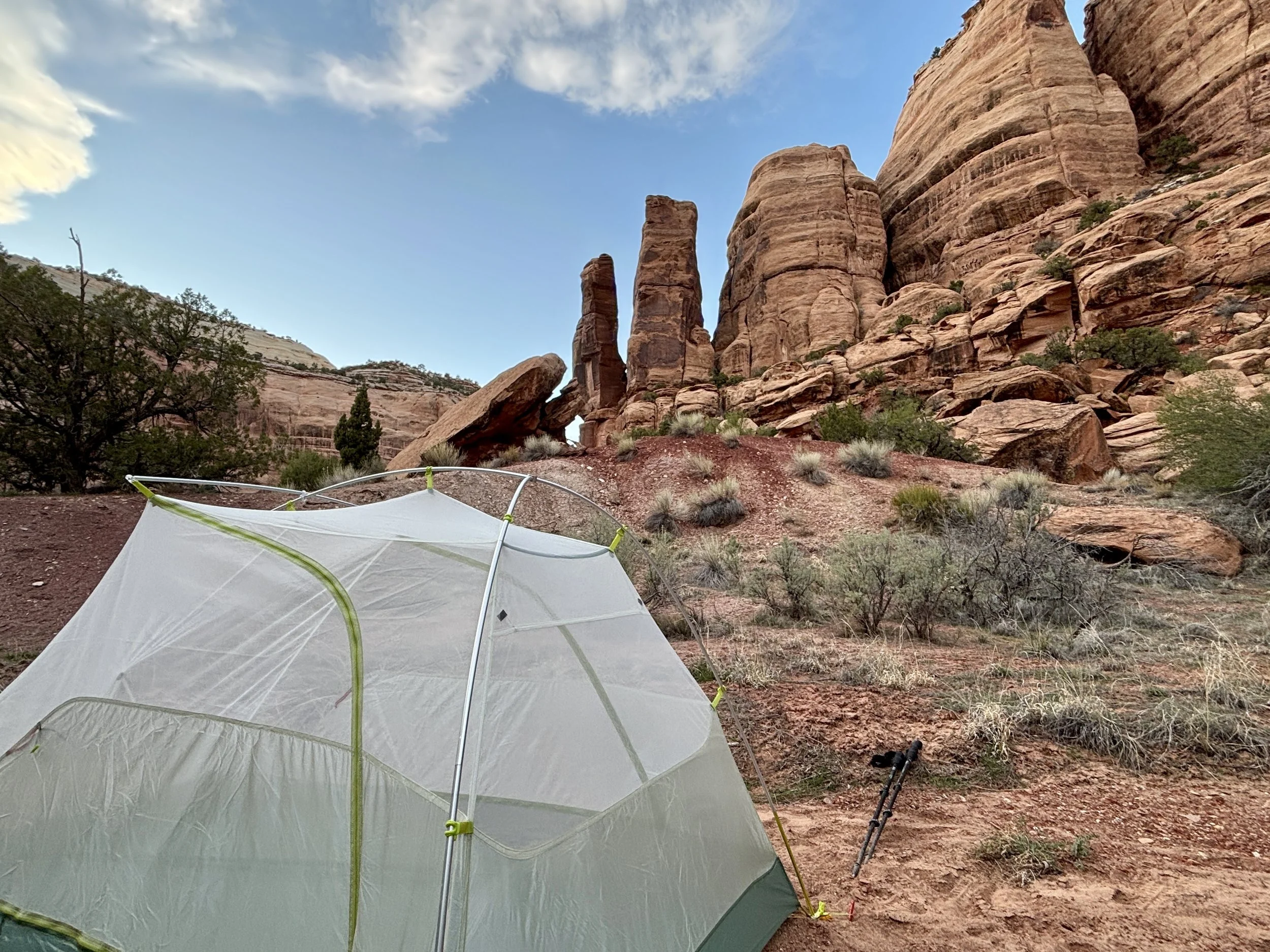
We finally found ourselves walking towards the river and walked for the next mile or so along the Black Rocks campsites along the river. We took a break near Black Rocks 1 campsite as we could see that the terrain was going to get more interesting again. After a snack, we began traversing some steeper slopes, but not nearly as steep as the previous part along the river. We found ourselves climbing up quite a bit, and we got to a point where we had to turn right and navigate down into a small side canyon. We then followed this canyon back to the river. This next mile was my least favorite of the day. It involved either some epic bushwhacking or steep side-hilling. We tried both options and neither was fun. We just put our heads down for this part and finally made it through to the intersection of Mee Canyon. I was unbelievably happy to be done with this part. We found a very well-defined social trail coming out of Mee Canyon so we decided to continue for a few more miles before camping for the night. We were almost out of water, but had no problem finding some in Mee to filter. Thankfully, we didn’t have to filter any from the Colorado River. Again, we had a little difficulty finding a spot to camp that was on a durable surface and not cryptobiotic soil, but ultimately found a spot with some great views. This was a very full day for us and it took 9.5 hours to go 14 miles that day (I think we went 6 miles in 5 hours along the Colorado).


Day 3
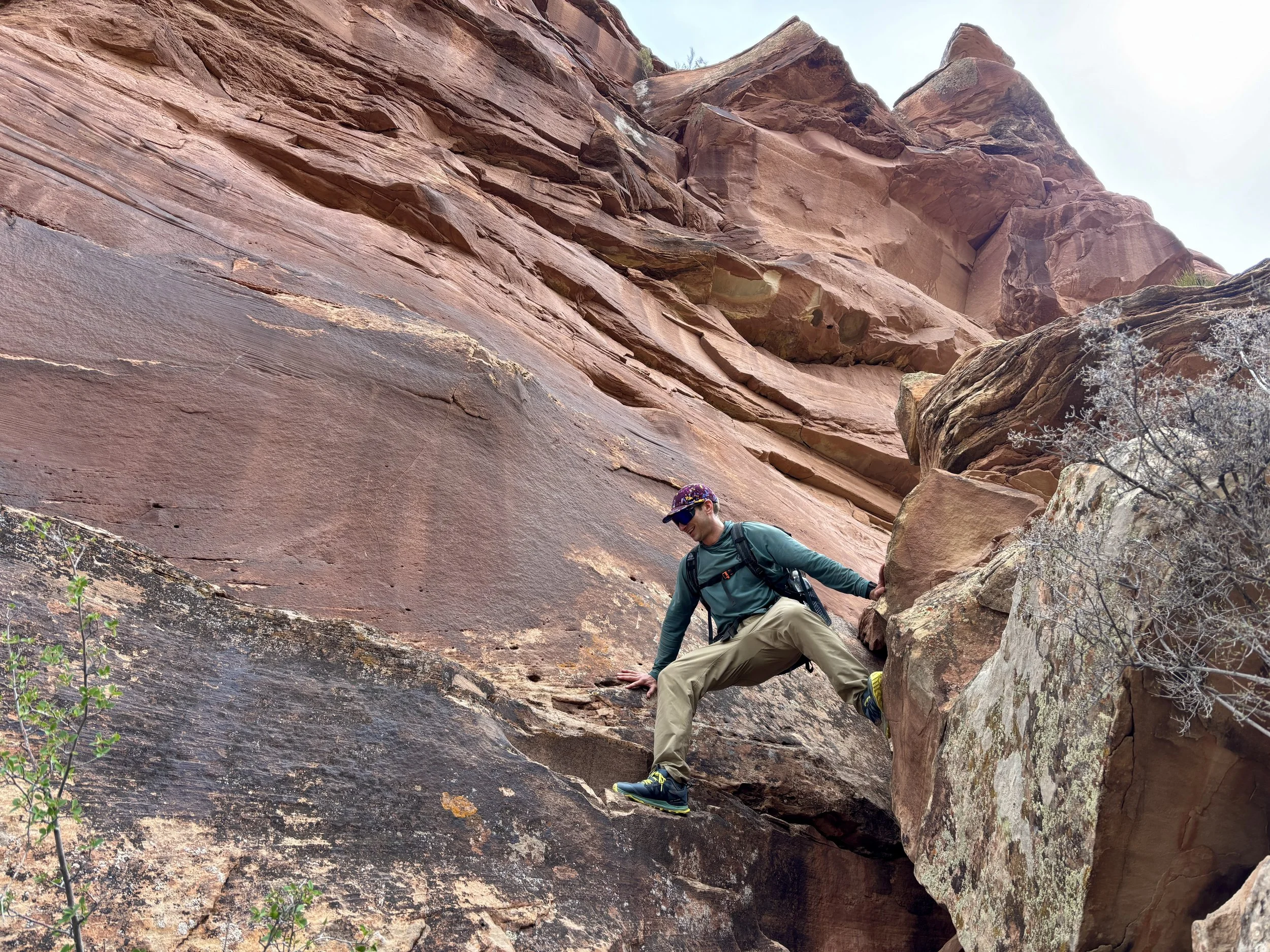
After a good night’s rest, we found ourselves waking up with the sunrise again. We started heading up Mee Canyon along the well-defined social trail. After a few more miles, the social trail disappeared, and we were left to navigate on our own. What made navigation particularly difficult for this part was that the stream was flowing and had water in it so we couldn’t walk in the steam bed. Then on the banks, there would be plenty of cryptobiotic soil that we also wanted to avoid. This led to a lot of bushwhacking and walking on old reeds. I was hoping that as we got closer to the official trail that went down into Mee Canyon we would find a trail, but this never turned out to be the case. We had about 5 miles from our campsite to the trail that would exit the canyon and it took us about 4-5 hours to walk those 5 miles, which was much longer than expected. Once we found the trail that exited the canyon, we filled up 2 liters of water each and began our ascent out of the canyon. This was another spot where following the cairns is crucial to navigating out of the canyon. We soon found ourselves at the class 3 spot, which actually took us a few minutes to realize it was the way we had to go. At this spot, we had to climb up to a narrow, down sloping shelf and shimmy along the wall for ~10 ft. Handholds in the beginning were sparse, but got better. I was relieved once we got through this part as turning back at that point wasn’t really an option considering how much work it would take to retrace our steps. After this feature, we continued to follow the cairns which then led us to a hole in the rock that you had to go through to get to a ledge on the other side. As we continued walking, we started to wonder how we would get out of the canyon as all we could see were smooth, vertical walls around us. This is what can be so neat about desert hiking - you start to think it may be impossible to get in or out of a canyon, but then one weakness in the wall is found and a way out presents itself. In this case, the weakness still required the USFS to put in a ~7 ft ladder to climb up to get out of one spot. Once we were up this ladder, we found ourselves on the rim of the canyon and knew that our car was in reach. Since we only had ~2 liters of water each, we didn’t have enough to comfortably camp another night plus walk to the car so we knew that getting to the car that night was the goal. In hindsight, I hadn’t looked closely enough at how much farther we would have to walk that day as we still had 9.5 miles left in hilly terrain, but in my head I was thinking it would be much less mileage and much flatter. We followed the trail back to the Mee Canyon Trailhead and then began the final part of the journey that involved following some old dirt roads that meandered through the forest. This part went on much longer than I needed it to, but with no real choice but to keep moving, we ultimately made it back to the car with a little time to spare before sunset. My feet were pretty happy to get out of my shoes.


Overall, I really enjoyed this adventure. The loop was much more challenging and had more type 2 fun than expected, but that made completing the loop more satisfying. I found the canyons to be much more beautiful than anticipated, but also more difficult to navigate than anticipated. The part along the Colorado River was the most surprising part and was much harder than I expected it to be. We did the loop in 2.5 days and in hindsight, I would have spent an extra night in Mee Canyon to make the last day less brutal. If you’re looking for an epic desert adventure, this should be on your list - but please stay off the cryptobiotic soil!
Day 1 Stats: 8.4 miles, 400 ft of elevation gain
Day 2 Stats: 14 miles, 700 ft of elevation gain
Day 3 Stats: 15 miles, 2400 ft of elevation gain
Total Stats: 37.4 miles, 3500 ft of elevation gain