Backpacking in the Wind River Range (Cirque of the Towers), Pinedale, Wyoming
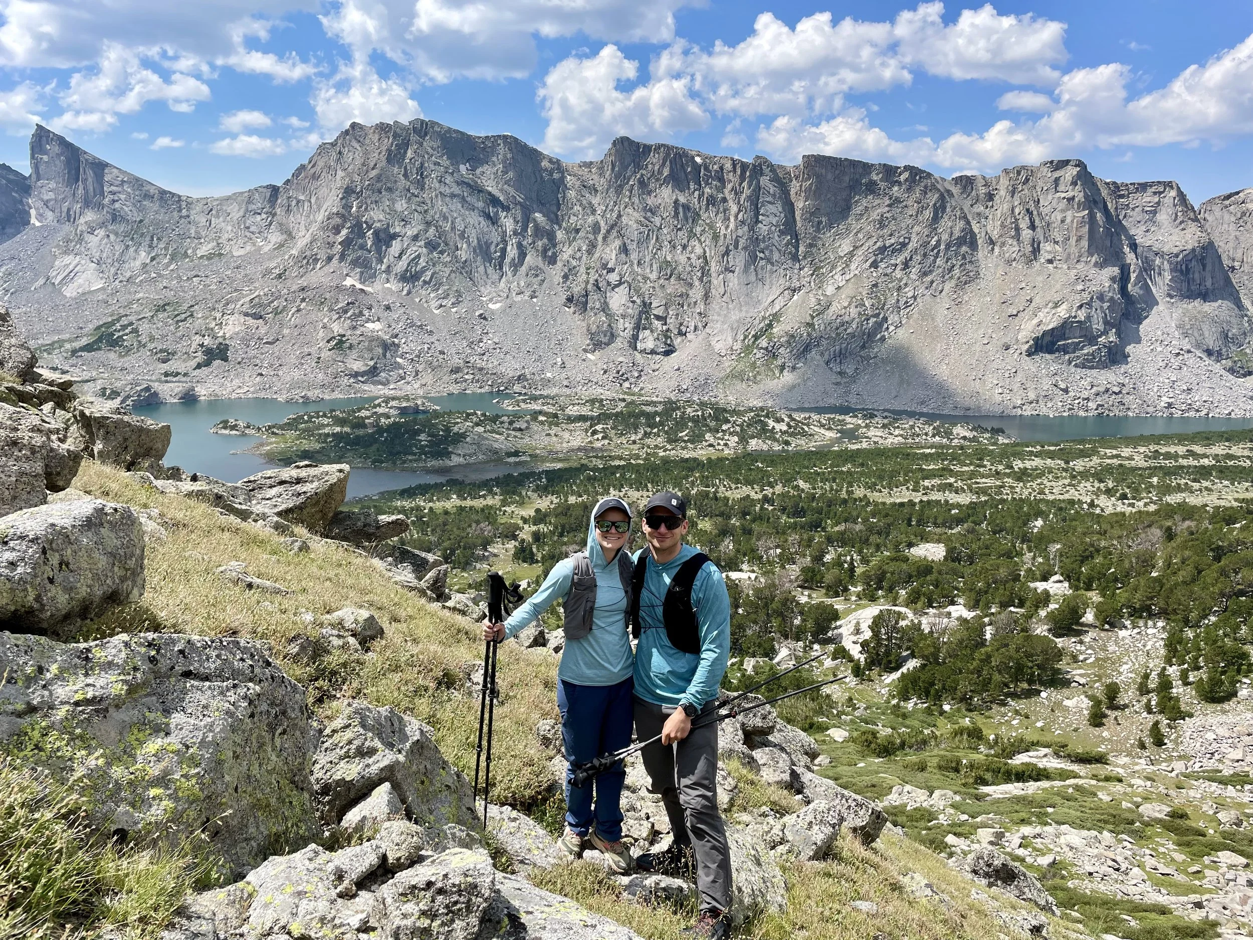
A backpacking trip in the Wind River Range has been on my bucket list for several years now. After 6 months of planning, I finally made the trip a reality this summer. The most difficult question to answer was: what area of the range to visit?! The range runs about 100 miles from north to south along the Continental Divide. It has over 40 peaks that are over 13,000 feet in elevation and is home to over 1,300 lakes. It encompasses several Wilderness Areas. With over 2.25 million acres to explore, there are an infinite number of trip options to choose from. After countless hours of research, I finally chose an area to base our trip around: the Cirque of the Towers. There were several options of how we could approach the Cirque of the Towers, and we settled on making it a 6 day/5 night loop that would start and end from the Big Sandy Trailhead. Joining me would be my husband, Mike, and my friend, Annie, along with her dog, Kai.
Day 1: Big Sandy Trailhead to Mays Lake
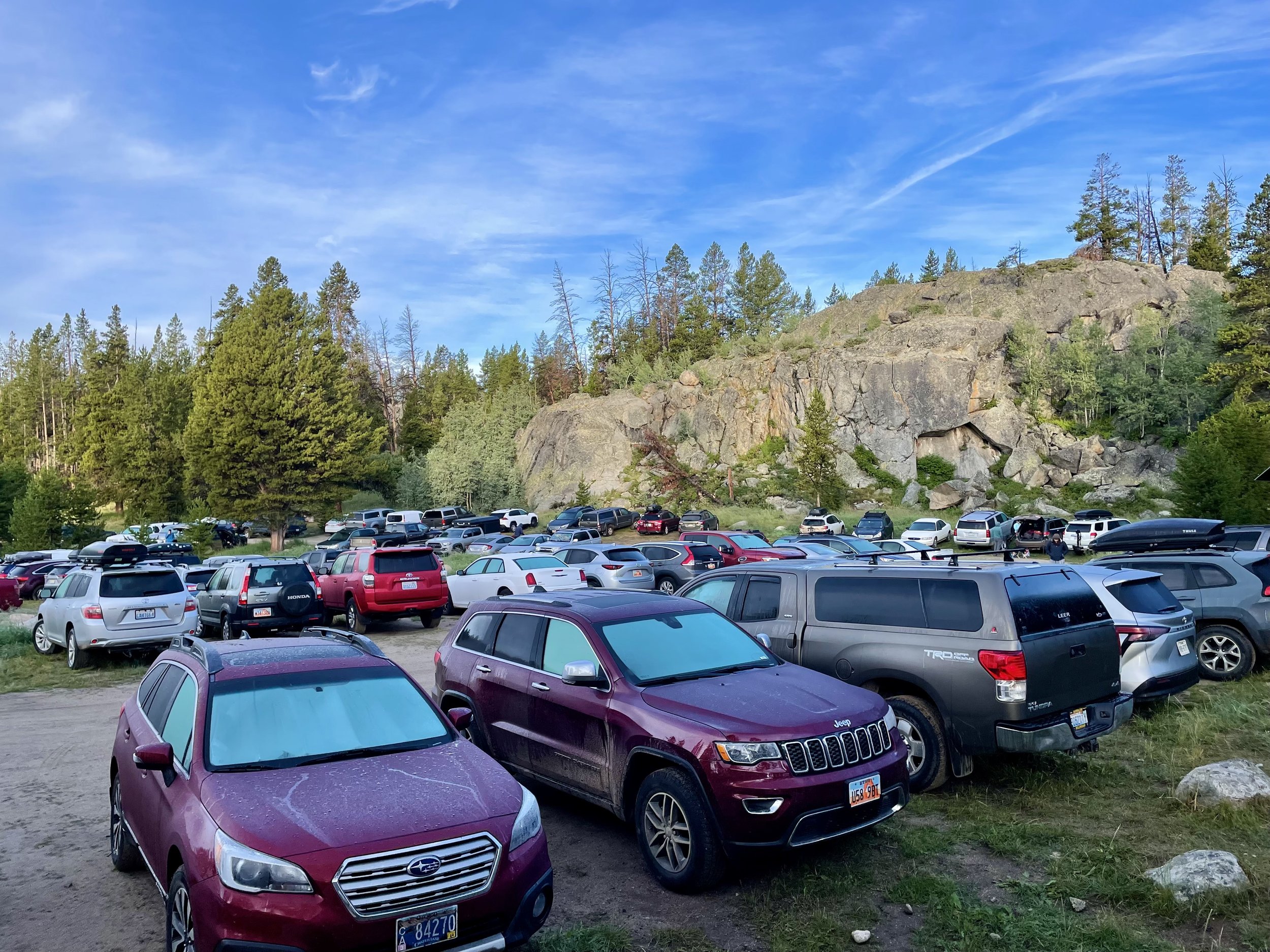
We set out early on a Monday morning from our hotel in Rock Springs as we had a 2.5 hour drive to the trailhead and were looking to hike somewhere between 10-13 miles that day. Our alarms went off at 4 a.m. which allowed us to be at the trailhead by 7 a.m. to start our adventure. Our goal for the day was to hike from Big Sandy Trailhead to set up camp near one of the following lakes: Skull Lake, Mays Lake, or Pyramid Lake. We got to the trailhead, which felt pretty busy, but once we got on the trail towards the lakes we were targeting, we didn’t see too many people along the way. After 5.5 miles, we came to Dad’s Lake where we decided to stop for lunch. There were quite a few campsites set up, and we saw some people jumping off cliffs into the lake. After some food and water, we continued along the trail past Marm’s Lake to the Shadow Lake Trail intersection where we decided to filter some water in Washakie Creek. We got our first real views of the backside of the Cirque of the Towers. We didn’t linger for too long as clouds were starting to build, and we still had a few miles to our future campsite that we had yet to find. When we got to Skull Lake, there were no tents in sight and so we decided to continue along to Mays Lake to get a little bit closer to the East Fork Lakes, which was where we were planning to do a day hike the next day. When we got to Mays Lake, there was a group of climbers that had set up camp on the south end of the lake so we continued along the trail and found a great spot to set up our camp on the west side of the lake. We had great views of Pyramid Peak and Mount Hooker. After setting up camp, we took our first lake dip of the trip. The water was cold so we didn’t linger in the water for too long. With the 4 a.m. alarm catching up to us, we had an early dinner, which was followed by an early bedtime. Shortly after heading to bed, we listened to our first thunderstorm of the trip and got to fall asleep to the sound of the rain hitting our tent.
Stats: 12.1 miles, 1790 vert


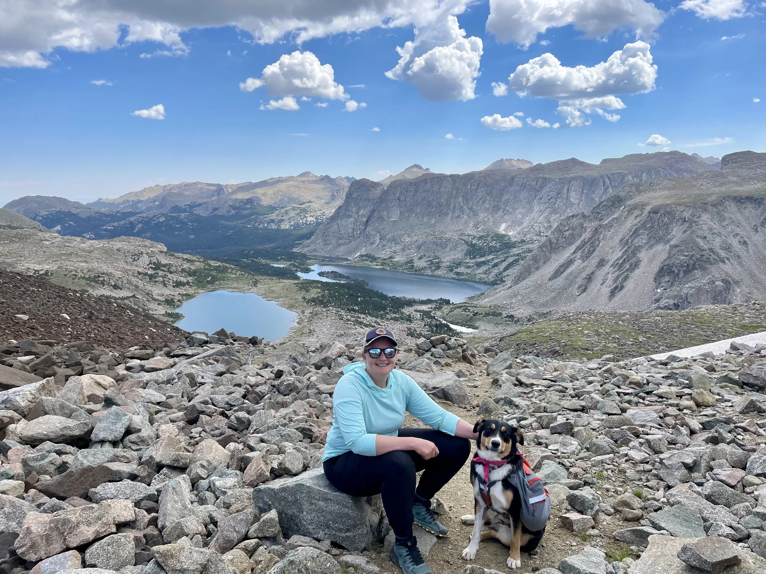
Day 2: Mays Lake to East Fork Lakes to Pain in the Ass Pass (Out and Back)
The next morning, Mike and I headed on a day trip to the East Fork Lakes Basin and up to Pain in the Ass Pass. Annie and Kai had spent several weeks leading up to the trip at sea level and were a little more tired than Mike and I were so they decided to hang back closer to camp for the day. We continued hiking down the trail to Pyramid Lake and then cut off trail to the west to head towards the East Fork Lakes. Once we got into that drainage, those mountains and that basin were some of the prettiest of the trip in my opinion. Most of the day was off trail with a mix of walking on grass to hopping on large rocks and boulders on the way up to Pain in the Ass Pass. Once we made it to the pass, we stopped for a lunch break and checked out the views looking east. There wasn’t a bad view in any direction. We started seeing some clouds building so we decided it was time to turn around a head back. We made it back to camp in the early afternoon, just before we got hit with our first afternoon storm. This actually turned out to be the only real afternoon storm of the trip that we would experience. Once the storm passed, I tried my luck with fishing and caught a few medium sized trout right off the bank near our campsite.
Stats: 8.5 miles, 1430 vert


Day 3: Mays Lake to Washakie Pass to South Fork Lakes
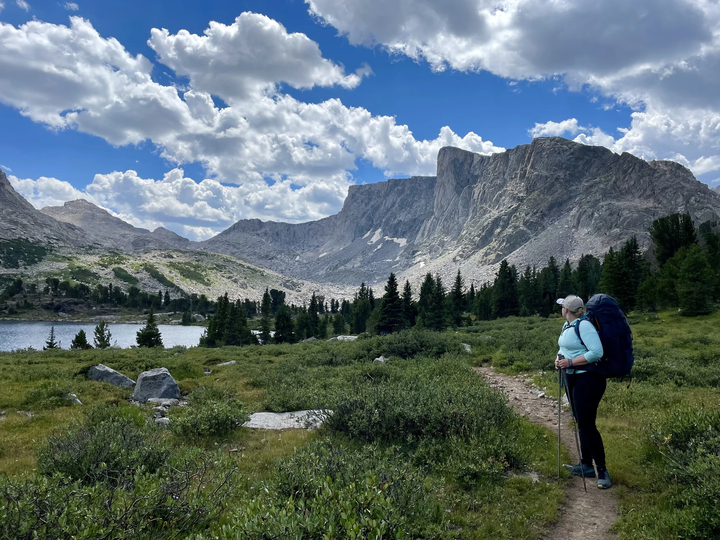
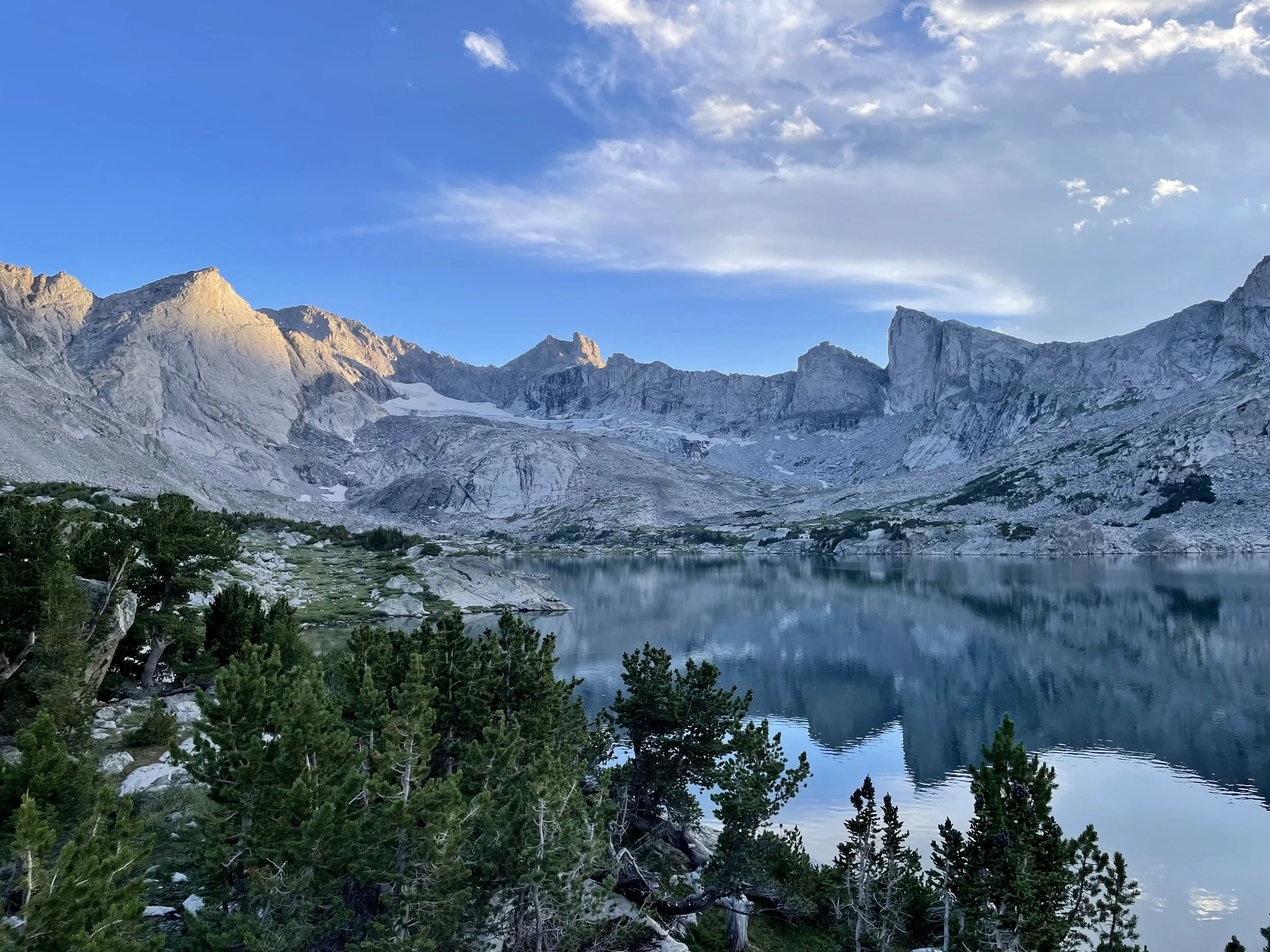
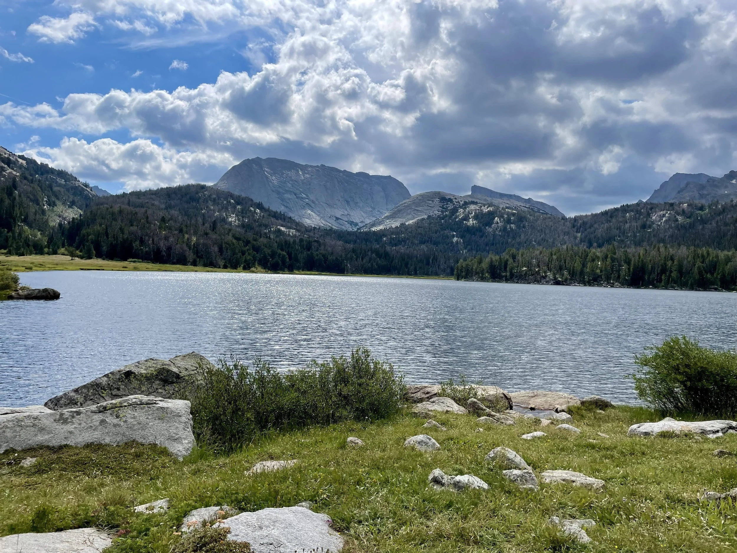
After having spent the previous two nights at the same campsite on Mays Lake, we were going to be on the move again on the third day of our trip to find our next campsite near the South Fork Lakes. We got an early-ish start as we would be going over Washakie Pass and wanted to be over the pass before any afternoon thunderstorms arrived. While a dark cloud loomed not very far away as we were going over the pass, it seemed to almost disappear as we approached the saddle, and we were soon met by sunshine at the top. We began our descent towards Macon Lake and Washakie Lake. We saw several groups of backpackers along the way. We stopped for a lunch break at Washakie Lake. The lake was so beautiful, we wondered if we were making a mistake by going to South Fork Lakes instead of setting up camp here. We decided to take the gamble and continued to South Fork Lakes, and it’s one I’m very happy we made. The South Fork Lakes, in particular Helmet Lake, ended up being my favorite lake and camping spot of the trip. When we arrived, there was only one other tent set up that we could see, and it felt like we almost had the lake to ourselves. We were pretty hot from the hike that day so we jumped right into the lake which cooled us right off. Early dinners and early bedtimes seemed to be the theme of the trip and this day was no different.
Stats: 10.2 miles, 2100 vert


Day 4: Explore South Fork Lakes (Helmet Lake)
We decided to take a day off from doing any big hikes and hang out by the lake on the fourth day. A morning spent sleeping in was welcome, followed by some fishing. I caught the biggest fish of the trip in Helmet Lake. All of the fish I caught were well over 12 inches, with the largest being in the 18-20” range. The fish in this lake really put up a great fight and it’s a lake I would recommend checking out if you like to fish. After a few hours of fishing, we went on a short hike to check out a gully that would take us up to Lizard Head Plateau the next day. This gully would be off trail, but would cut out ~5 miles of hiking the next day if it seemed passable. After determining it was, we headed back to camp for a mix of reading, fishing, and swimming for the remainder of the day.


Day 5: South Fork Lakes to Lizard Head Trail to Papoose Lake
Having spent two nights at this campsite, we were ready to keep moving the next morning. We had an early wake up as I wanted to have us off of the Lizard Head Plateau before any type of storm might roll in. At this point, the NOAA weather forecast we had was 5 days old and the basic forecast we got from my Garmin inReach didn’t tell us much so we erred on the side of caution timing-wise. We also had no idea how long the off-trail gully would take. The gully ended up taking less time than anticipated which allowed us to spend some time at an overlook looking down at South Fork Lakes, the lakes we had just camped at. We got to watch as the sun rose over the lake. We continued across Lizard Head Plateau, which felt like it lasted a lot longer than a few miles and started heading down over East Lizard Head Lake and Bear Lake by Lizard Head Peak. We also got our first views of the Cirque of the Towers. We ran into a couple that told us there were some other campers near East Lizard Head Lake the night before so we decided to head to Papoose Lake with the hopes of it being less busy. I hadn’t done a ton of research on Papoose Lake, but on the topo map, it looked like it was in a pretty flat area that would have a lot of camping options. What we found was certainly not what I was expecting. It turns out that half of the ground surrounding Papoose Lake is a huge boulder field, and we are talking about boulders that are 20 ft across in some instances. We initially couldn’t even see the lake when Gaia GPS was telling me that I was ~100 ft from the lake because of being blocked by the large boulder field. My hopes for this lake to be a good camping spot started to diminish because of how hard the terrain was to navigate. In our search for a campsite, we ran into a campsite of climbers. I also had not been expecting this lake to be a popular climbing spot. It turns out there are several climbing options in what is called the “Monolith Cirque” on Big Sandy Mountain. He said there were several other groups of climbers at the lake. Having lost much hope of finding a suitable camping spot on the lake, I decided to have Annie and Mike hang out while I went to explore the northeast side of the lake. I was happy I put in the last effort to find a campsite at this lake because we found our most secluded spot of the trip. Towards the edge of a boulder field we found a perfect spot for us with no one around. Because of our early start, I had plenty of time to try my luck at fishing that afternoon. This lake was a little trickier for fly fishing because there were a lot of trees along the shoreline and it was difficult to get too far out on the lake because there weren’t many rock options to stand on. I caught a handful of 8-12” trout and lost a few flies in the trees behind me (whoops!). I gave Annie her first fly fishing lesson, and she caught a fish on her third cast ever on a fly rod! Dumb luck or does that make her a natural? After our final early dinner, we headed to bed for the last night of the trip.
Stats: 6.8 miles, 1325 vert


Day 6: Papoose Lake to Lonesome Lake to Jackass Pass to Big Sandy Trailhead
It was our final morning, and I wasn’t ready for the trip to end. We got another early start because we knew we had a decent length hike to get to the car and then a long drive back to our home in Colorado. The early start meant we got to see the sunrise as we were drinking our coffee, which led to some of my favorite pictures of the trip. The sky looked like it was on fire. We headed out to the trail and started our trek to Lonesome Lake. We had a snack there and continued up to Jackass Pass while taking in the views of the Cirque of the Towers along the way. We saw some climbers on Pingora Peak, which was neat to watch. This was the day we saw the most people. We saw climbers, backpackers, trail runners, and day hikers. I’m actually happy we decided not to camp near the Cirque of the Towers and to just hike through it on our last day. While pretty, I believe they weren’t the prettiest part of the route we took. I also prefer camping in spots that are much less busy than the Cirque was. From a climbing perspective, it looked like a beautiful place to climb, and I can see why one would go there to do that, but if you’re just looking for a backpacking adventure, I’d recommend checking out less popular spots in the Wind River Range. After the pass, we passed Arrowhead Lake, North Lake, and Big Sandy Lake. We ate lunch by Big Sandy Lake, looking at Schiestler Peak, Haystack Mountain, and Big Sandy Mountain. These mountains and the drainages around them all looked beautiful and are areas that caught my eye for a future trip. Unfortunately, I managed to roll my ankle again (see Canyonlands post) when we were 0.5 miles from the car. While that isn’t how I wanted to end the trip, I’m happy it happened when we were nearly done instead of on the first day.
Stats: 11.9 miles, 1300 vert


Overall, I had one of the best backpacking trips of my life. The Wind River Range is as beautiful as people say it is. If you ever get the opportunity to spend some time in these mountains, I would highly recommend you take it. I have a feeling this won’t be my last trip to the Winds.
Total stats: 50.8 miles, 8532 vert