Trekking the Cordillera Huayhuash Circuit, Huaraz, Peru

Disclaimer: This website uses affiliate links, meaning: at no additional cost to you, I earn a small commission if you click-through and make a purchase. As an Amazon Associate I earn from qualifying purchases. I only feature products that I believe in and use myself. Your support means the world to me and allows me to host this website. Thank you!
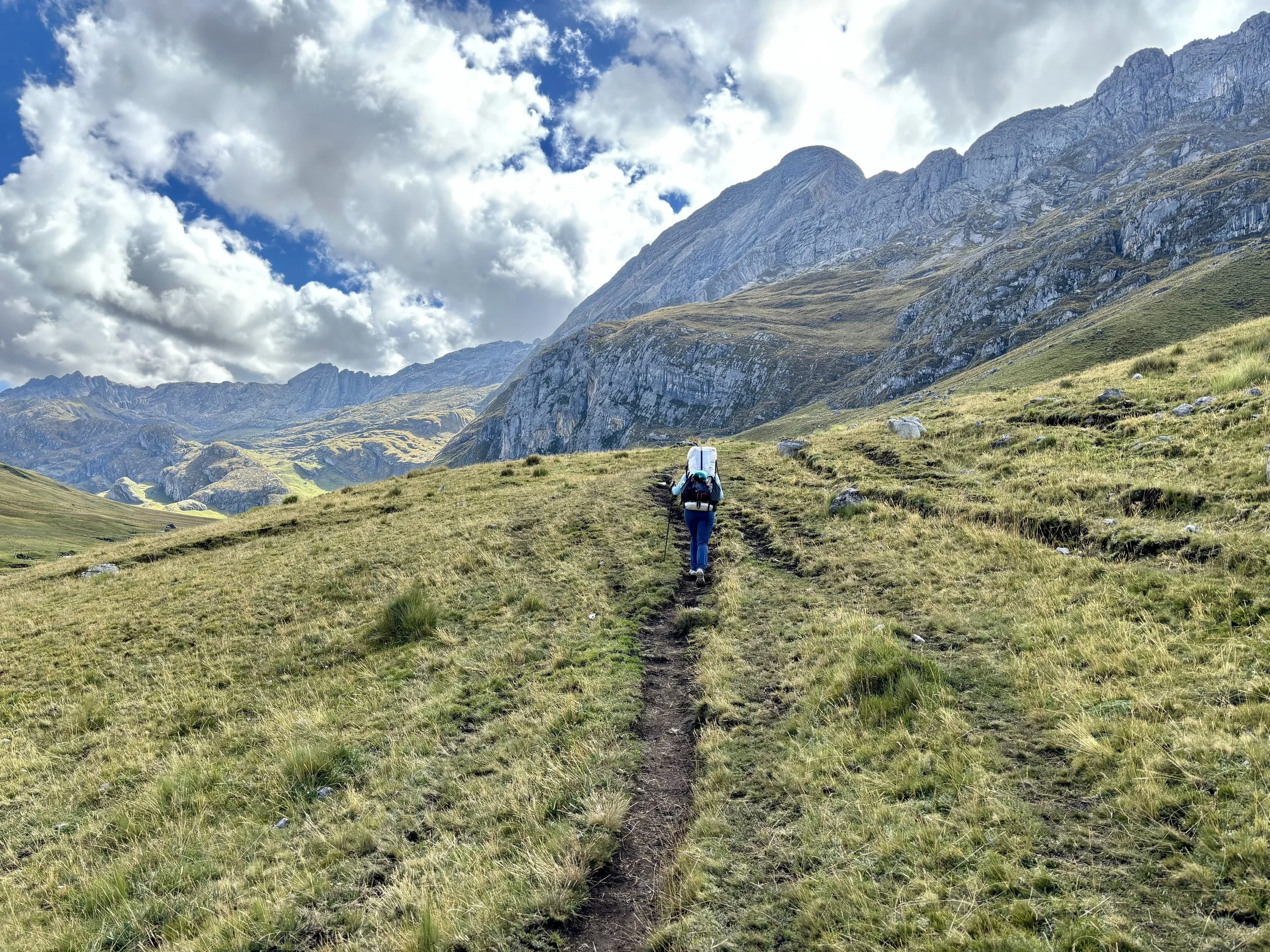
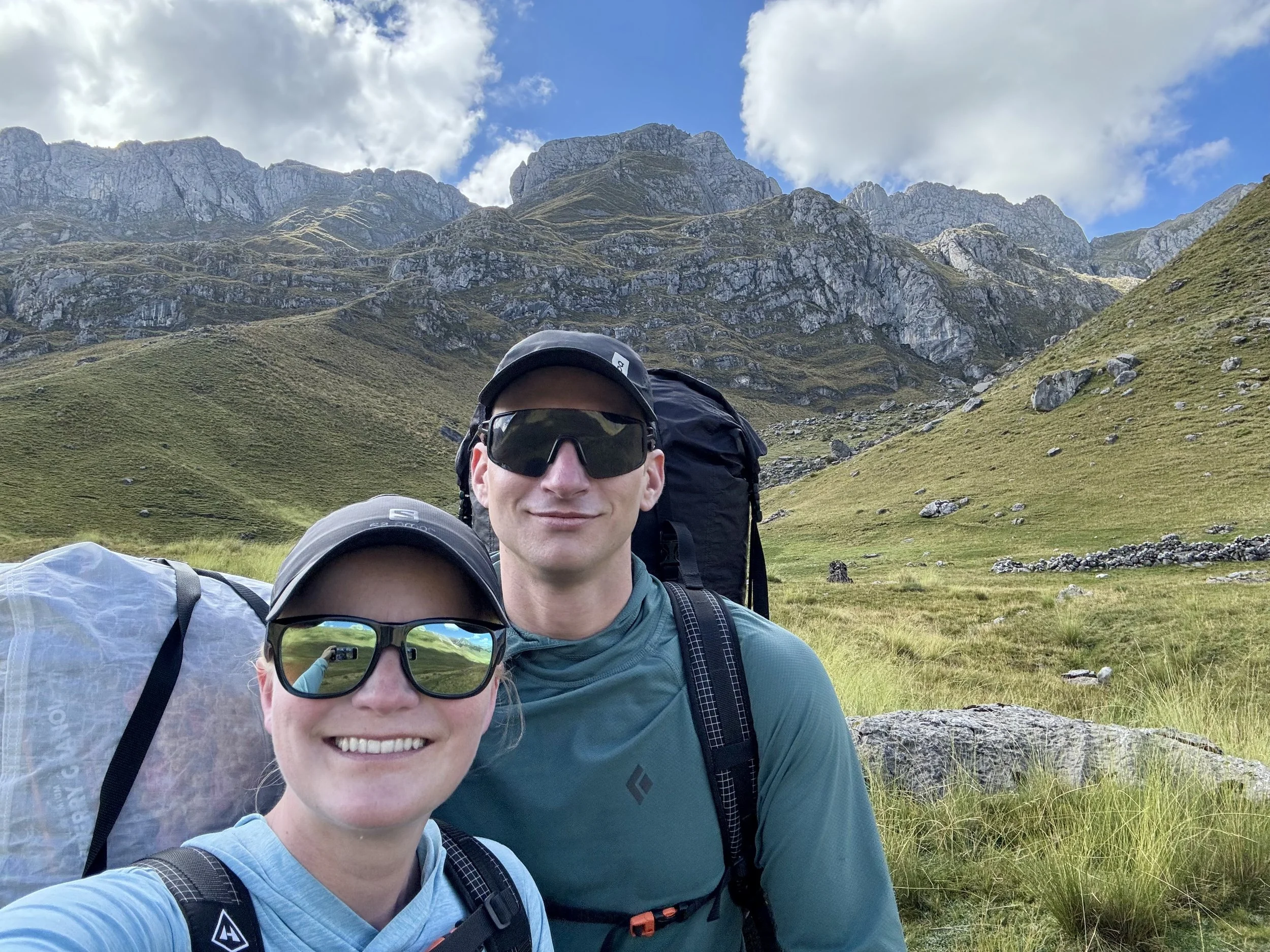
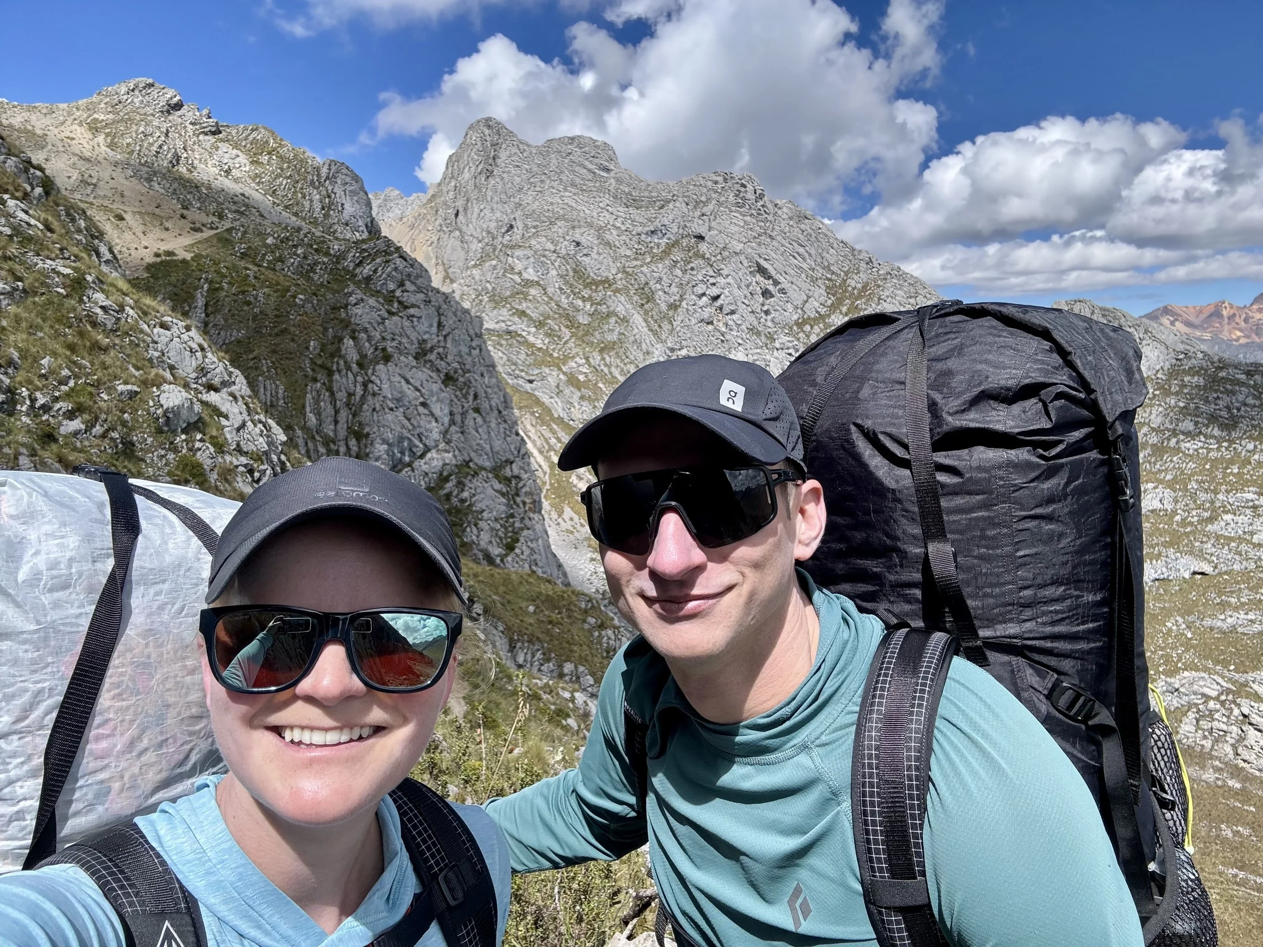
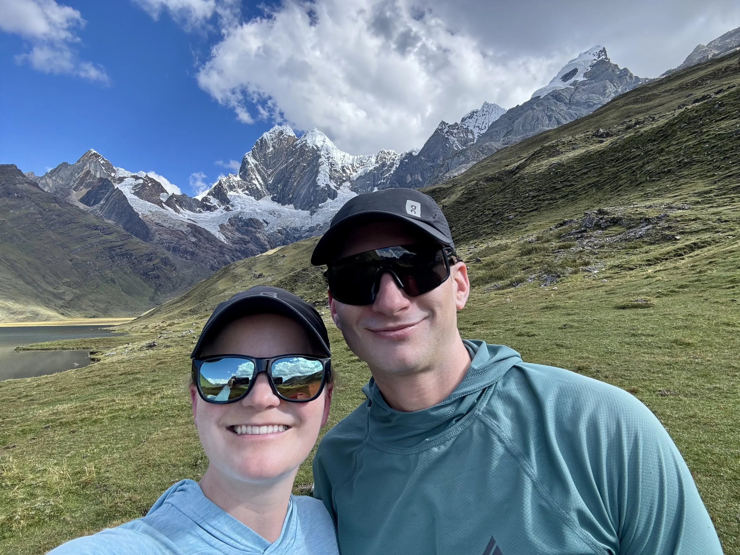
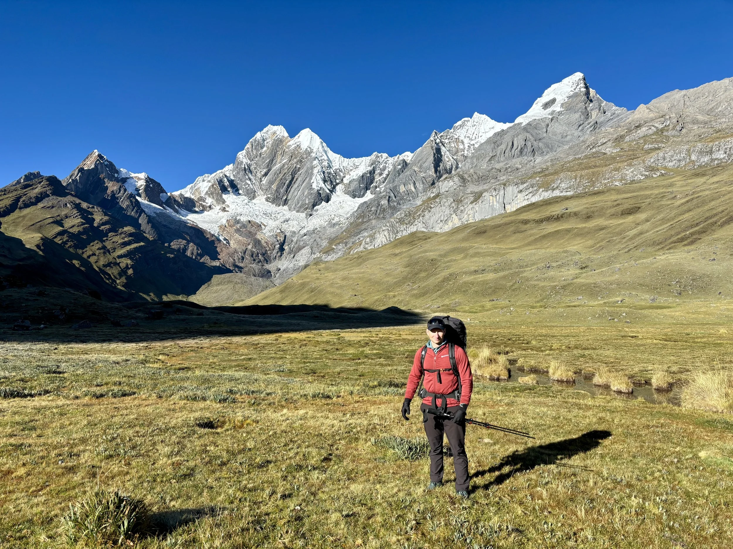
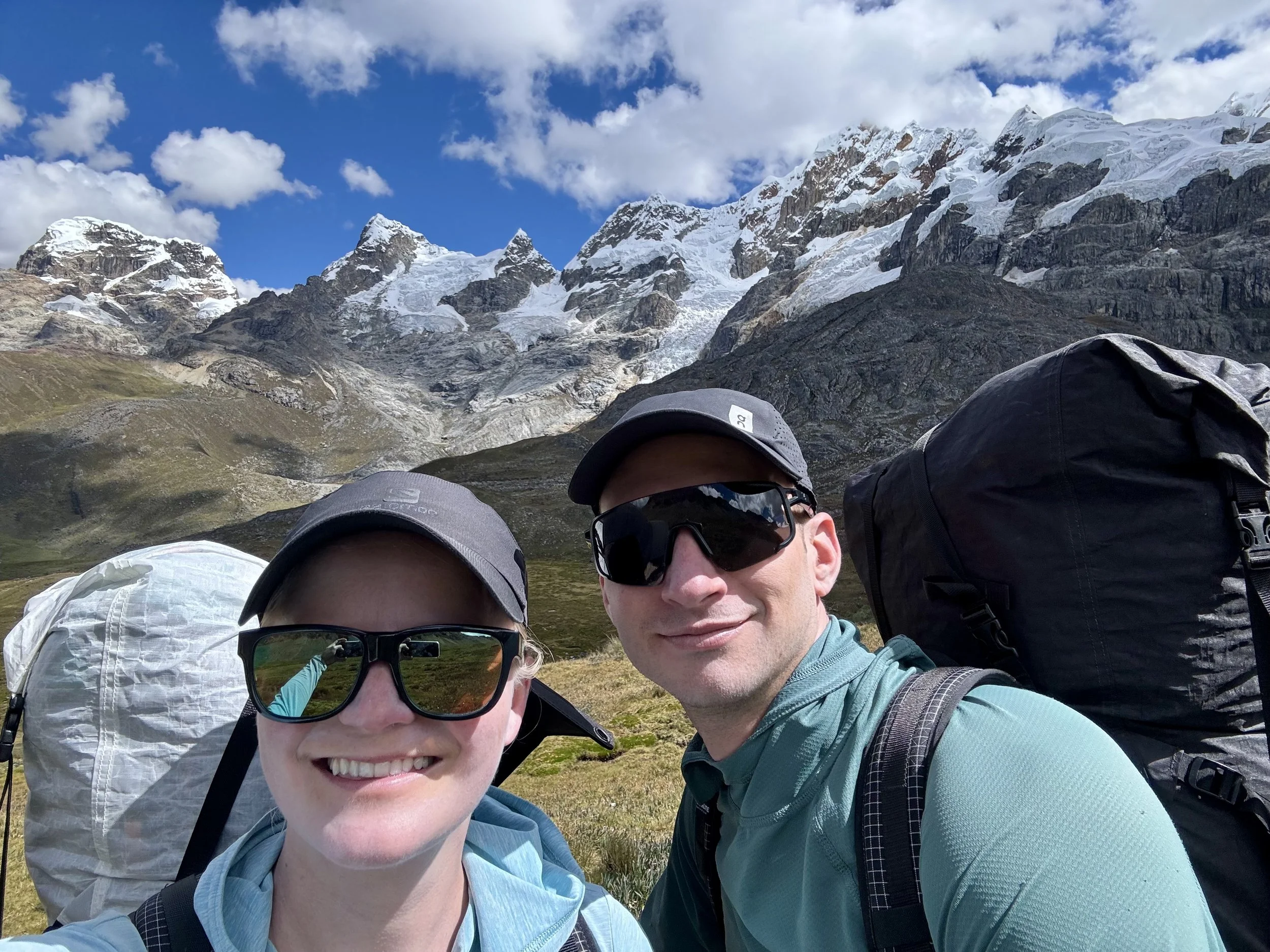
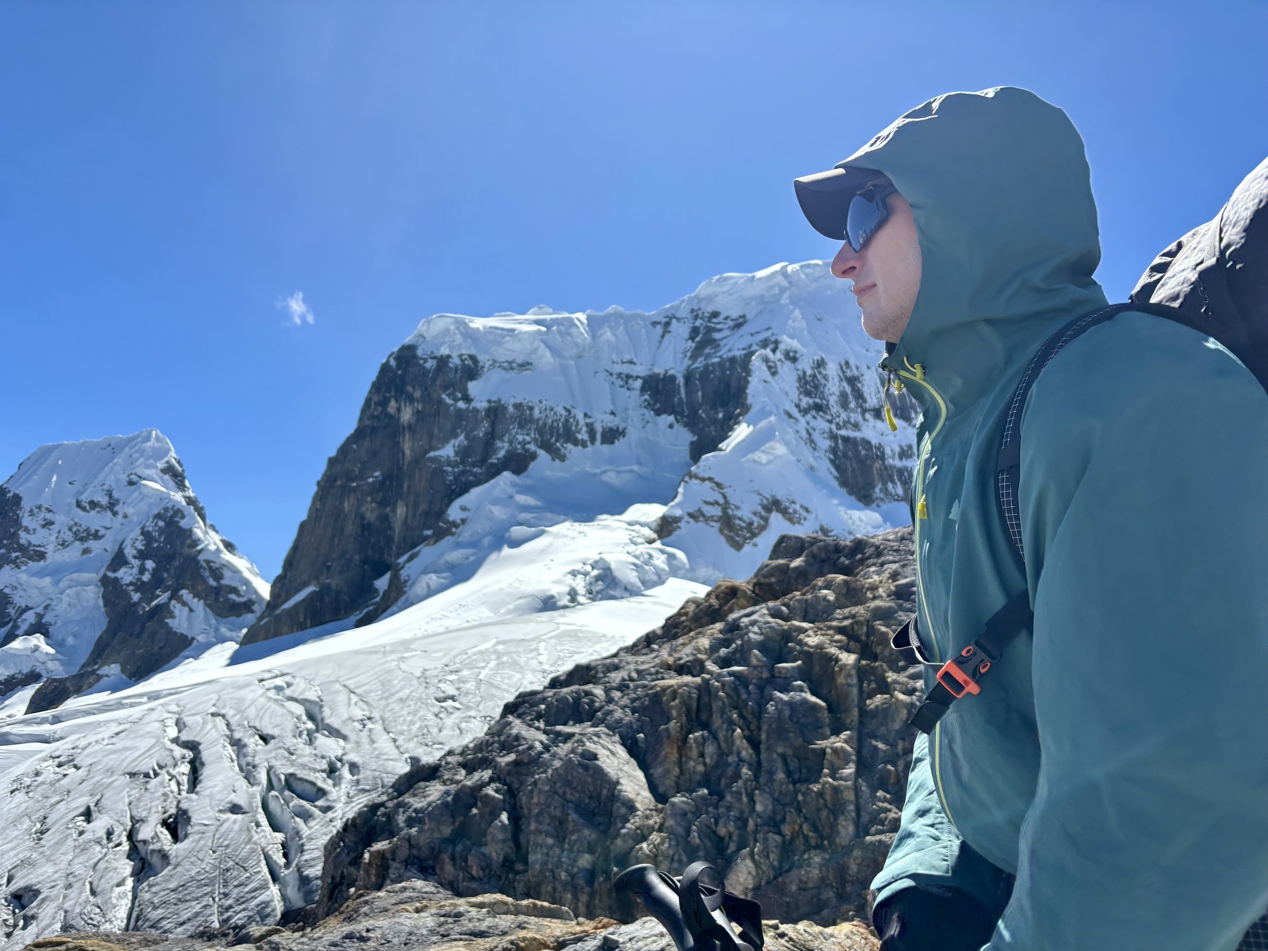
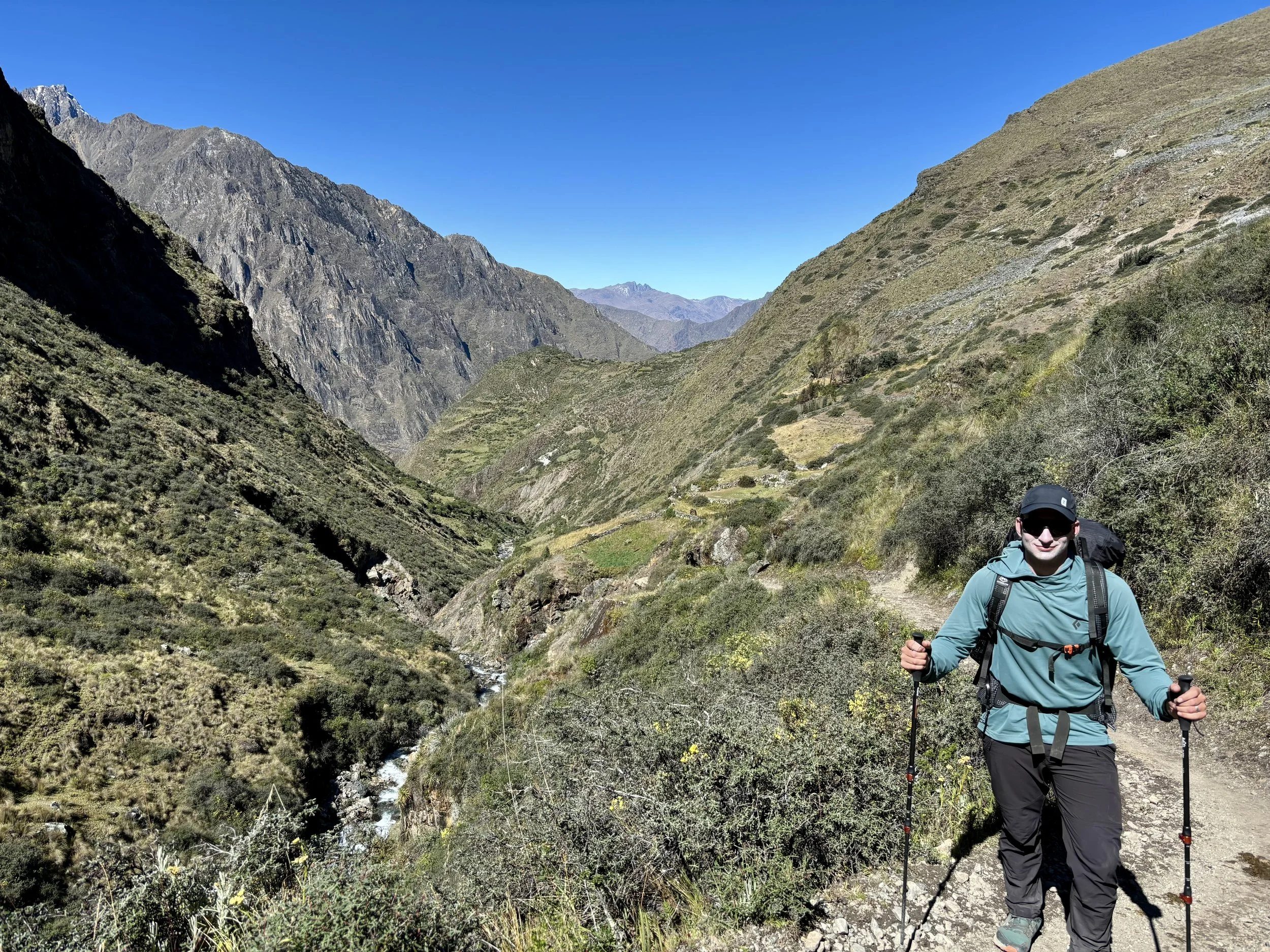
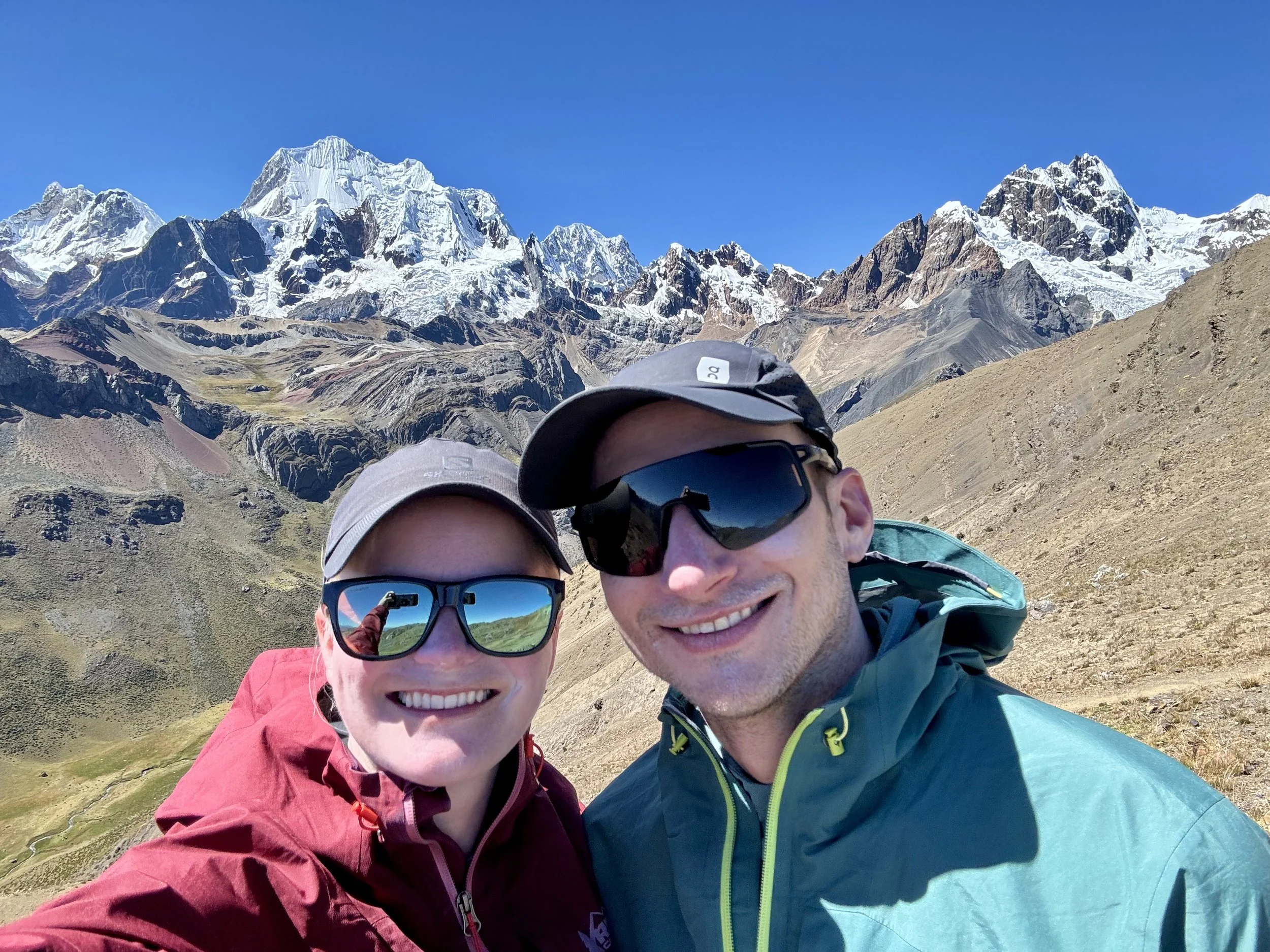
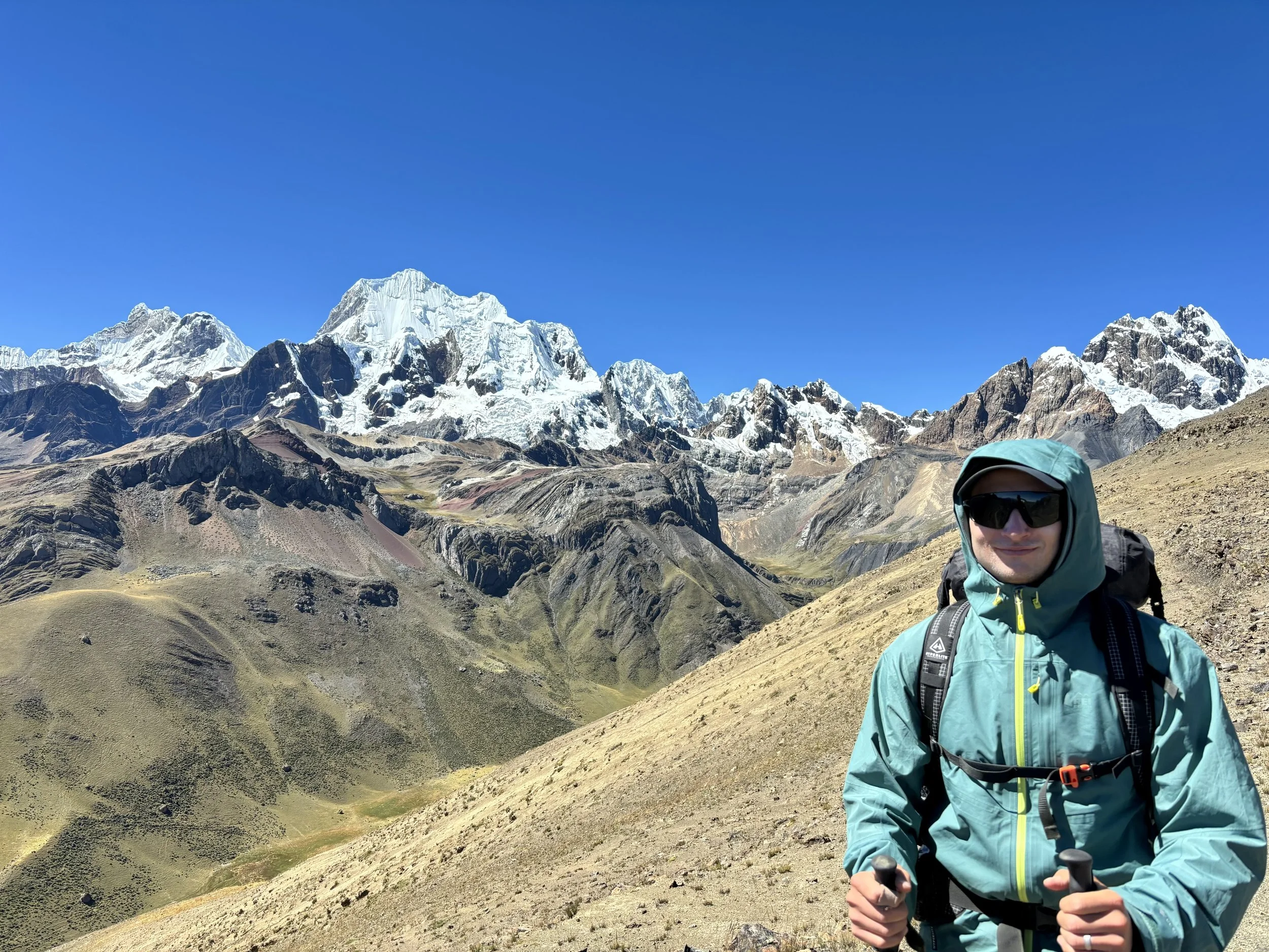
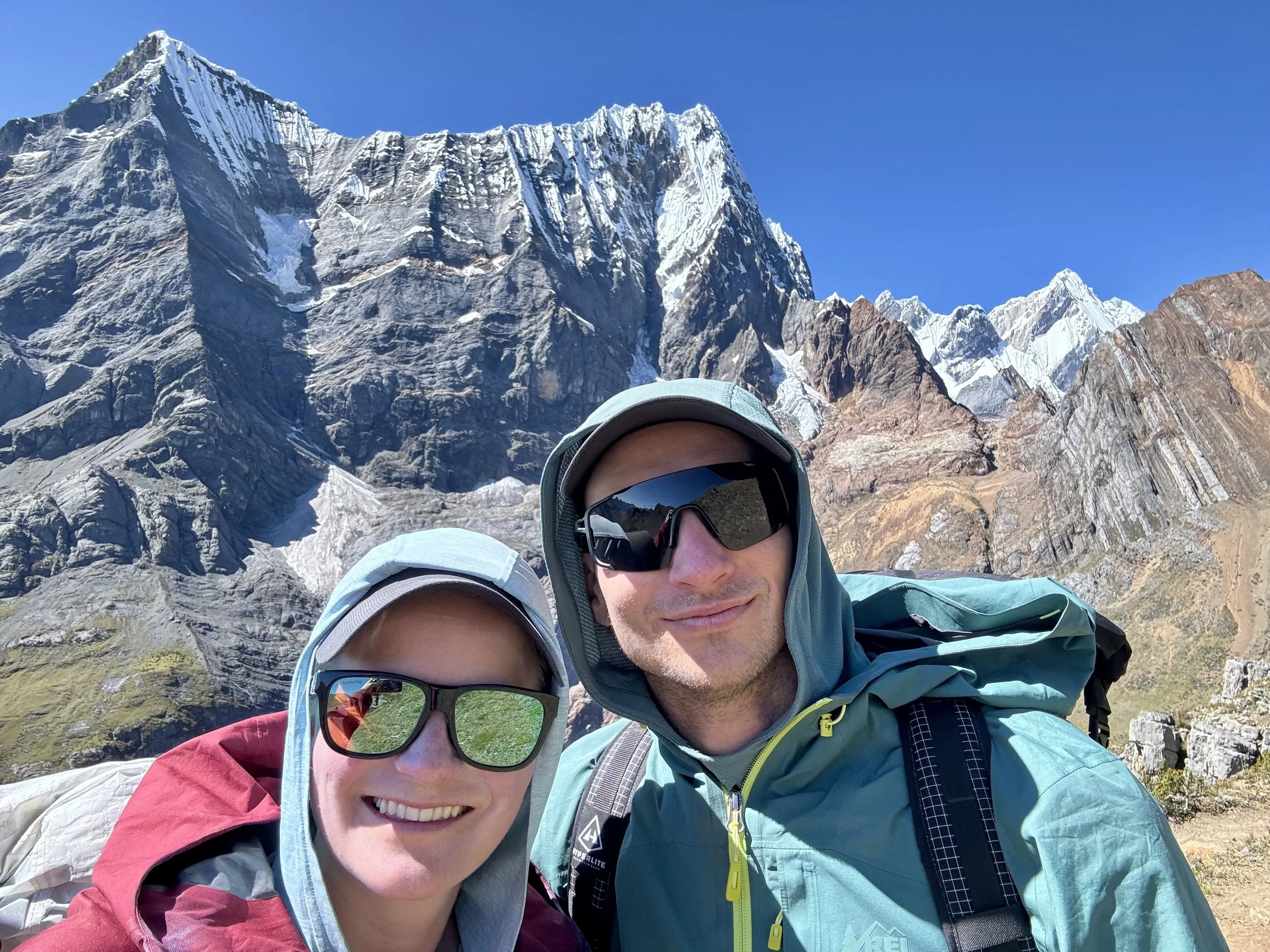
This past May, Mike and I headed down to Peru to backpack (self-supported) the Cordillera Huayhuash Circuit. It was one of the best experiences of my life. Keep reading to learn more about each day.
Day 1
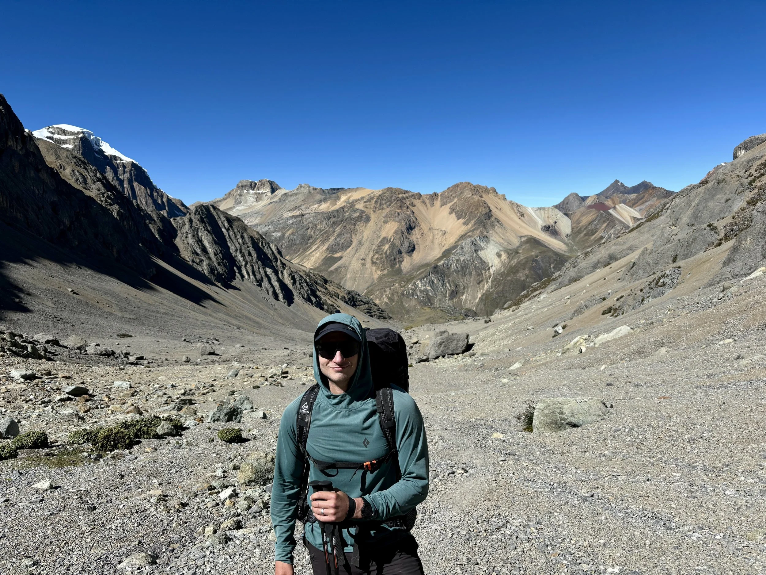
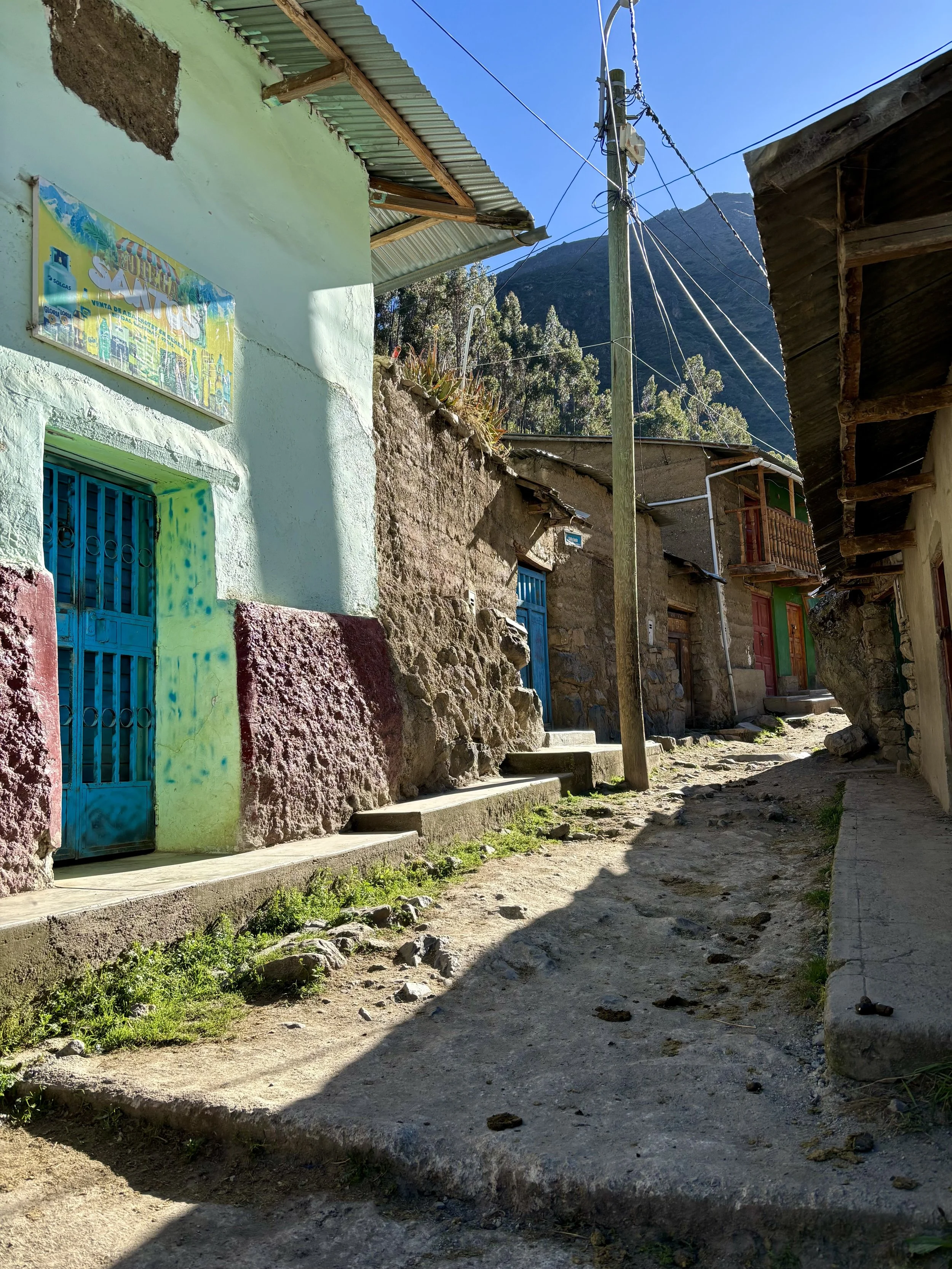
After months of planning, we were finally going to start the Cordillera Huayhuash Circuit today! I was really excited to start the trek. I arranged private transport to the start of the trek using High Summit Peru, organizing the logistics with Marco Reyes and his wife. We would also use High Summit Peru to pick us up on the last day so that we could end at Rondoy. Our driver was waiting outside of our hotel for us by 4:30am. We started the 4 hour drive to Quartelhuain with a quick stop for breakfast in Chiquian along the way. Breakfast was a bit more eventful than I would have liked. I decided I wanted to drink a bottle of Coke after breakfast (sorry Mom), but instead of drinking it, I managed to have it explode all over my puffy and pants. The same puffy and pants that I’d be wearing for the next 8 days. Nothing like starting a backpacking trip covered in sticky sugar. At least we didn’t have to worry about bears!
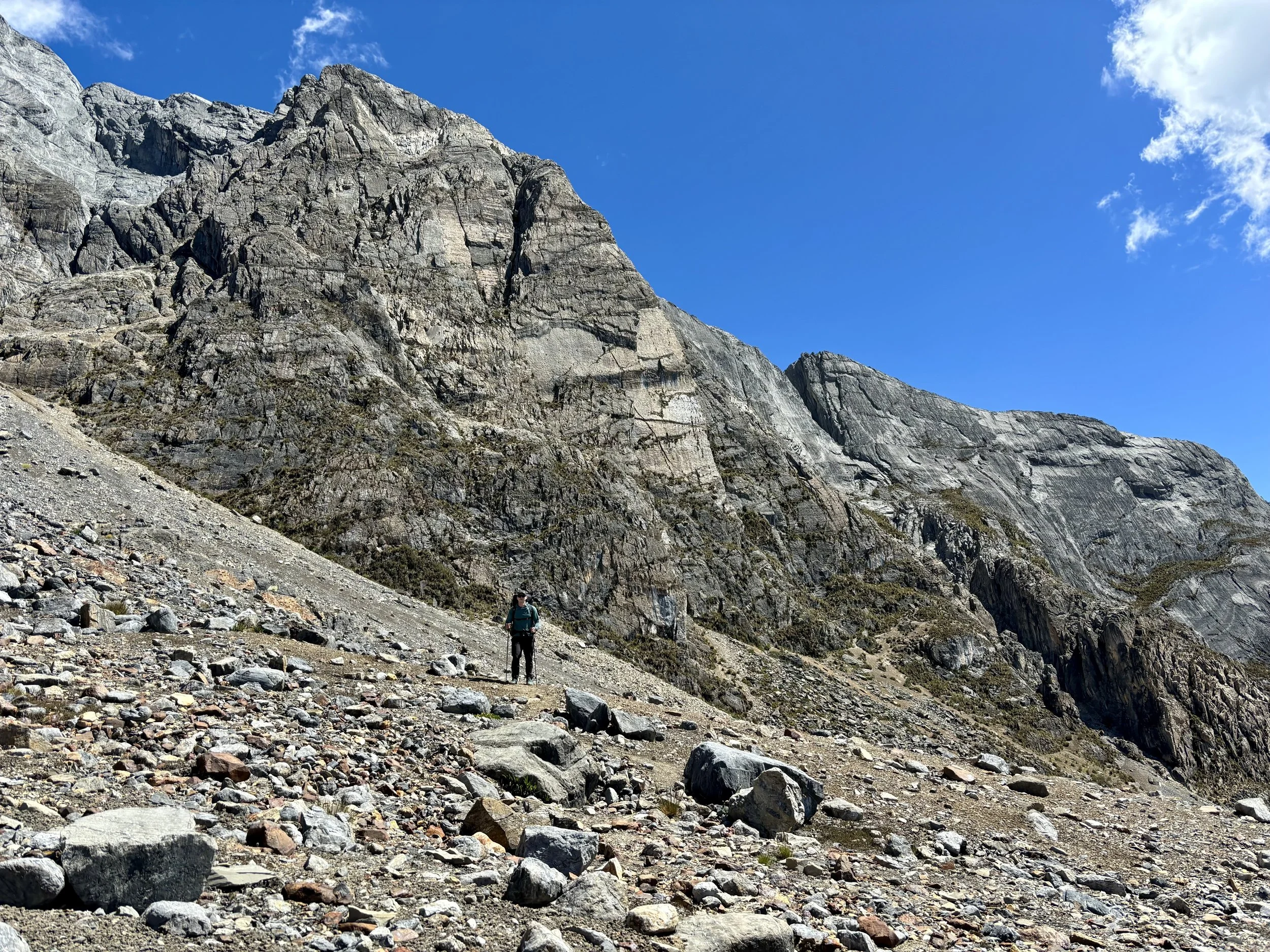
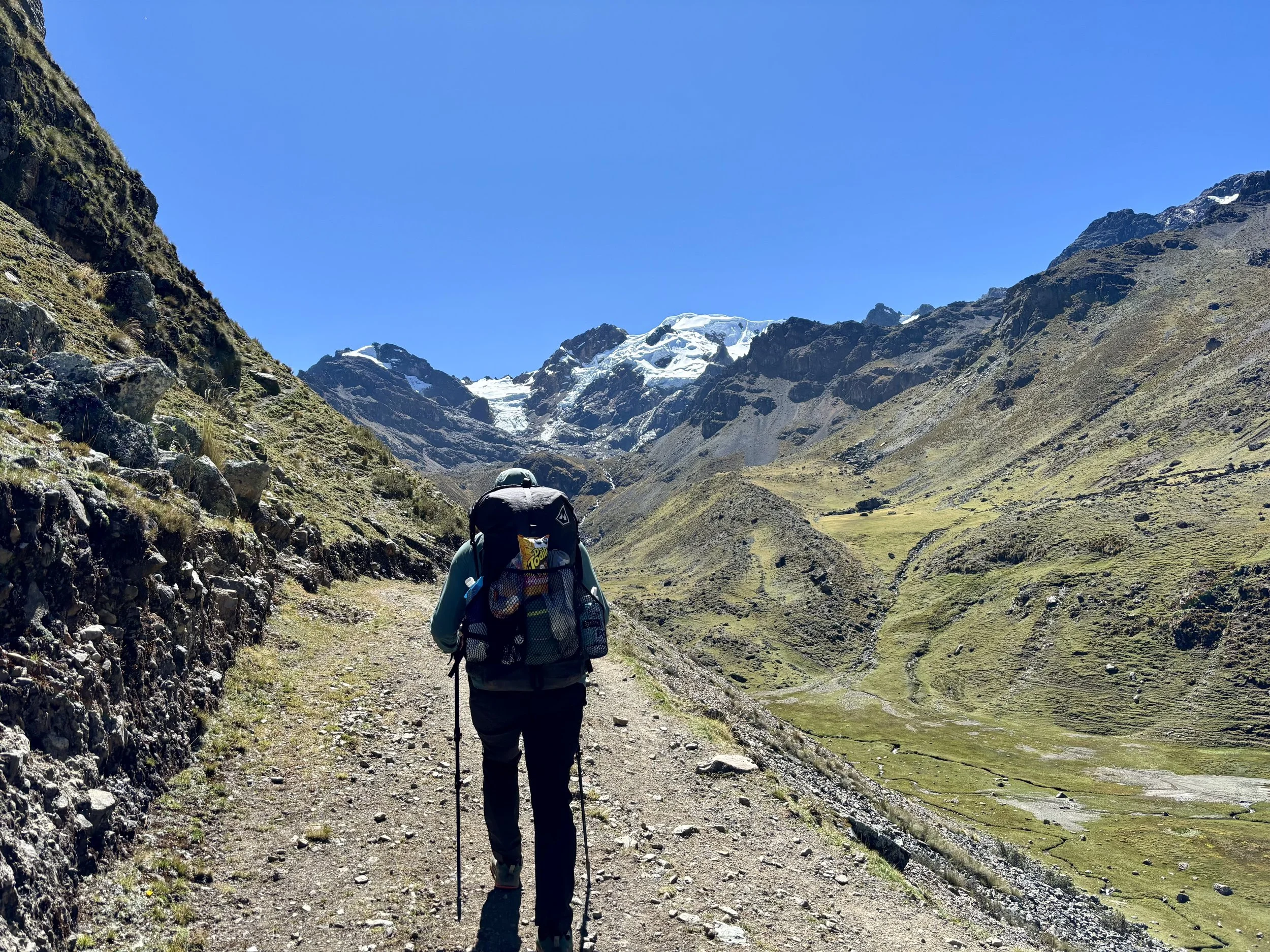
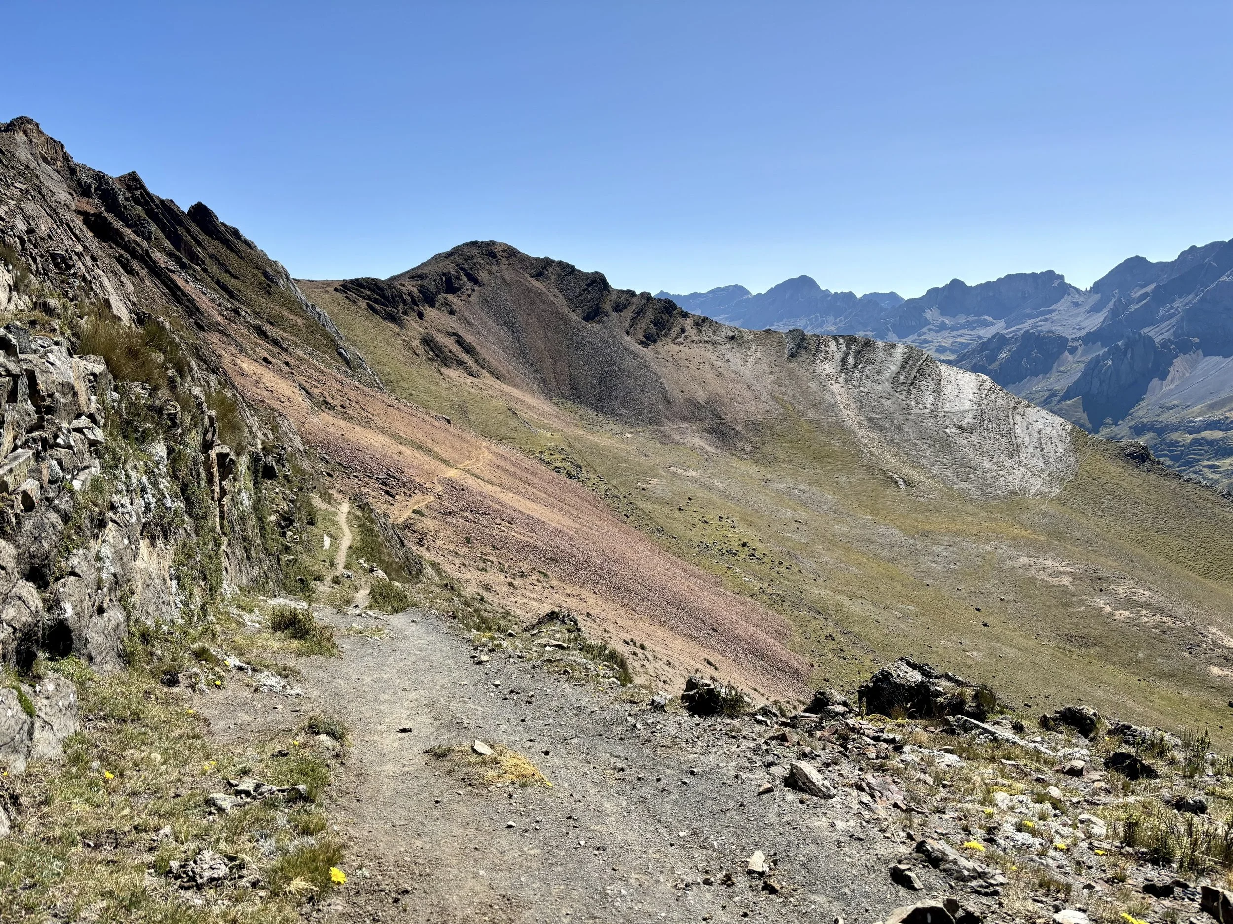
Once we finally made it to the trailhead, Mike and I wasted no time getting on trail. There were definitely some clouds in the sky and since it felt like we were still learning how to judge the weather in this area, we figured getting up and over the one pass we had on the day’s schedule should be a priority. We started out feeling really good and made it up to the pass at 15,200 ft quicker than expected. The weather didn’t seem ominous at this point so we stopped for a while and took in the views. We then headed down the other side of the pass. We decided we were going to take the Alpine Route that day so we went off the main trail partway down the pass onto what felt more like a cow trail. This ended up being the correct move and the rest of the day we felt like we spent traversing the side of a hill, following meandering cow paths.
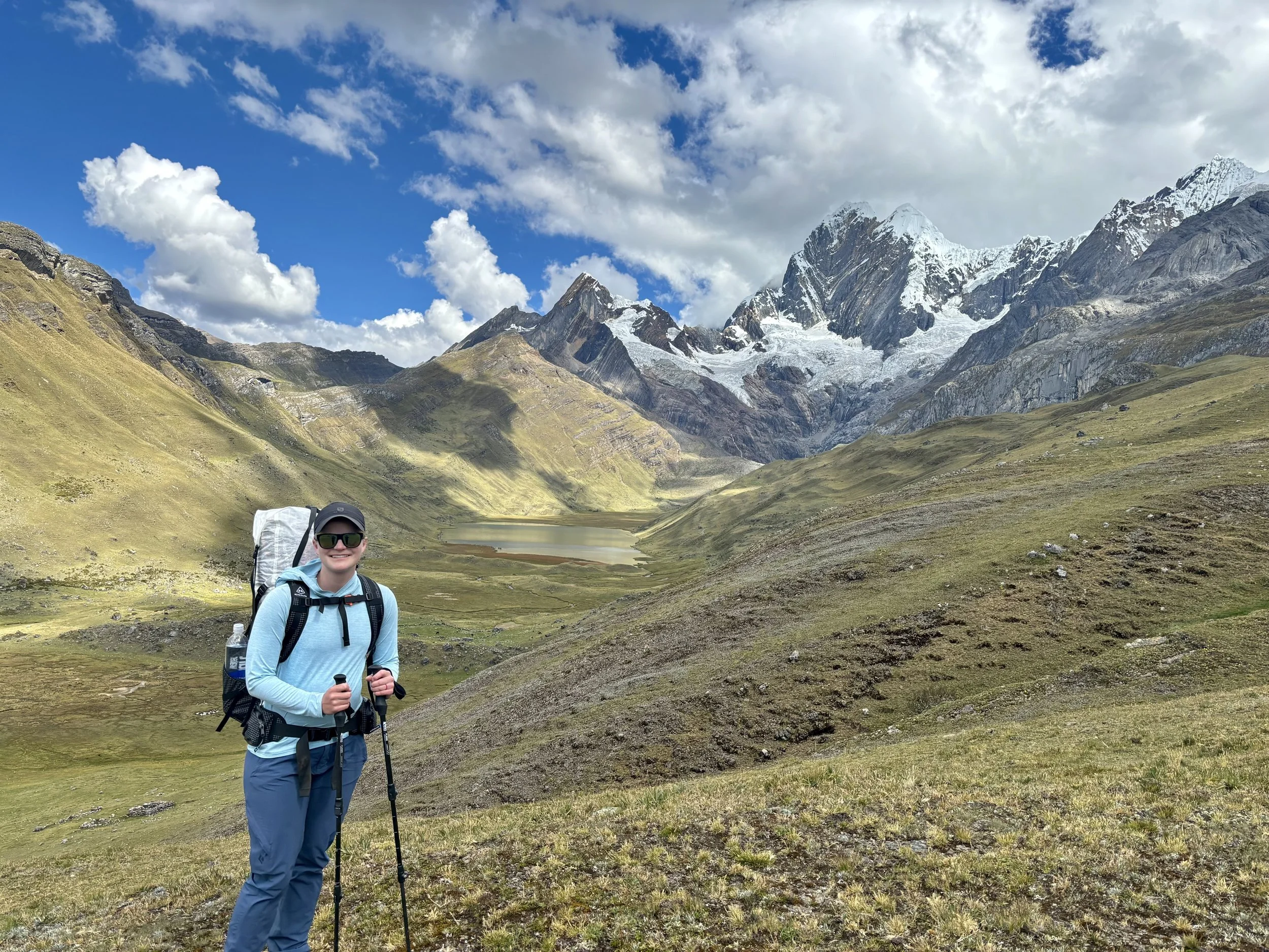
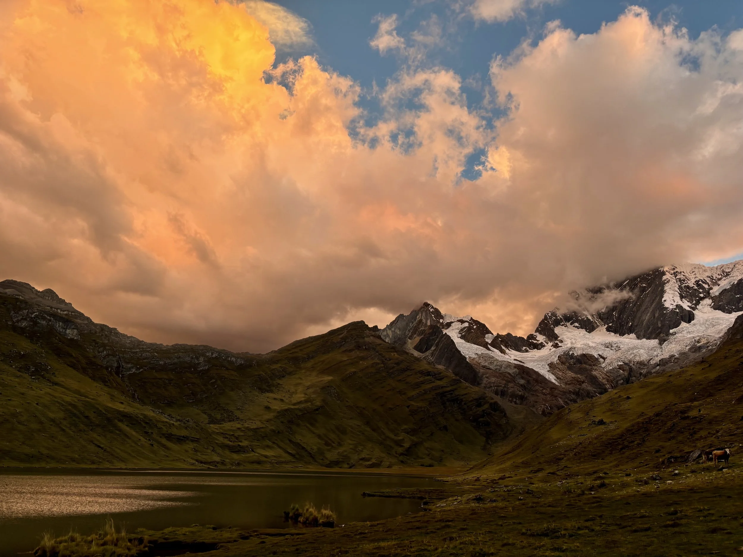
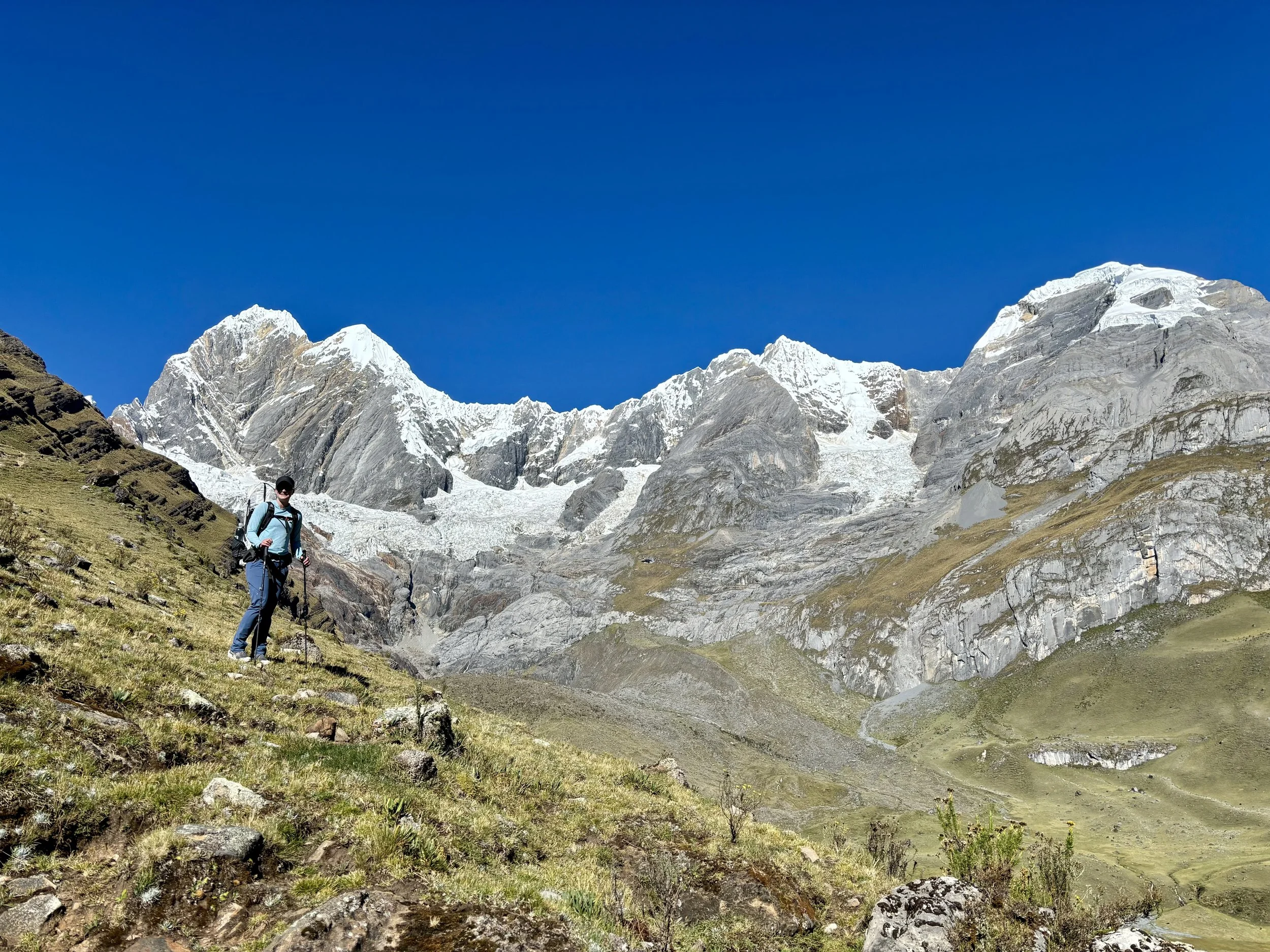
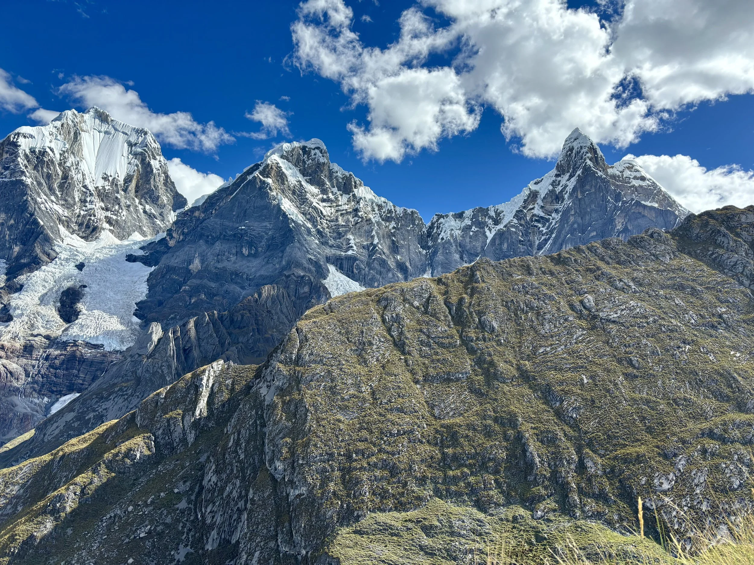
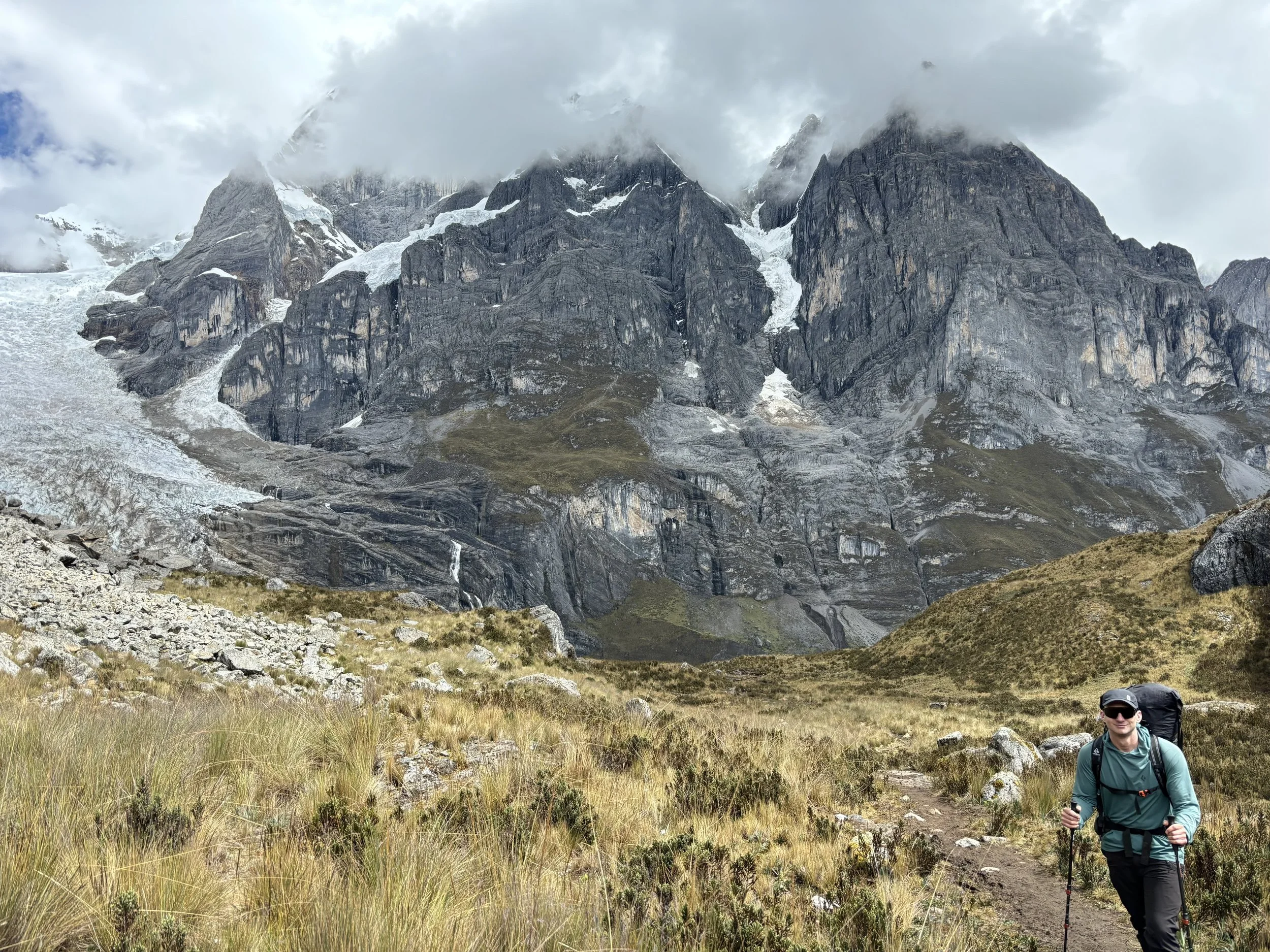
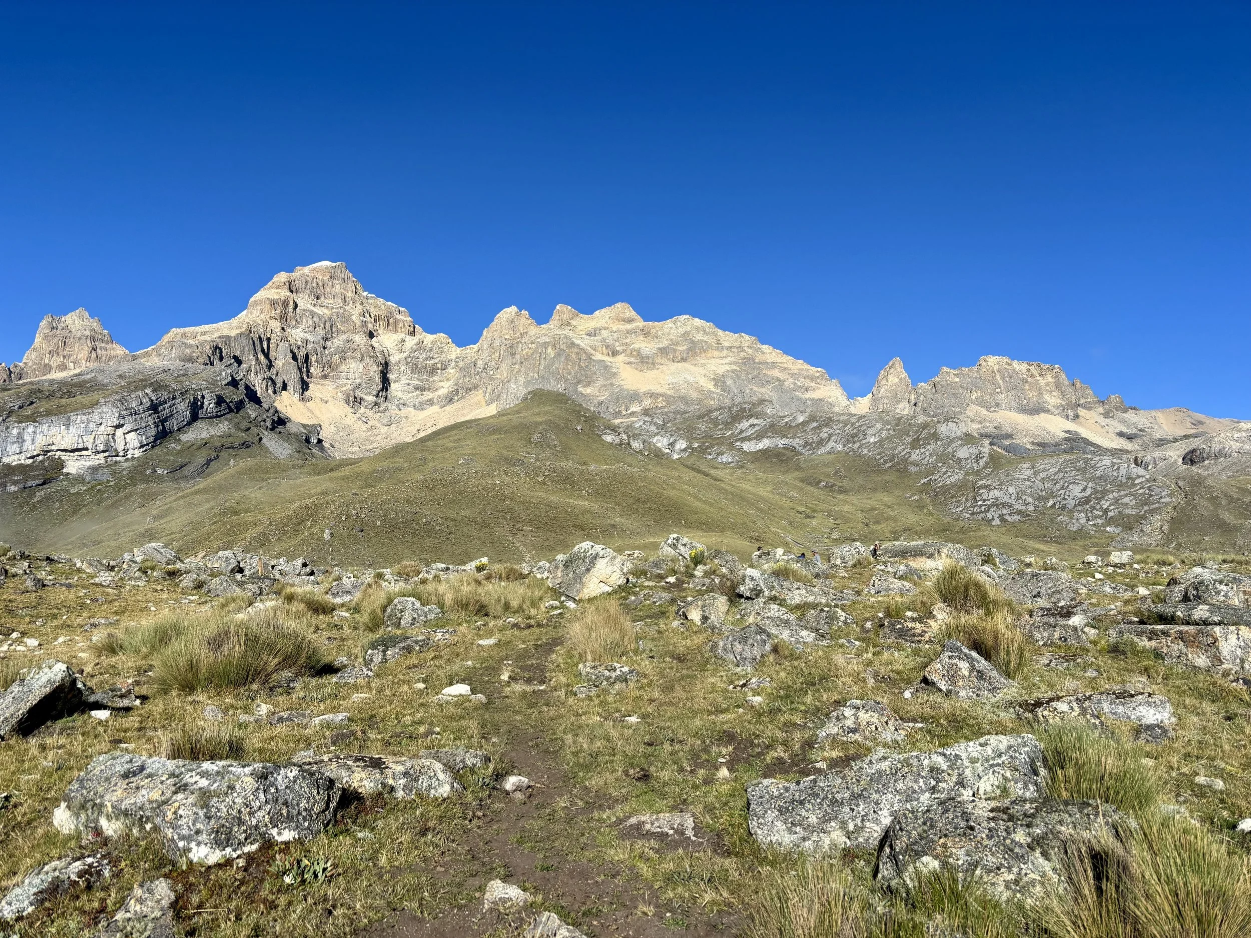
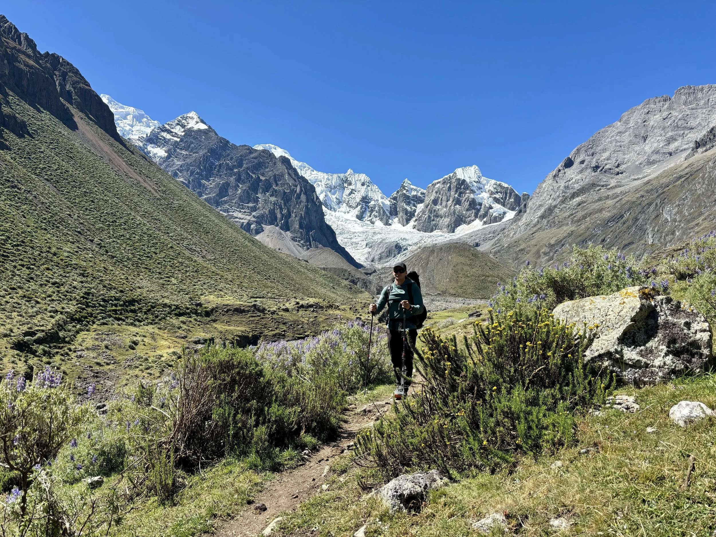
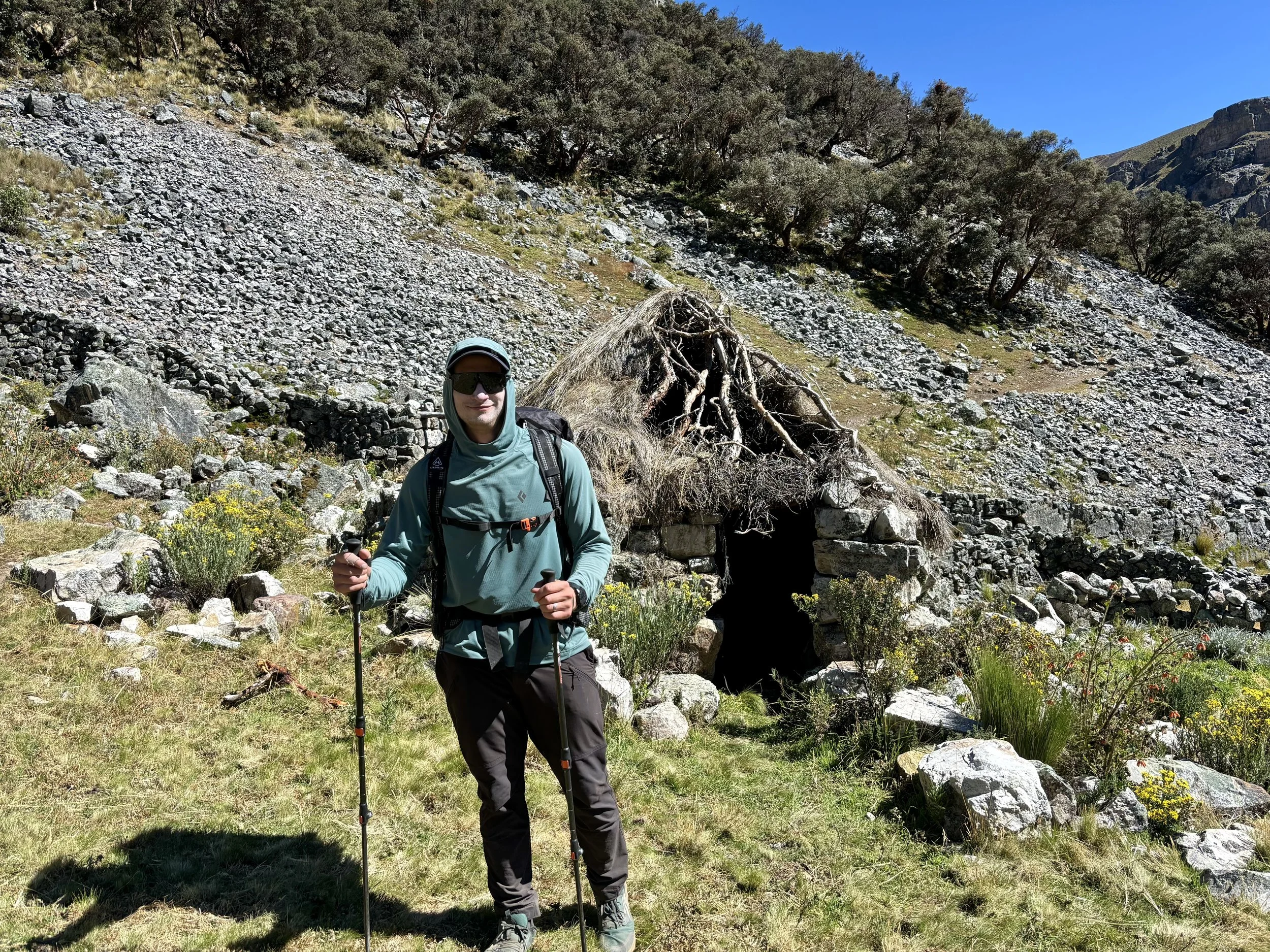
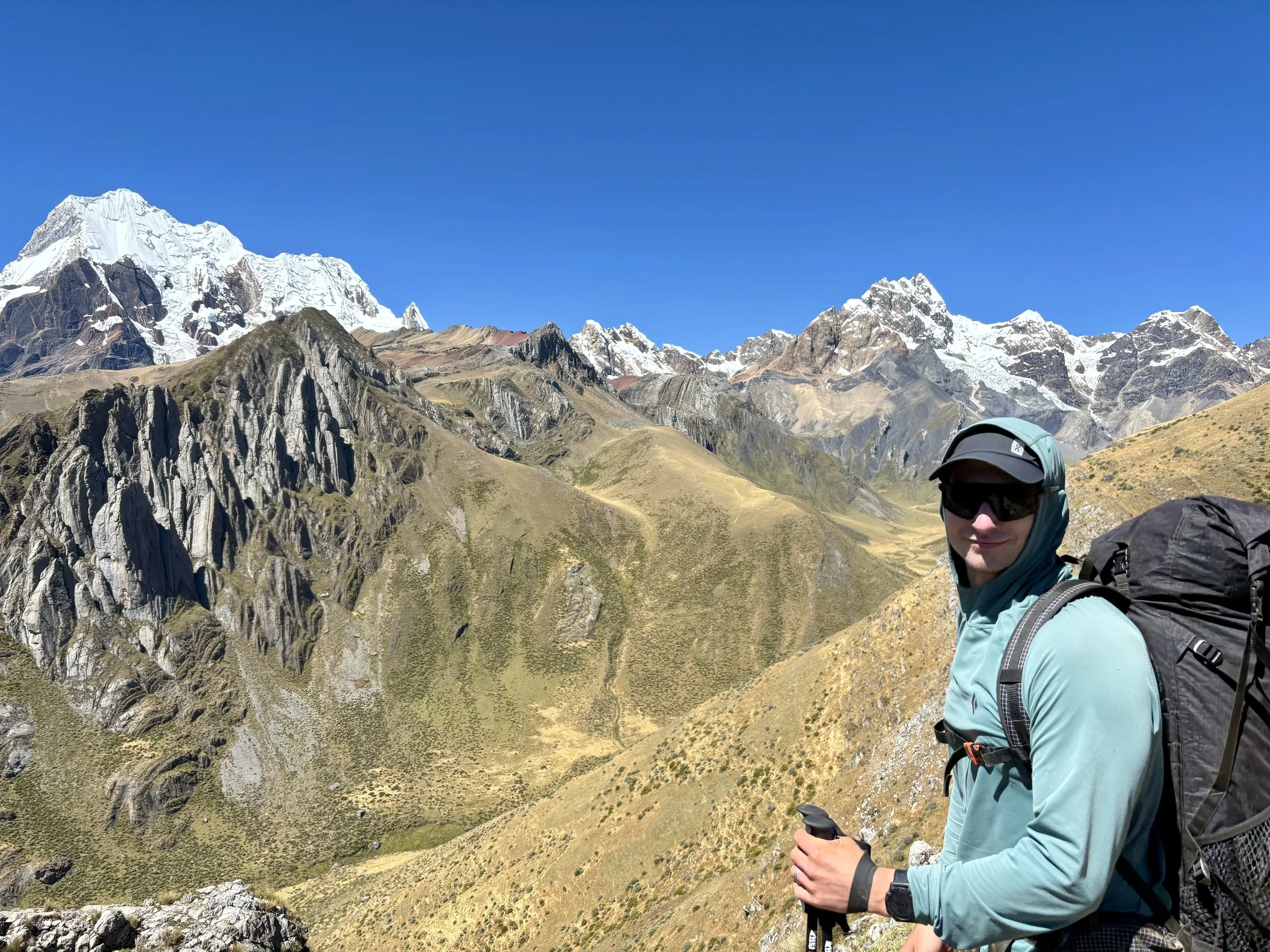
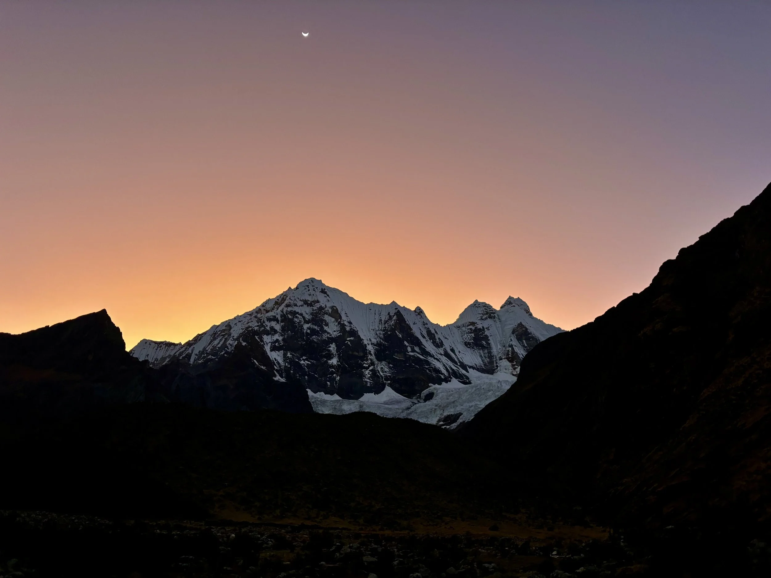
As we continued walking, views of Jirishanca started coming into view. This was one of my favorite mountains to look at of the whole trip. After a few hours of hiking and an encounter that involved being charged at by a cow, we found ourselves on the shore of Laguna Mitococha. This seemed like the perfect place to set up camp on the first night. With the Cordillera Huayhuash being so close to the equator, the sun set between 6-6:30pm every day, which is much earlier than I’m used to on backpacking trips. We ate dinner and watched a beautiful sunset that night. After dinner, we headed in to the tent to read for a bit before going to sleep.
Stats: 5.5 miles, 1800 ft of elevation gain


Day 2
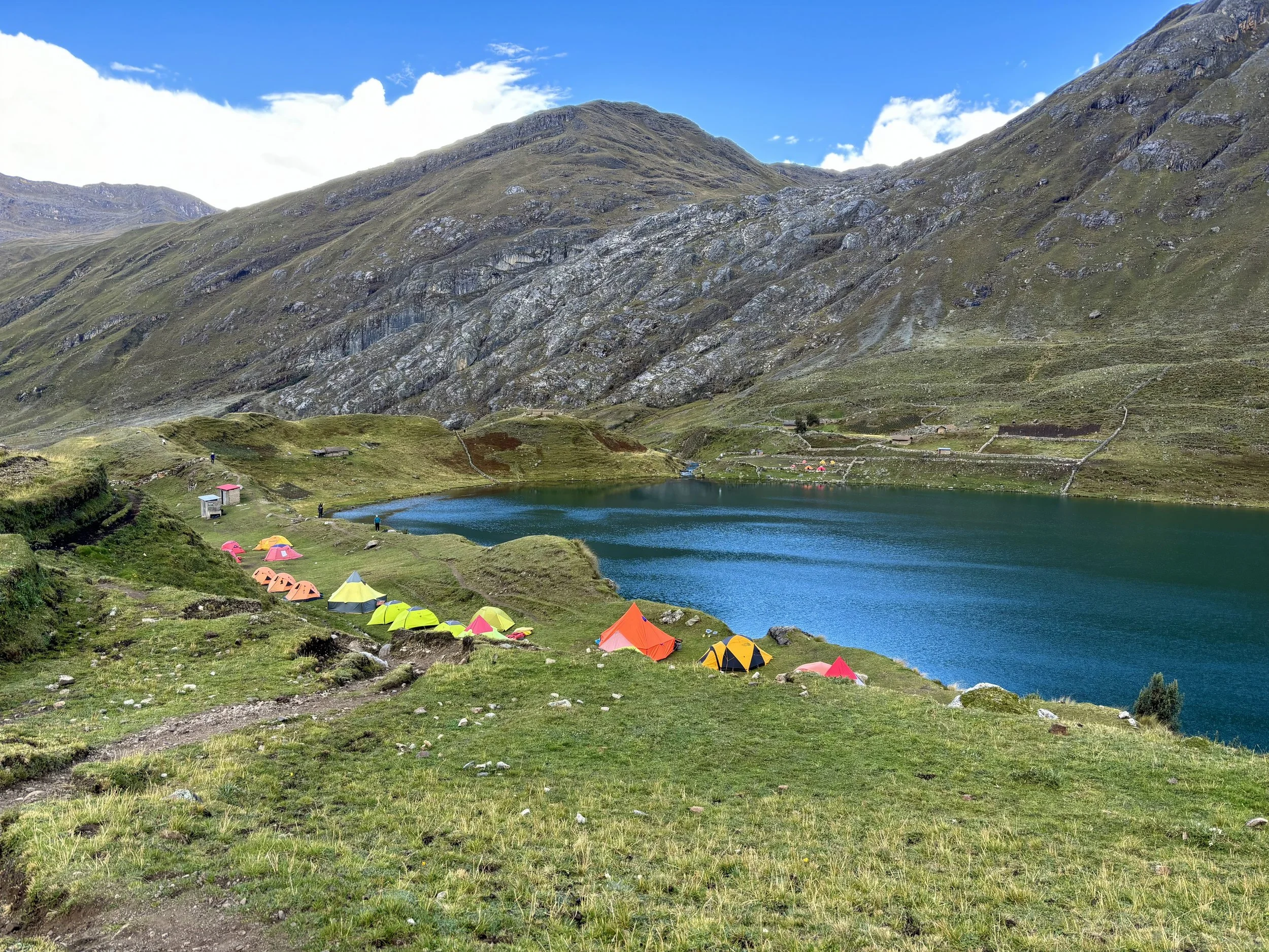
The next morning we woke up to the inside and outside of the tent being covered in frost. I managed to stay quite warm in my Western Mountaineering Sleeping Bag, but I did not want to get out of the sleeping bag. So we had breakfast in the tent, which I typically would not do if bears were a concern, but they weren’t on this trip so I felt ok with us eating in the tent. Breakfast in the tent became the norm for the next 7 days. Once I ran out of excuses to stay in my warm sleeping bag, we packed everything up and started day 2 of the trek. Our goal for that night was to sleep at the group campsite at Laguna Carhuacocha. We planned to take the alpine route once again.
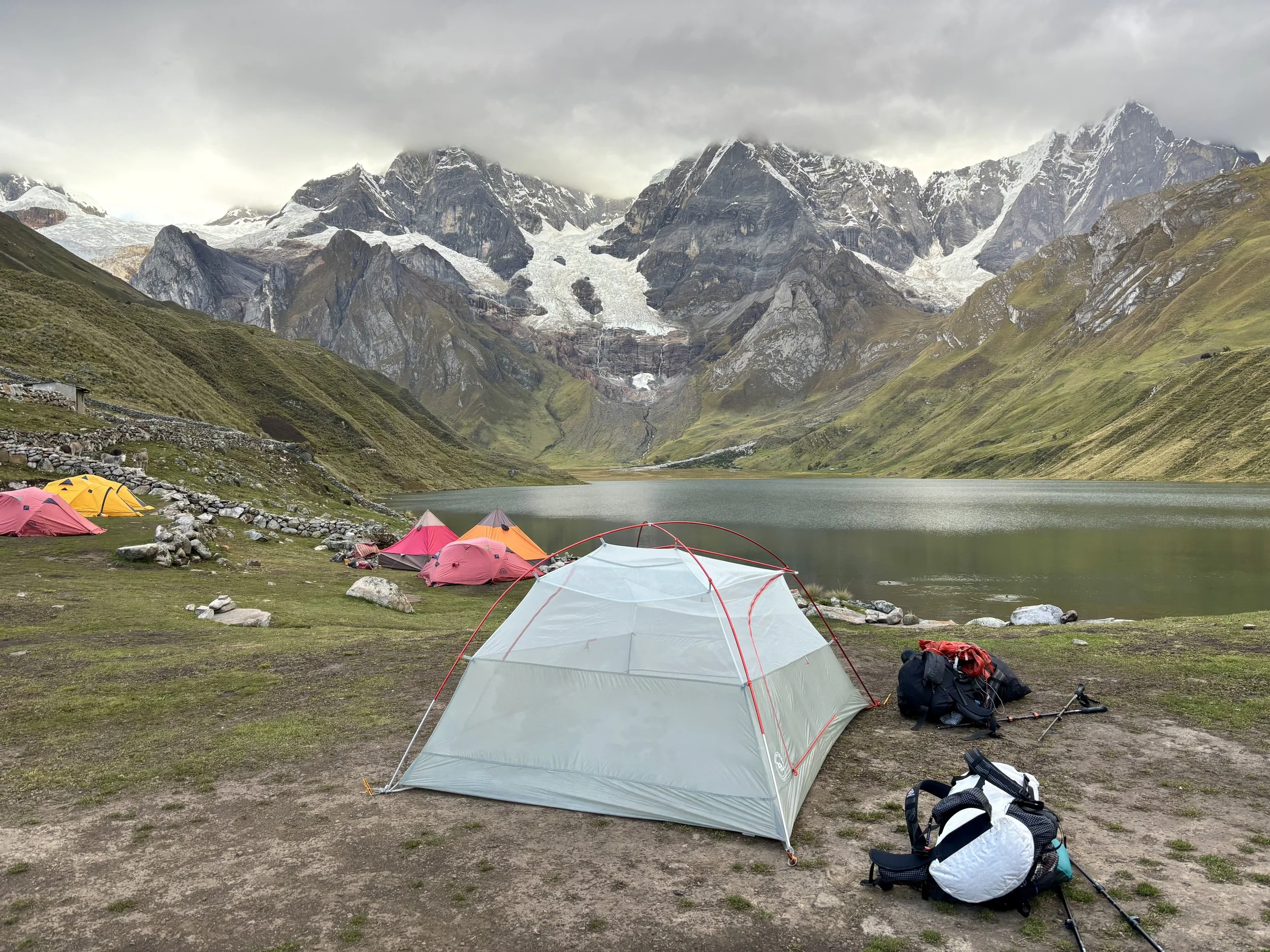
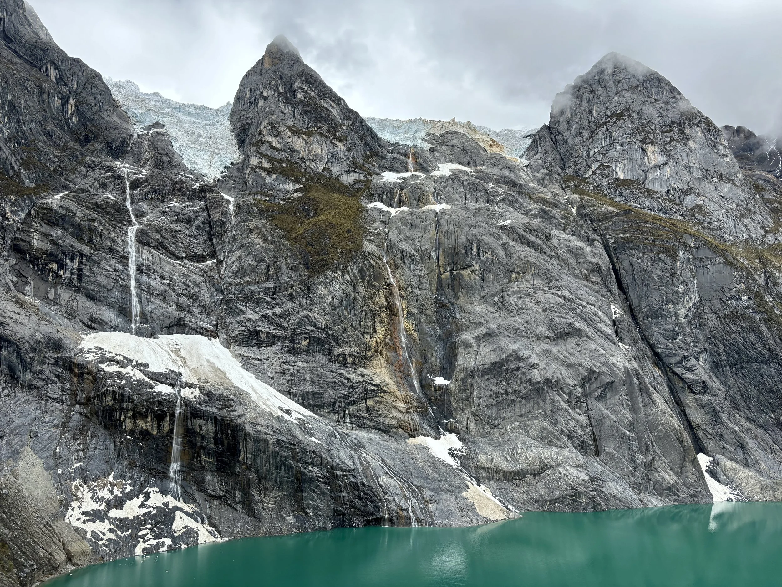
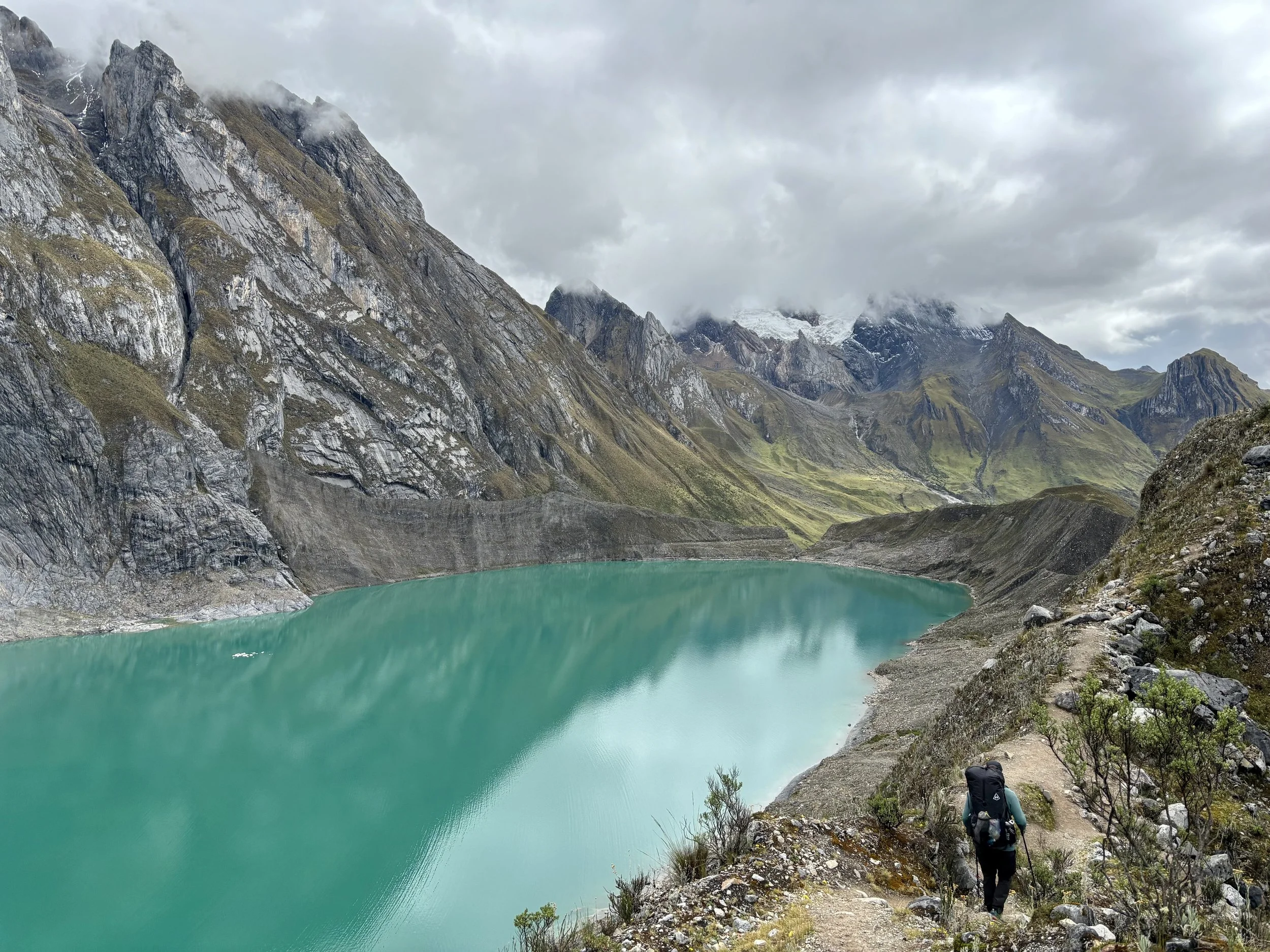
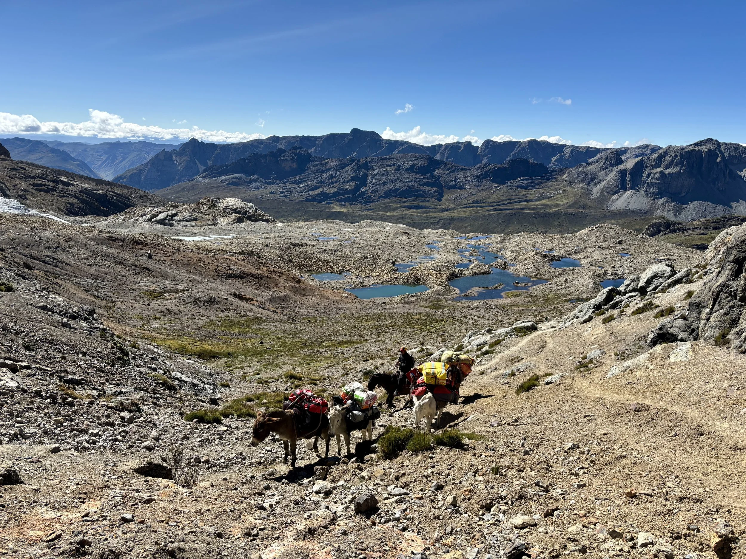
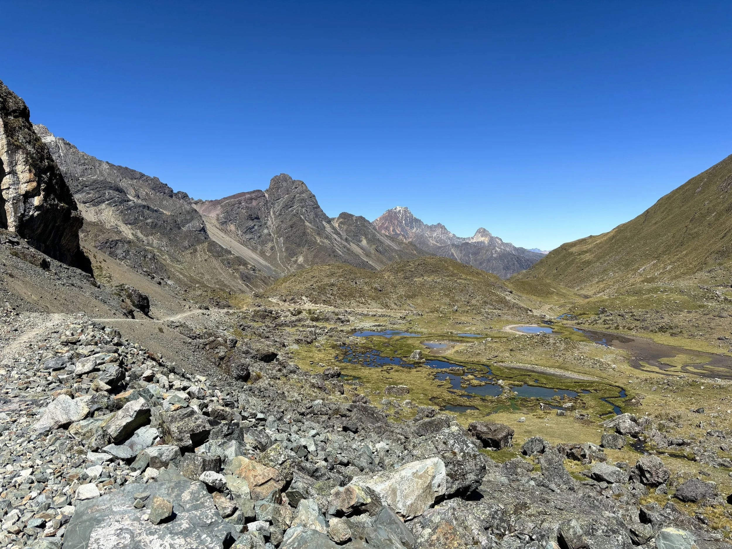
The crossing of the outlet stream at Laguna Mitococha ended up taking longer than we expected. Because it had rained the night before, the stream was higher than it had been the afternoon before, and we were unable to cross where we had planned. Ultimately, we found a spot, but it added some unexpected time and mileage to our morning. When we made it to the other side, we hiked along the east side of the lake. Once we reached the end of the lake, the uphill for the day really began. We hiked up a grassy field up to the ridge. This ridge also proved a little tricky in terms of figuring out where exactly to cross over it and start traversing on the other side. We watched another couple stay too high in one spot and they got cliffed out so we took a lower route. Ultimately, a social trail became more visible and we followed that to our high point of the day, around 16,000 ft. We then began our descent and passed Laguna Alcaycocha, where we found some cows that didn’t seem to happy to see us. We decided to filter some water here and then continued on to a viewpoint. This was one of the prettiest viewpoints of the trip and we had it all to ourselves.
The big debate we had from here was how to get down to Laguna Carhuacocha. Do we add miles and backtrack to a less steep descent or do we walk down from the viewpoint, which was so steep we couldn’t see over some cliffs to really see what it looked like? I knew people had walked down this slope before, but with the lack of visibility I got a little spooked and had us backtrack a bit. I then had us go off trail to go down another steep slope. In hindsight, I think I picked a worse option than just going down where others had gone because we found ourselves on just as steep of a slope without a social trail to follow. That was one of the worst descents of my life, and I was extremely happy to reach the main trail at the bottom. We then headed over to the camp on the southeast side of the lake because there were only a few tents set up over there. Exhausted from the last part of the day, we ate an early dinner and headed into the tent. This turned out to be a good move because a pretty big storm rolled in shortly after we finished eating, and we were happy we avoided getting soaked.
Stats: 7.3 miles, 2100 ft of elevation gain
Day 3
Our third day started in a bit of a fog with some low cloud cover over the mountains around us. We took our time packing up camp that morning as we suspected the longer we waited, the greater the chance of the clouds clearing for today’s part of the trek. Once again, our plan was to take the Alpine Route, which was the route it seemed like most people were taking that day.
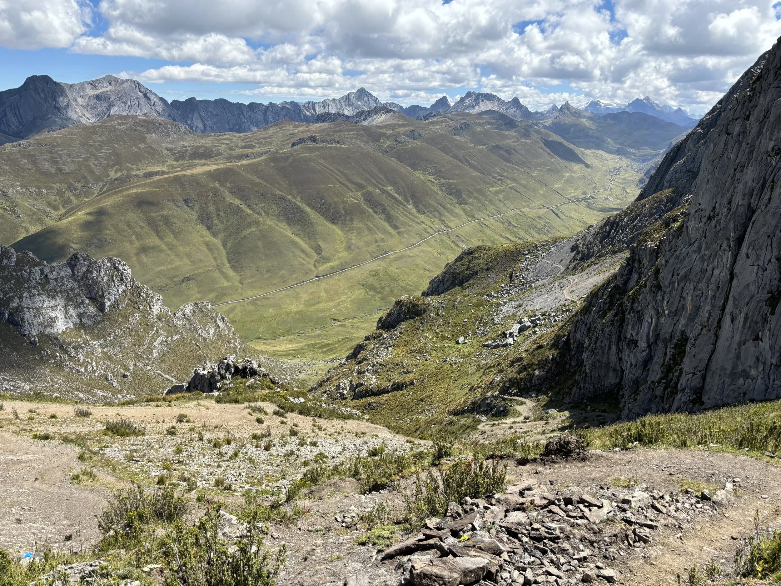
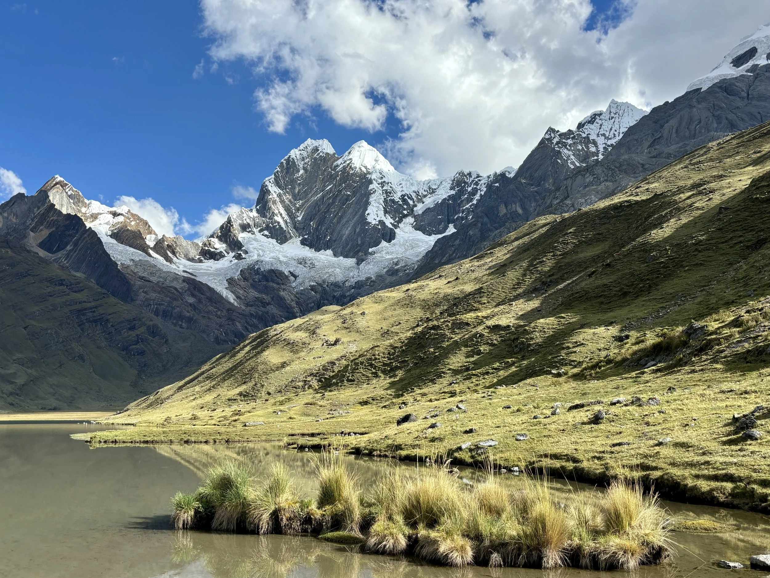
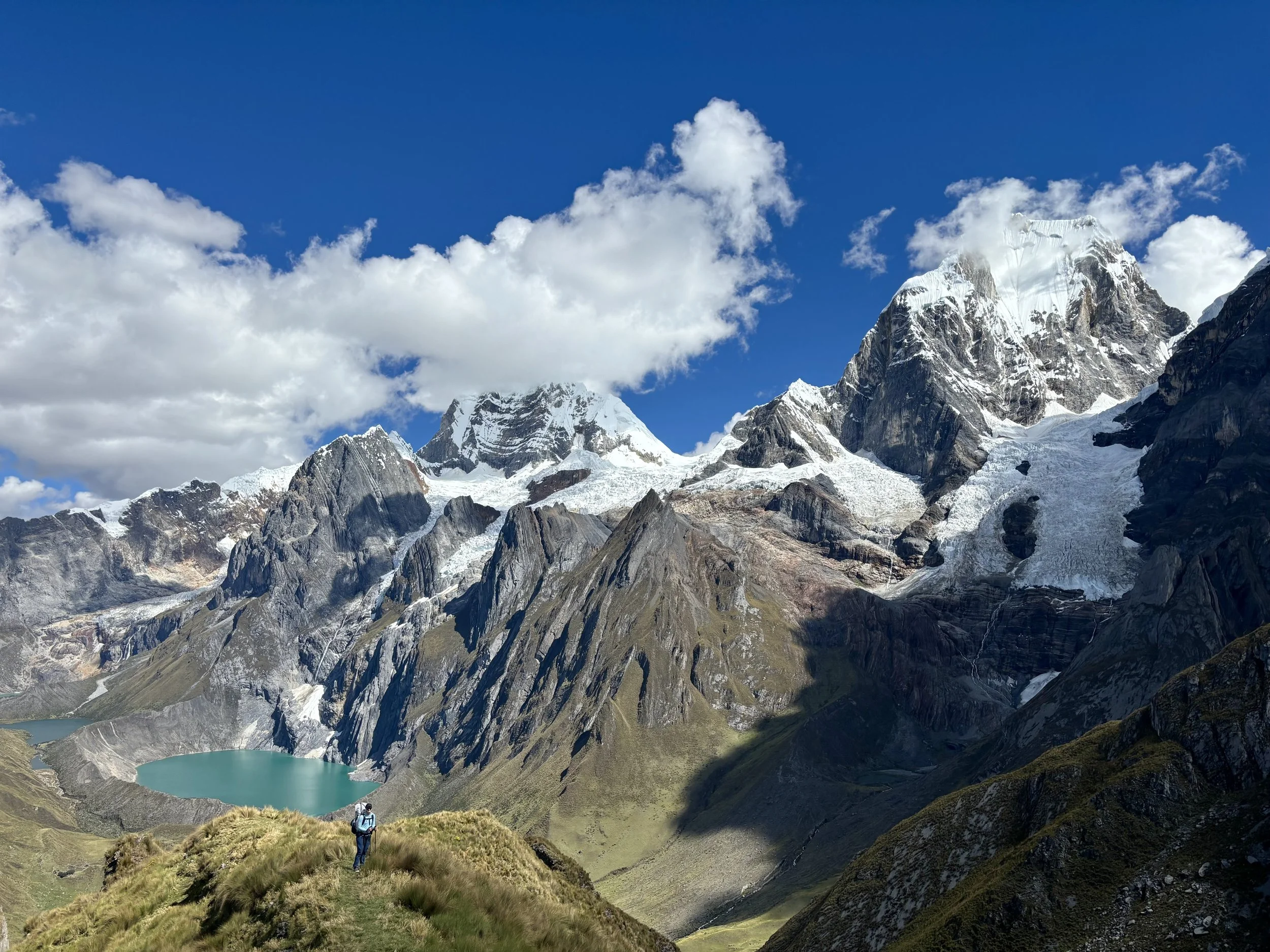
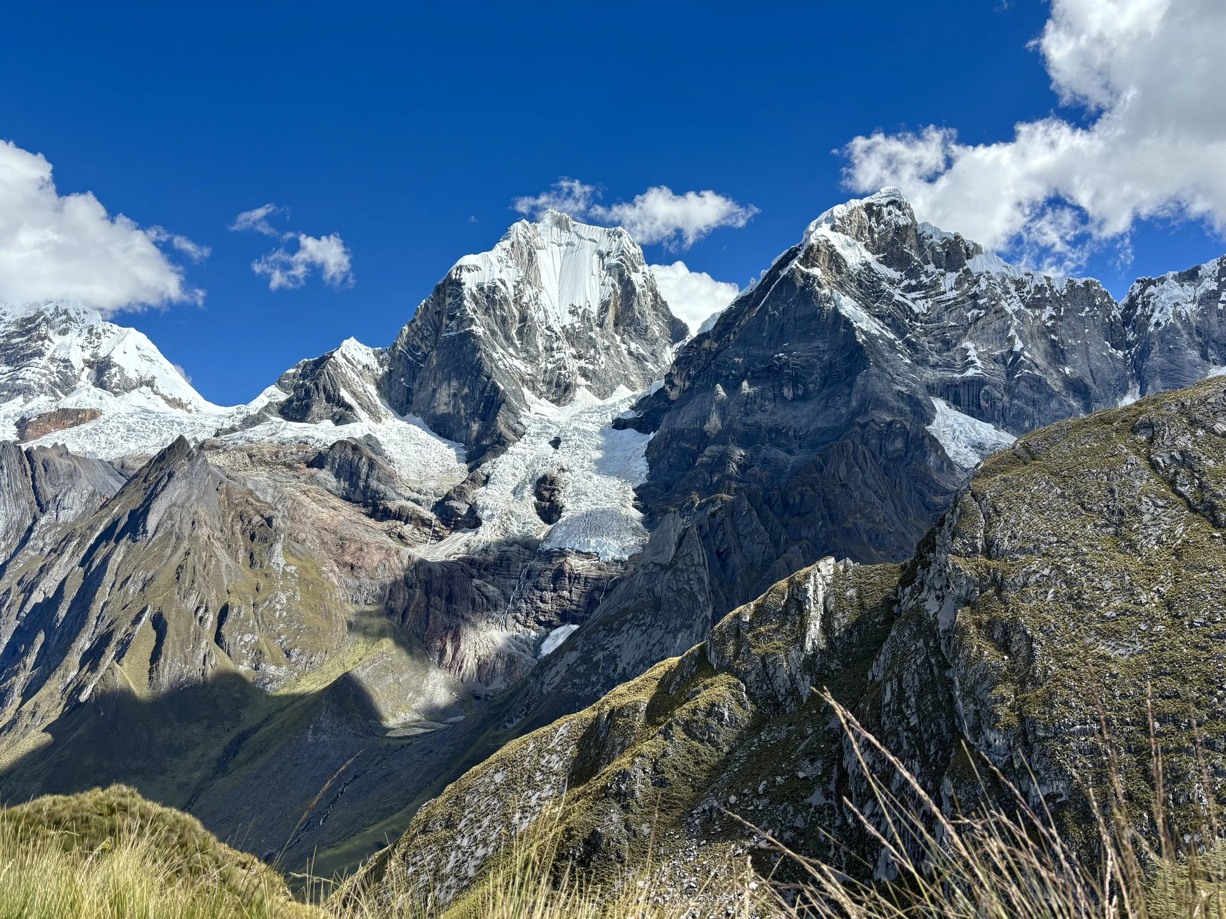
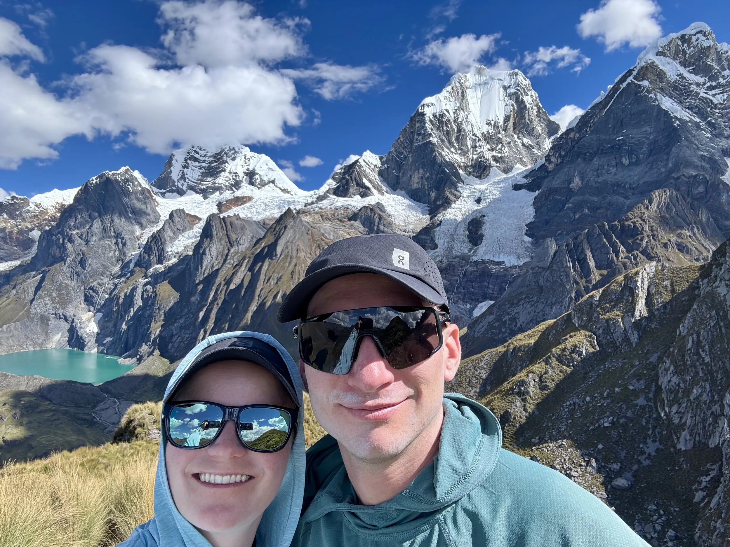
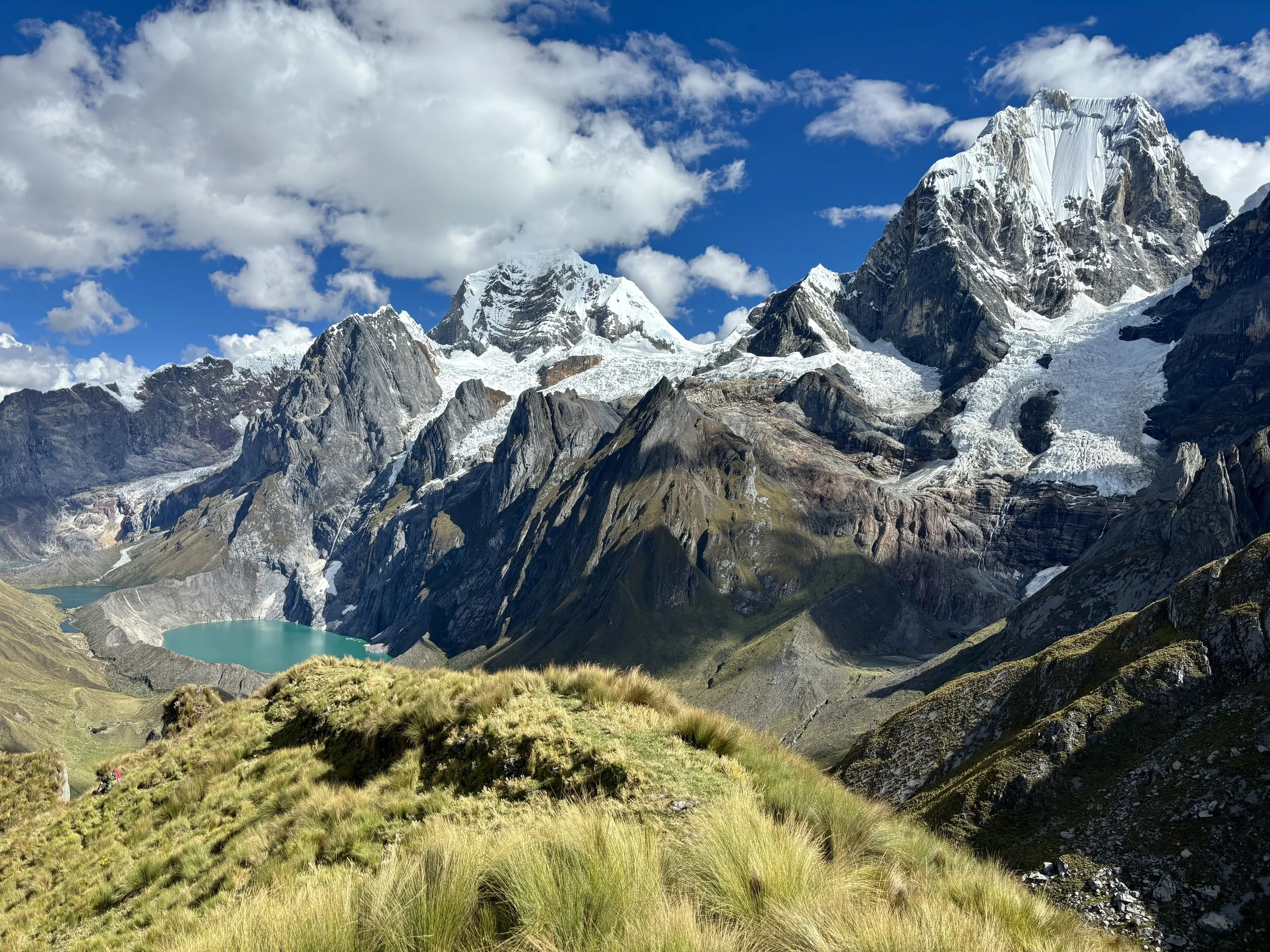
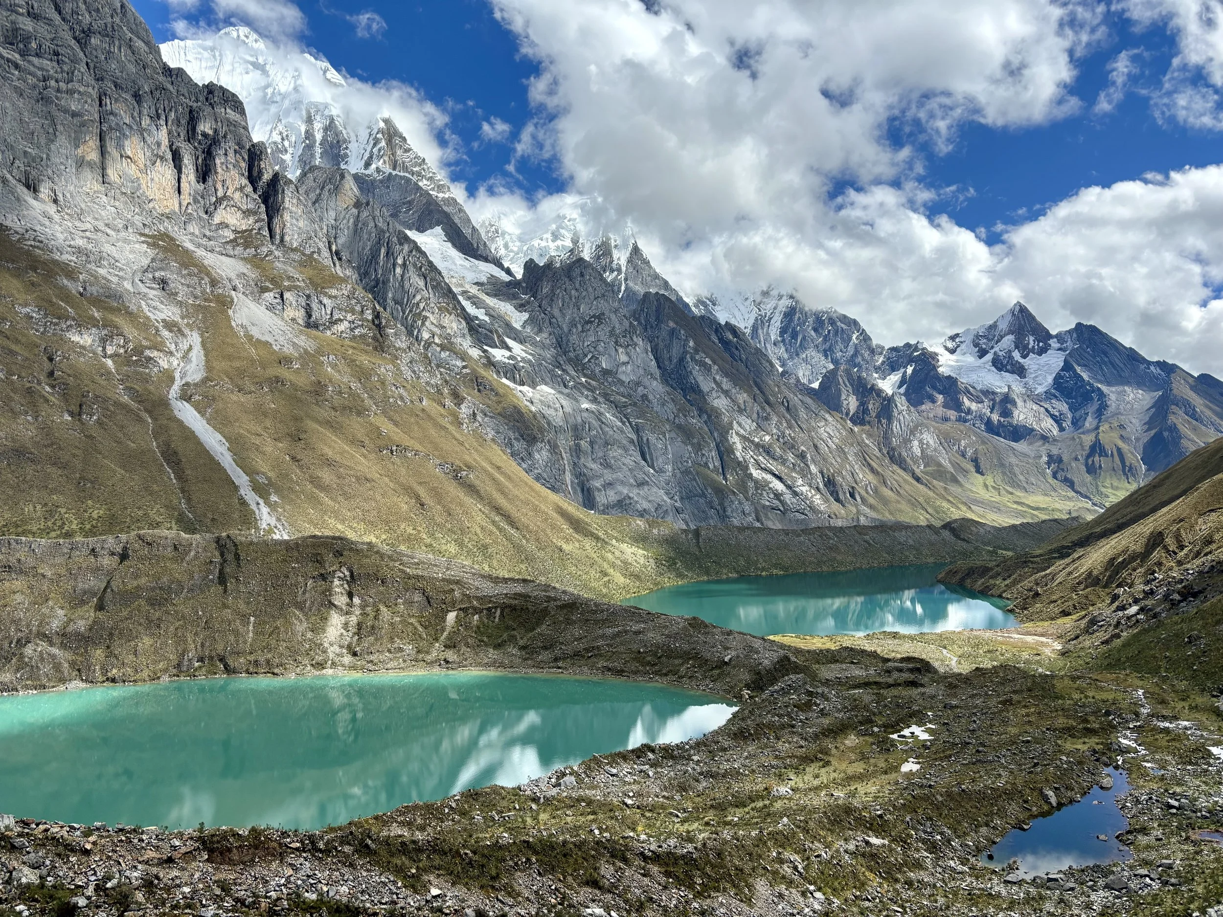
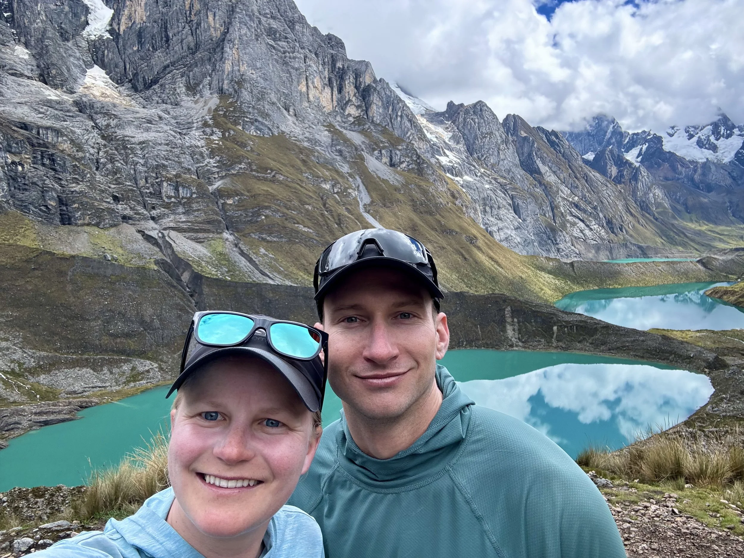
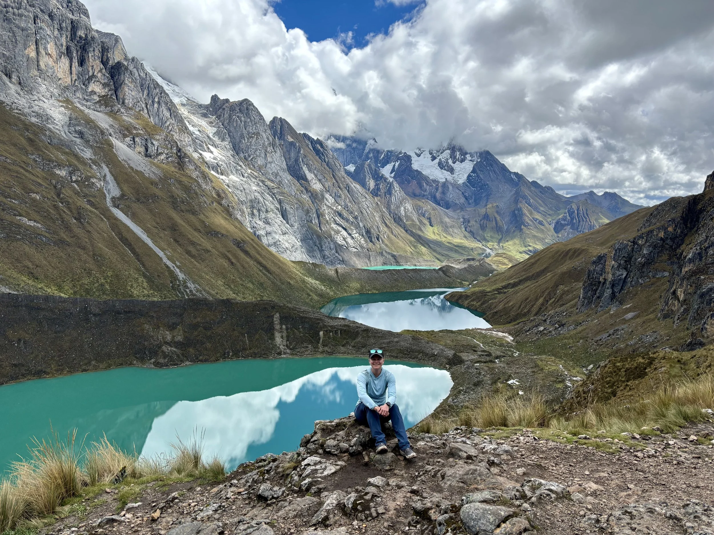
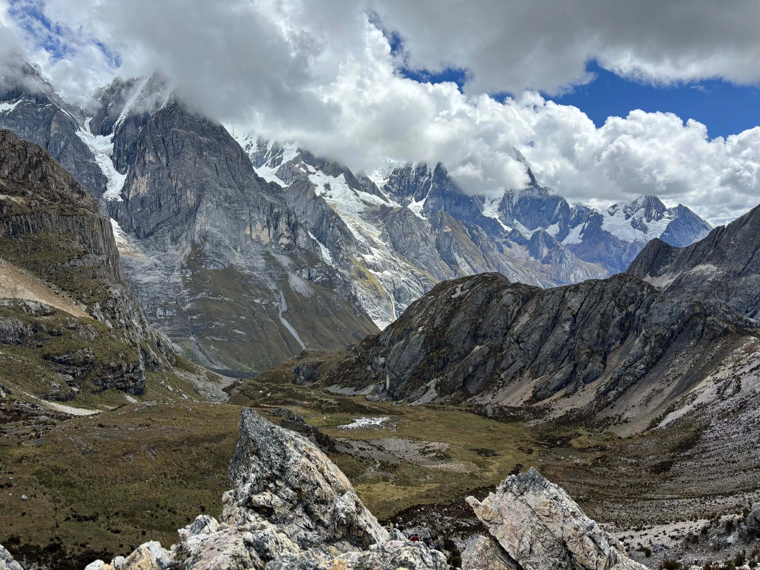
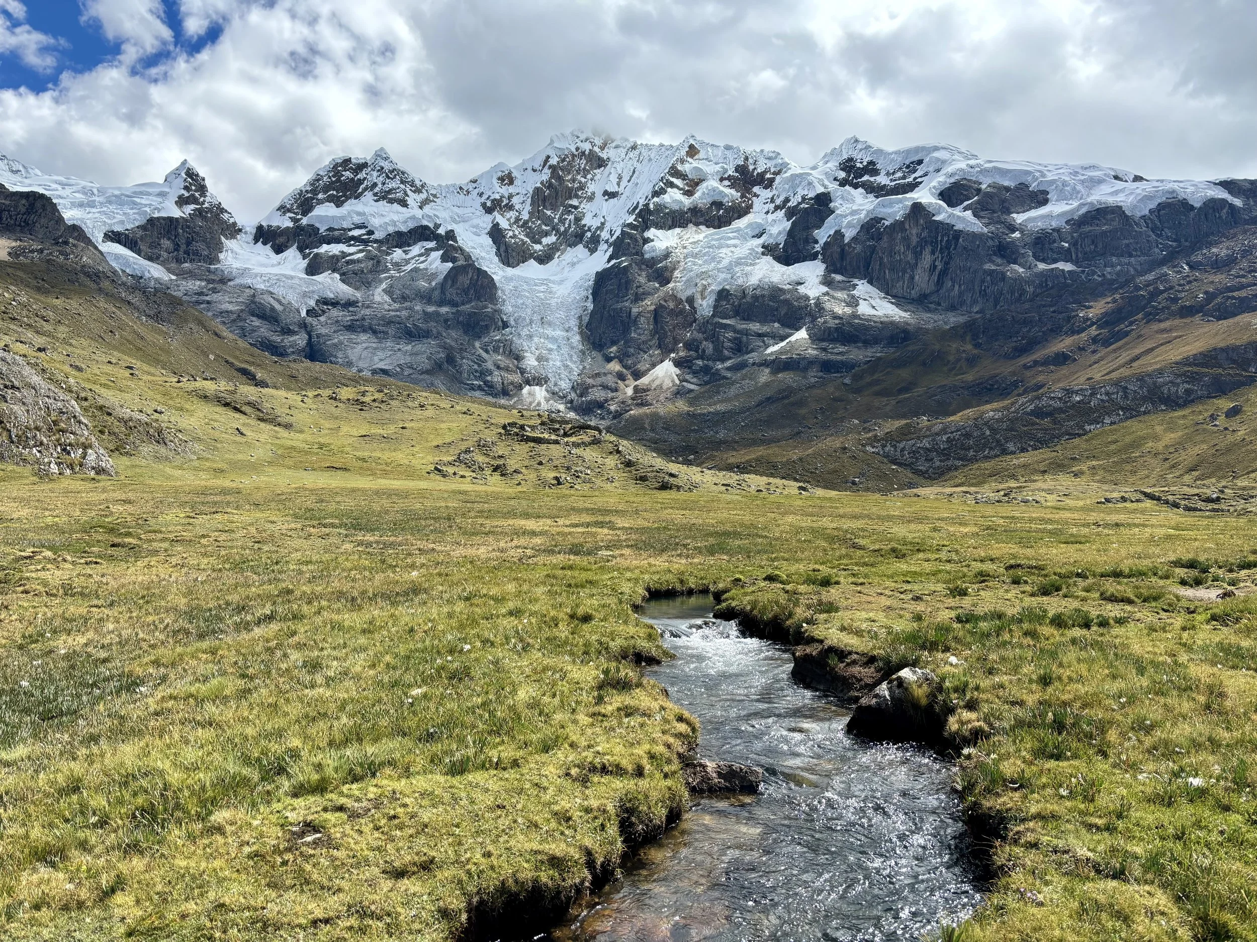
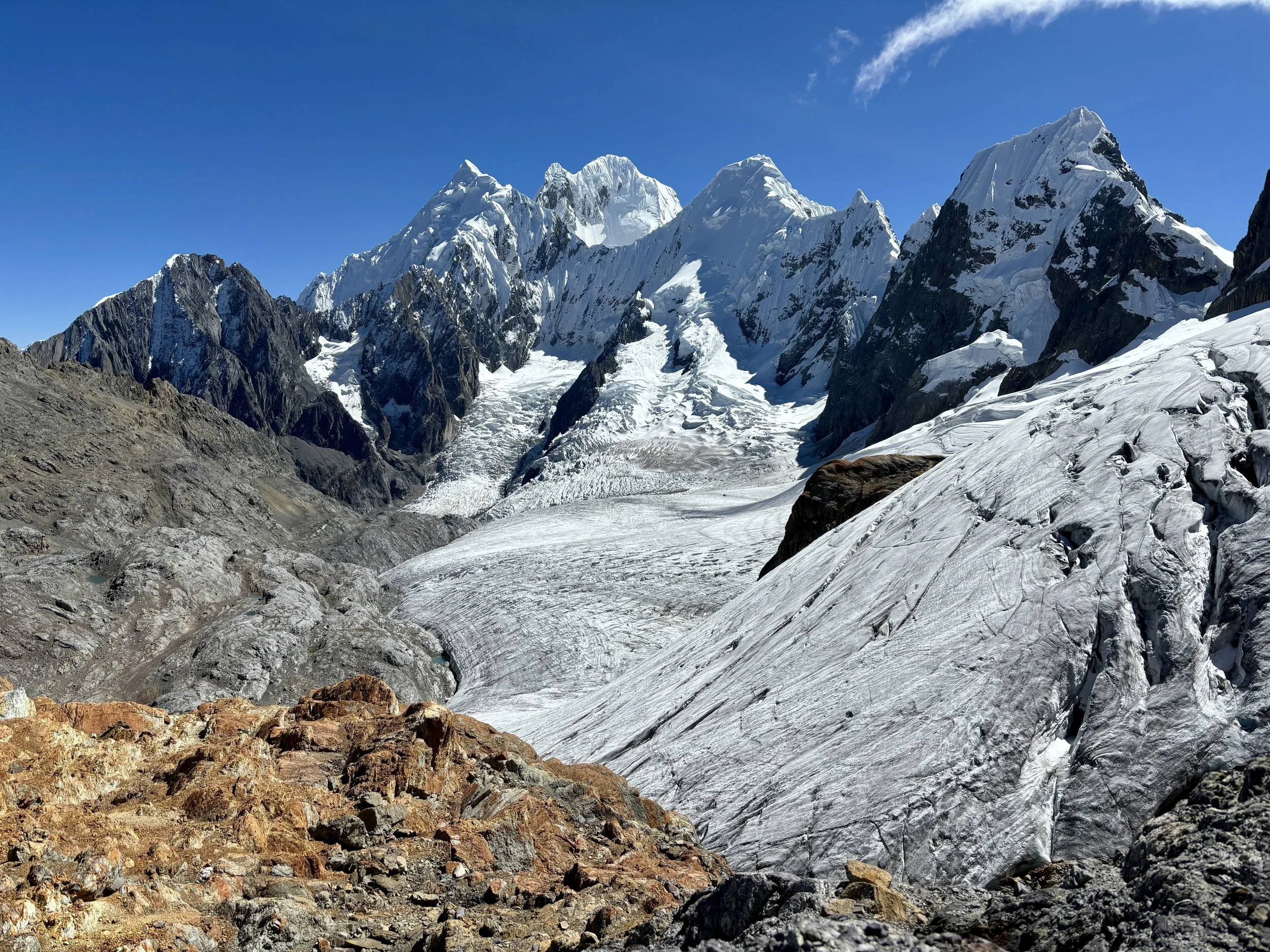
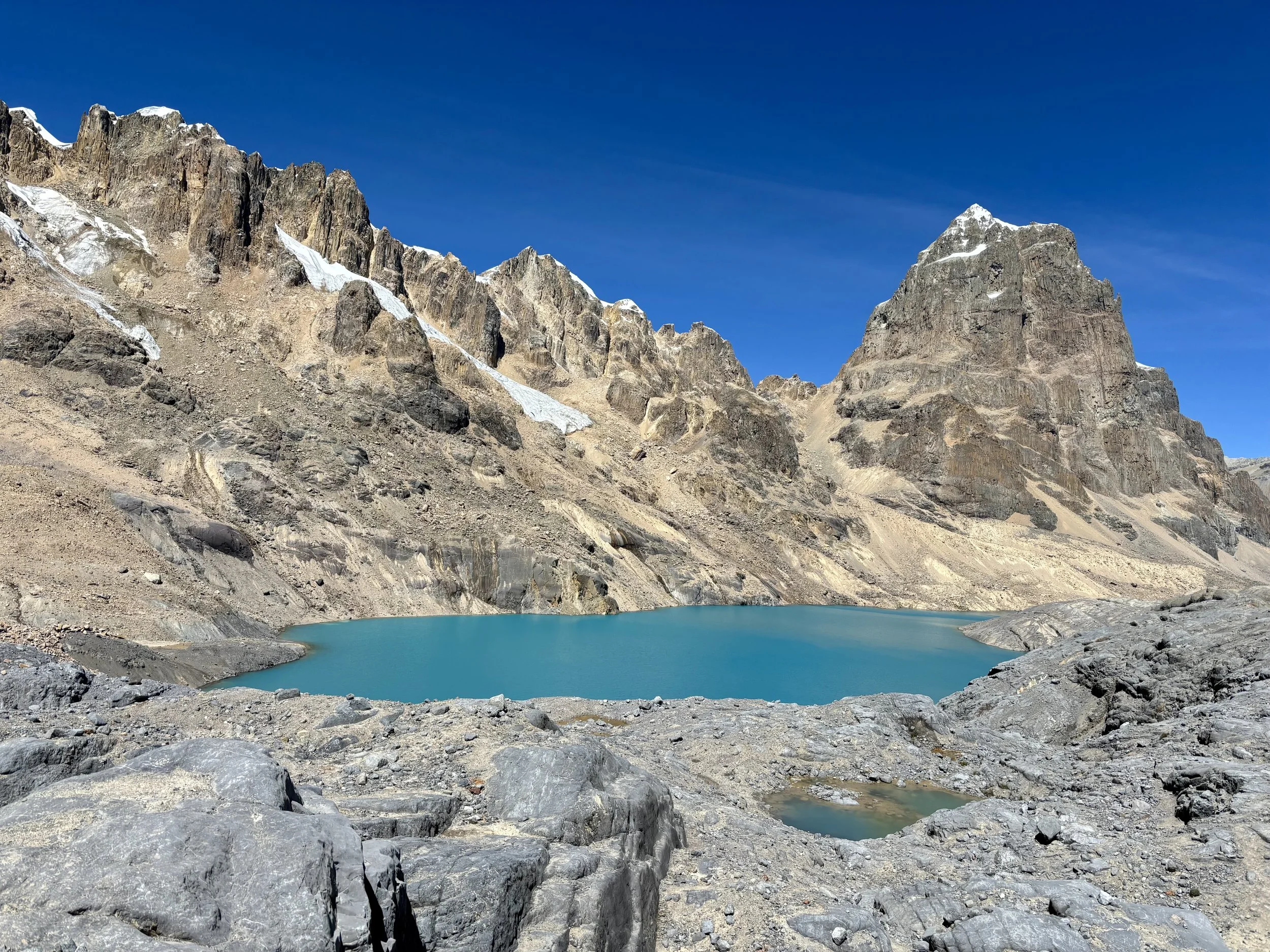
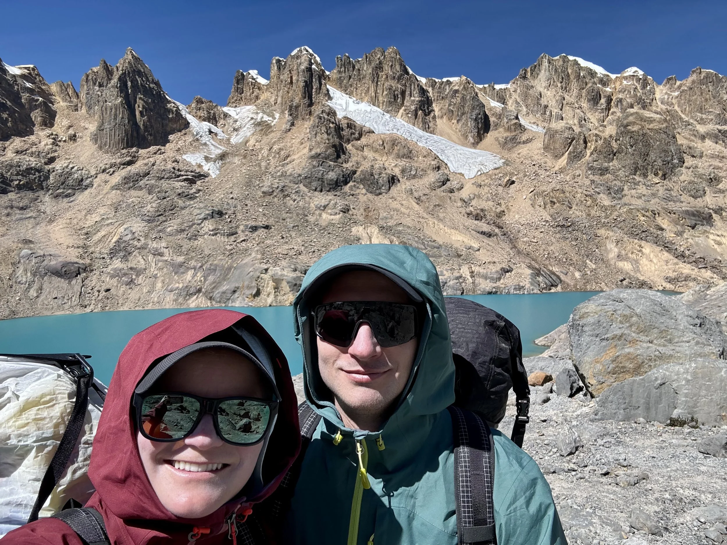
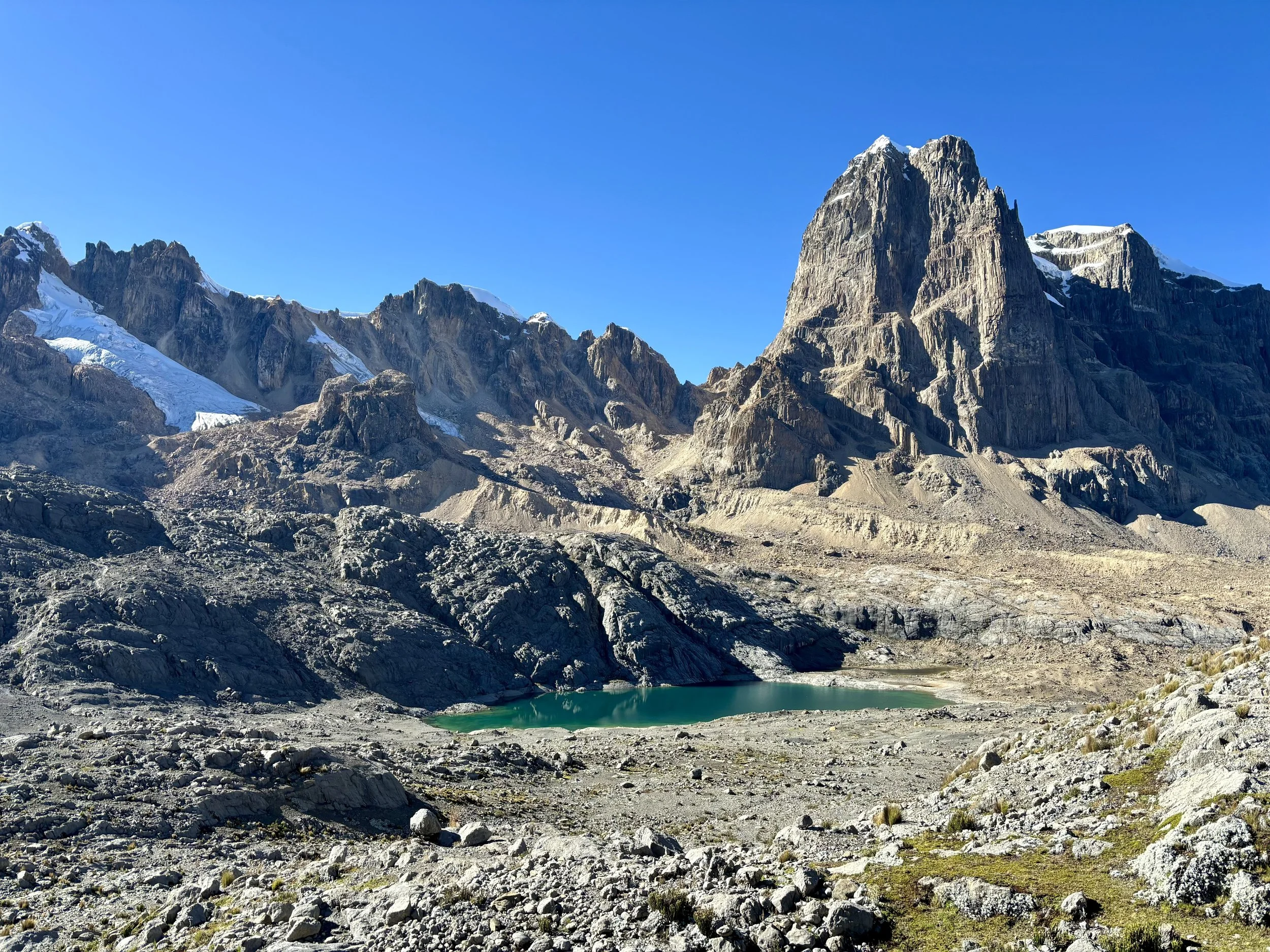
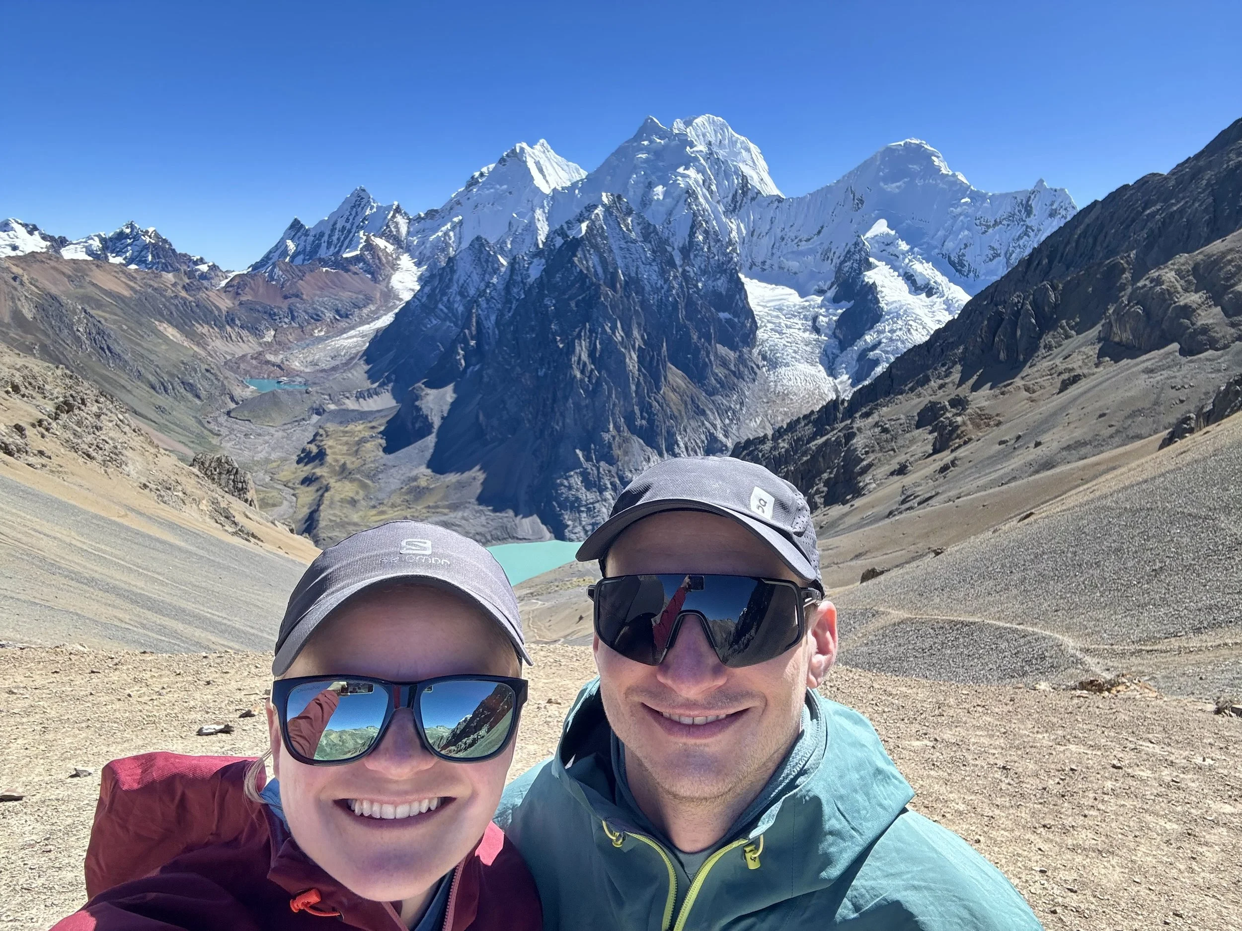
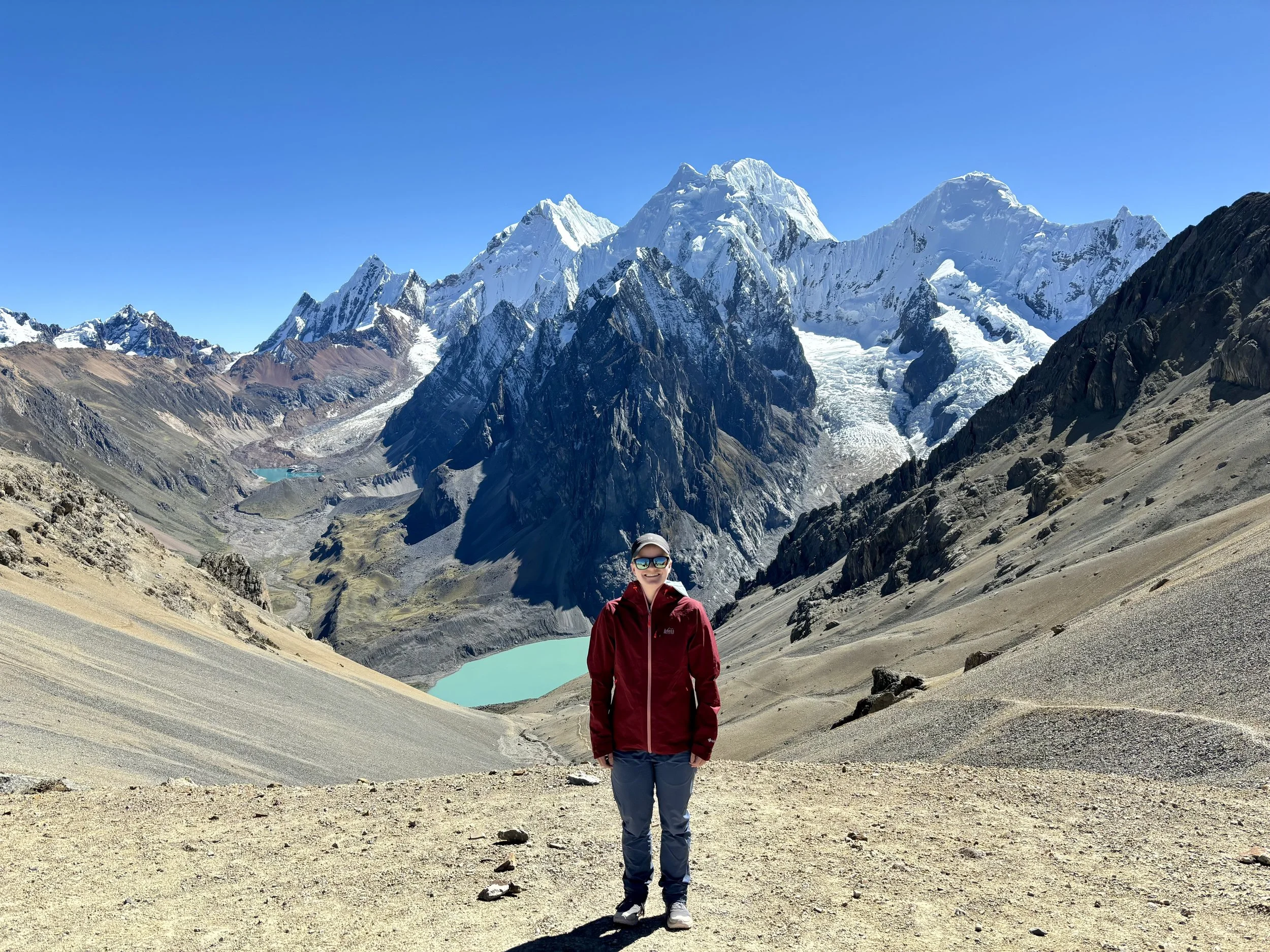
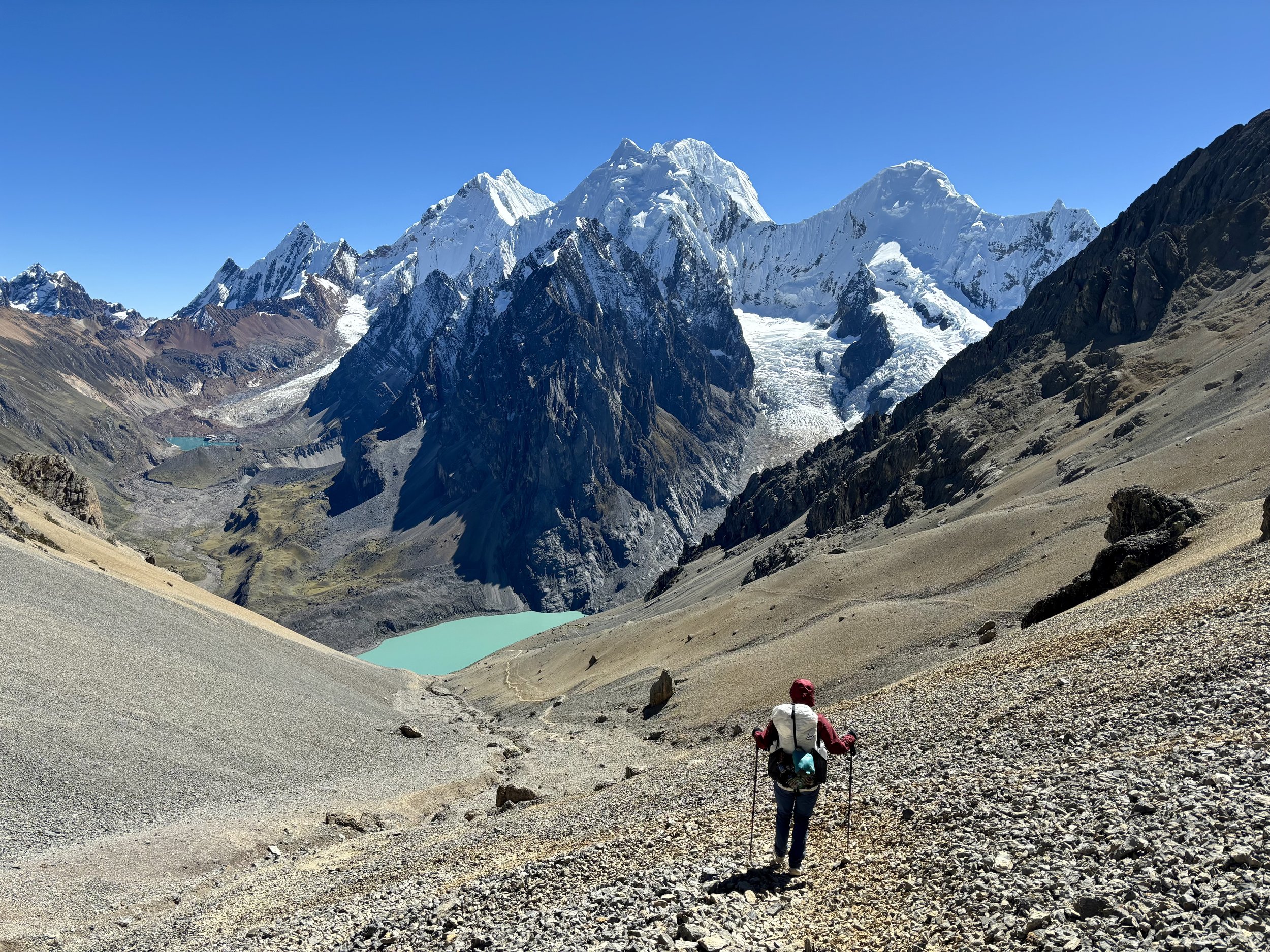
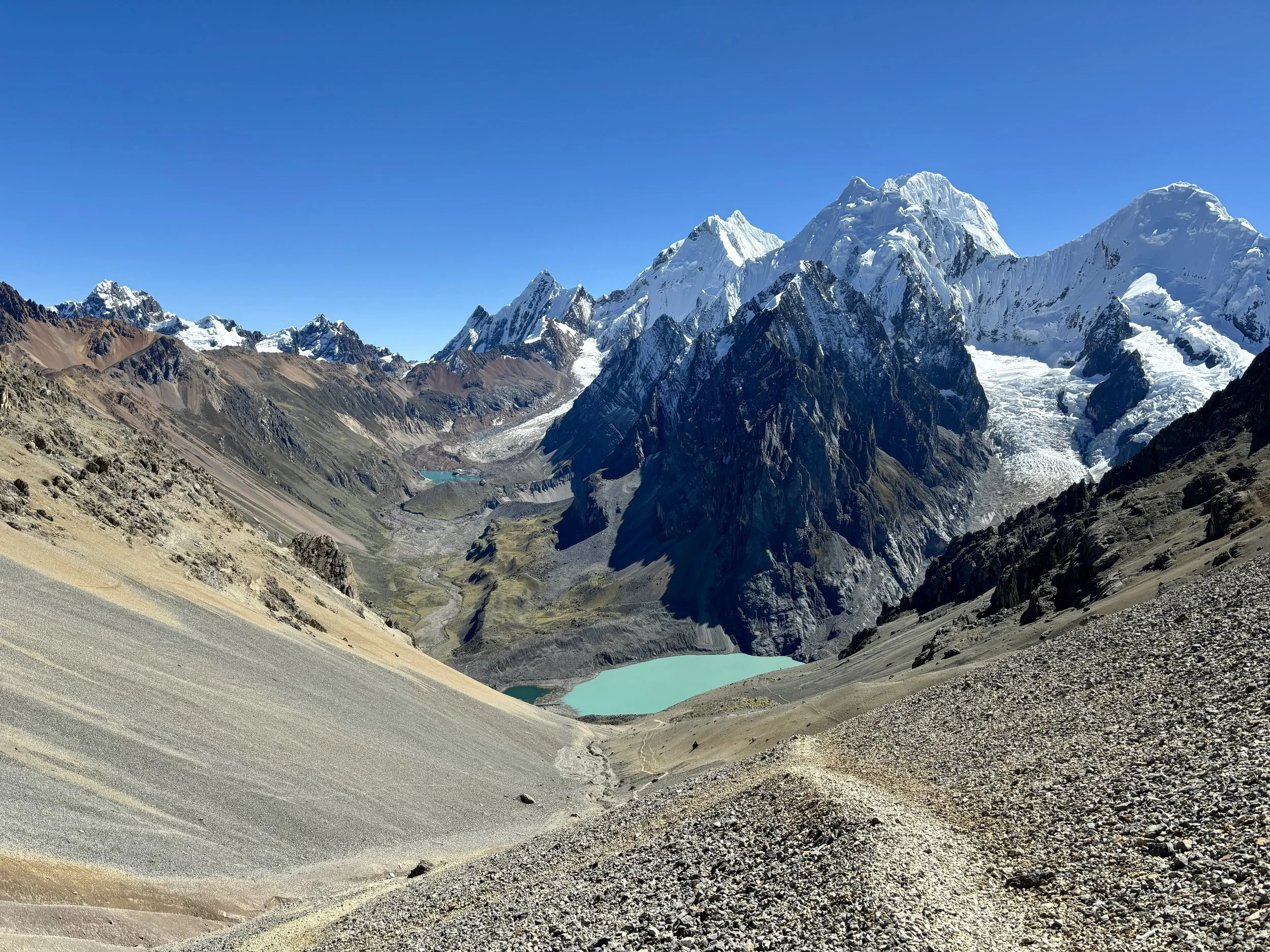
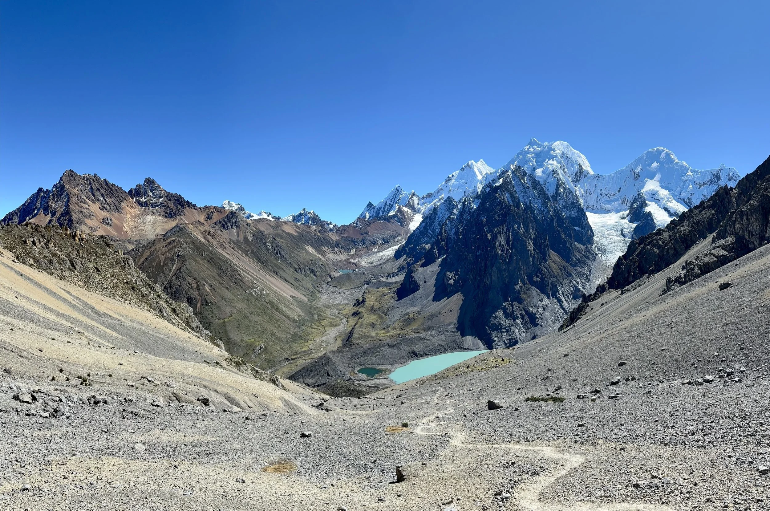
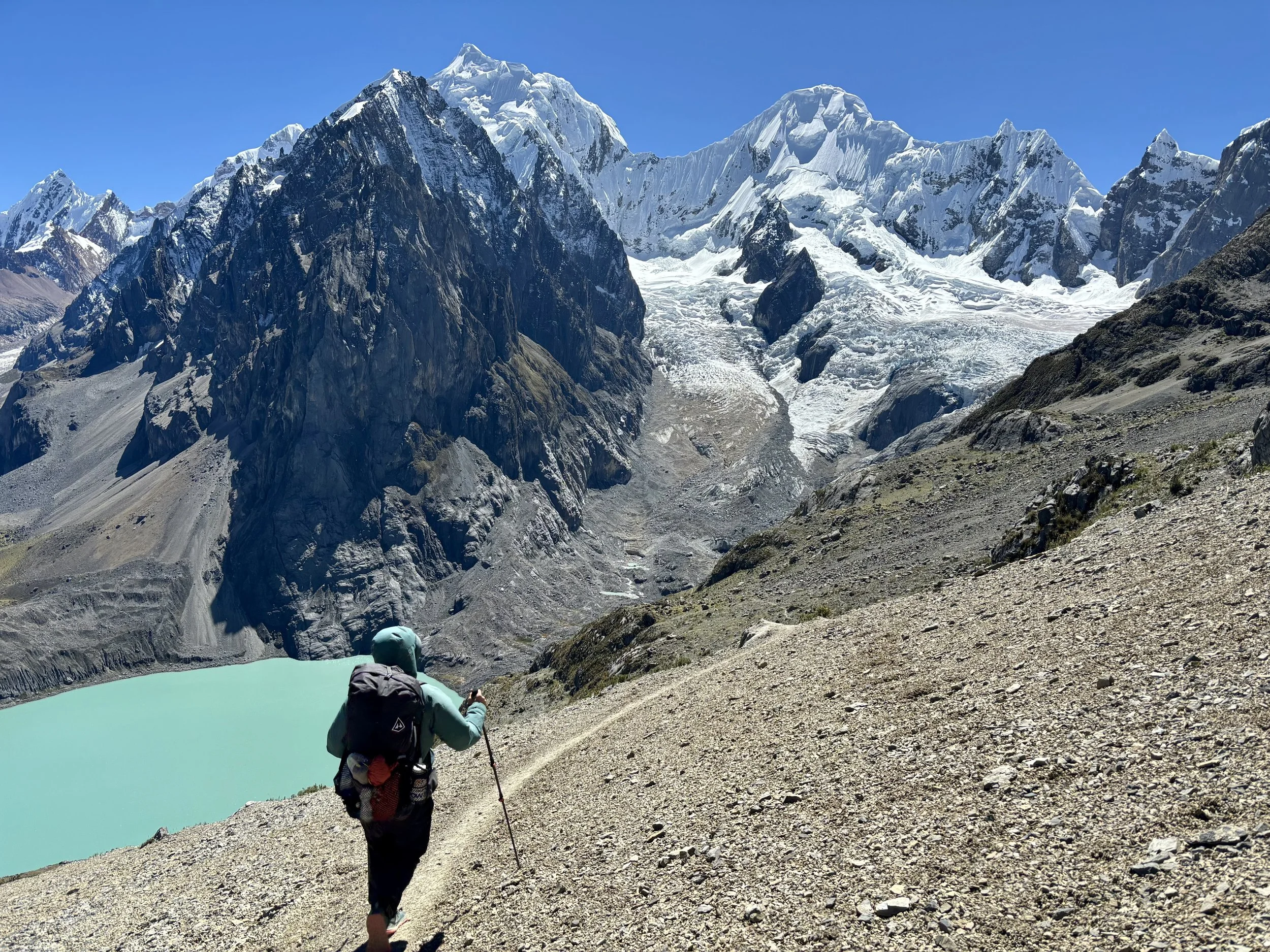
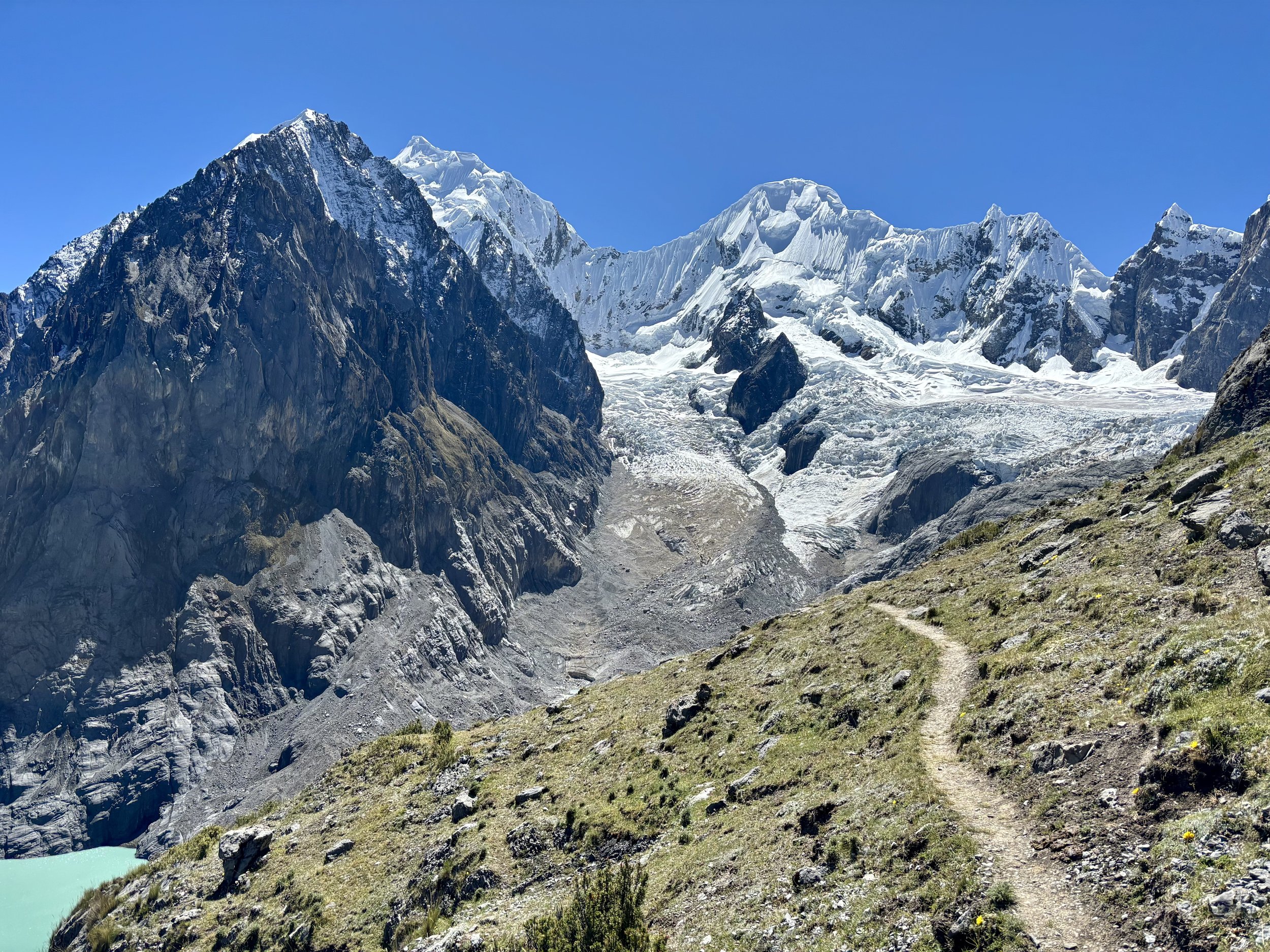
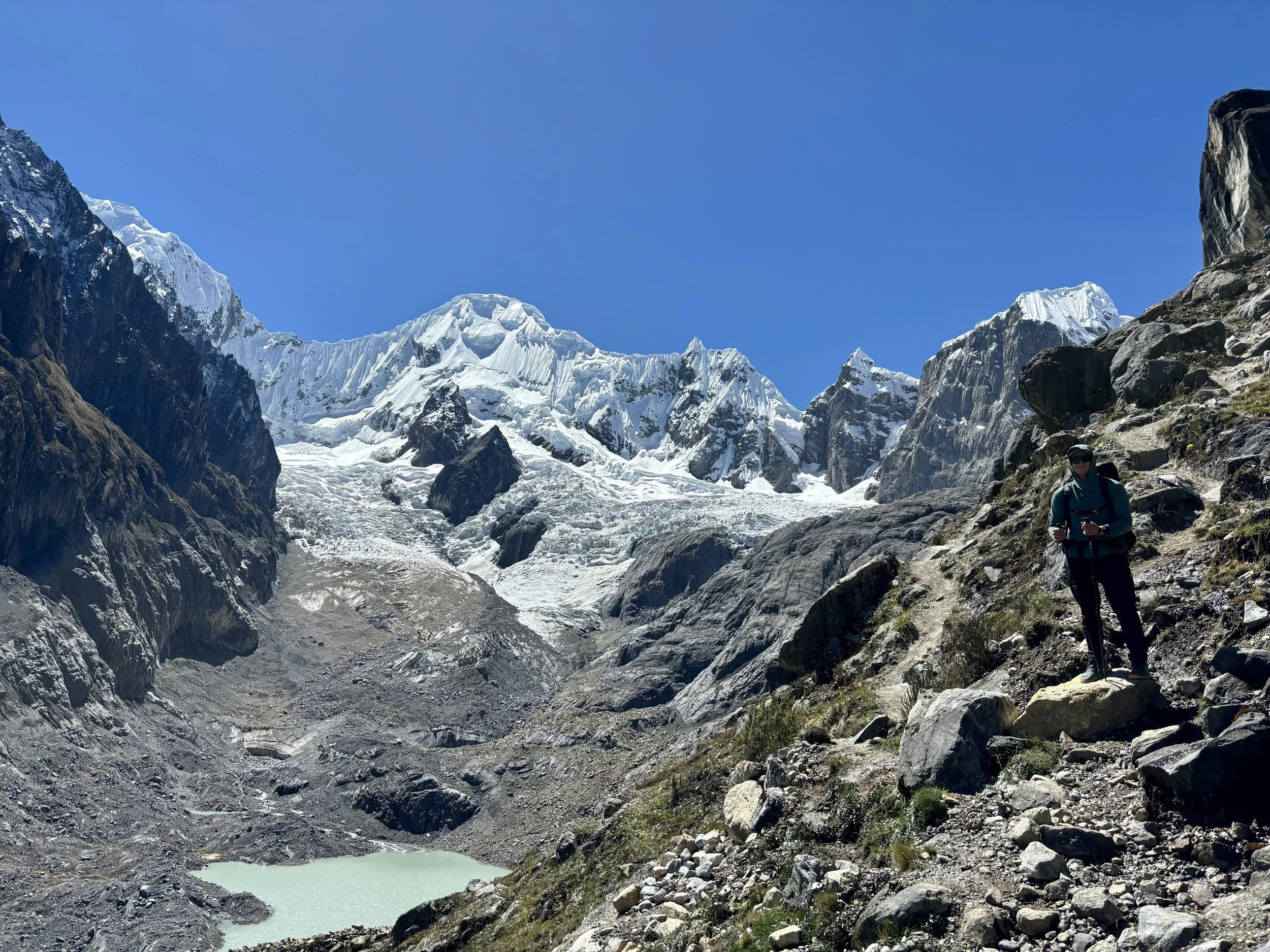
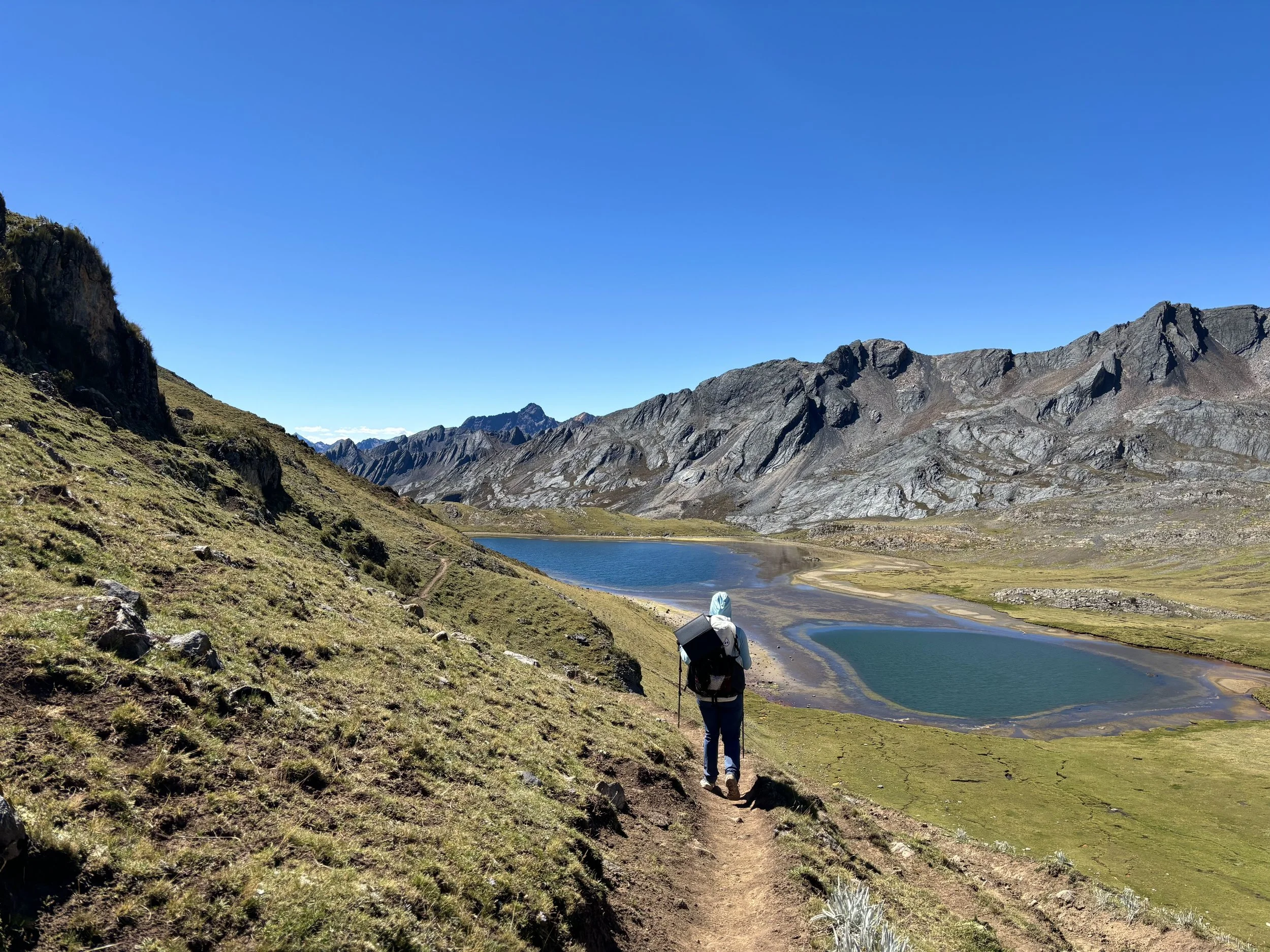
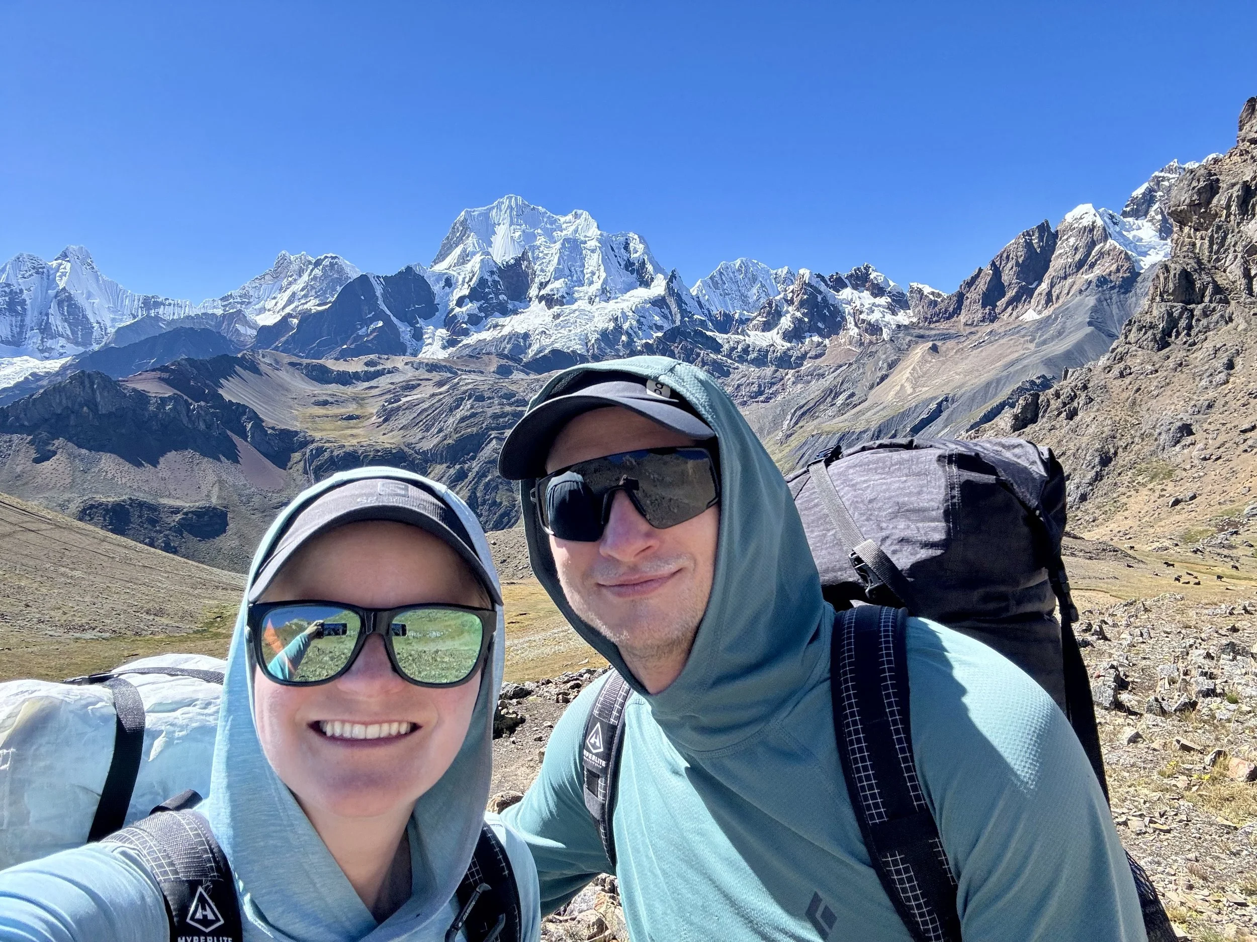
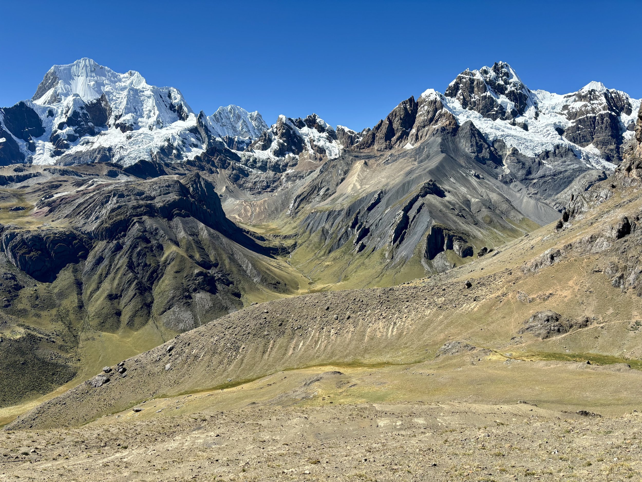
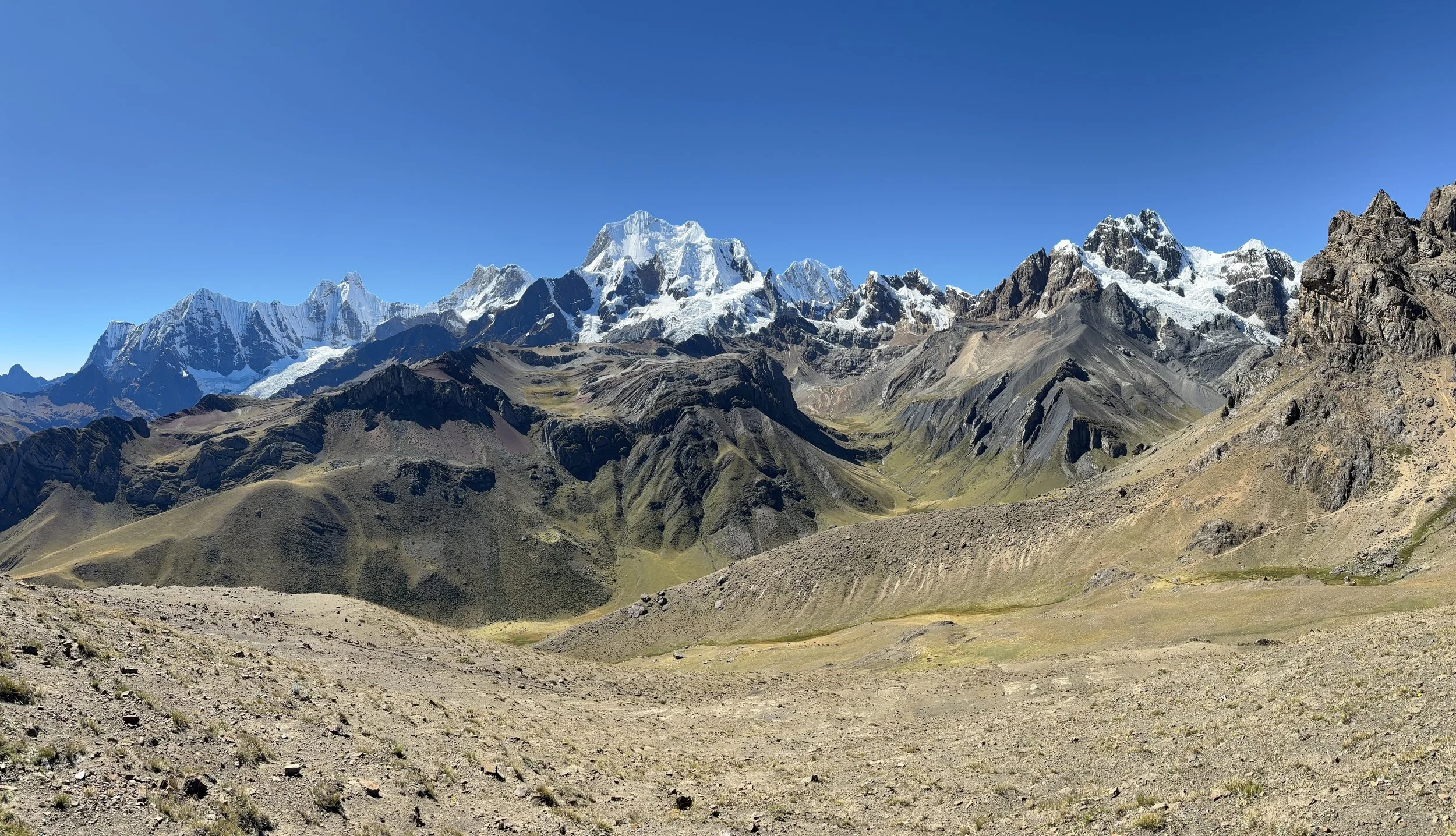
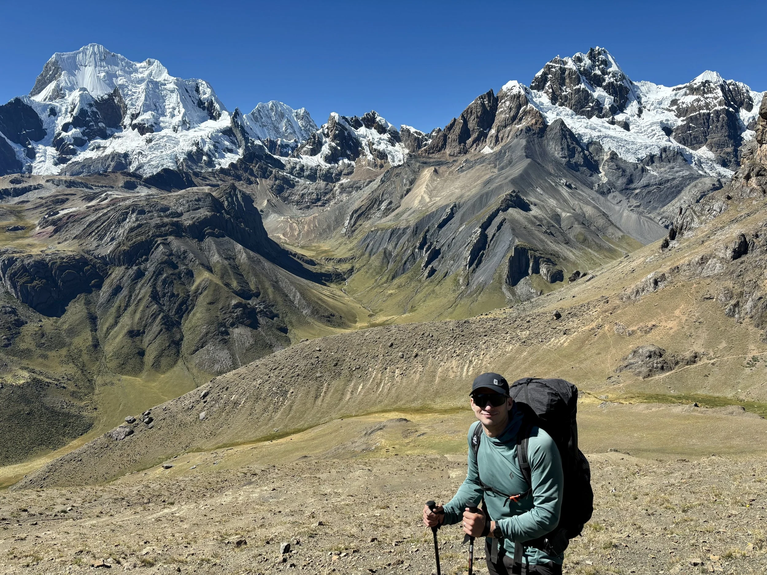
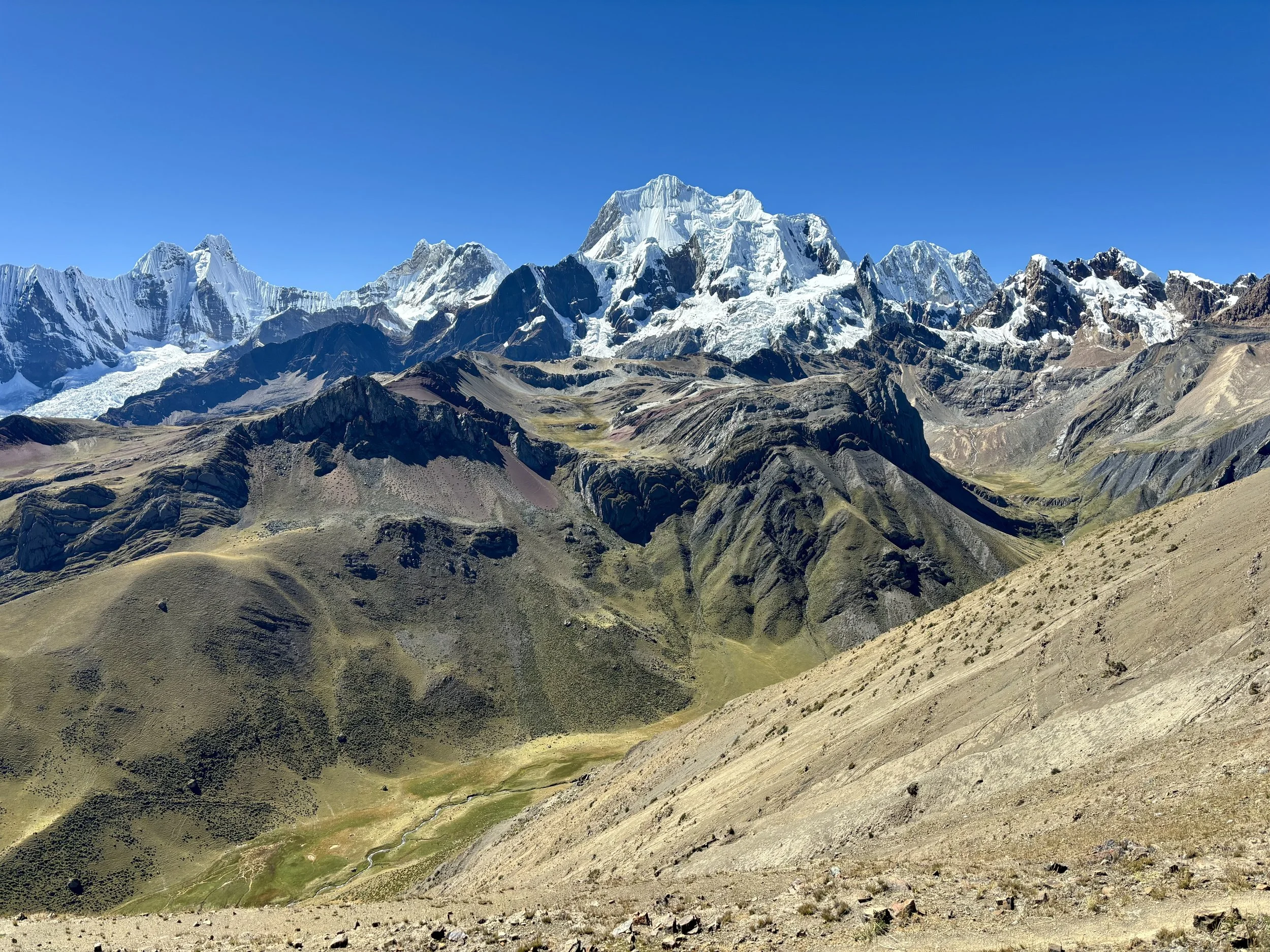
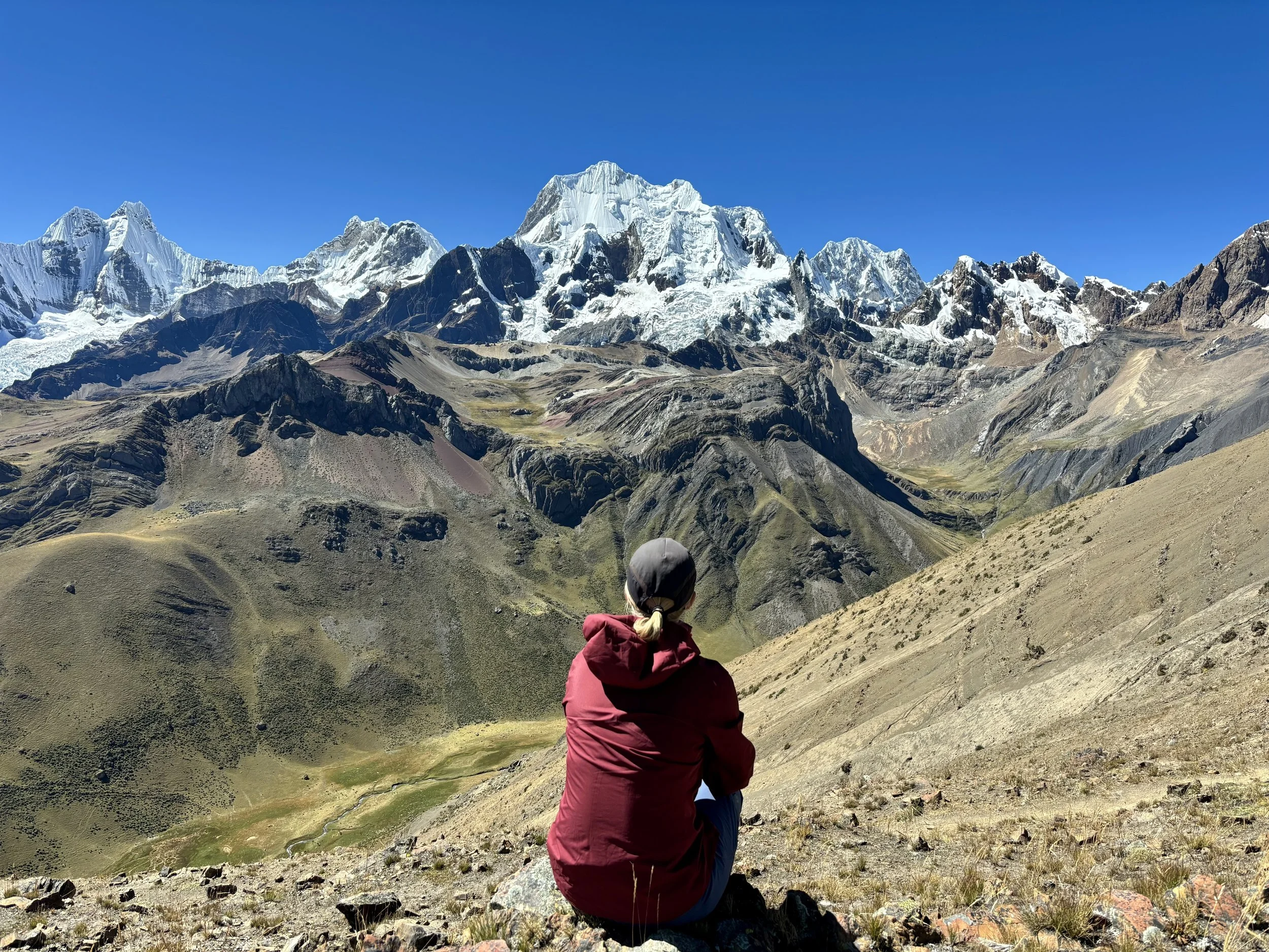
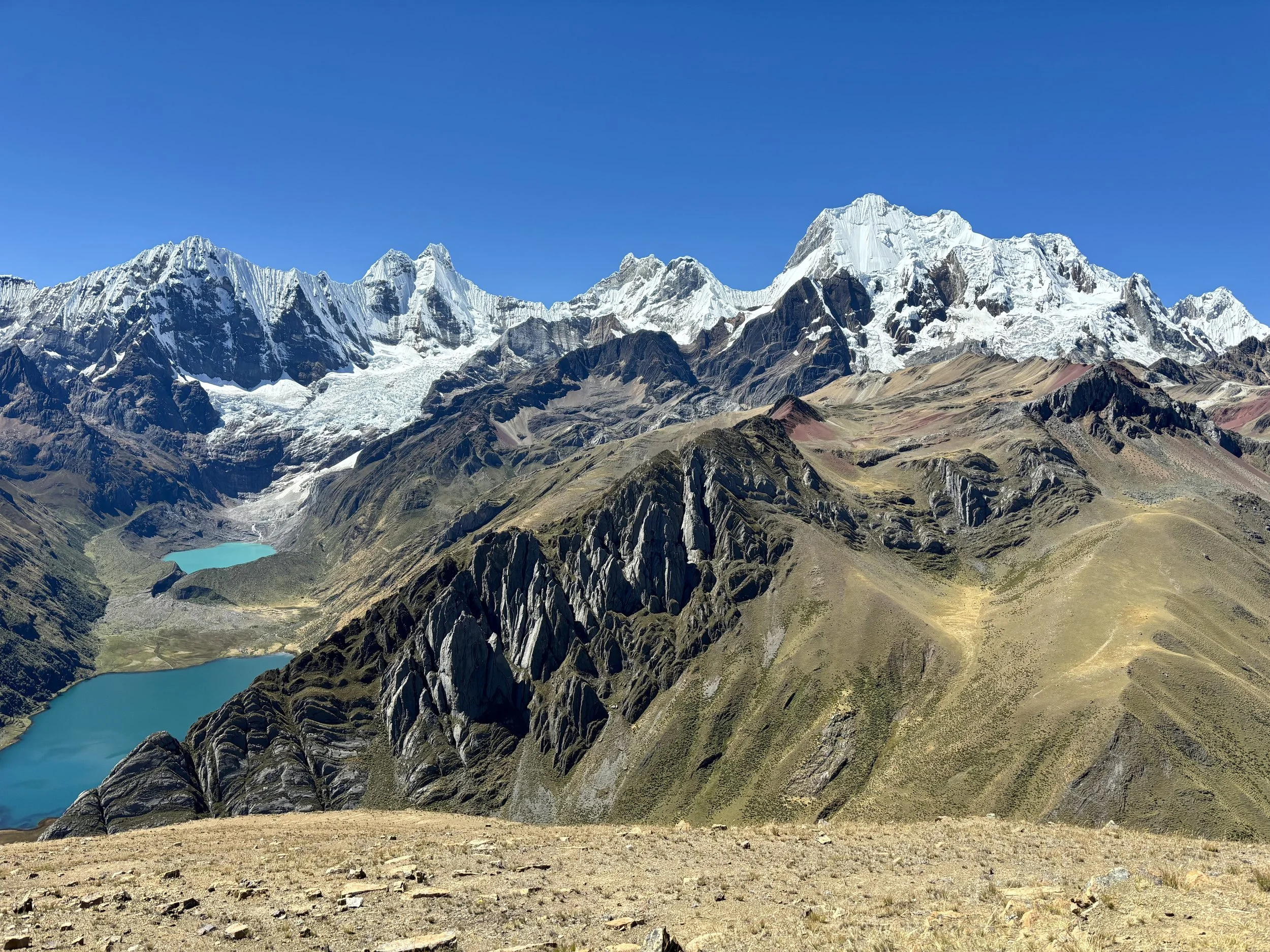
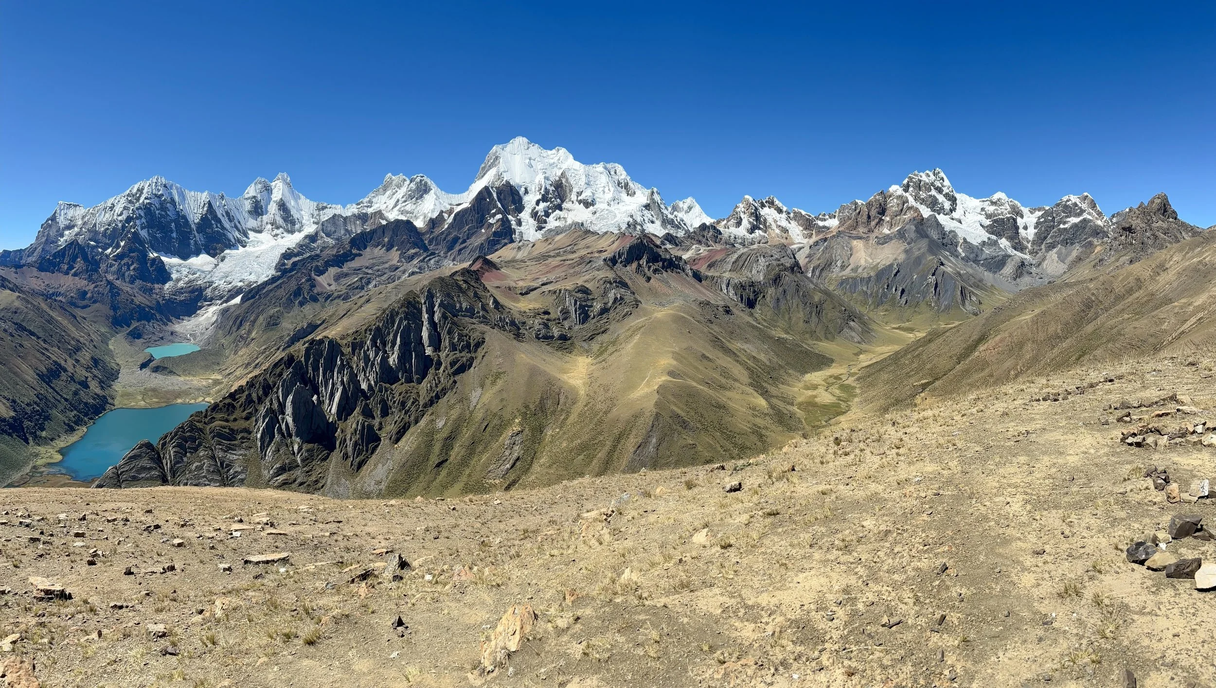
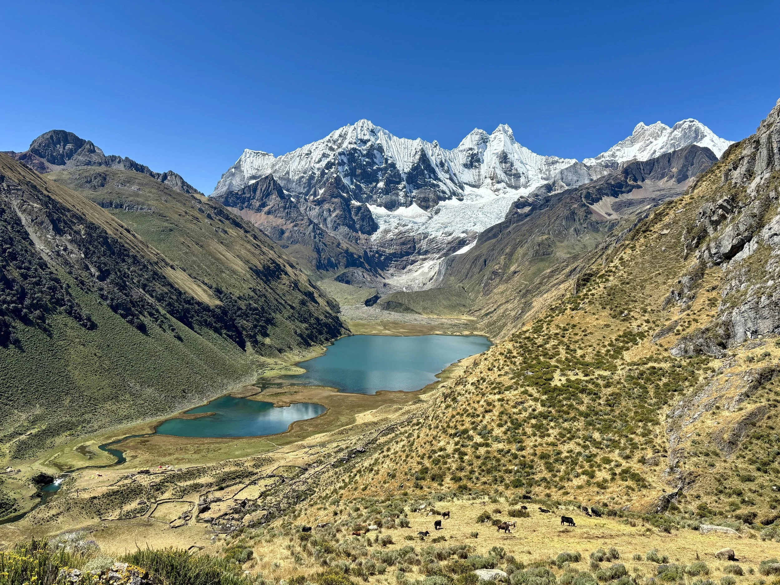
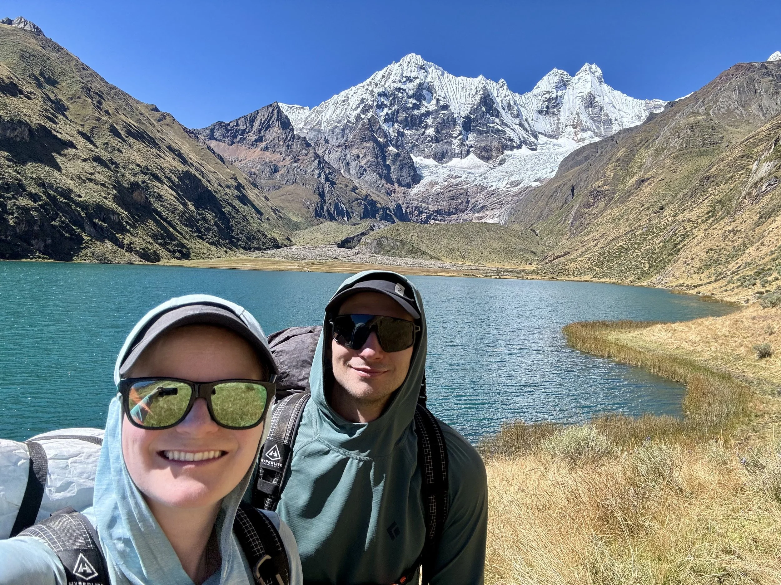
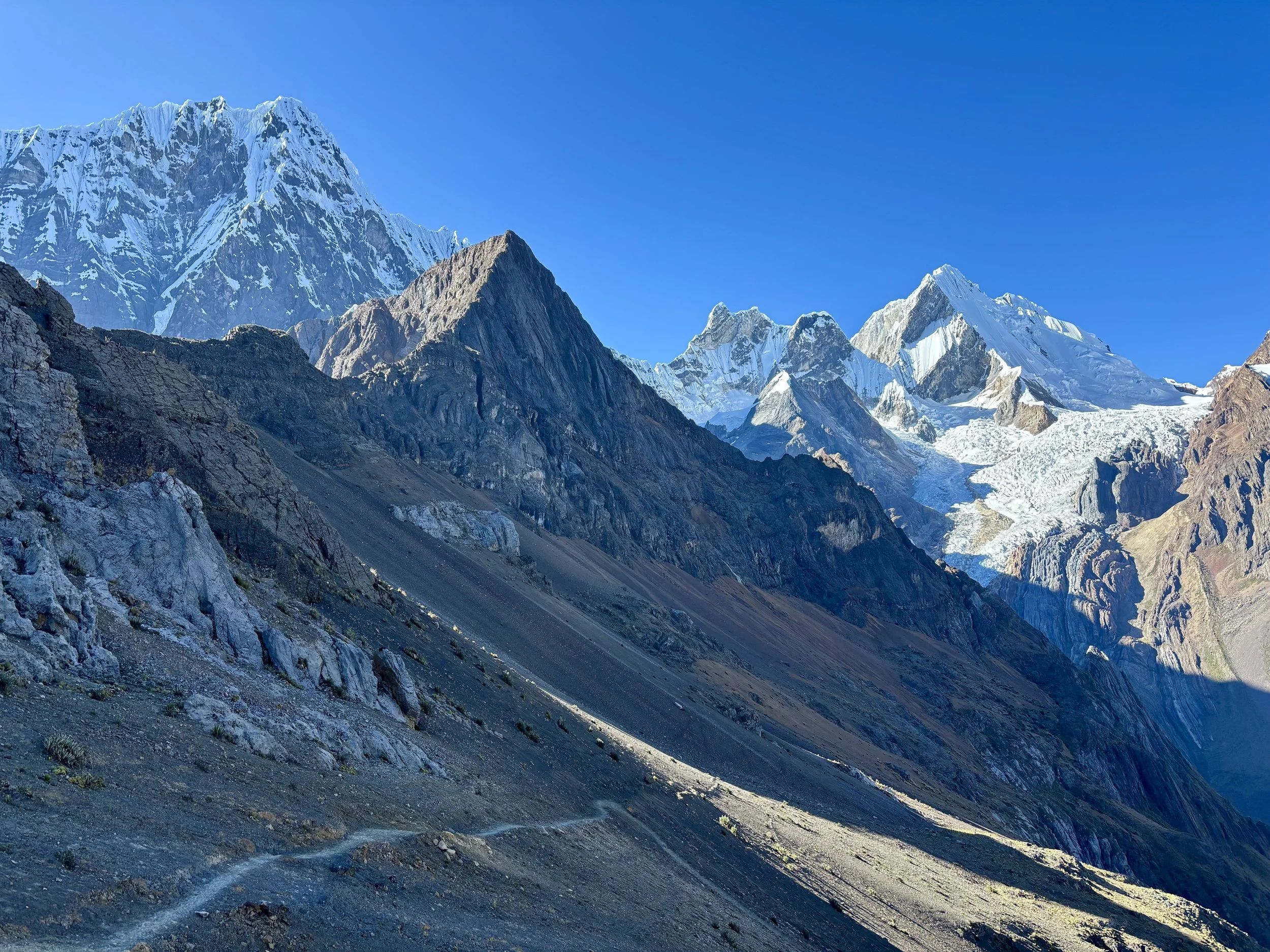
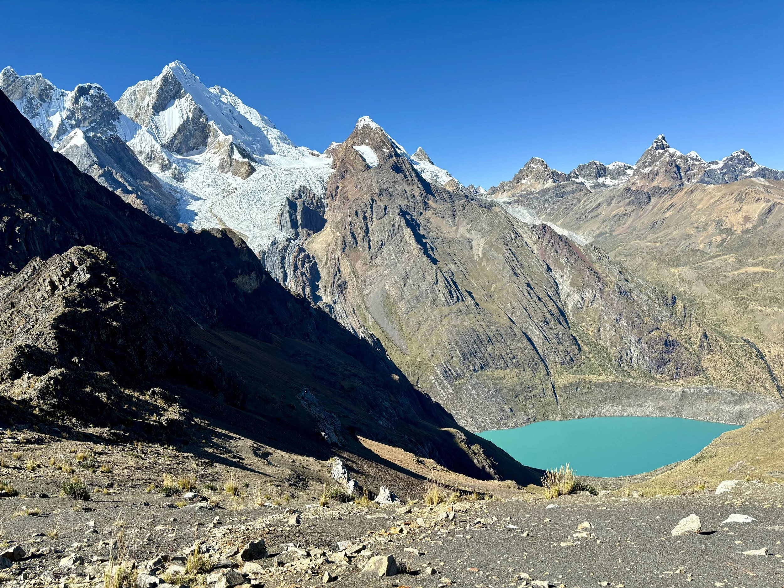
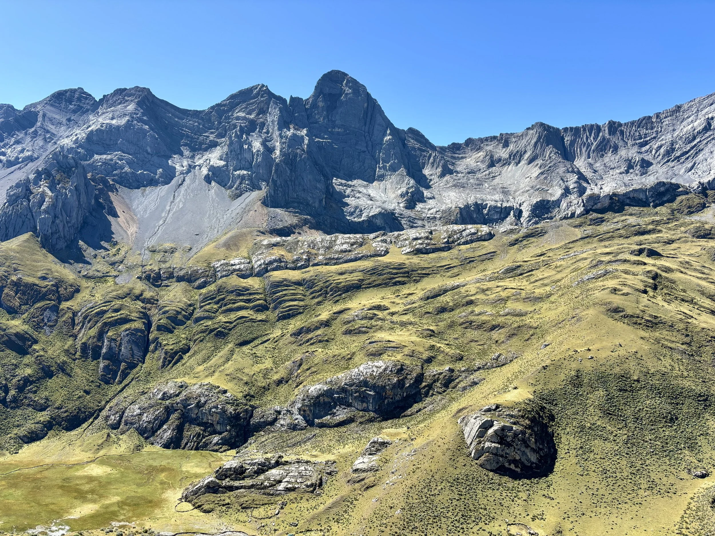
The start of the trail that morning meandered along the southern shore of Laguna Carhuacocha. At the end of the lake, it turned left, starting up a valley below Yerupaja, the highest mountain in the Cordillera Huayhuash. After a little bit of time, we found ourselves at a point where we could take a detour to see the lowest lake of the Tres Lagunas. We took this short detour (which I highly recommend) and stopped for a snack above the lake. During our short rest, we saw several avalanches cascade down into the lake. What a cool thing to experience (from afar!). We then headed back to the trail which would continue to head south towards the second and third lakes in the valley. The trail began to climb quite steeply, and I found myself to be very thankful that a real trail existed this day as the terrain would have been very difficult to navigate without a well established trail. After some time, we finally found ourselves at the lookout that would look back on these three lakes called Mirador Tres Lagunas. There were several other groups of people here taking pictures, for good reason. We had another snack and took some pictures of our own. Stumbling upon a picture on the internet taken from this spot is what initially piqued my interest in the Cordillera Huayhuash, and I assume that is the case for many people.
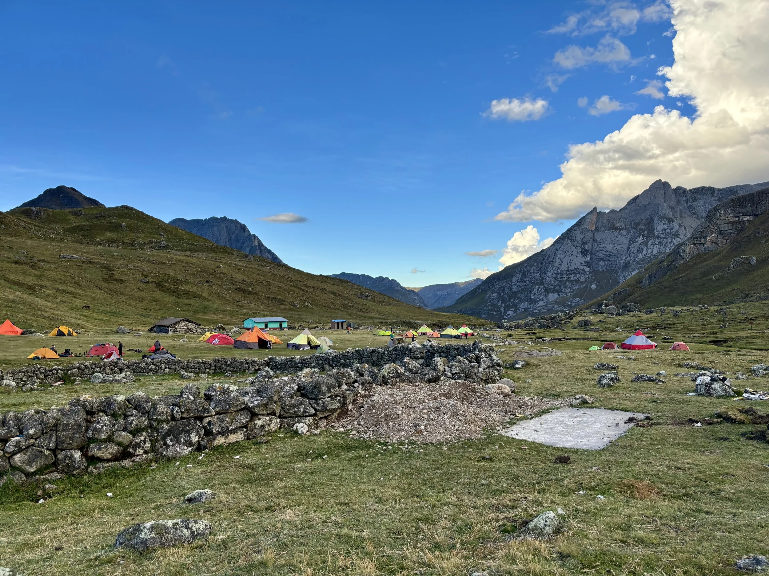
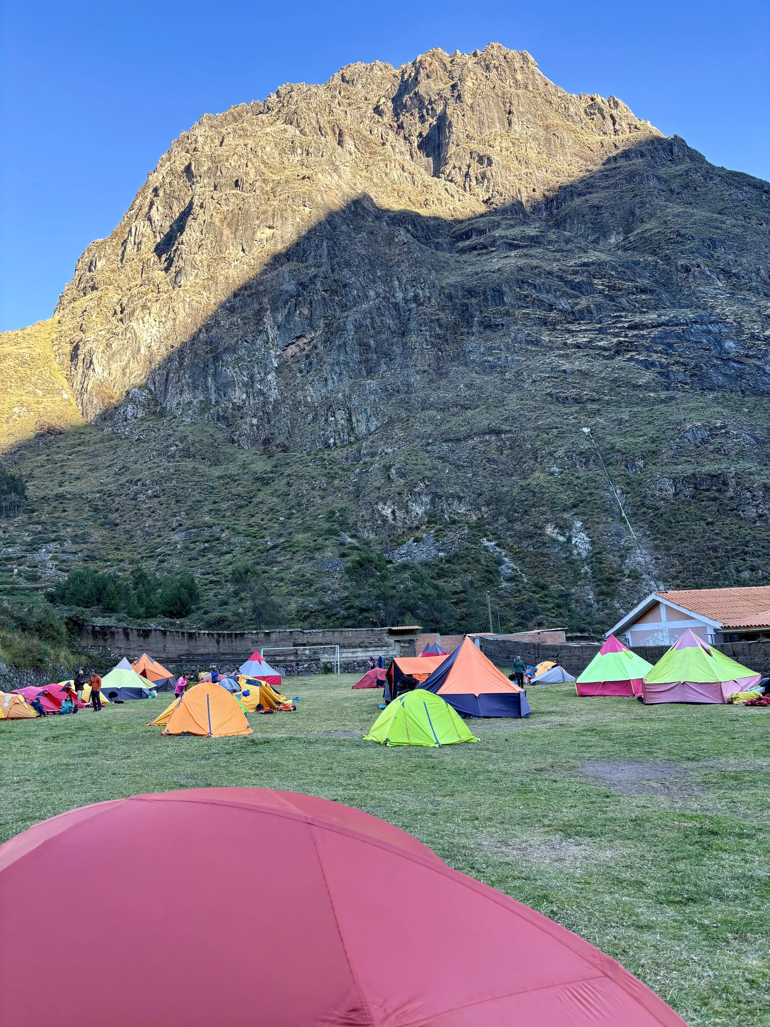
With more vert to be gained that day, we finally continued along the trail towards Paso Siula, where more beautiful views were to be found. The rest of the day would be flat or downhill, but it felt much longer than anticipated. Within view of Campamento Huayhuash, I found myself bonking and realized I didn’t eat enough that day. We decided stopping at the group campsite for the night was the right move considering my low energy level.
Stats: 8.2 miles, 2300 ft of elevation gain


Day 4
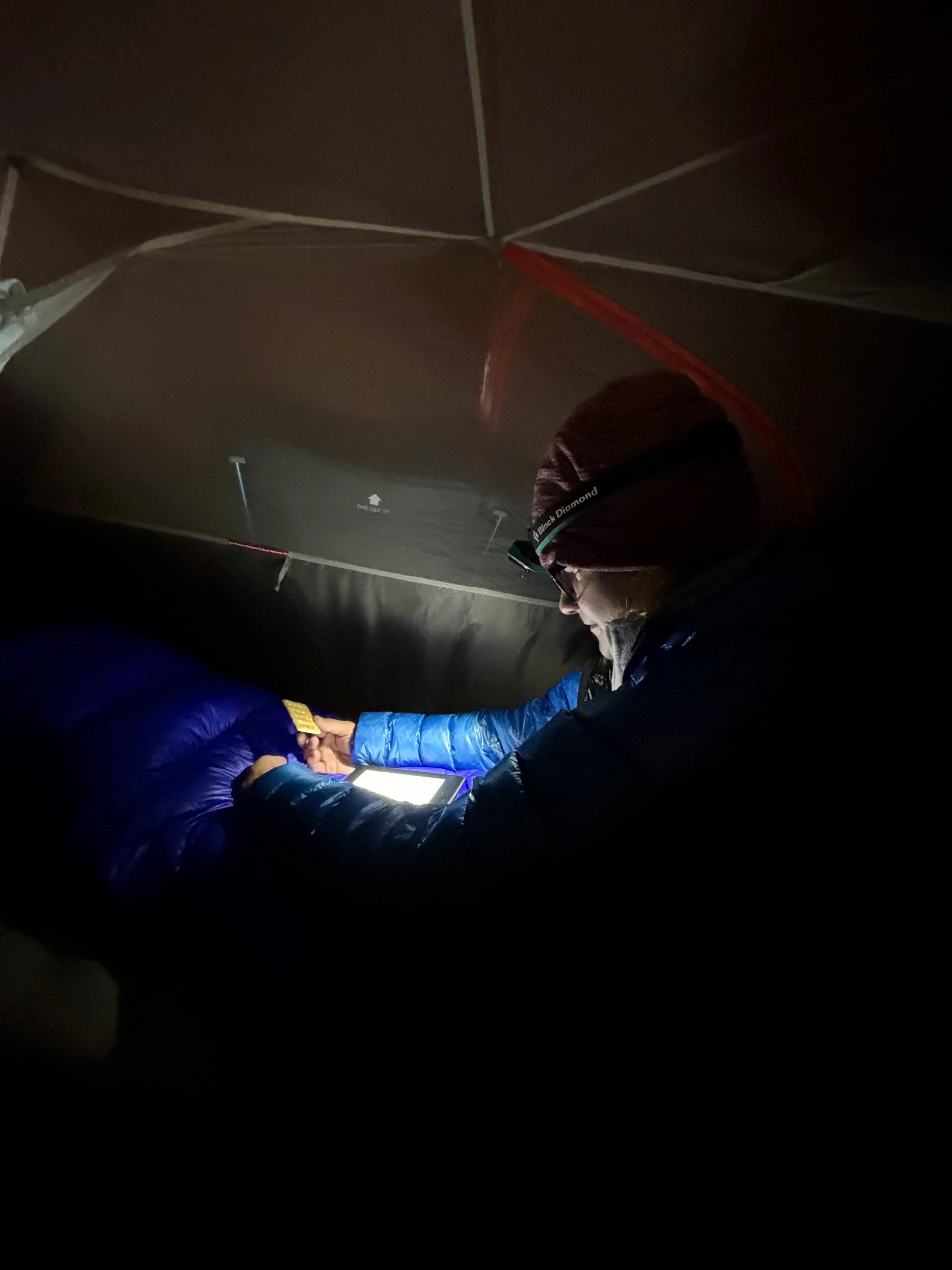
Day 4 was my least favorite morning of the trip. I woke up at 5am to a wet sleeping bag. I found the condensation from the inside of our tent was dripping right into the middle of our tent, leaving us both with wet sleeping bags. Upon realizing what was happening, I unfortunately had to wake Mike up to address the situation, which meant we were going to start our day early since getting our down sleeping bags any more wet seemed like a bad idea.
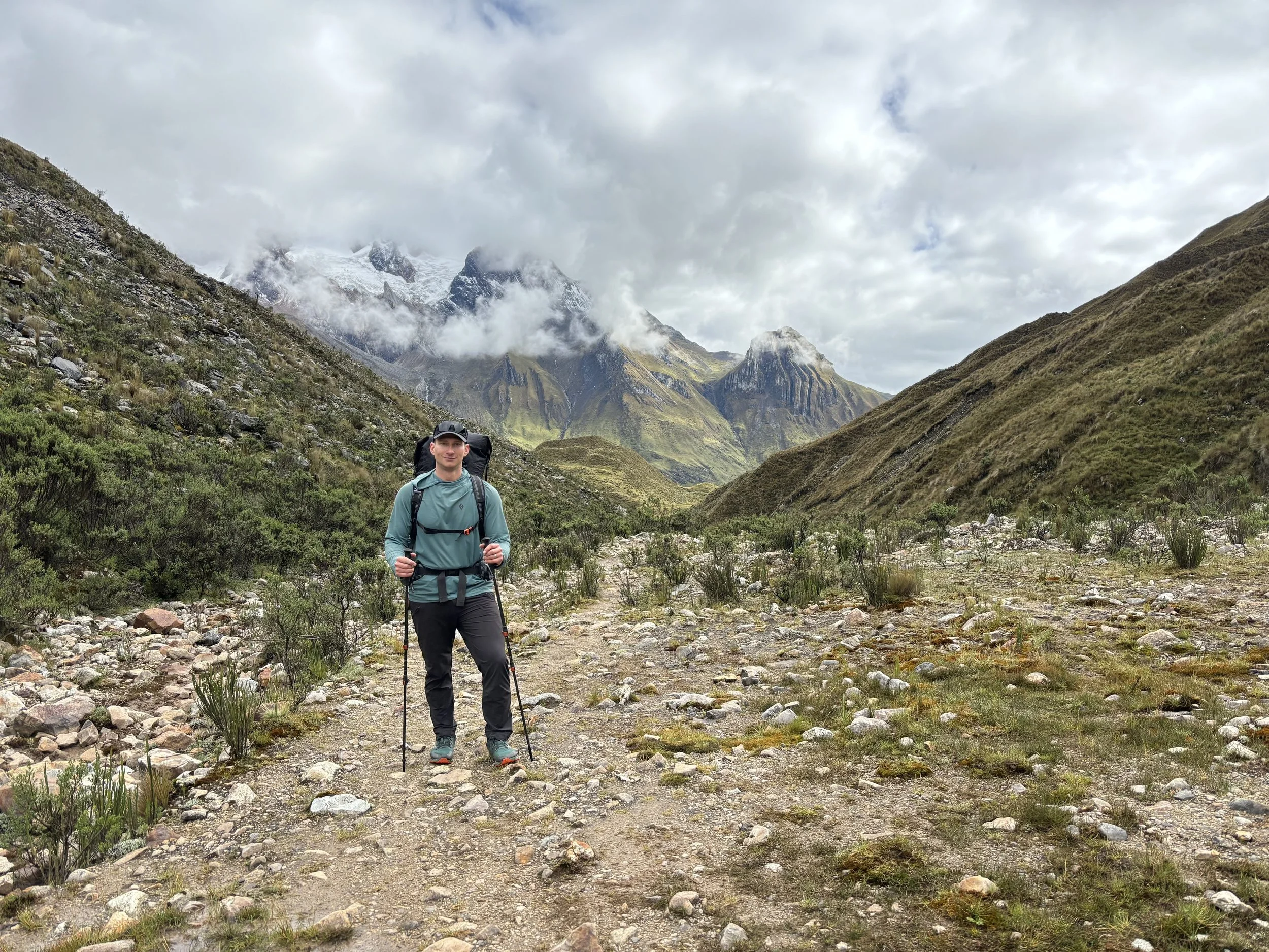
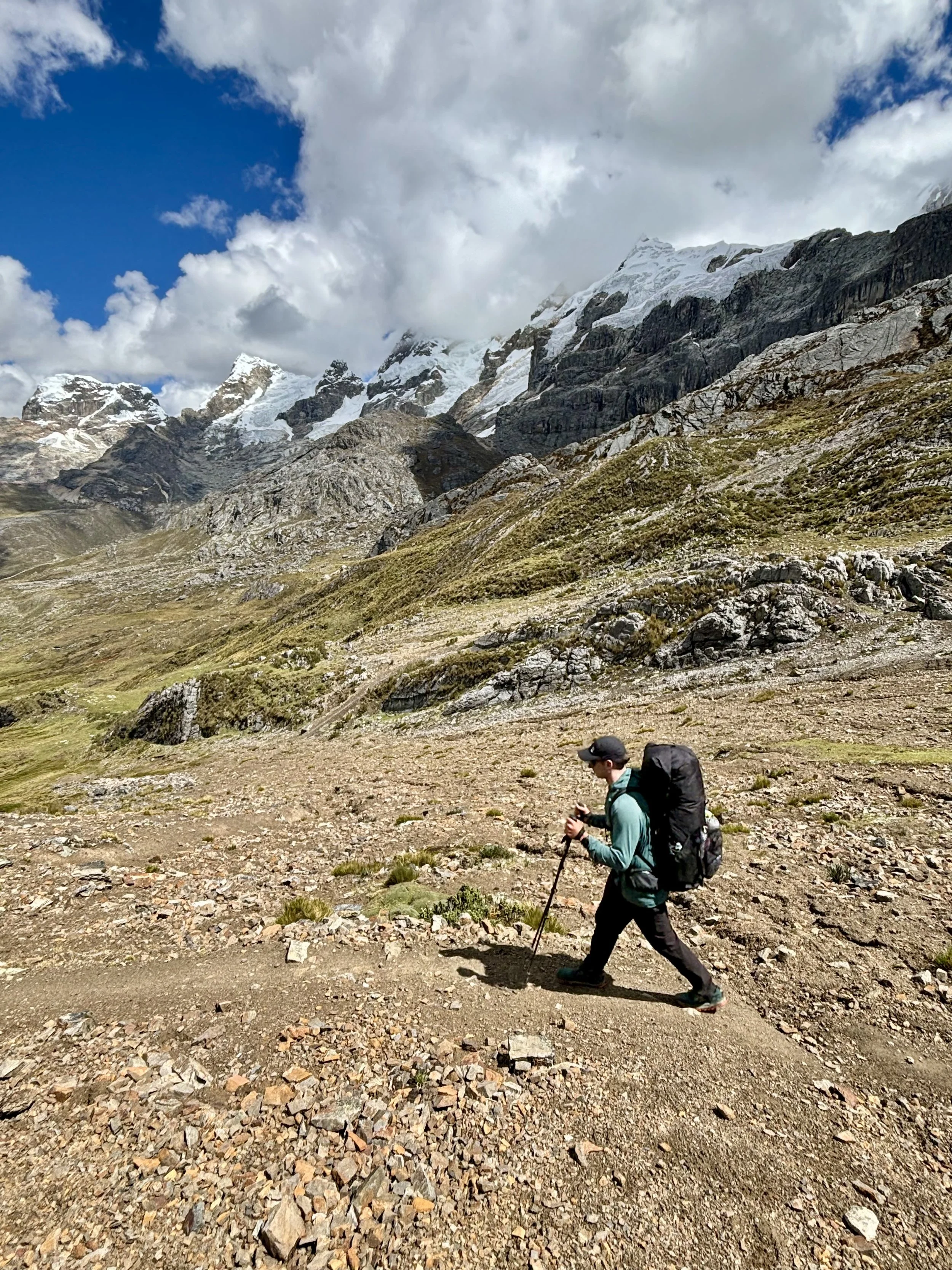
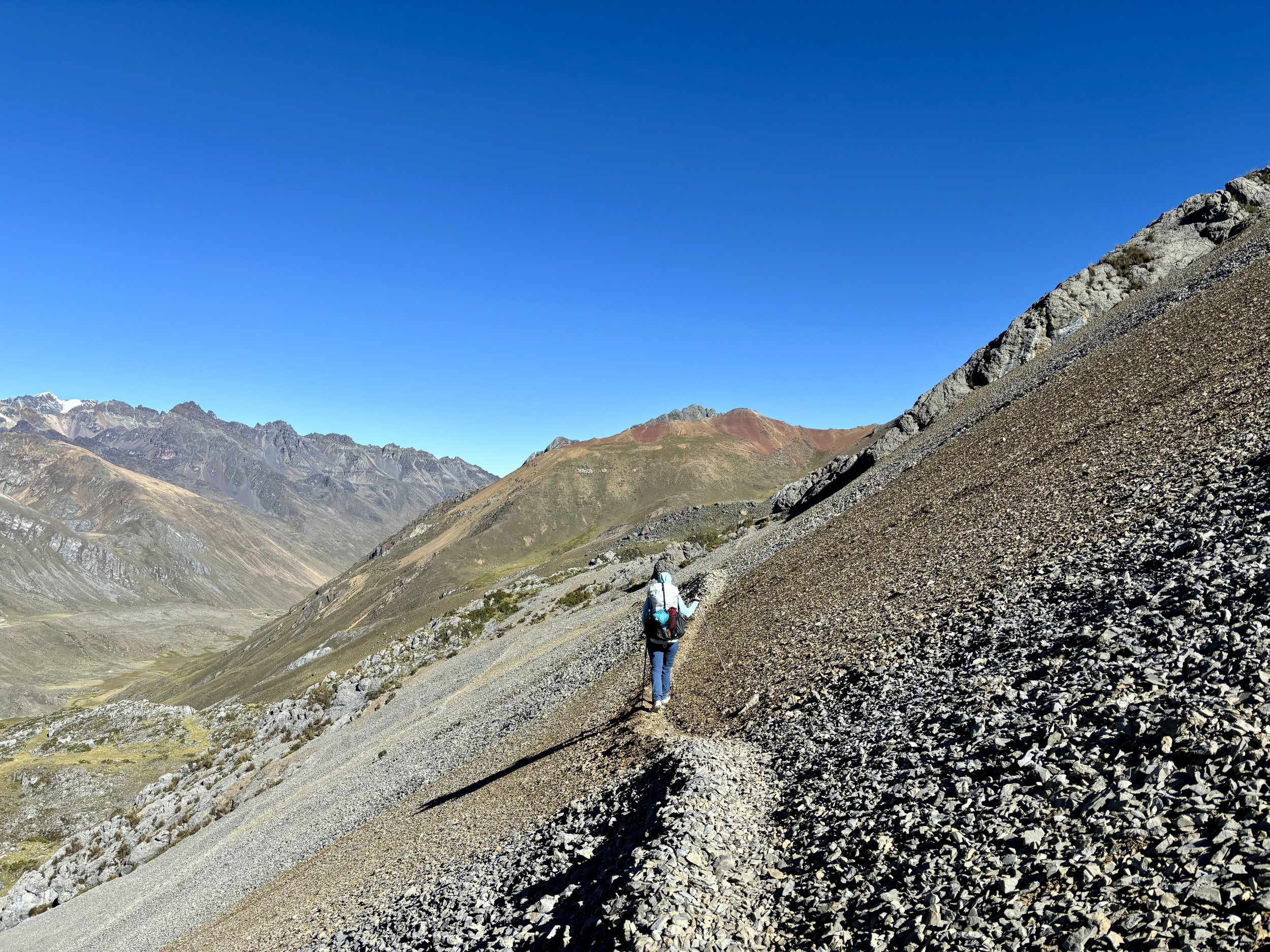
Our plan this day was to once again take the Alpine Route and head over Paso del Trapecio. This decision was pre-planned and would cut one day off the trek for us, but also meant we’d miss the hot springs at Viconga. Since we were self-supported and carrying all of our food, it seemed like a fair trade off to eliminate one day in order to lighten our loads early in the trek.
I was expecting to have the trail to ourselves today, thinking the guided groups would all go to Viconga. Apparently, my assumption was very wrong, and we found ourselves in the middle of three large groups that were all also going over the pass. The upside of how popular this route turned out to be was that the trail was well-established. I had been expecting to do some route finding that day, but we found ourselves following a very well-worn trail.
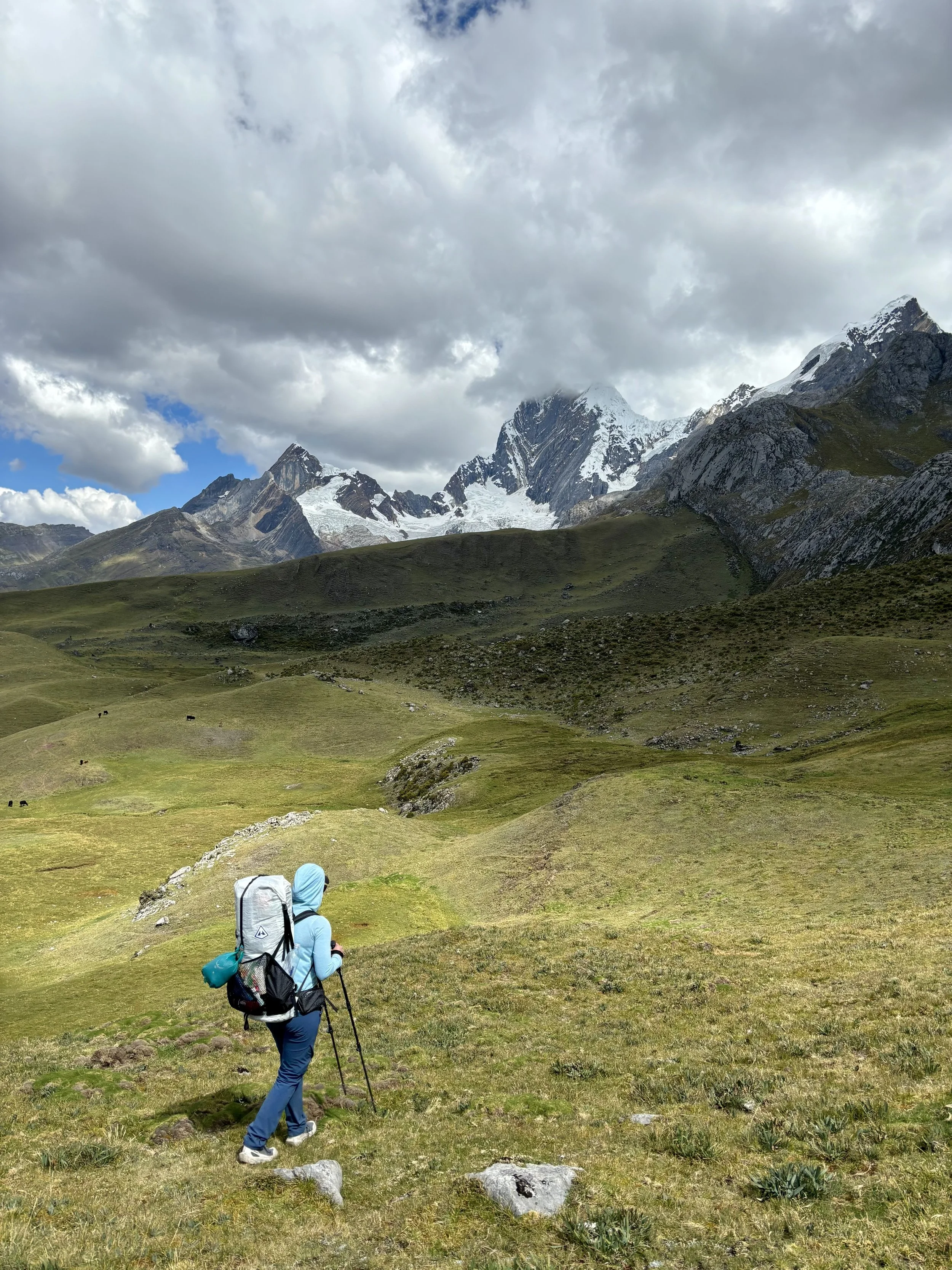
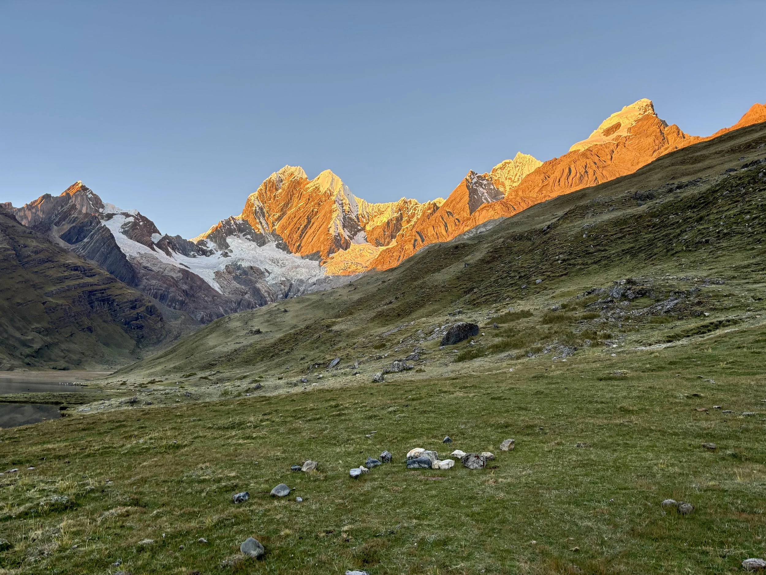
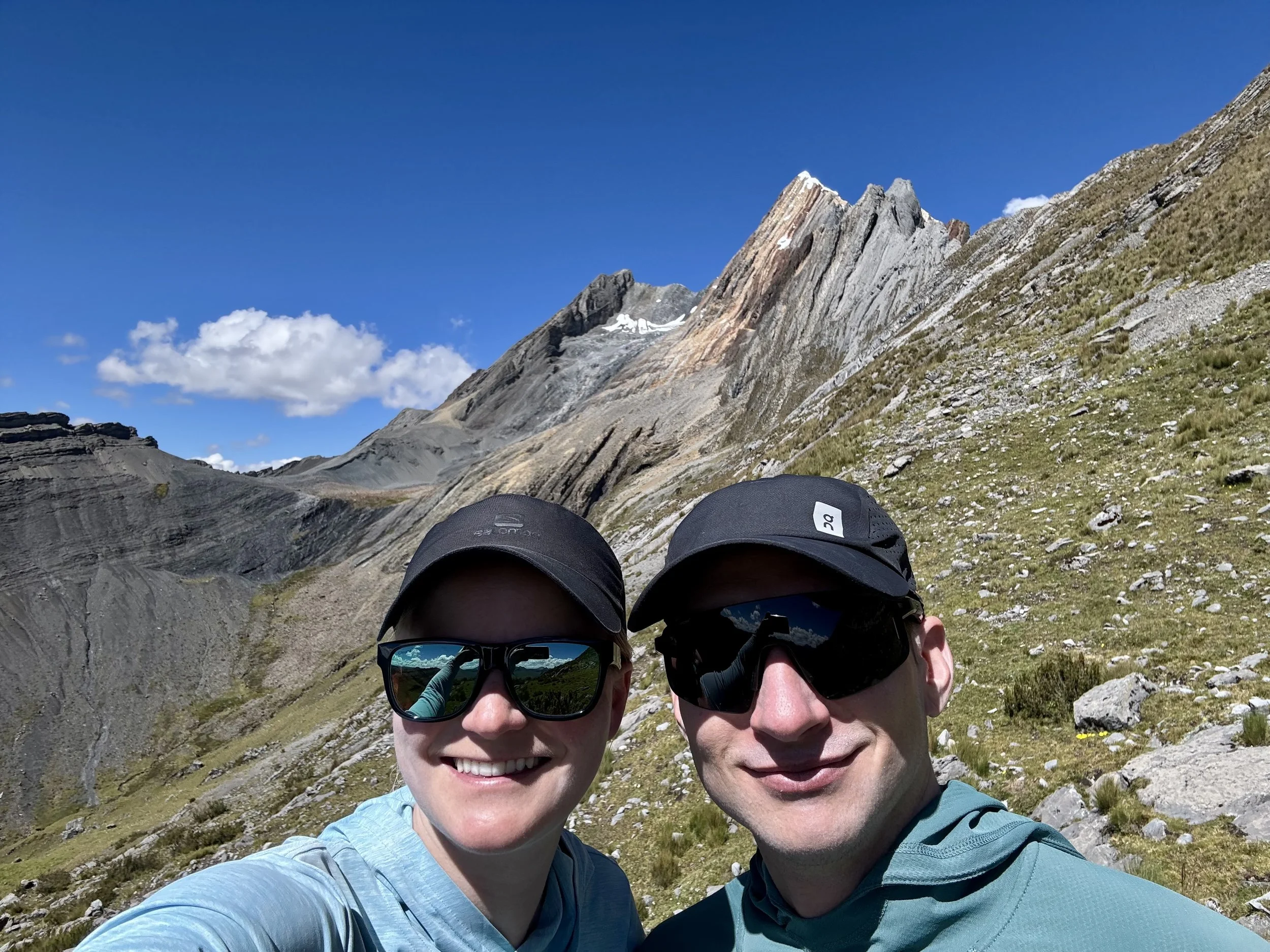
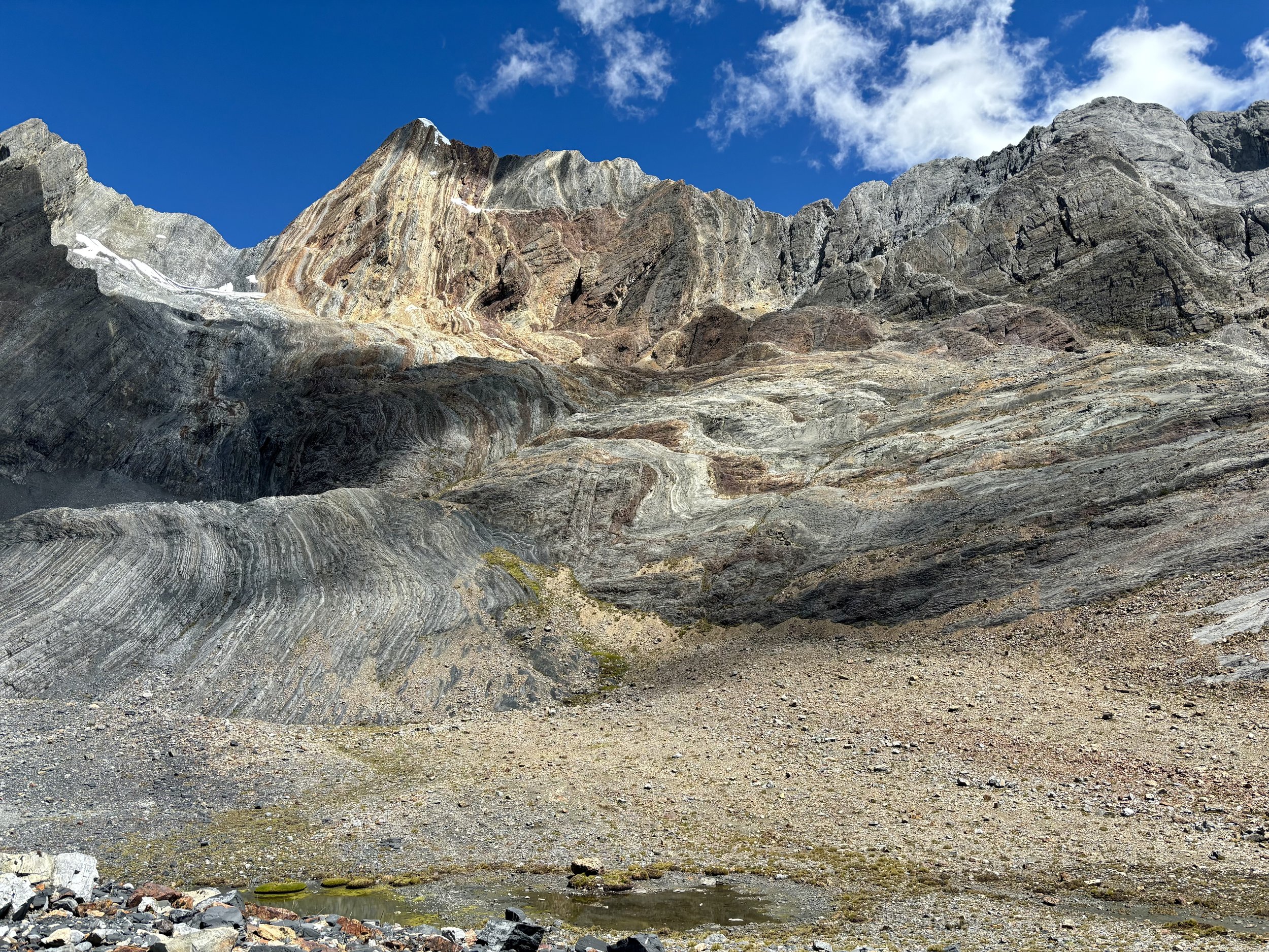
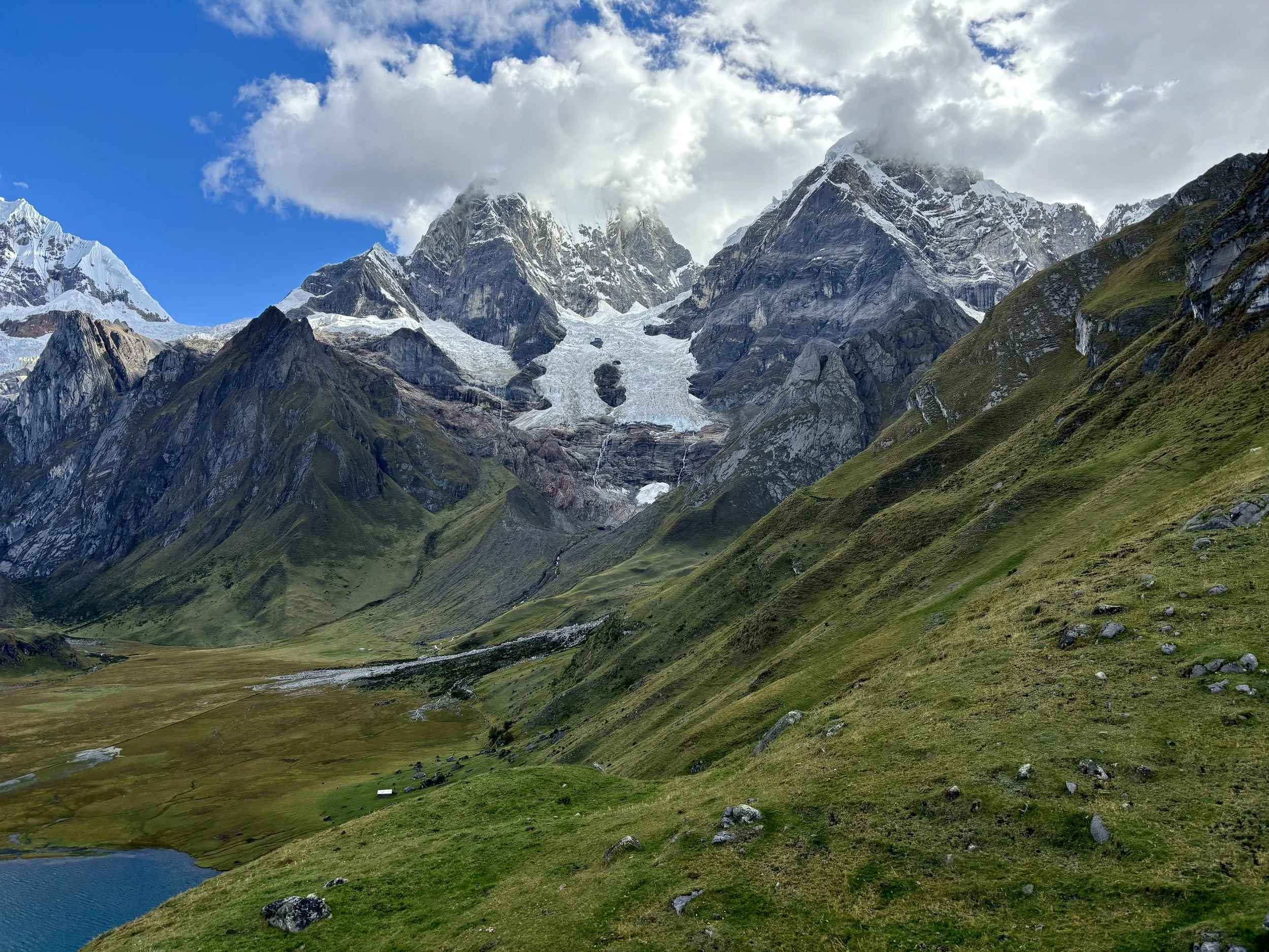
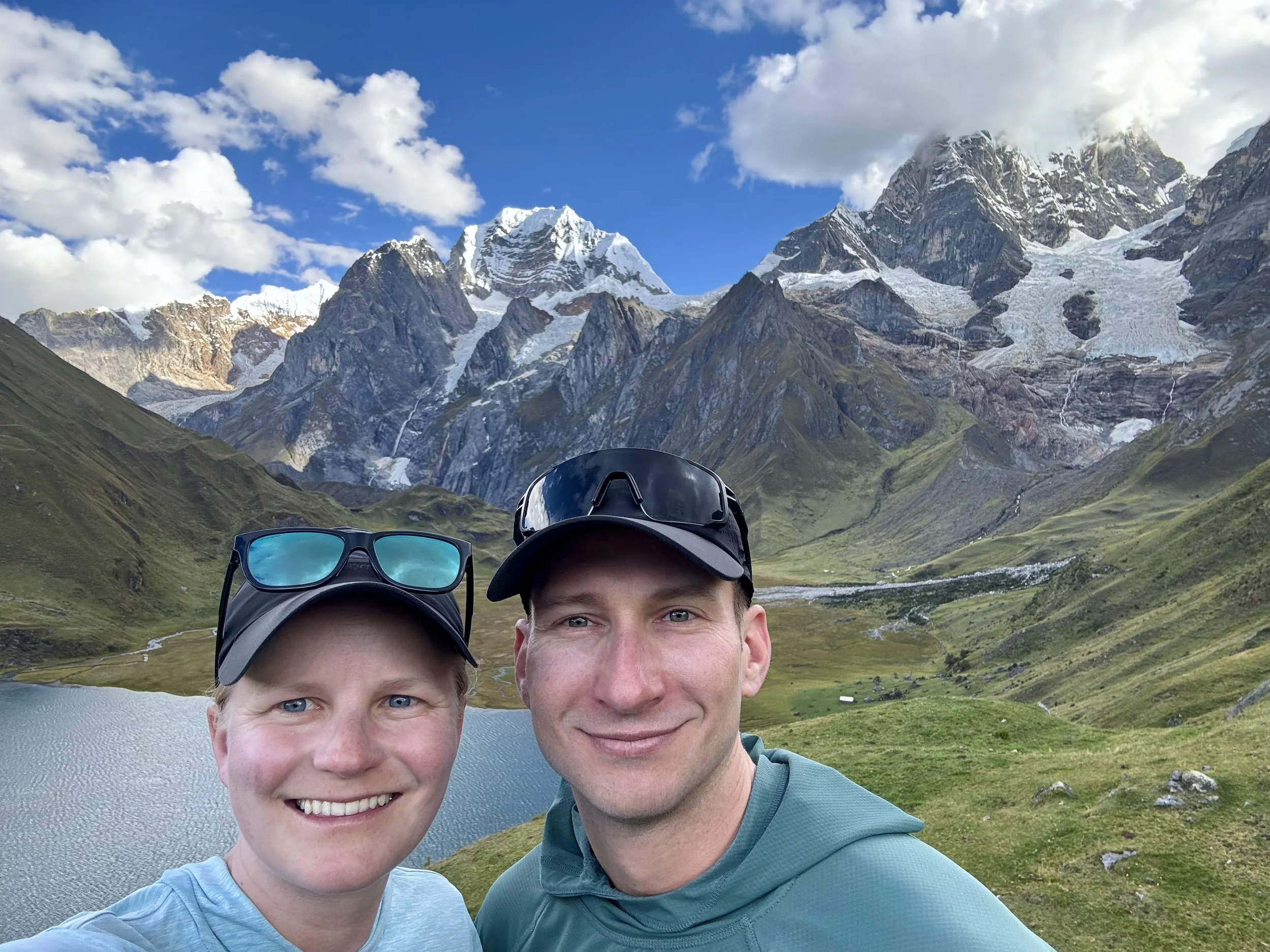
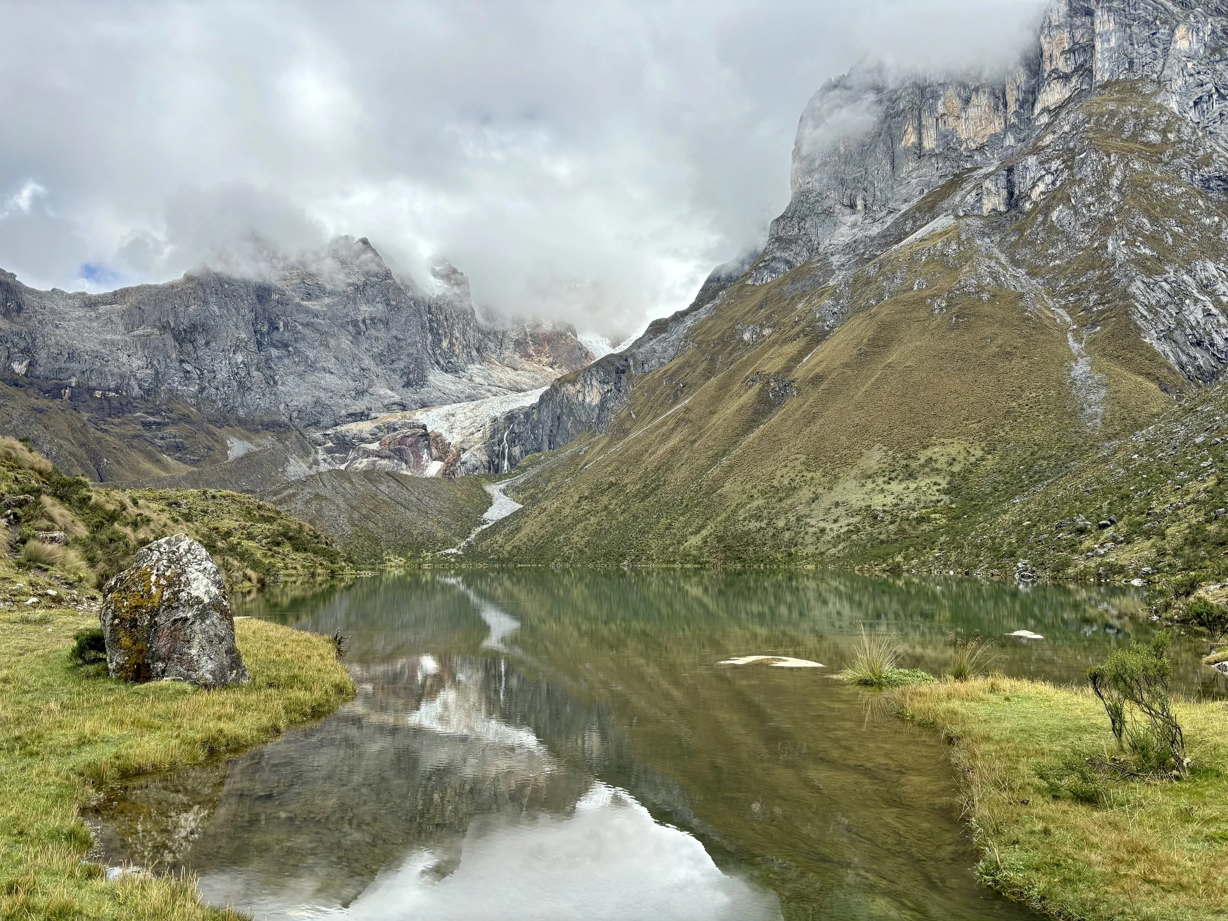
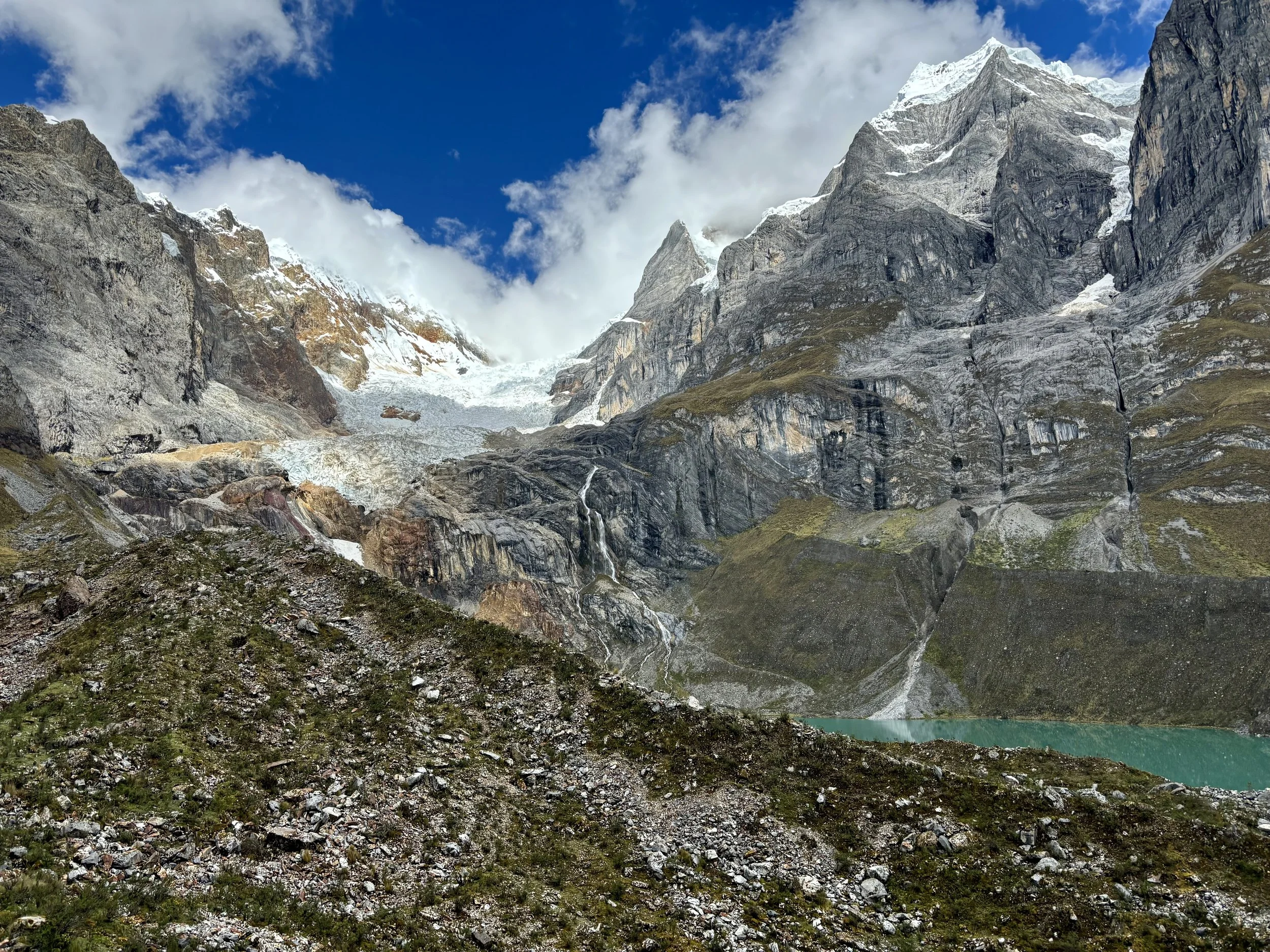
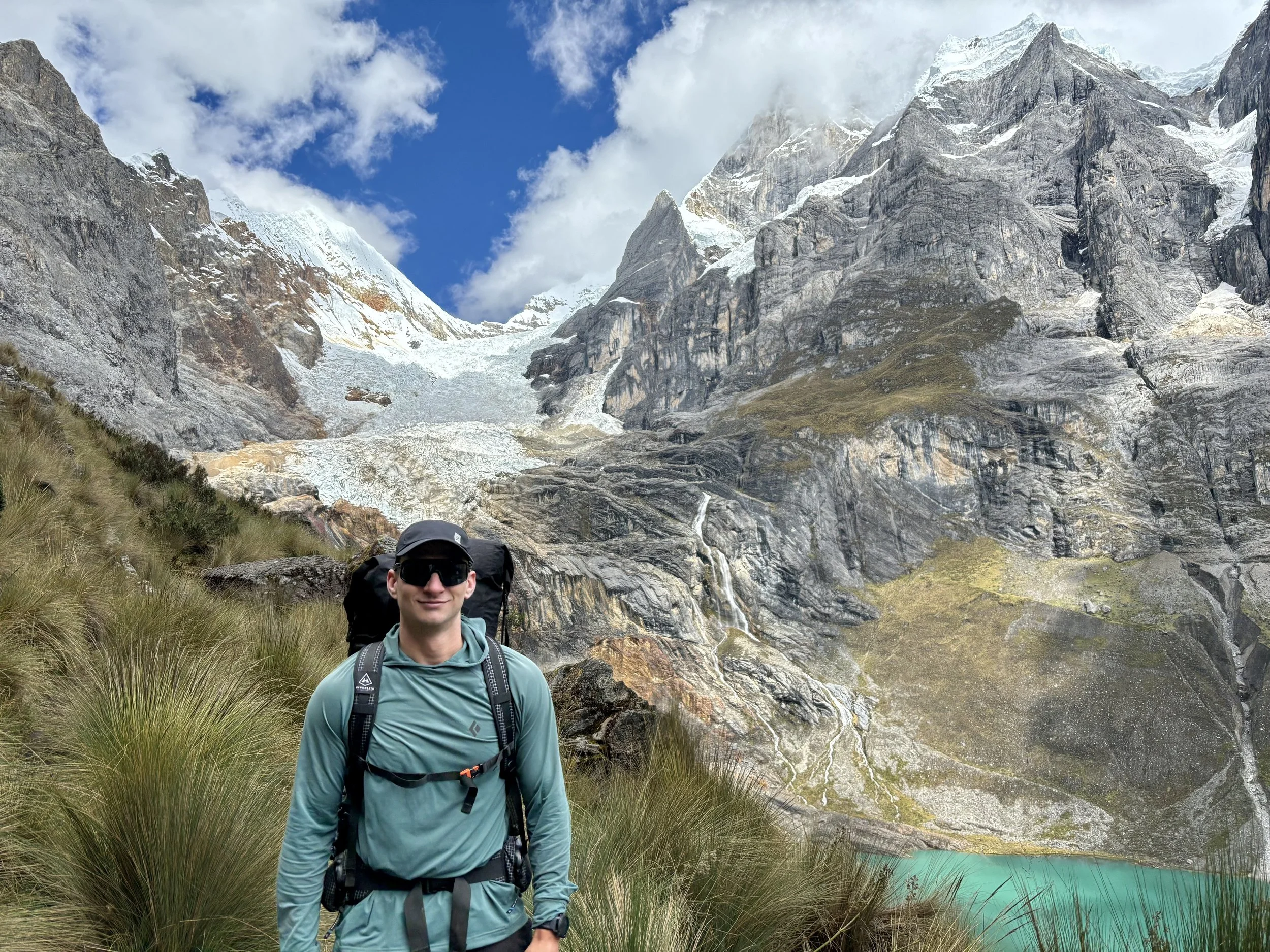
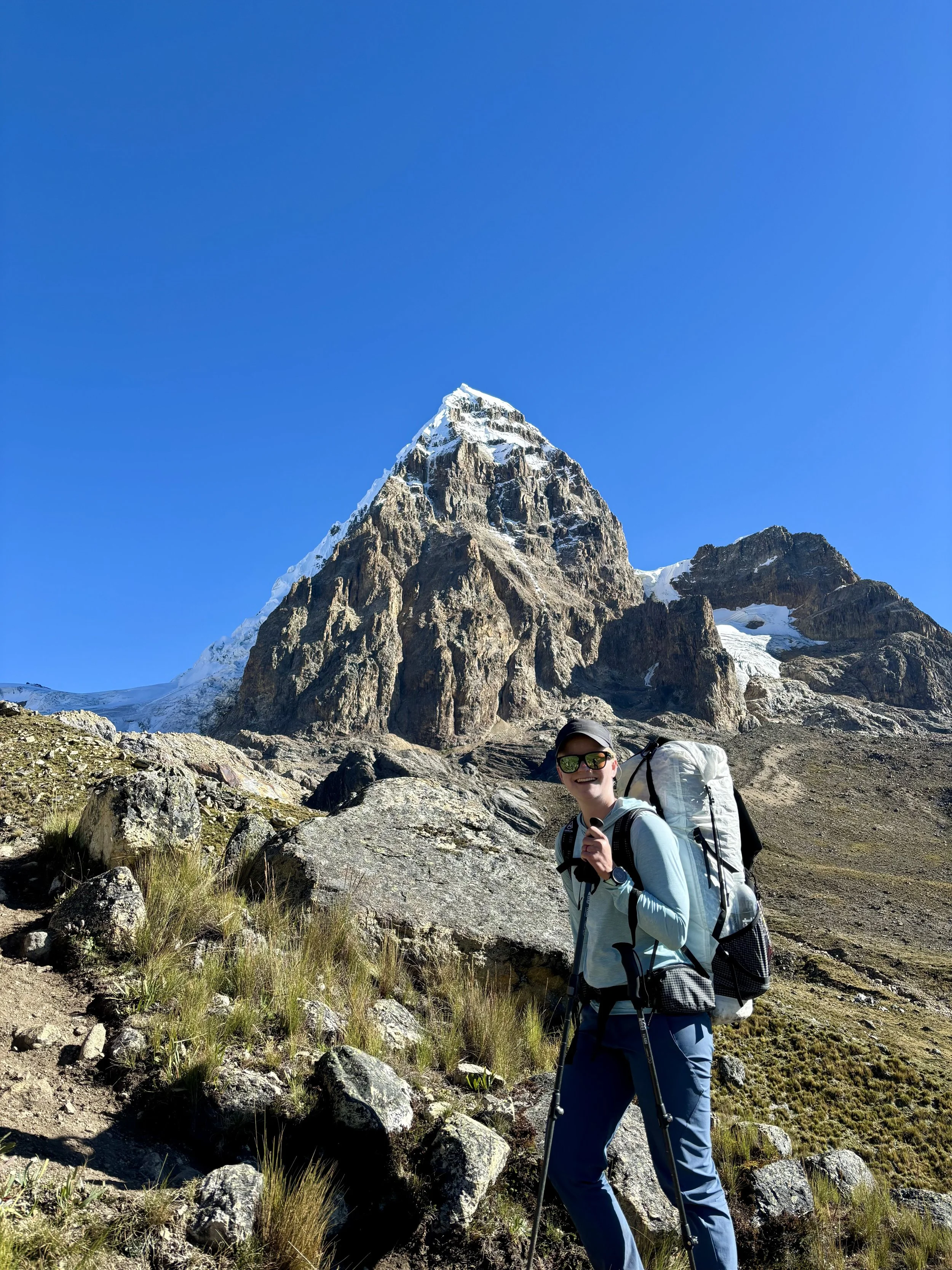
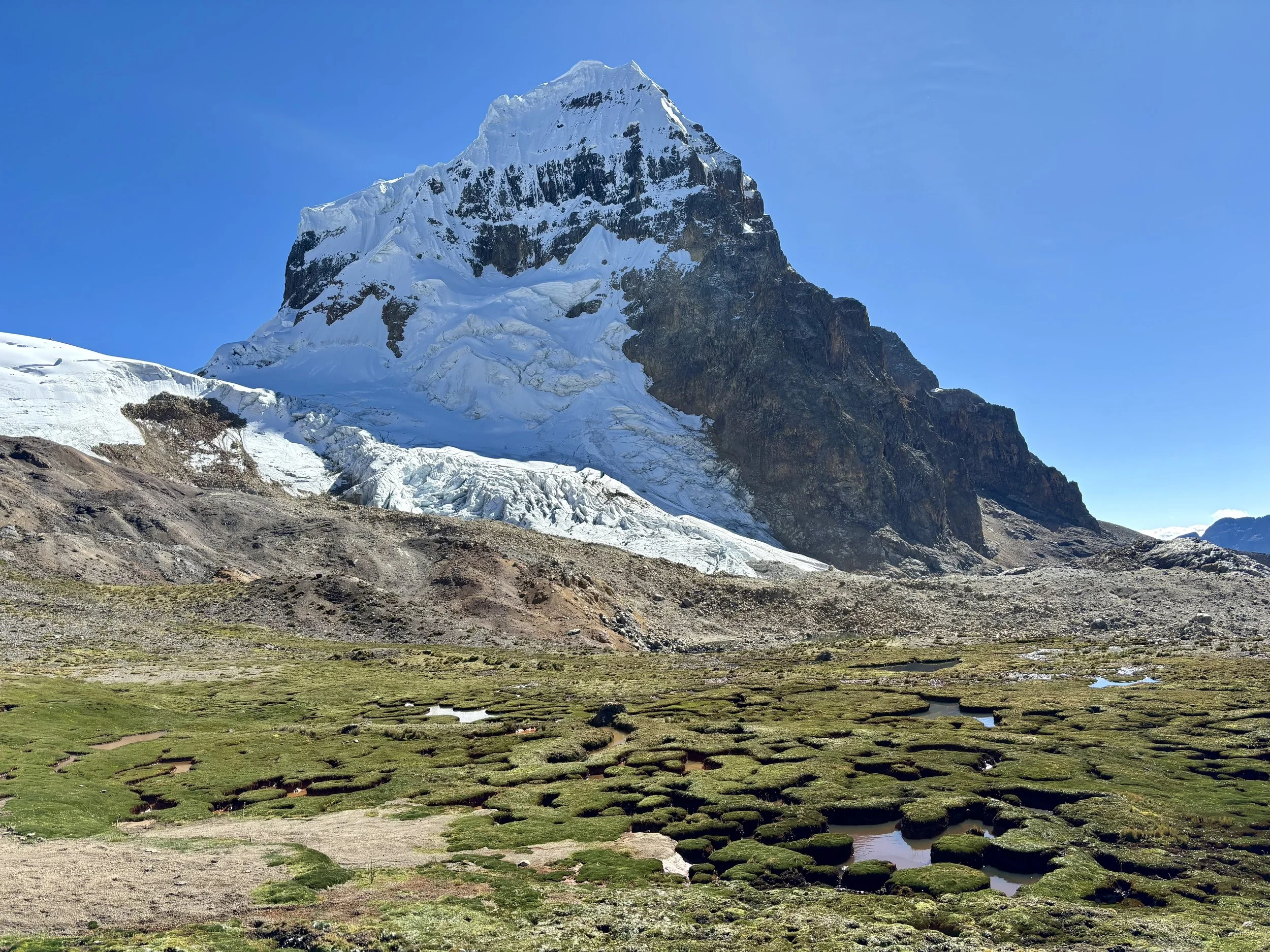
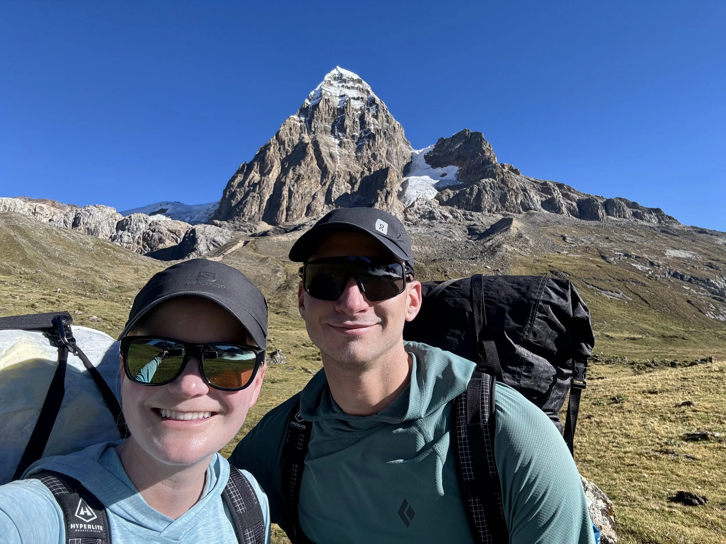
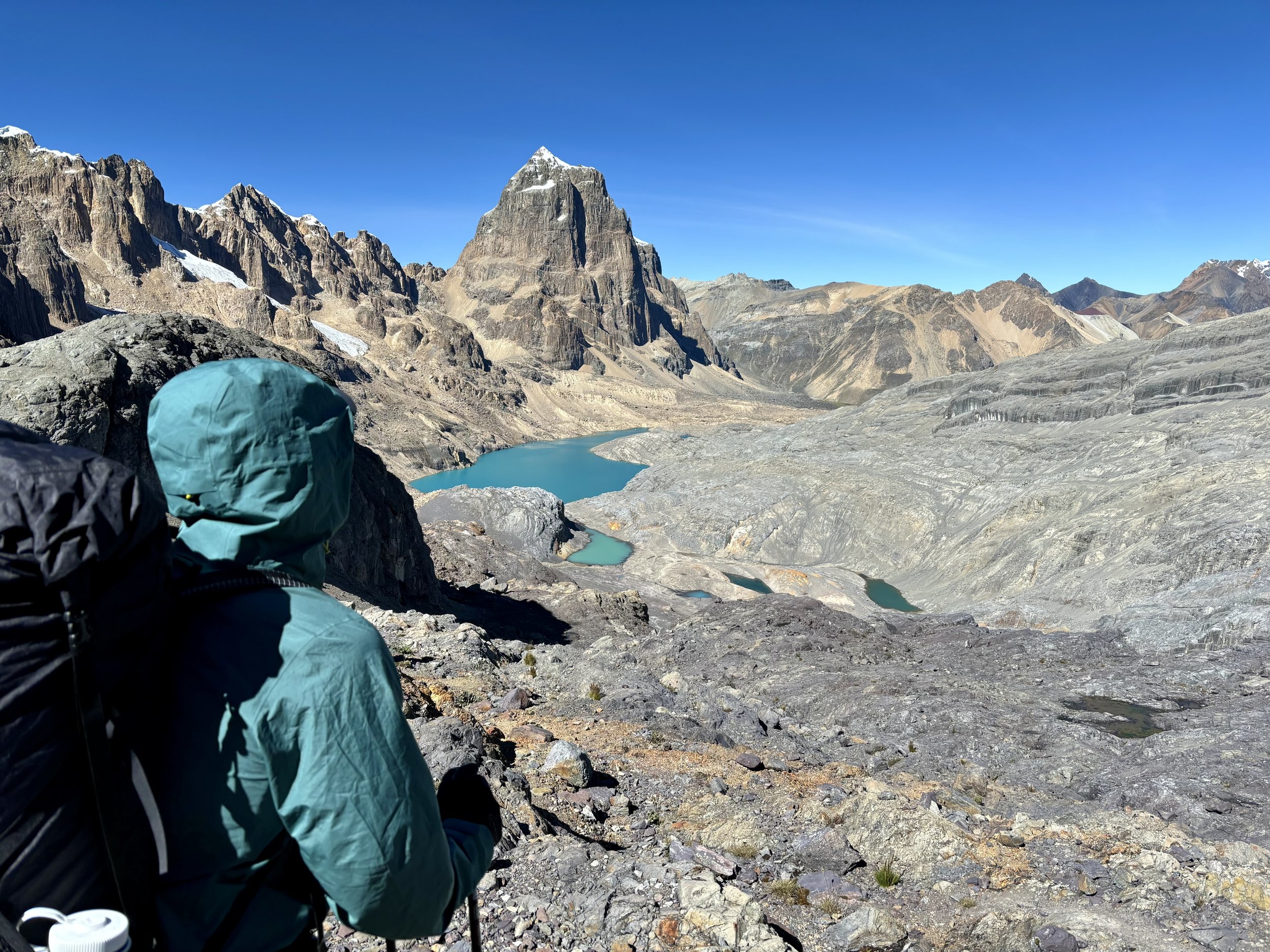
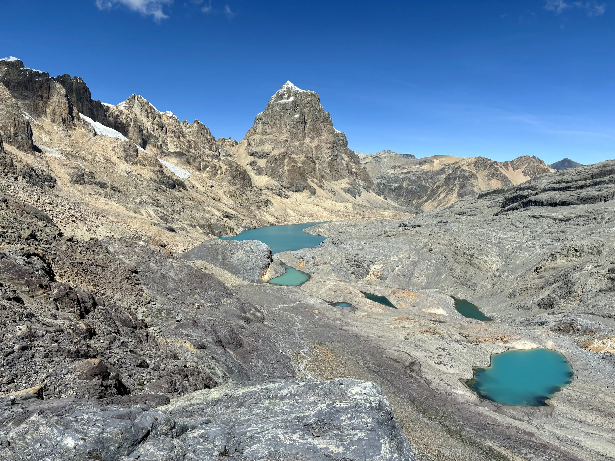
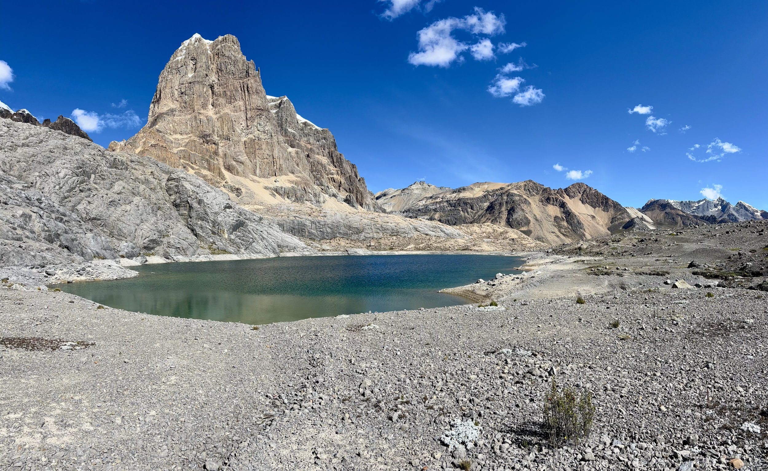
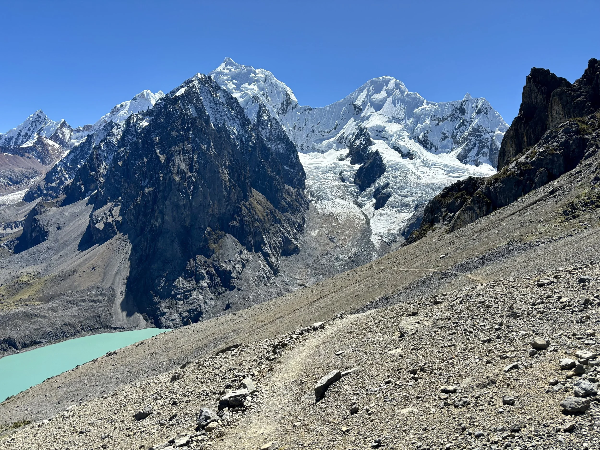
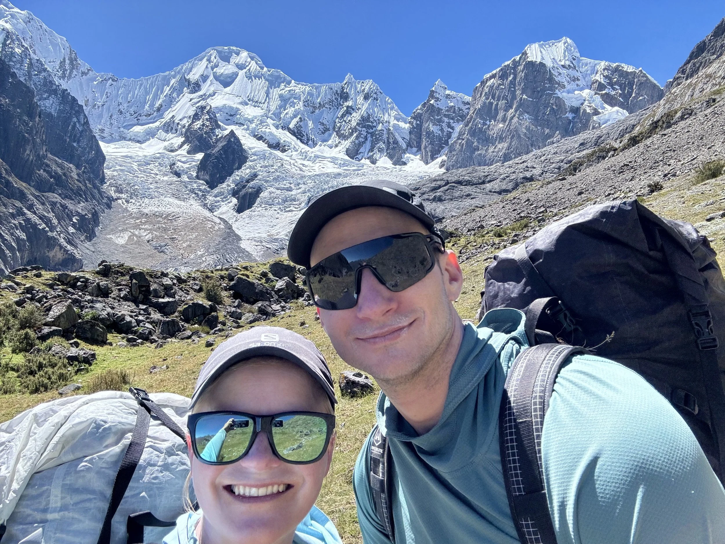
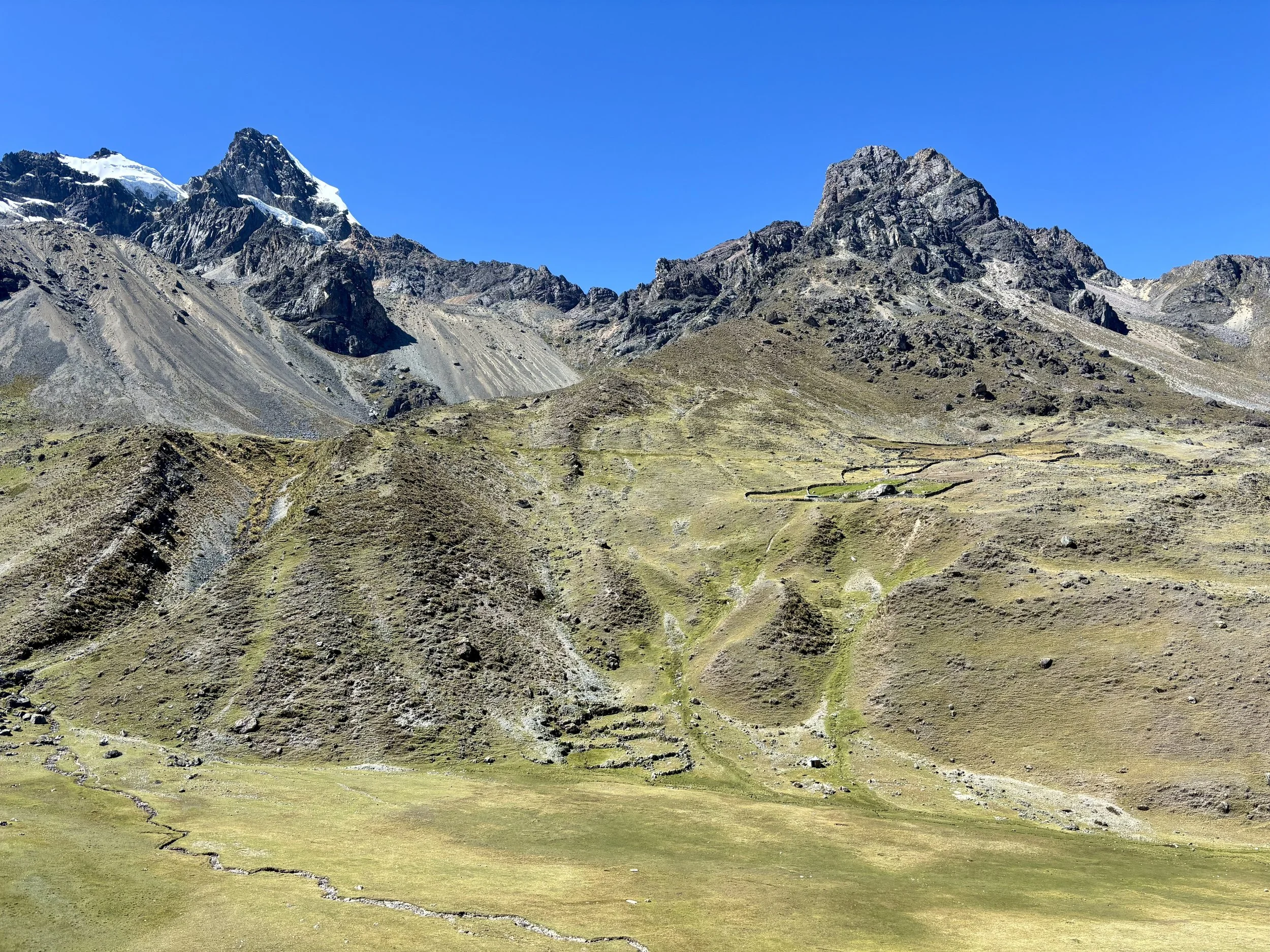
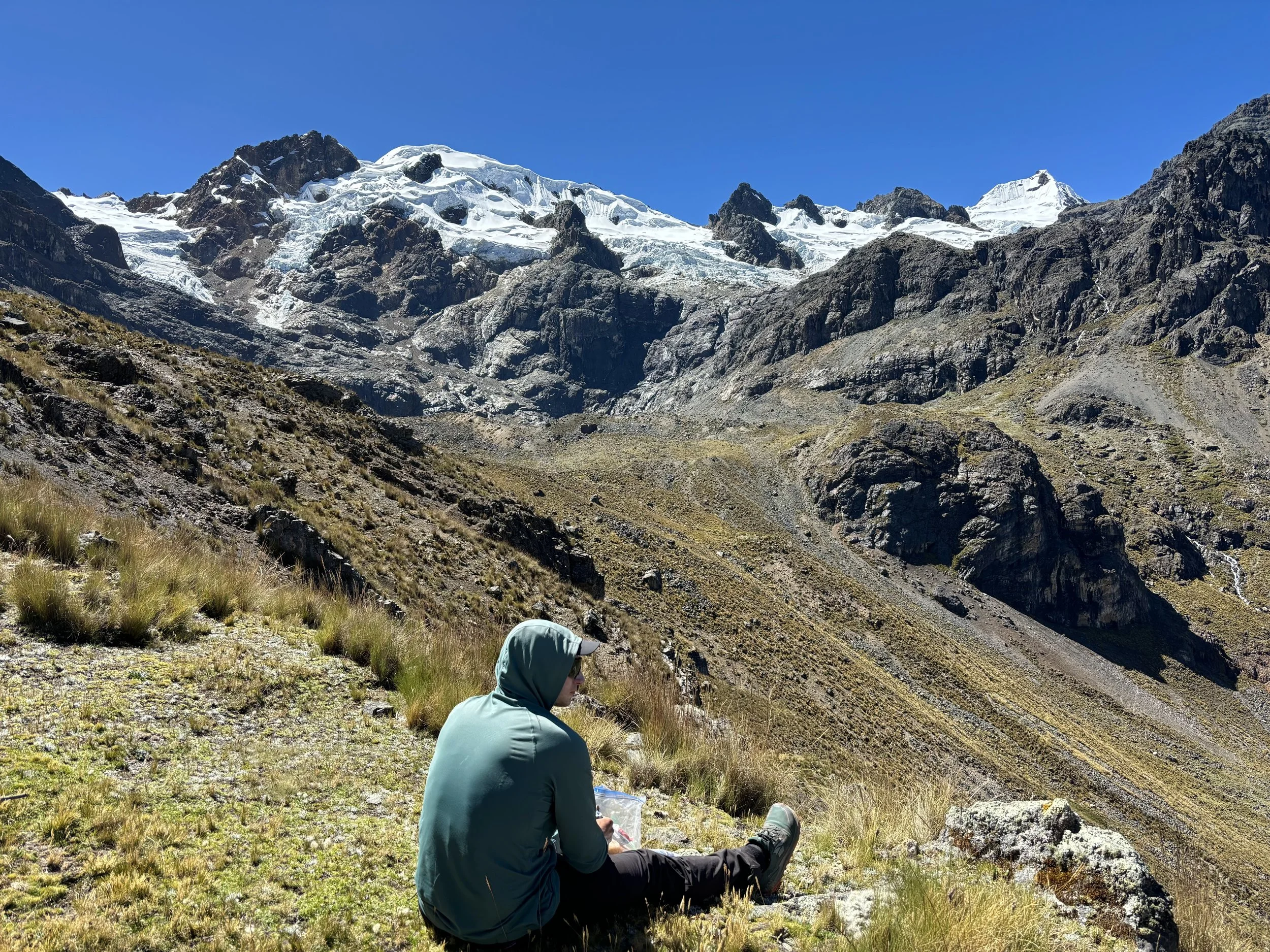
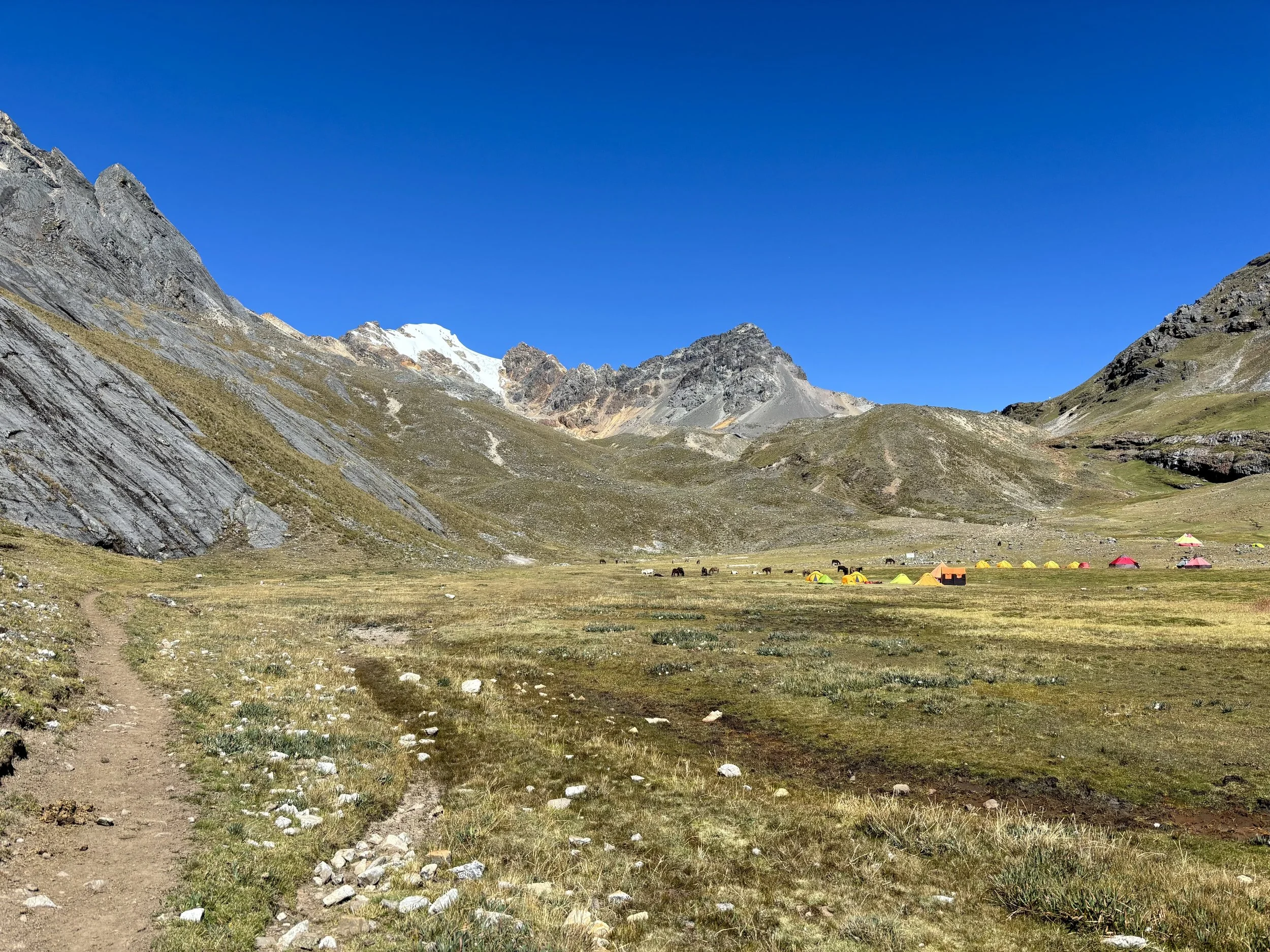
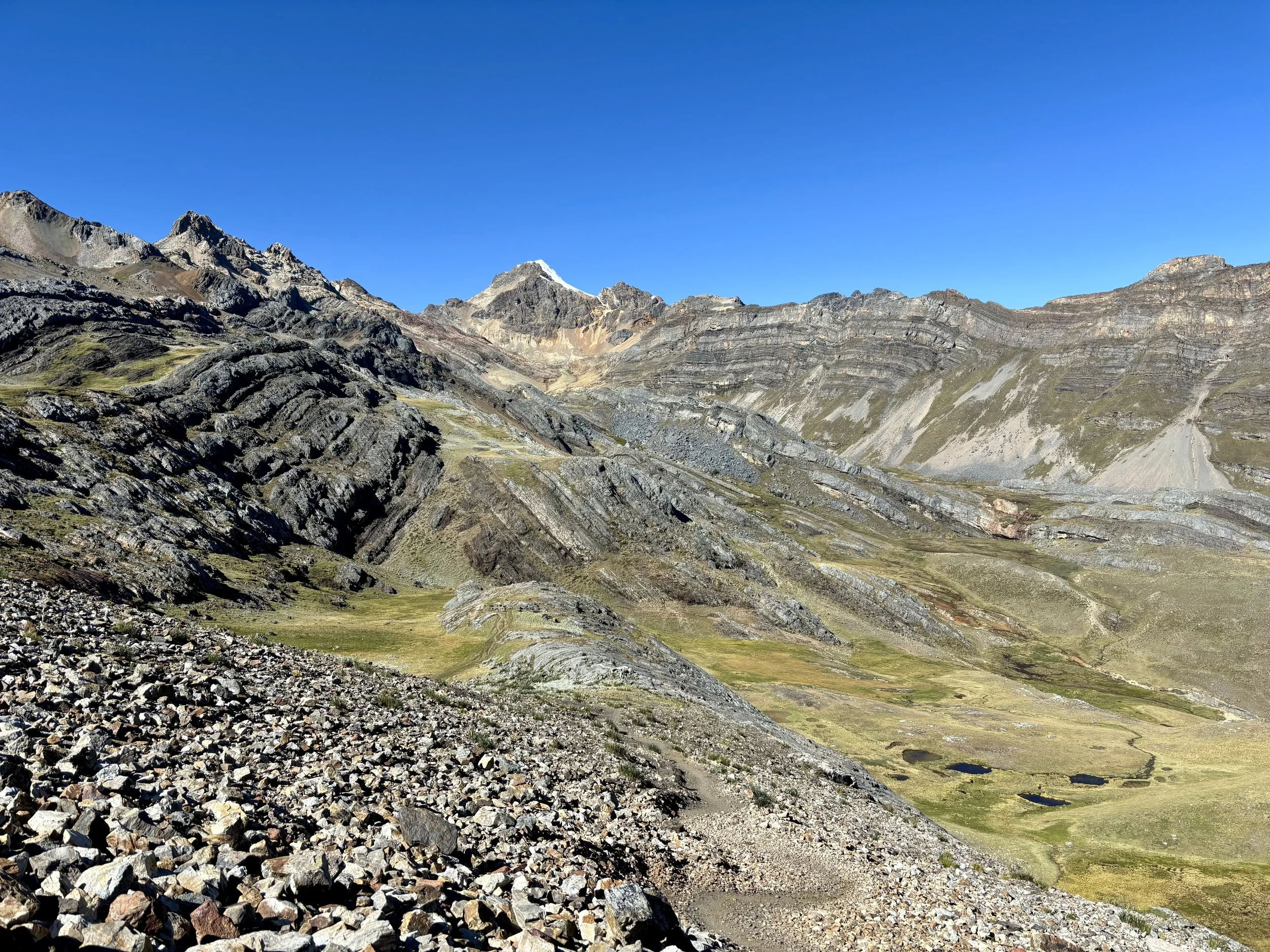
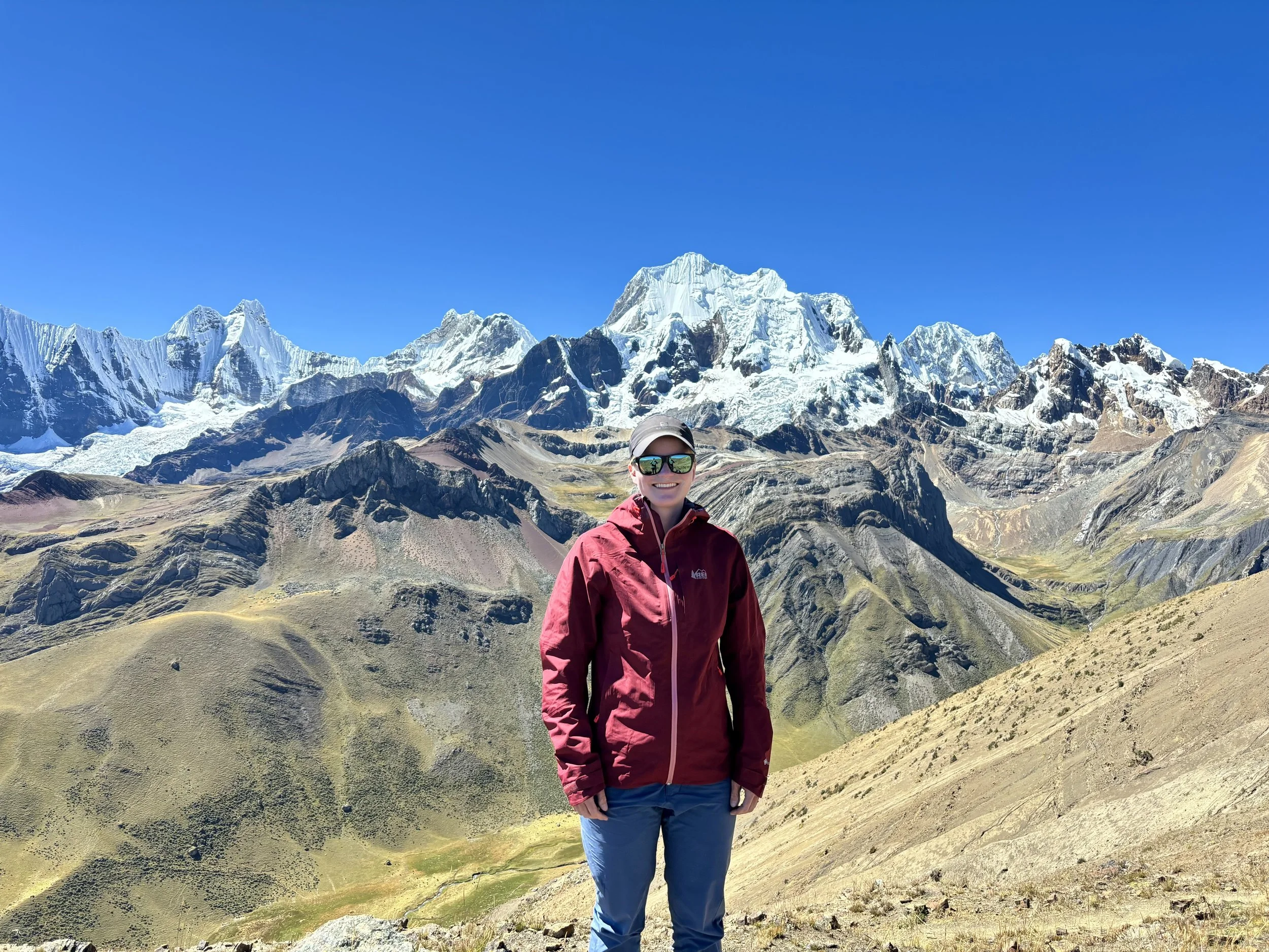
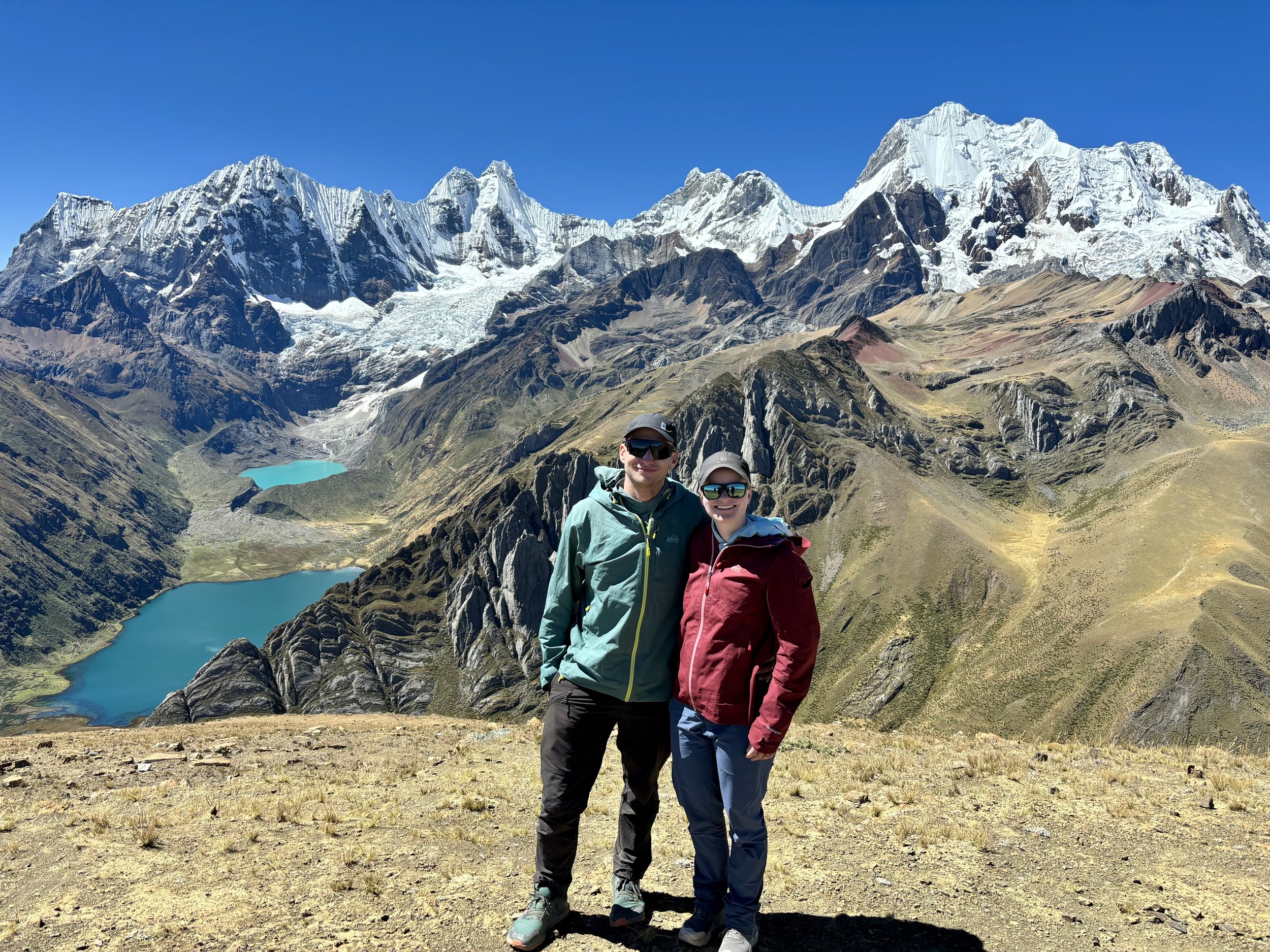
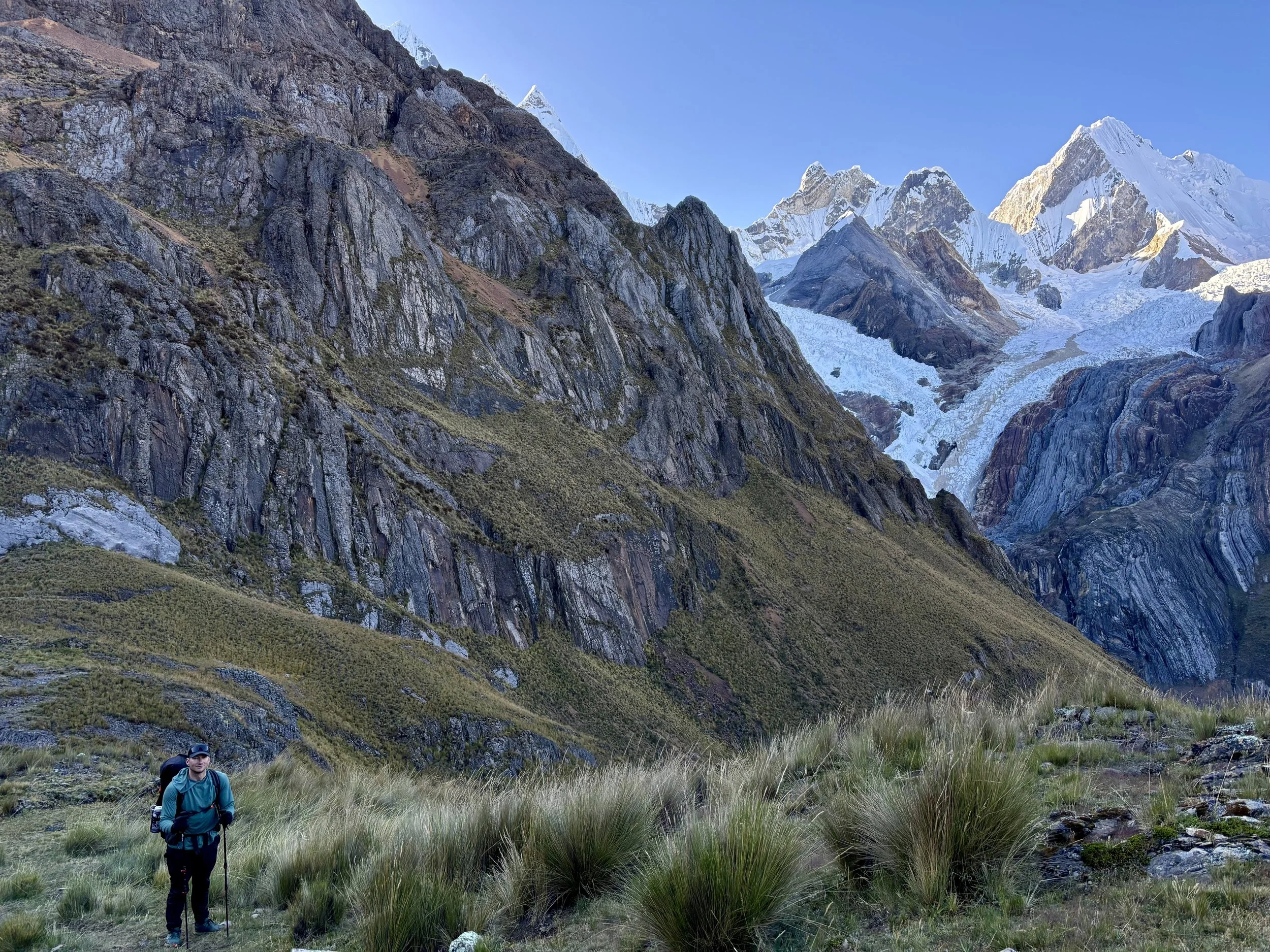
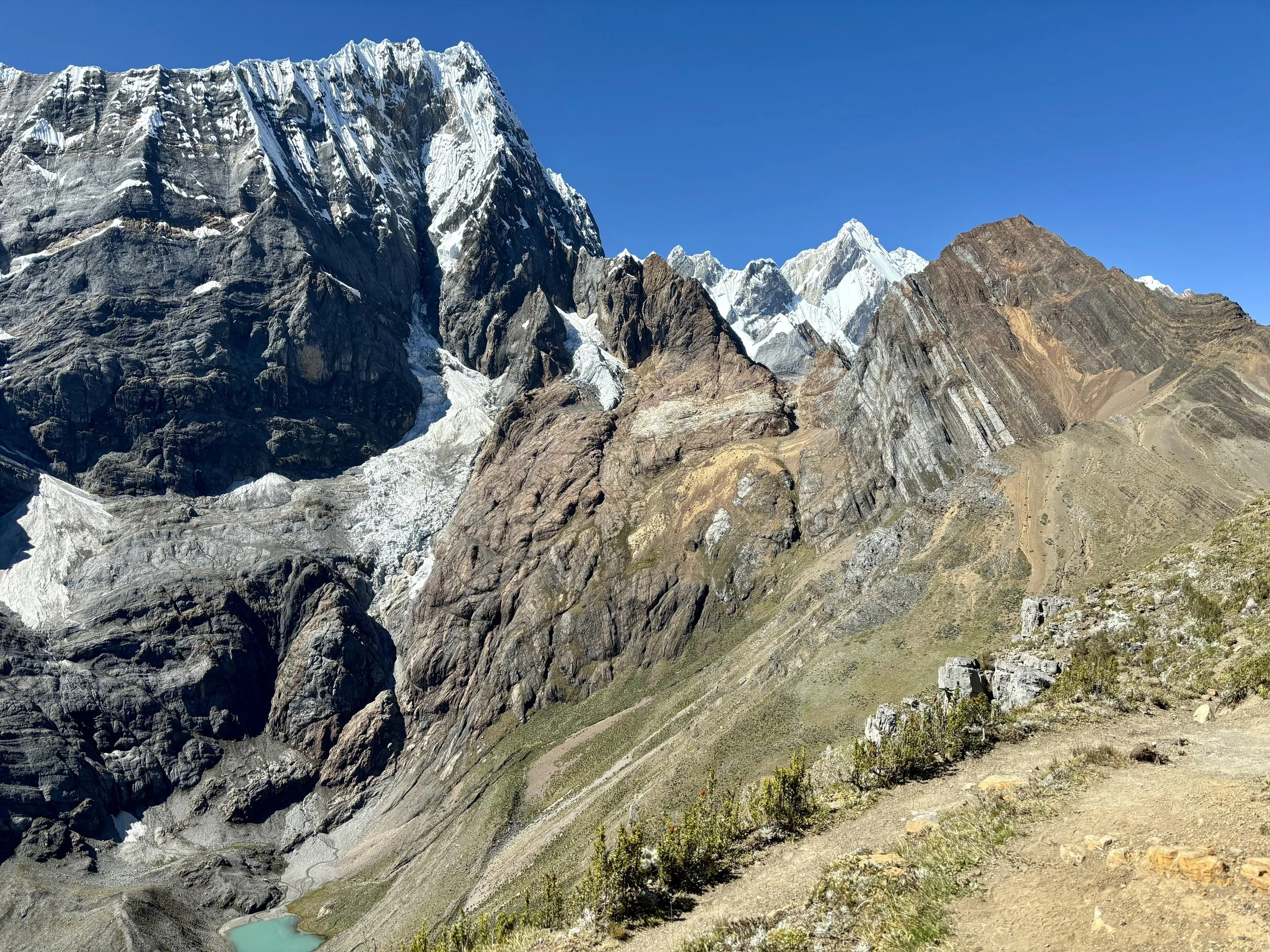
Once we made it to Paso del Trapecio, I had us climb up a few hundred more feet to the Jurau Glacier viewpoint. This was one of my favorite views of the trip. It was also our high point of the trip at around 16,800 ft. This spot was so pretty, we just sat there for over an hour and took in the view. We finally decided we were in the mood for some more oxygen so we started to head down towards that night’s campsite. We had been thinking we’d camp at the group campsite, but figured out a spot that would save us some vert the next day and decided to wild camp there. This was a mistake. The spot we picked was above 15,400 ft, and we weren’t acclimated enough to comfortably sleep at that elevation. I also had no appetite that evening, but found my stomach growling, so I had a mental battle of forcing myself to eat some unappetizing food (please don’t make me eat another granola bar!). This led to a pretty sleepless night and set us up poorly from an energy perspective the next day. So, while we cut out some elevation gain the following day, in hindsight, I would have been fine with a longer hike the next day if it meant better fueling and better sleep. This day was a real learning experience for me about how my body handles higher altitudes.
Stats: 6.2 miles, 2500 ft of elevation gain


Day 5
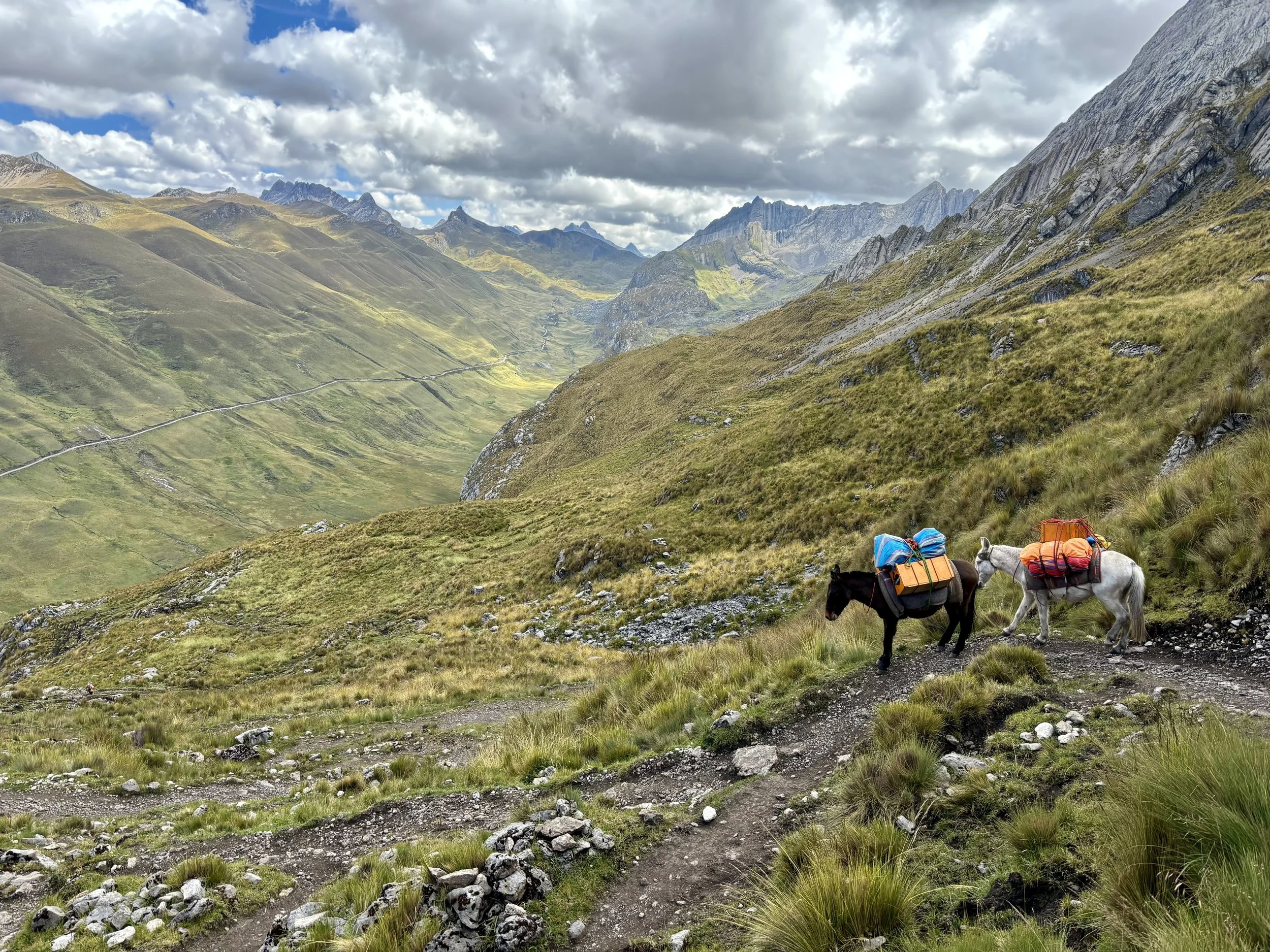
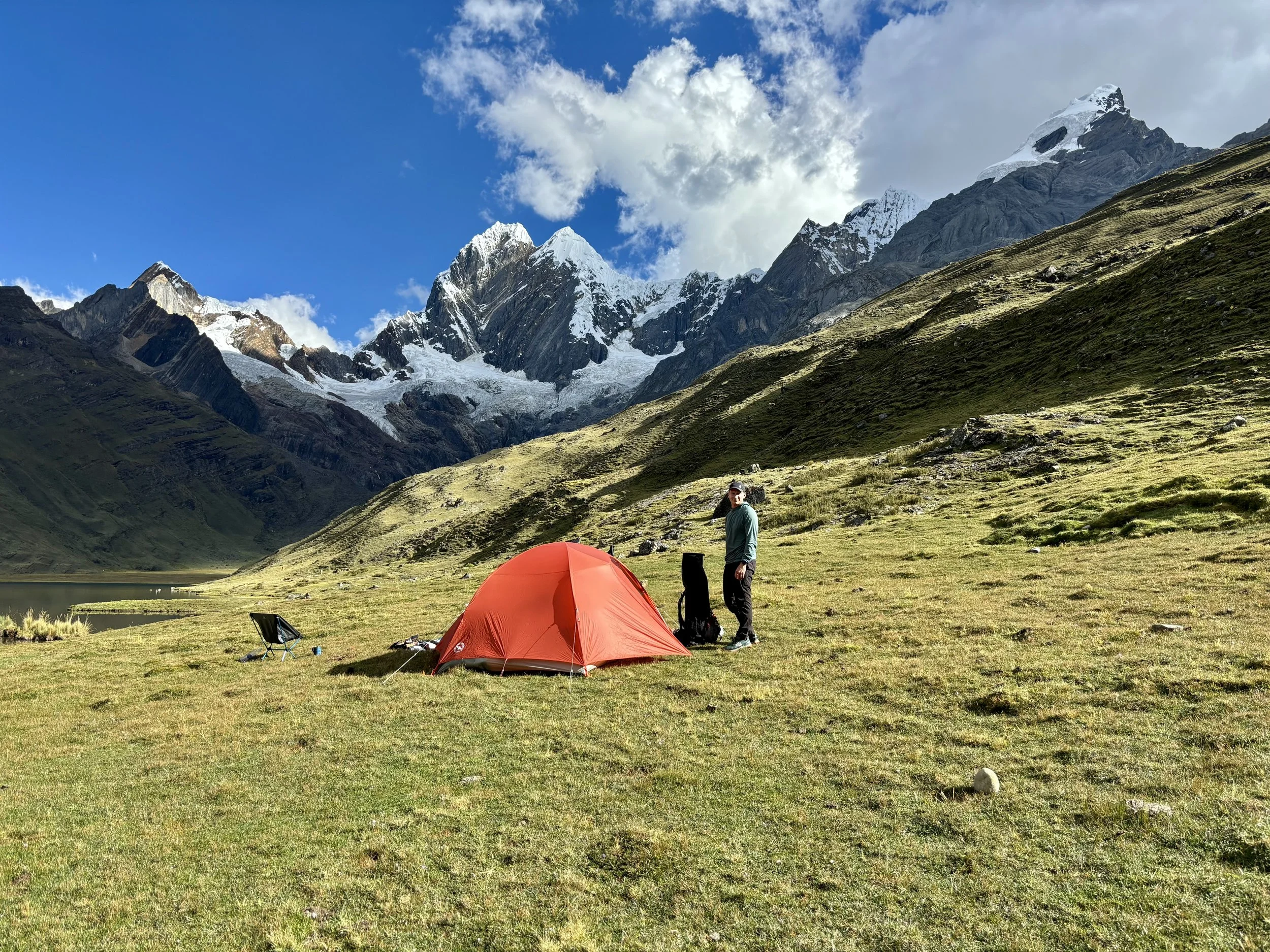
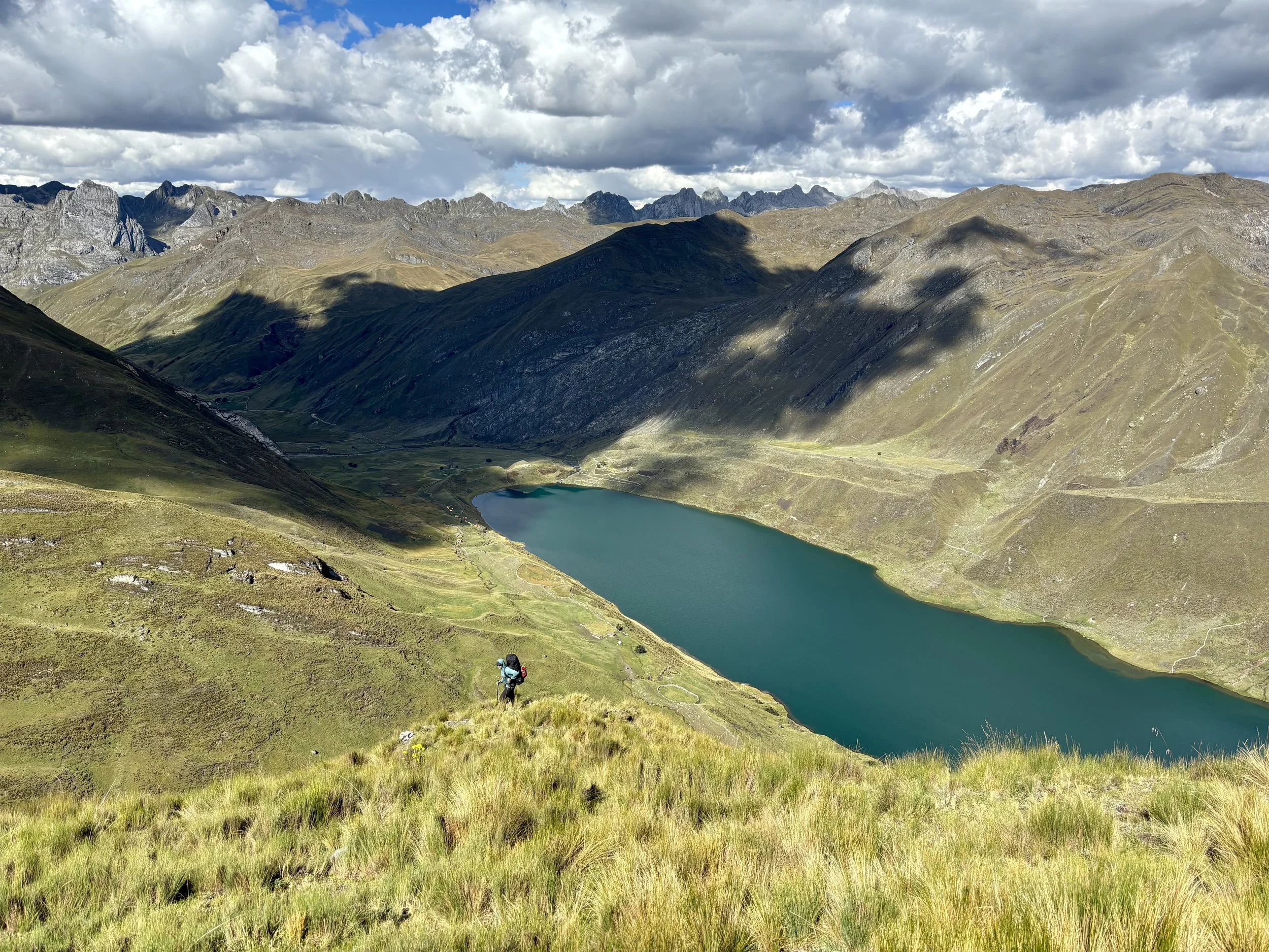
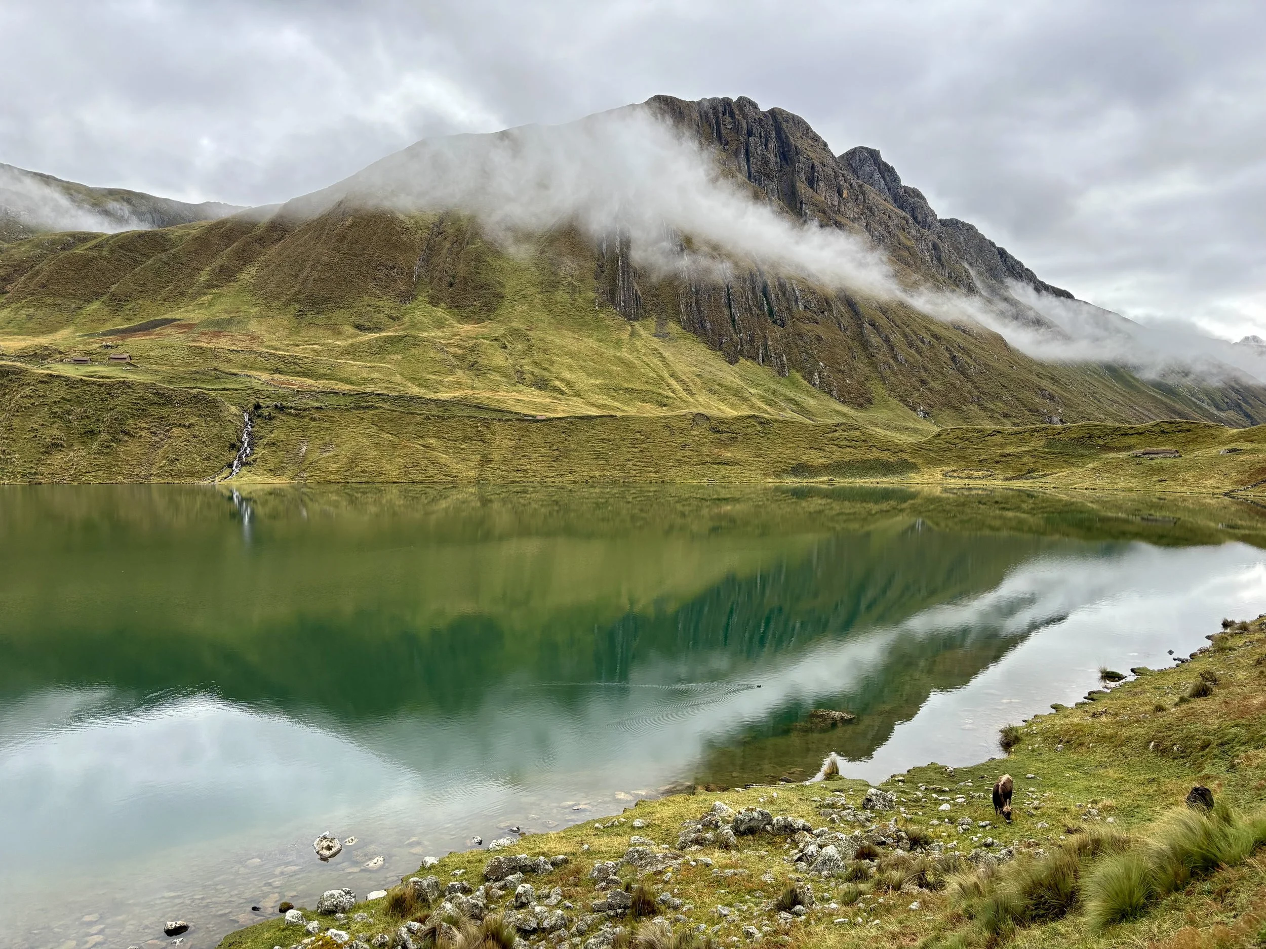
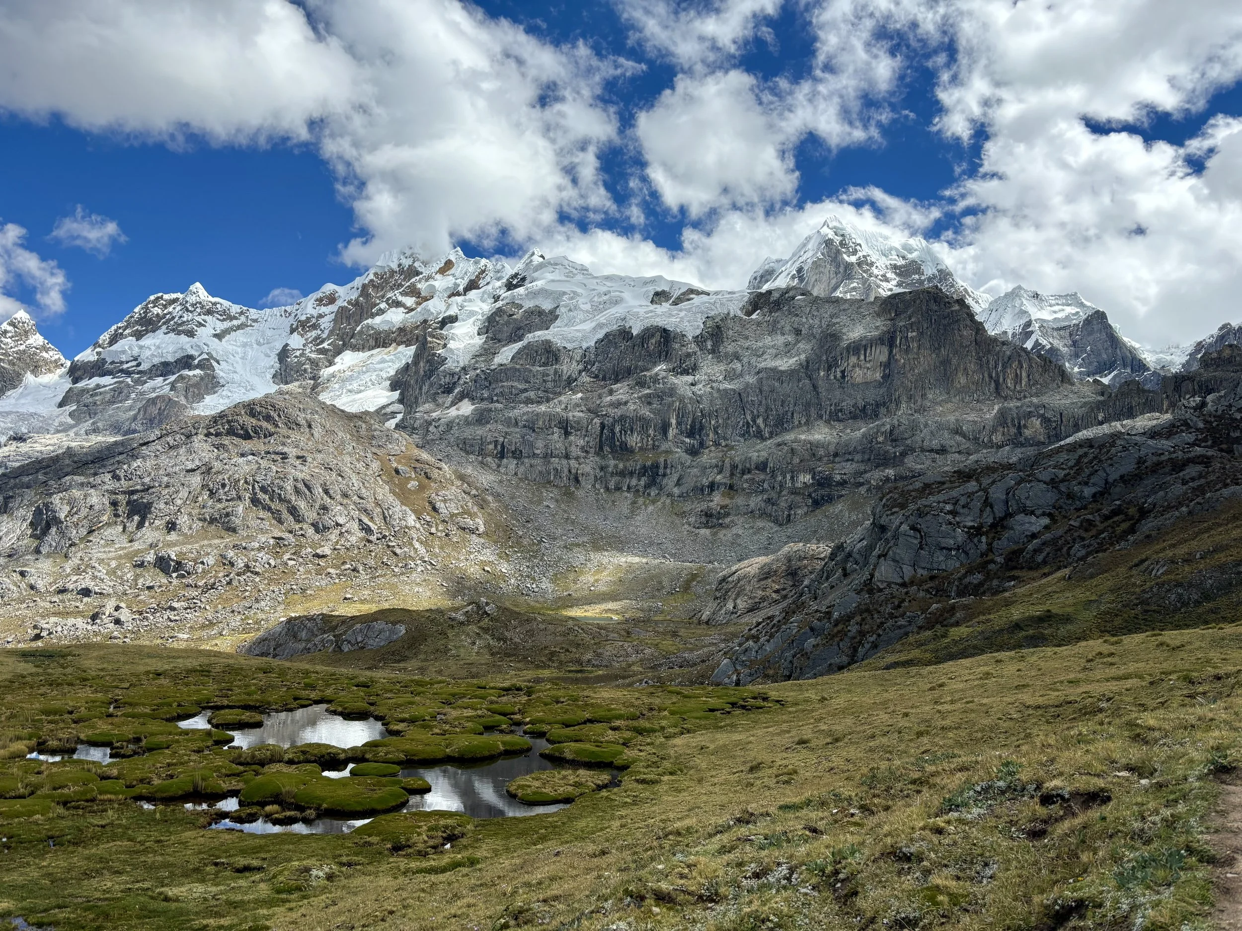
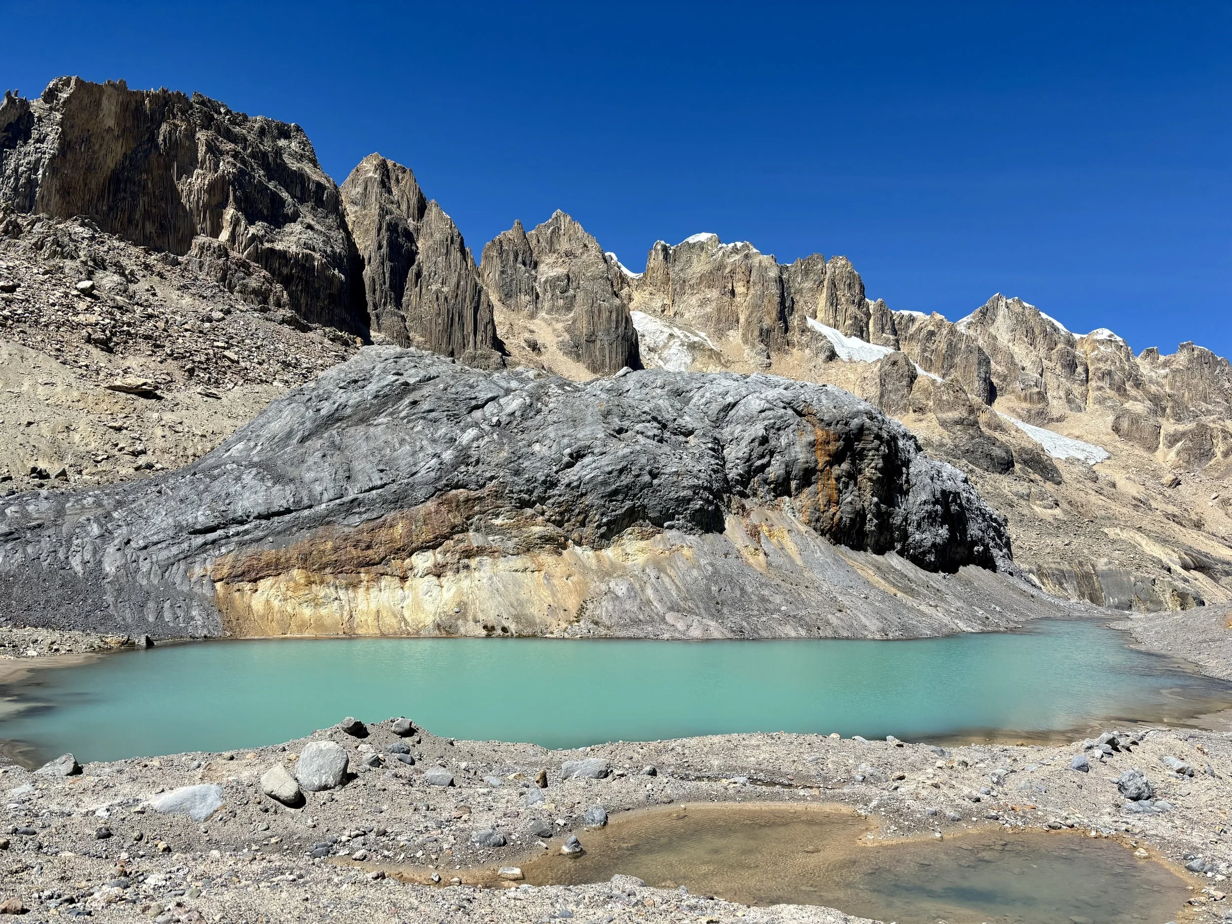
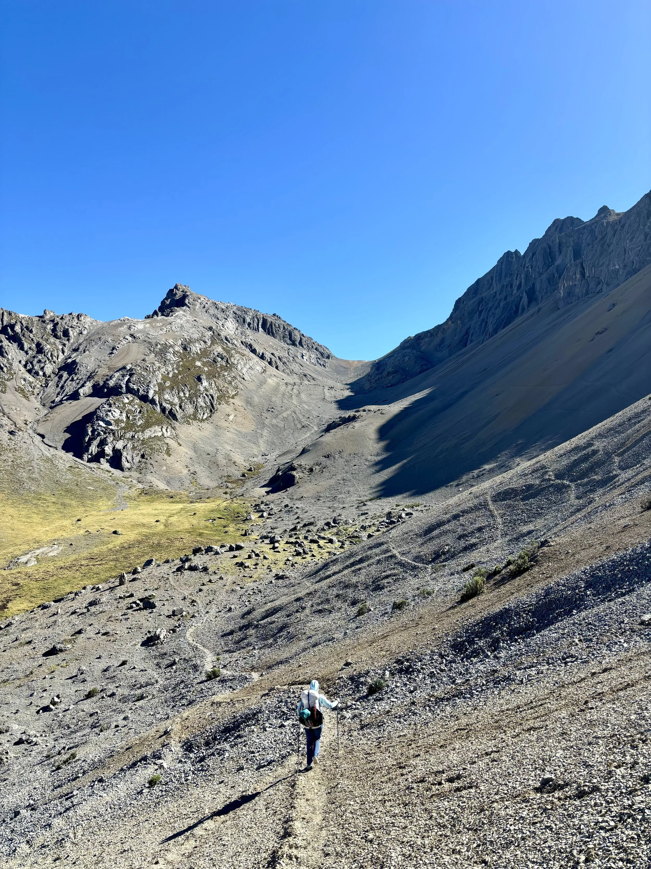
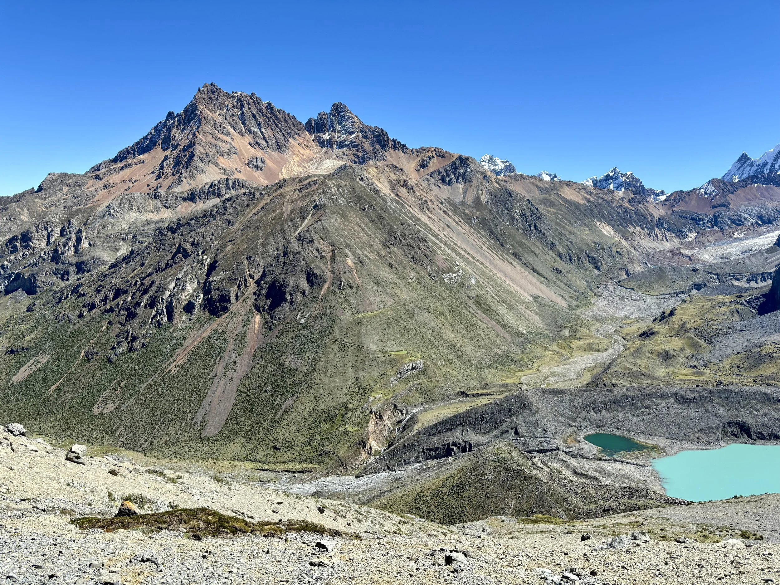
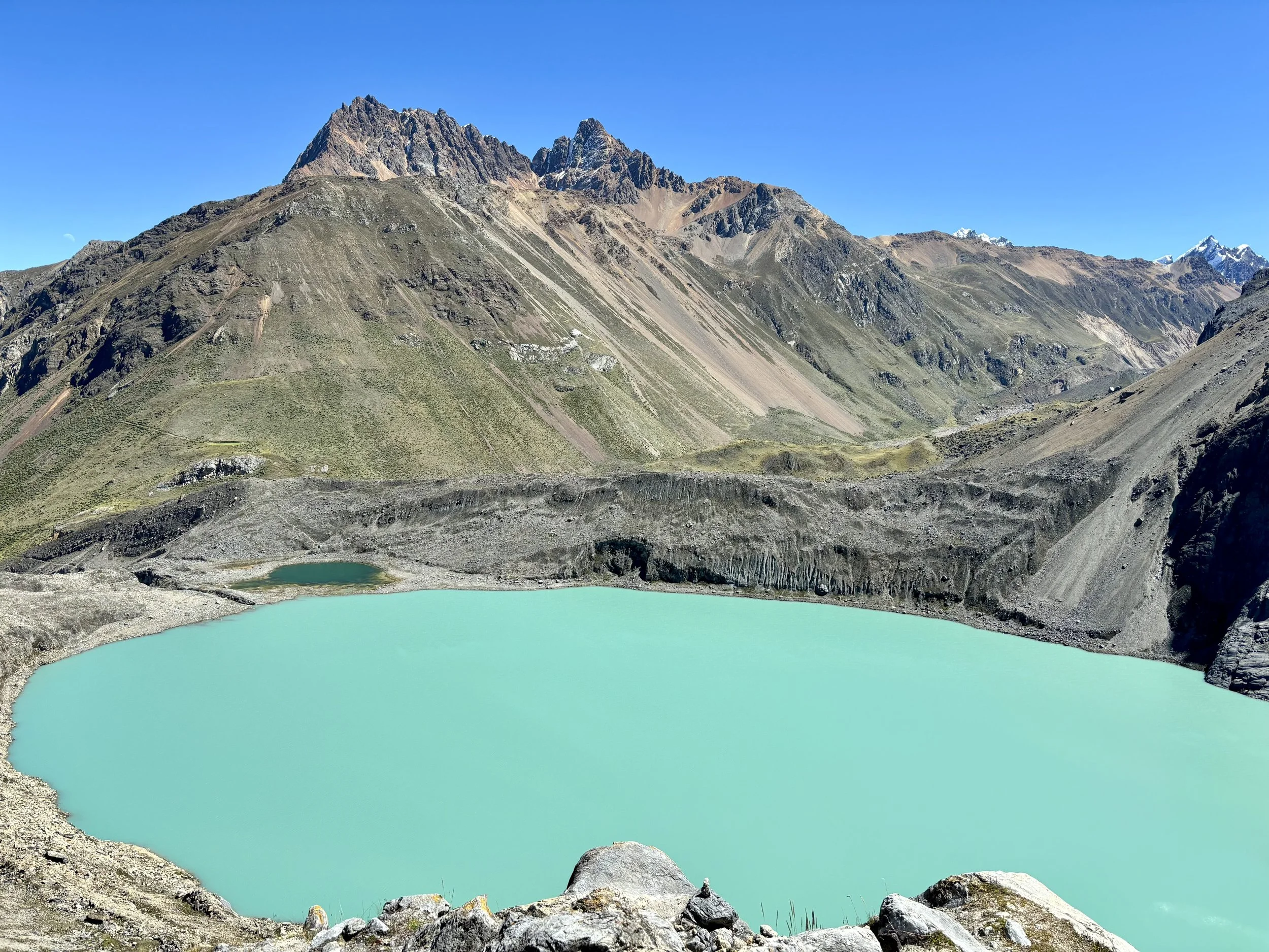
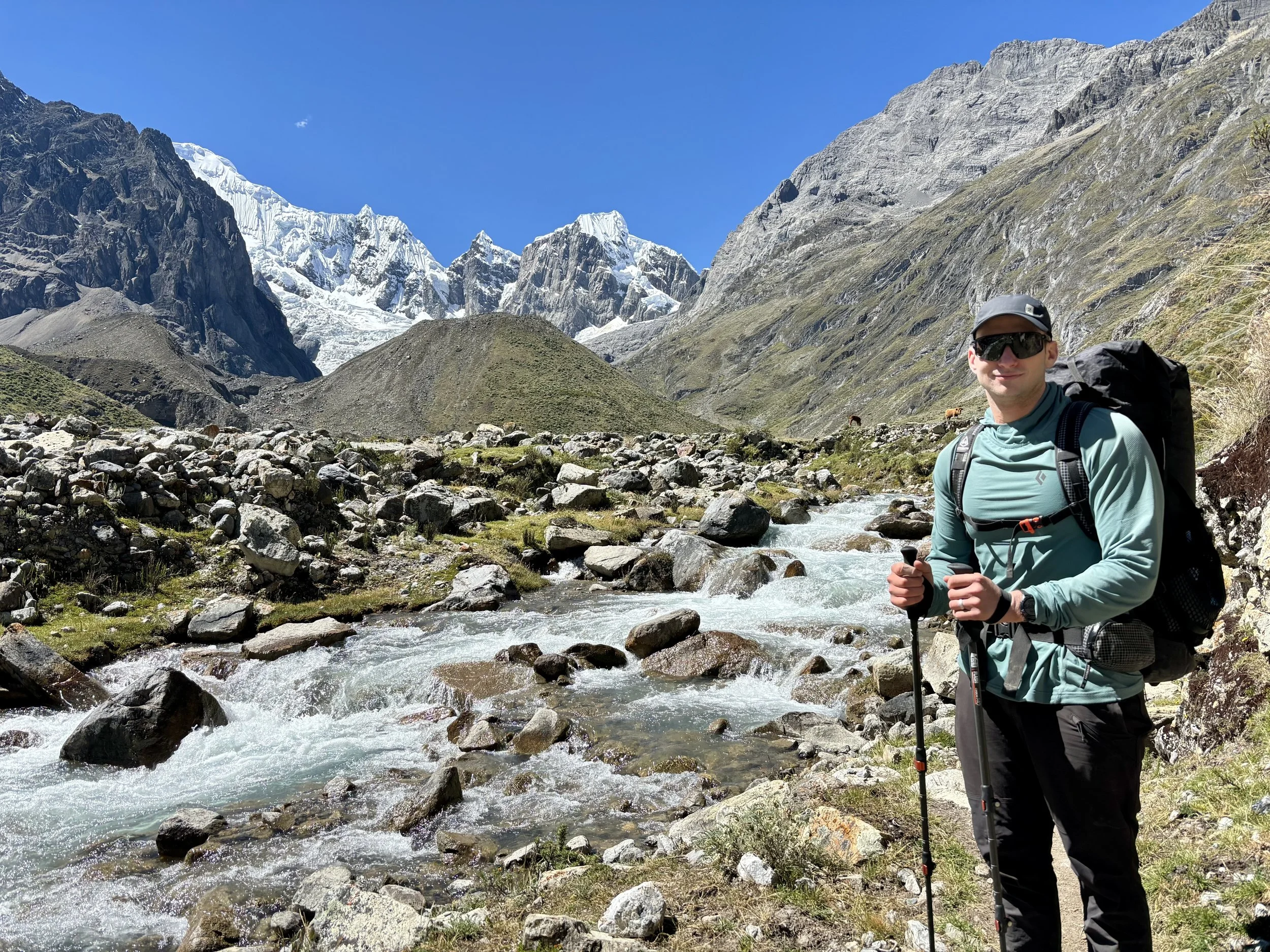
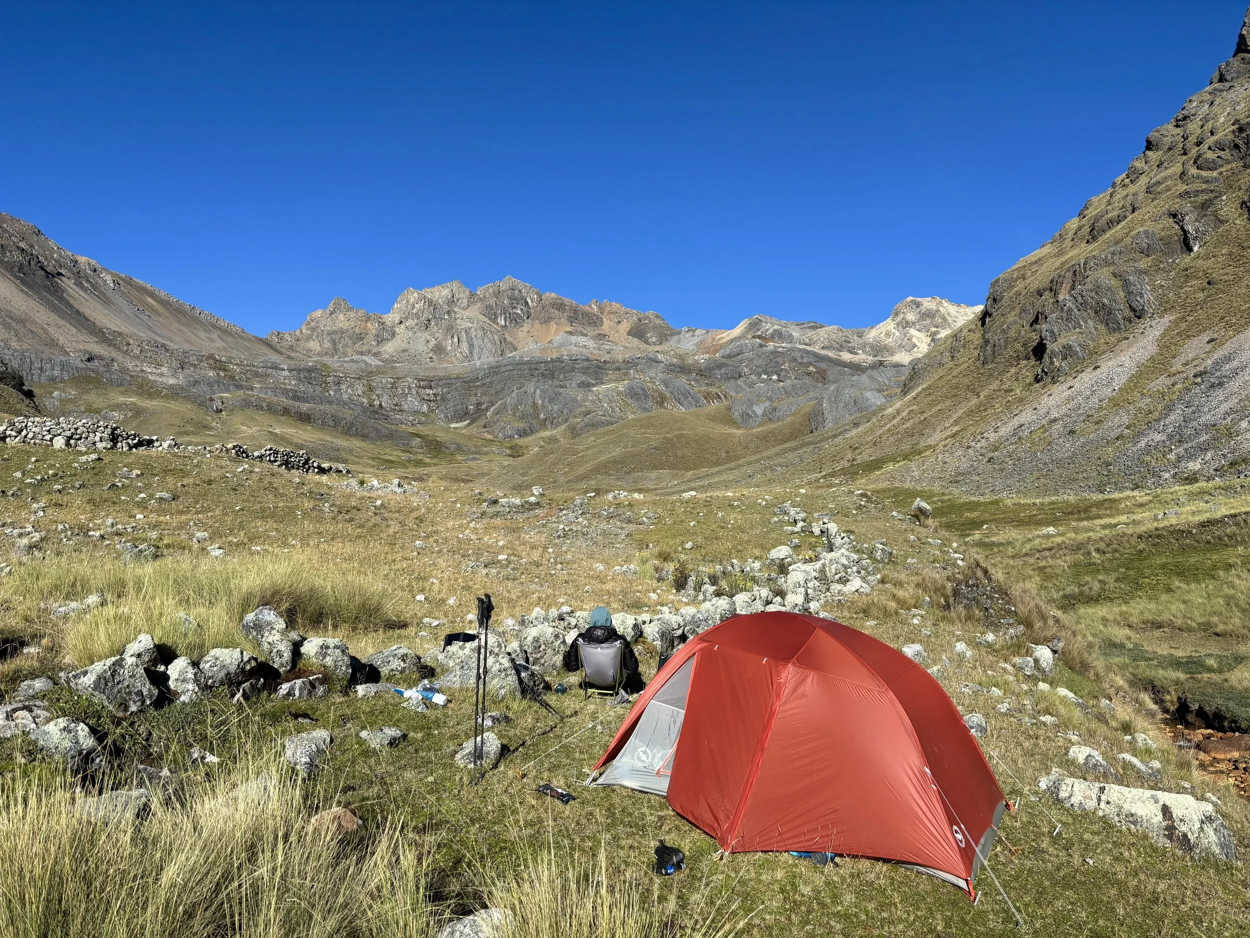
We woke up thinking this would be one of our shortest days from a mileage perspective, but it ended up being our longest of the trip. We left our campsite and headed towards Santa Rosa Pass. After spending much of the day leapfrogging with large groups the day before, I had been expecting to find some of these groups on the pass, but instead we had the pass all to ourselves, which I really enjoyed. We attempted to have a snack at the top of the pass, but the wind had other plans for us so we found a snack spot a few hundred feet below the top of the pass where it was slightly less windy. This part of the day included some of the steepest descending on loose rock of the whole trip. We finally made it just above the shores of Laguna Juraucocha and gave our knees and joints a little break. We then continued down into the valley where we had considered camping that night, at the Cutatambo group campsite. To our surprise, no one was here and it looked like the campsite hadn’t been used in a while. We still aren’t sure why. Perhaps it was closed?
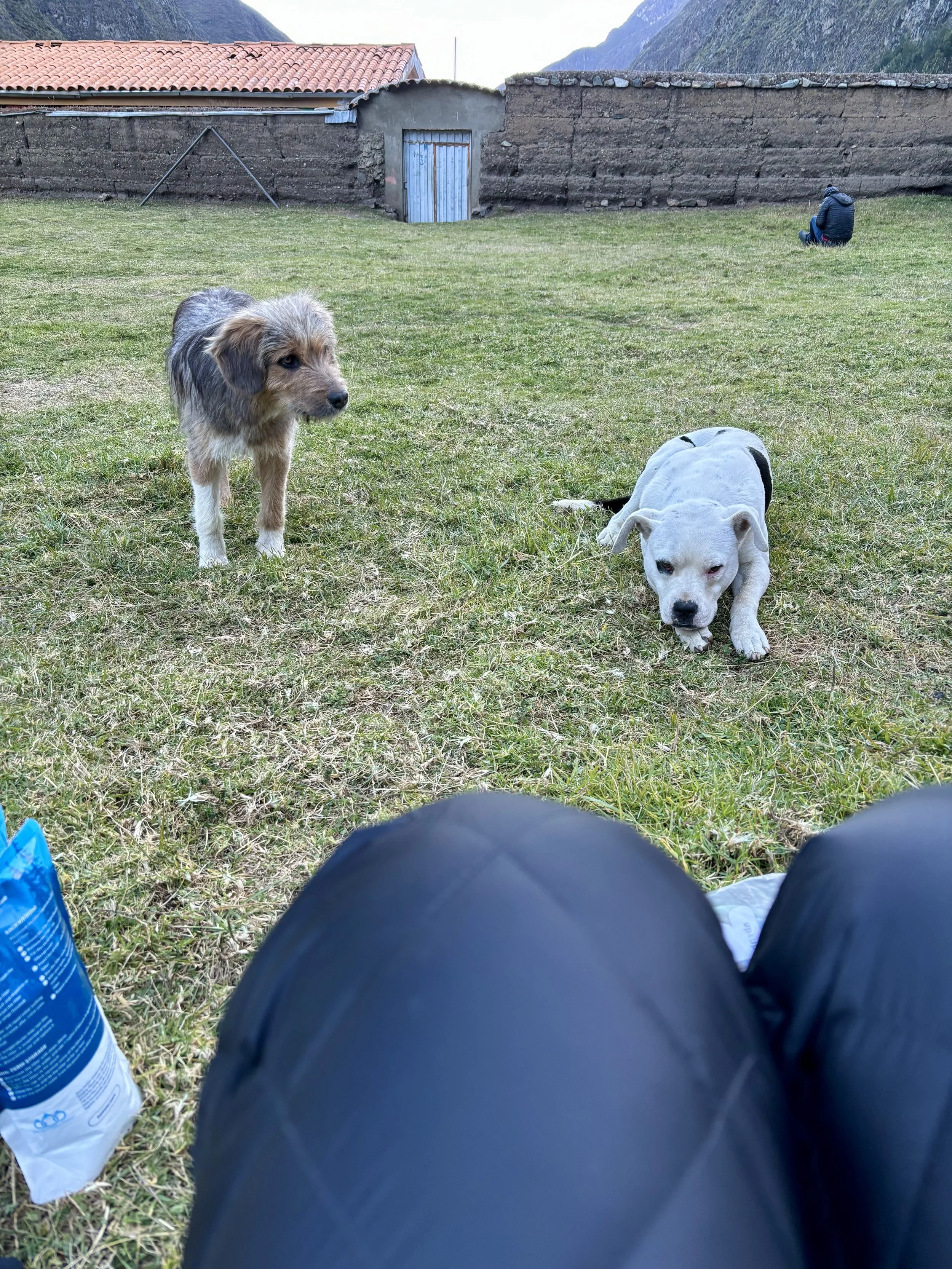
Since it was only noon, we decided we would keep moving down valley, and more importantly in our minds, down in elevation. After the poor night’s sleep the night before, we were really hoping for a good night’s sleep and knew that every foot we descended would help. The descent was along a beautiful river that had started as a small stream from Laguna Juraucocha, the lake we passed earlier in the day. There would have been plenty of opportunities to wild camp along the river, but we had turned our sights on making it to the town of Huayllapa that night, where we would be able to sleep at 11,500 ft. This sounded like sea level to us after the night before. We made it to town in the late afternoon and set up camp. One benefit of “town” (there really isn’t much) was that we were able to buy some soda and chips that tasted so delicious after 5 long days of backpacking. We had some local dogs supervise us eating dinner that night and then retired early.
Stats: 11.7 miles, 1300 ft of elevation gain
Day 6
We started day 6 with the most energy we’d had since the first day. We were able to get a really good night’s sleep and were happy our decision to sleep in town worked out as we’d hoped. We even let ourselves sleep in. The one downside of sleeping in town was that we were going to need to regain all of the elevation we lost the previous day so we knew we had a long day ahead of us.
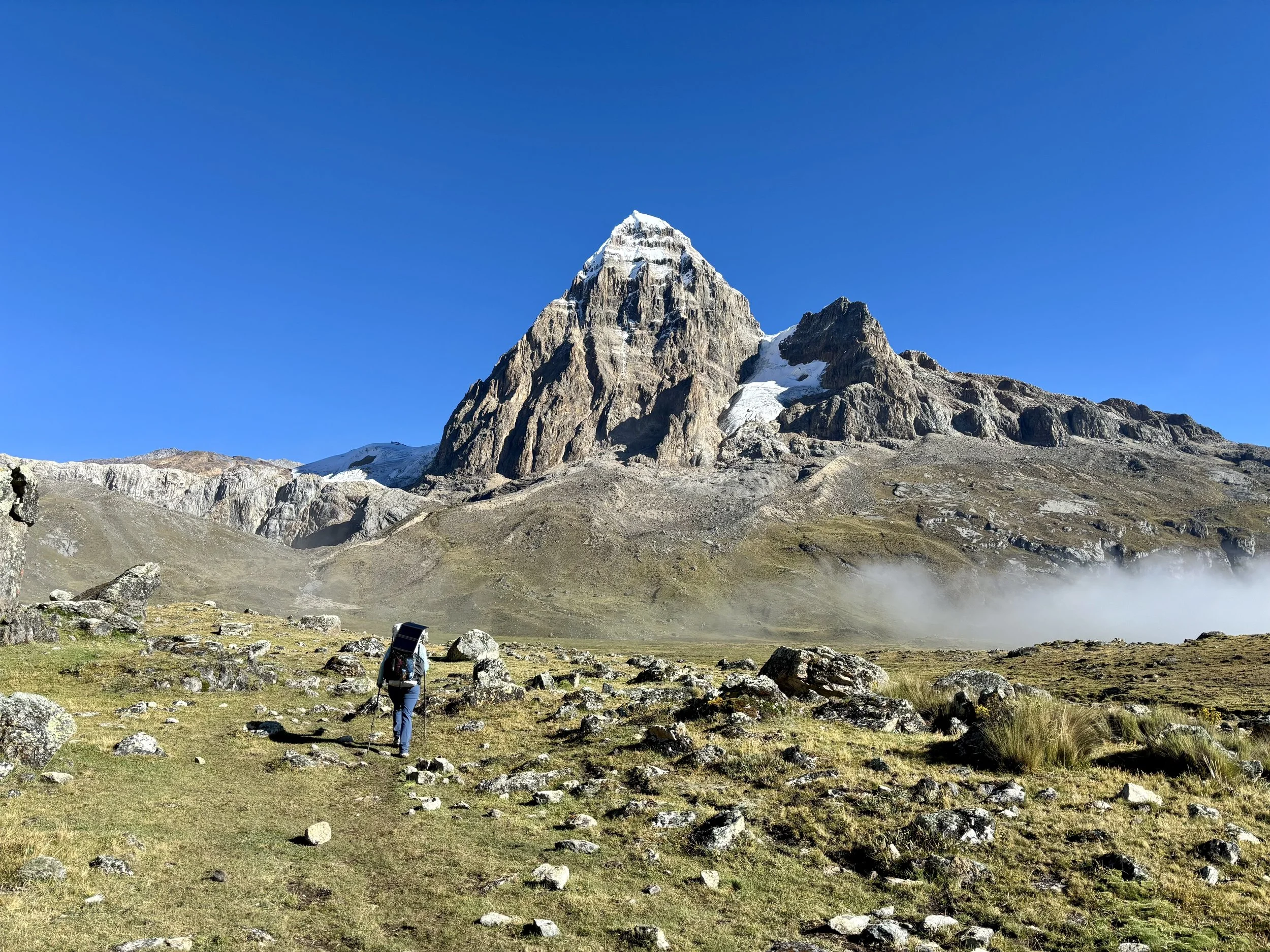
We left town that morning without much water to help with our pack weight as we knew we had a lot of “up” in front of us. We followed a stream for the first few miles. As the steepness of the trail started to mellow out, the views really opened up and we saw some people herding sheep. After a few more miles, we finally reached our high point for the day, below Punta Tapusch. It was a pretty uneventful ascent as we both had just put our heads down and focused on the climb.
We headed down towards Gashpapampa, a group campsite. There were already quite a few tents set up so we decided to keep moving and find wild camp that night. After a little more hiking, we found a suitable spot and set up camp for the night. It was nice to be out of the hustle and bustle of a group campsite that night which allowed us to enjoyed the solitude that I love to find when backpacking.
Stats: 8.3 miles, 4200 ft of elevation gain


Day 7
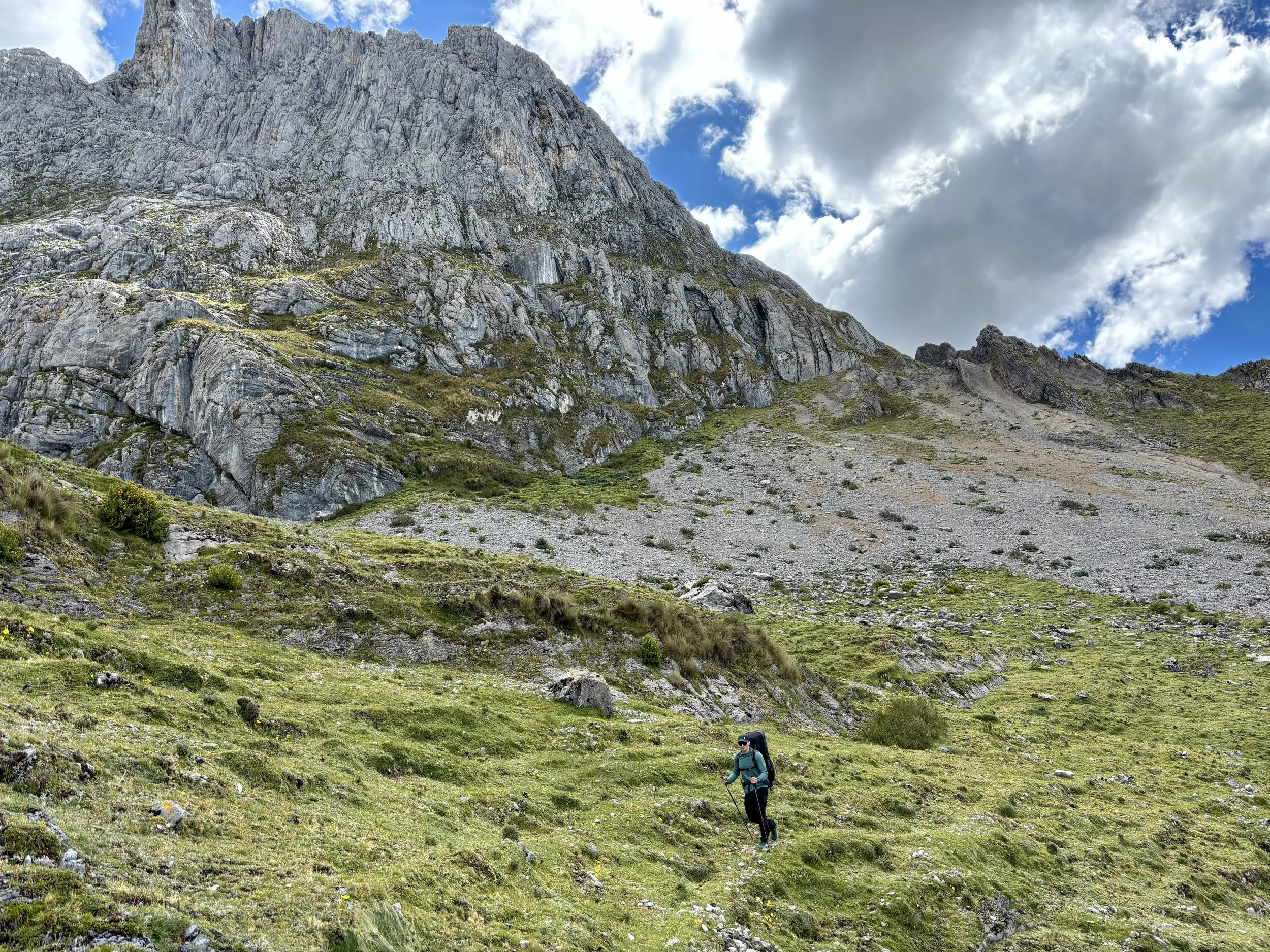
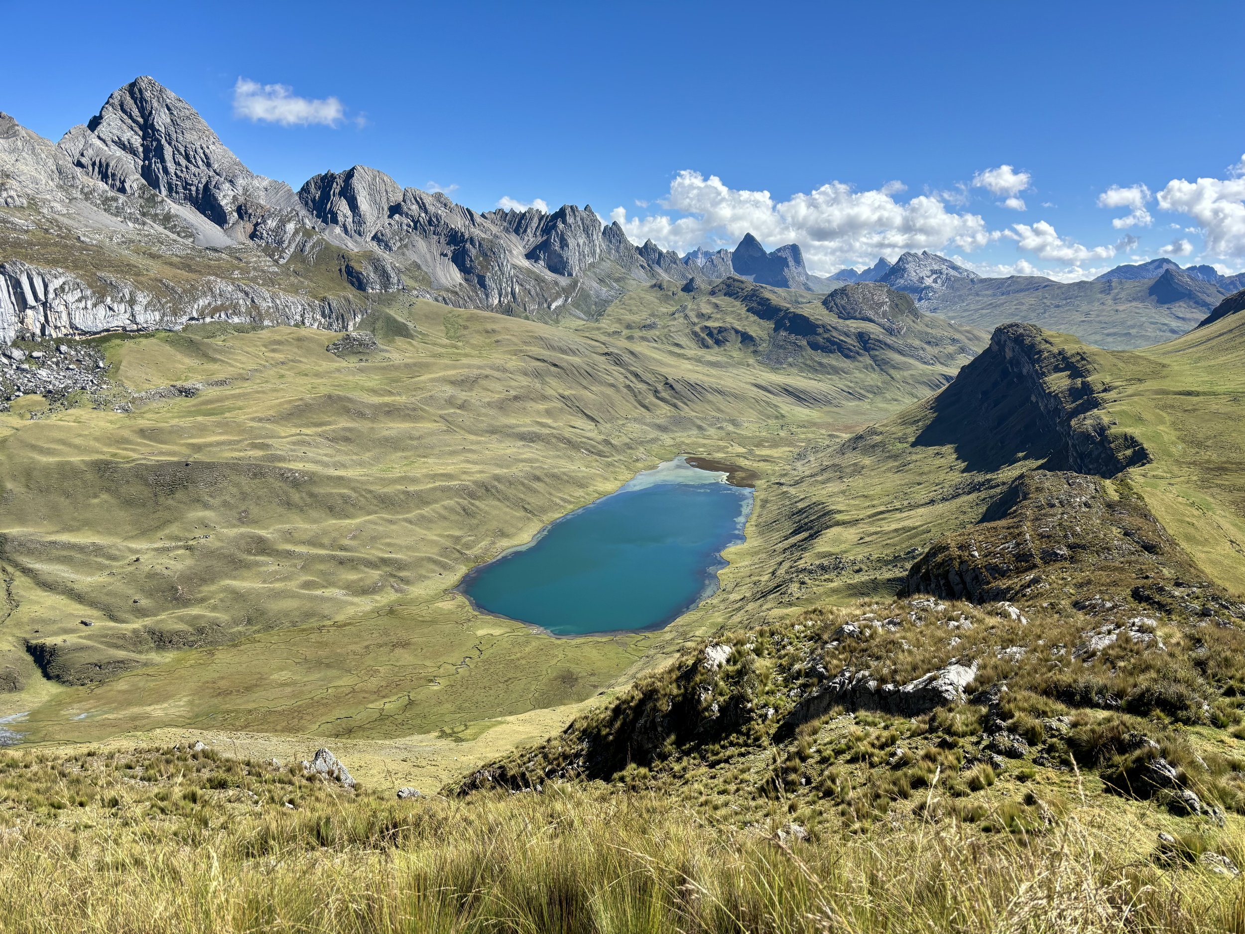
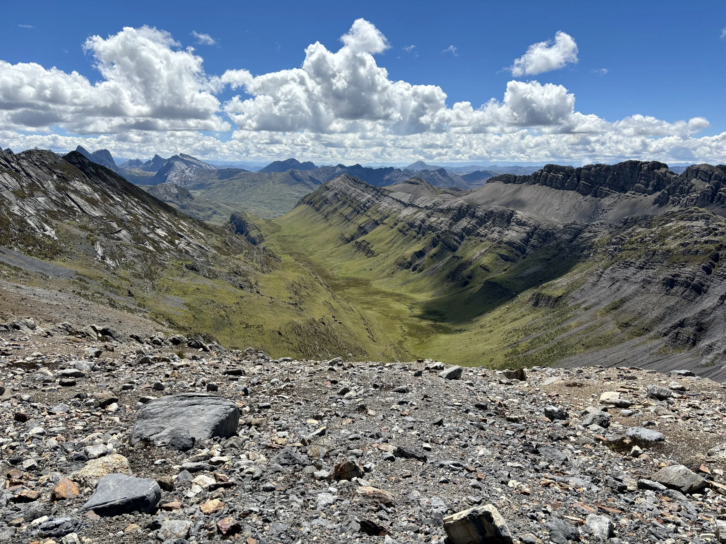
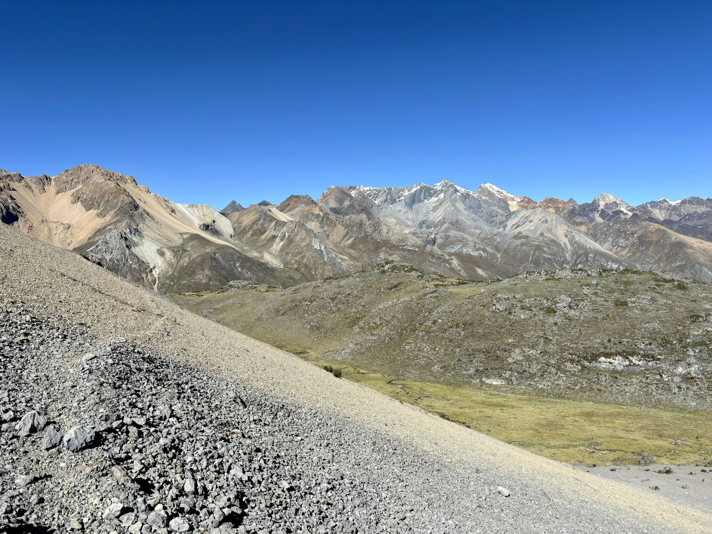
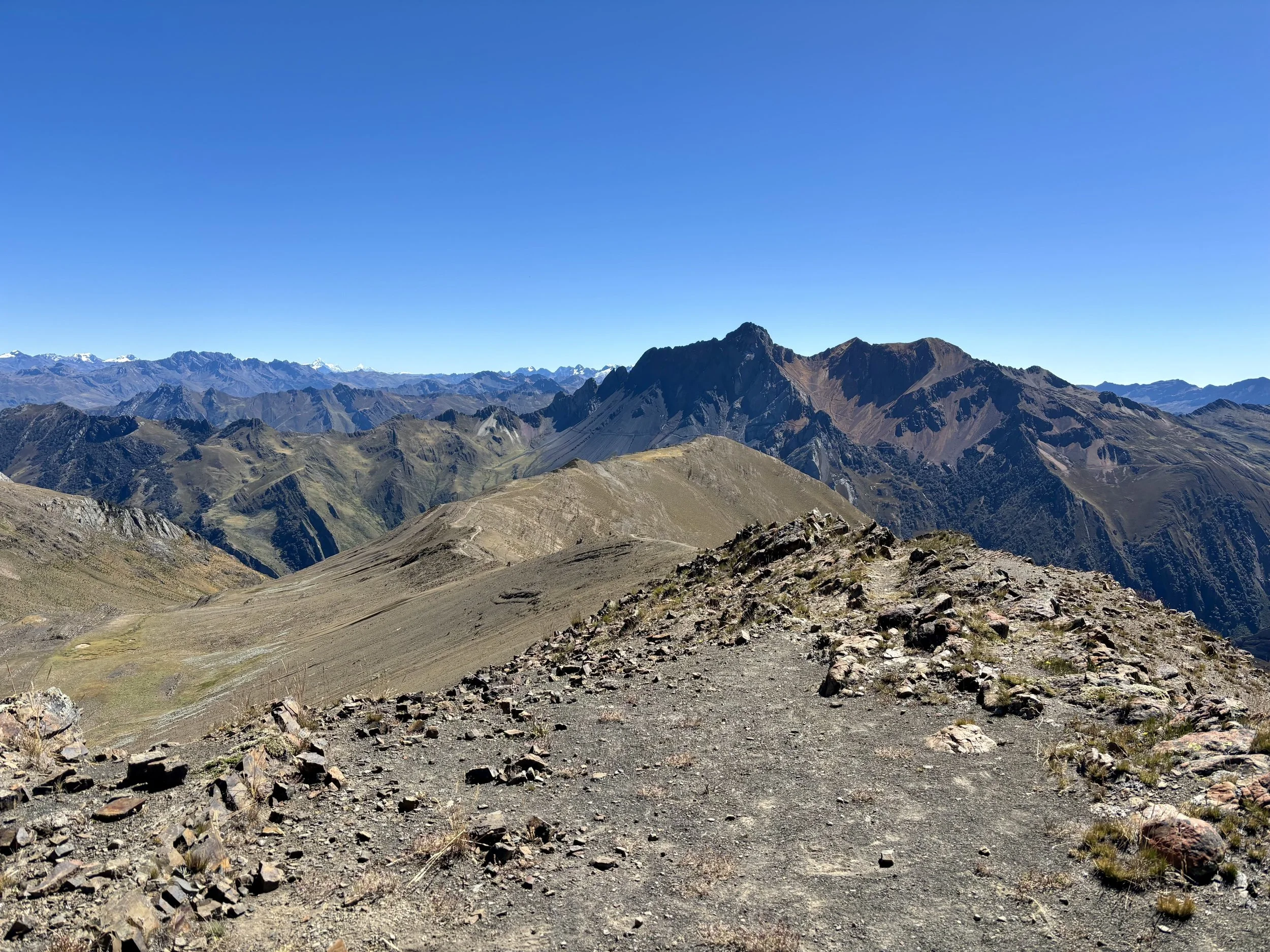
We expected day 7 to be one of our easiest days as we only needed to make it over one pass to the next campsite. Unfortunately, I slept pretty poorly again the night before so I found myself to be pretty low on energy this morning. We sluggishly set out on the trail, which unfortunately was pretty swampy in the beginning so it tested my already short patience that morning to figure out where the trail went. Eventually, the soft, wet ground changed to firmer rock and a distinguished trail, and it felt like we were able to make some progress. We made it to the pass in better time than I was expecting and stopped for our first of many snacks along this ridge to take in the view.
The roughly 1.5 miles we walked along the ridge on this day were some of my favorite views of the trip. They gave us such a great view of a majority of the range. We even saw some condors circling overhead. After another snack break, we began the descent towards Laguna Jahuacocha. This was my second least favorite descent of the entire trek (Day 2 had my least favorite). It was loose sand, dirt, and rocks and was extremely tiring on my knees. Just when I thought we were getting close to the bottom, another ~500 ft of vert would appear in front of us to descend. When we got to the bottom, we took a moment to filter some water and give our knees a break.
That night we decided to wild camp along the shore of Laguna Jahuacocha. We were told by one local person before we set up camp that we were allowed to camp in the spot we picked. At 5:30pm, we had another local person approach us and tell us that we were not allowed to camp in that spot. We explained in our broken Spanish that someone else told us it was ok, but he wasn’t interested. Unfortunately for him and fortunately for us, at that point in the day it was nearly sunset, making it too late to expect us to take down our tent, put away all of our gear, and walk back to the group site before sunset. So, we were told we could stay for the night if we promised to leave first thing in the morning, which we did. I’m still not sure if what we did was or wasn’t permitted. There were no signs or warnings saying where you could or couldn’t camp around the lake. I’m not someone that wants to camp in spots illegally or put stress on an environment that can’t handle it so I am sorry to that local community if we did indeed break any rules. If anyone has any insight on where you’re not allowed to camp along the circuit, particularly around Laguna Jahuacocha, I’d be interested in learning more. We headed to bed early, knowing we wanted to be up and out of the site before sunrise so we wouldn’t have any more issues.
Stats: 6.6 miles, 1500 ft of elevation gain

Day 8
Our last day of our trip. I was sad the trip would be over, but I was also excited for a real meal, a real bed, and most importantly, to sleep at lower elevation. We had arranged for the same company that had dropped us off at the start of the trek to pick us up at noon that day at Rondoy. Not knowing exactly how long it would take us to get to the pick up point, we didn’t waste any time in the morning and started making our way up the pass towards Paso Rondoy. On the way up, I frequently found myself looking over my shoulder at the formidable Yerupaja.
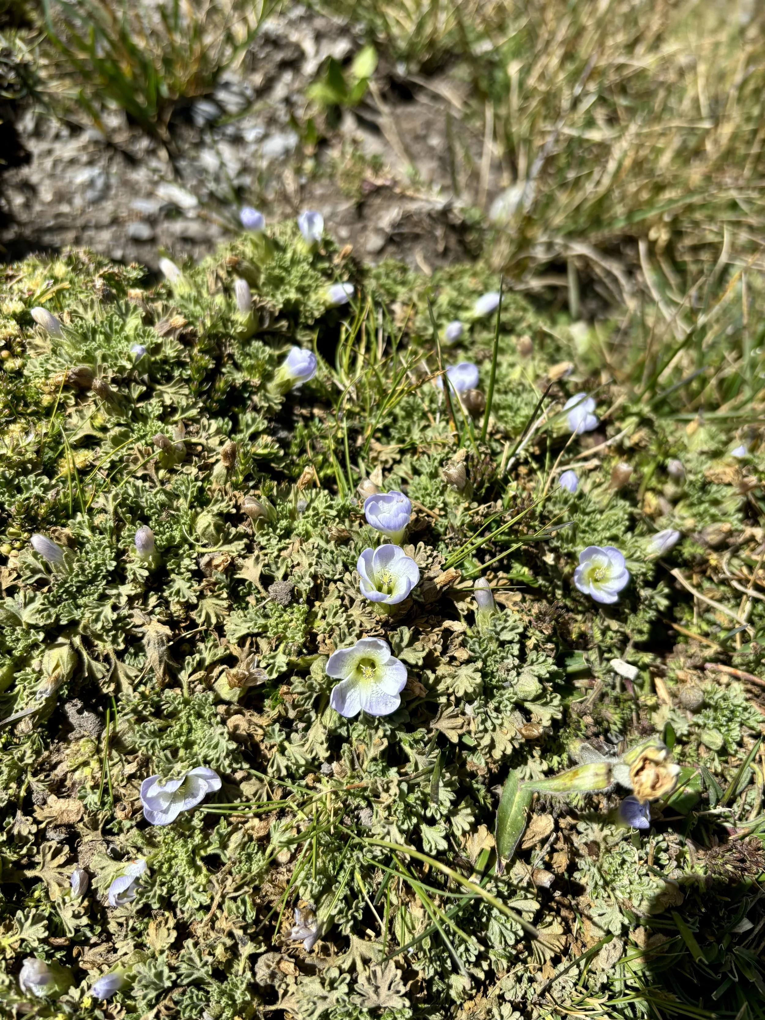
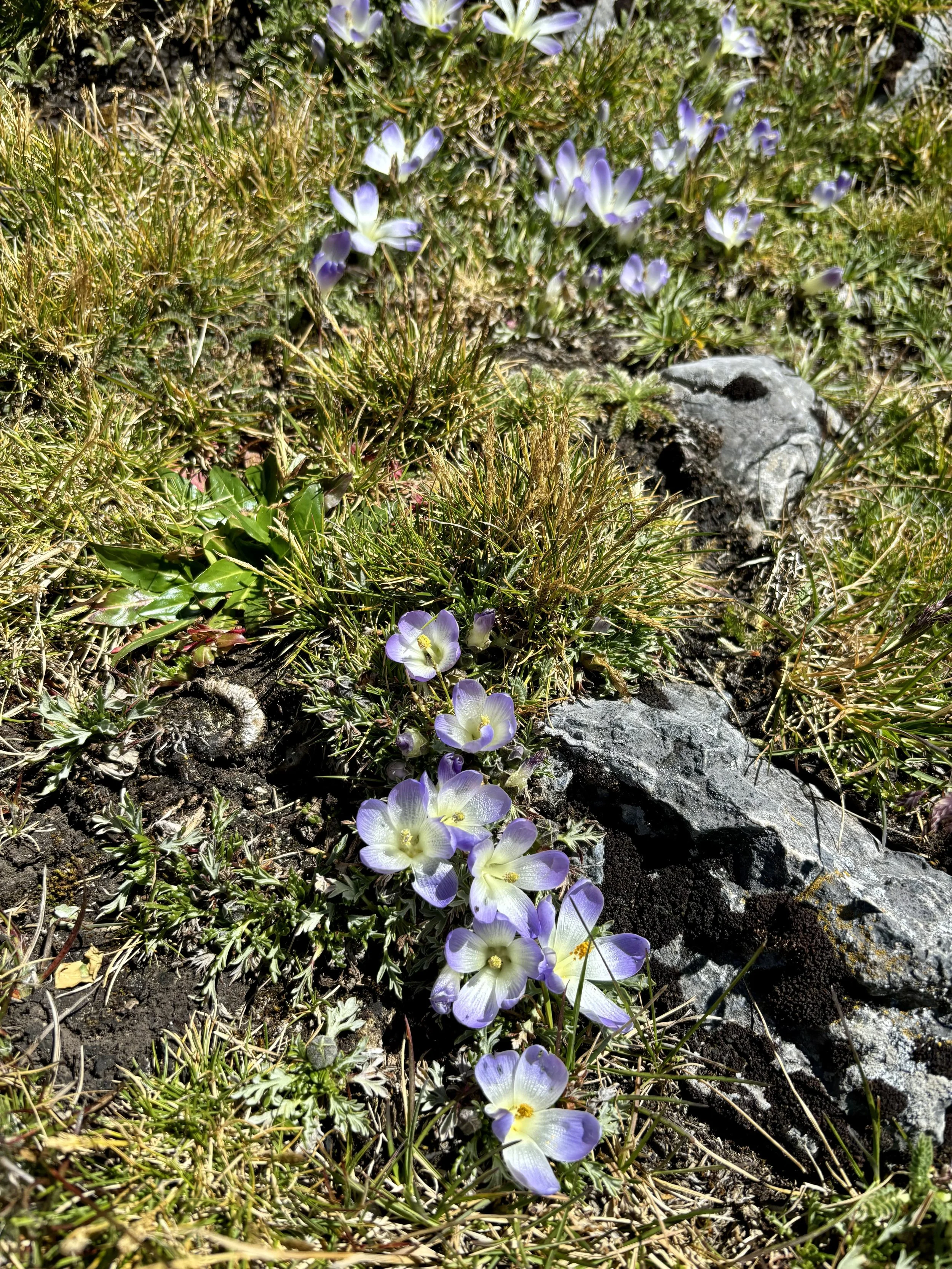
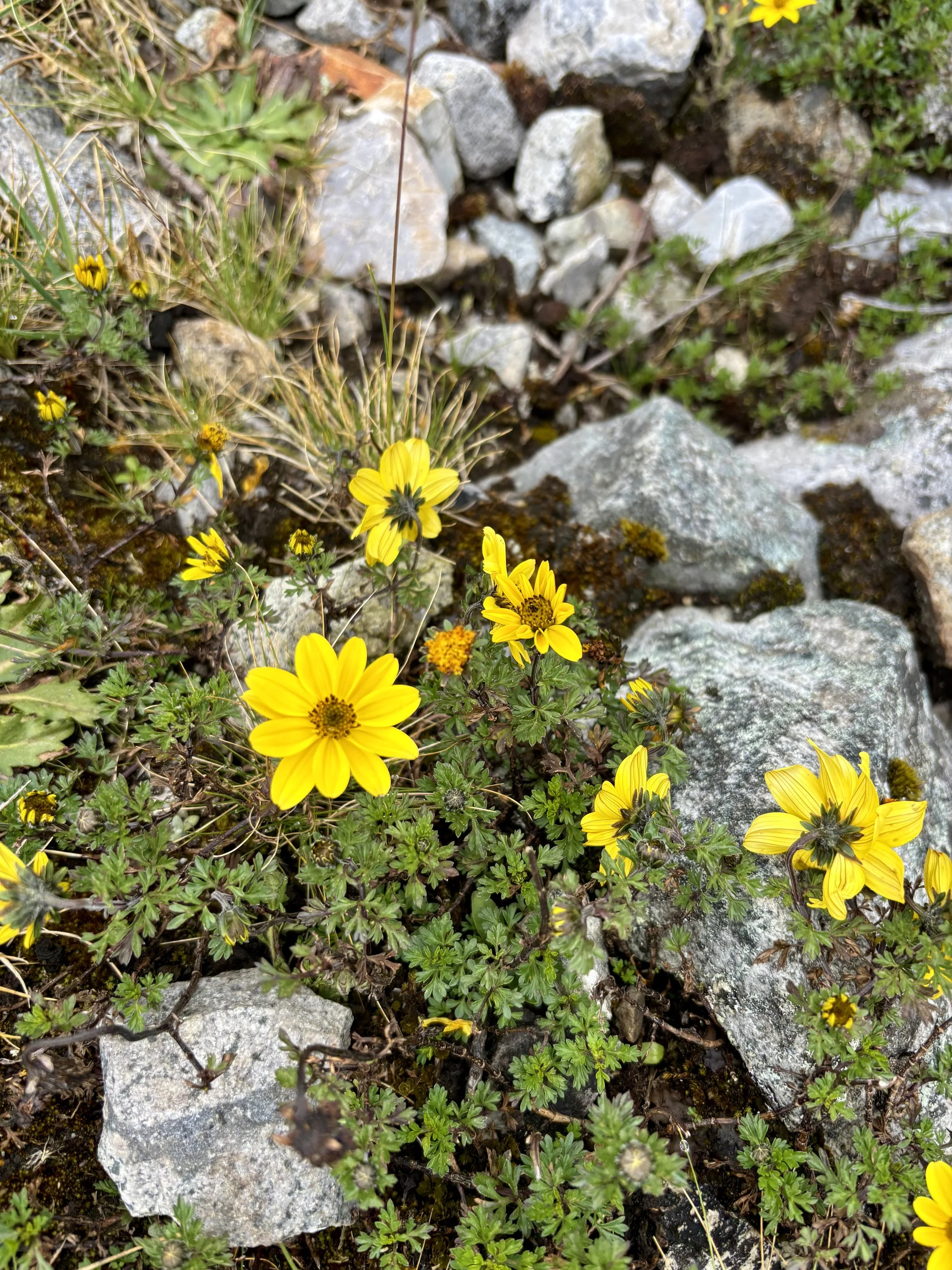
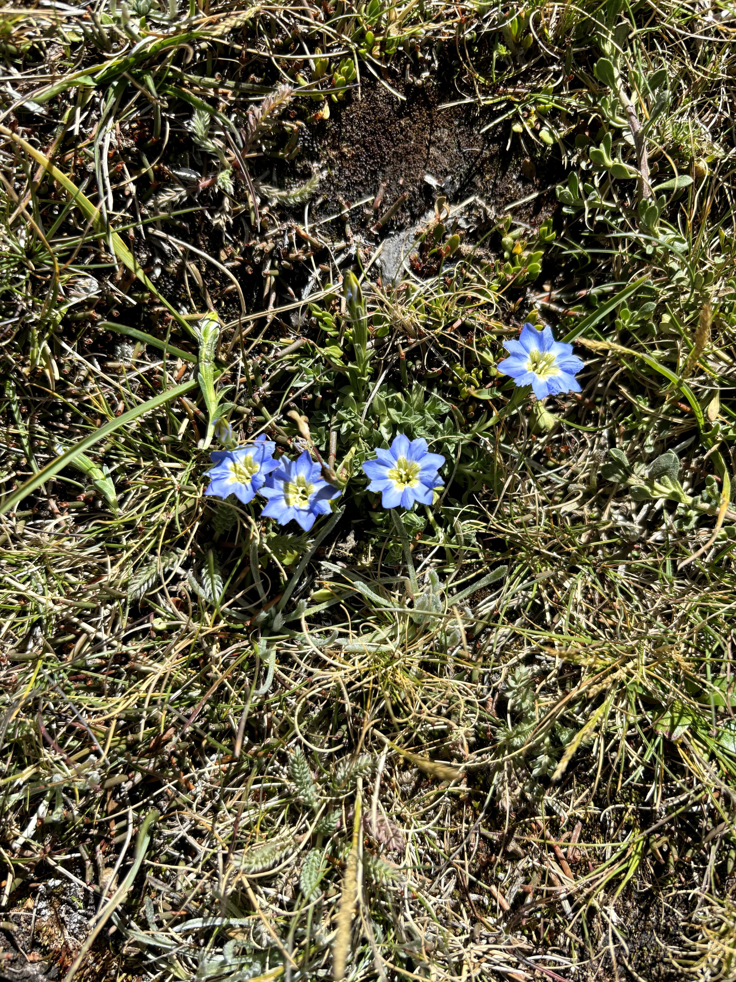
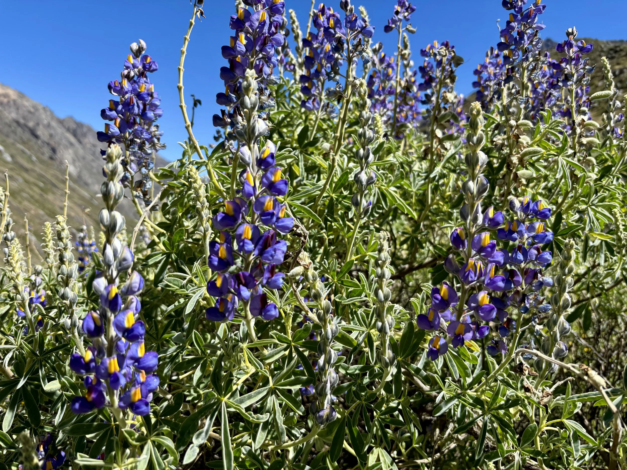
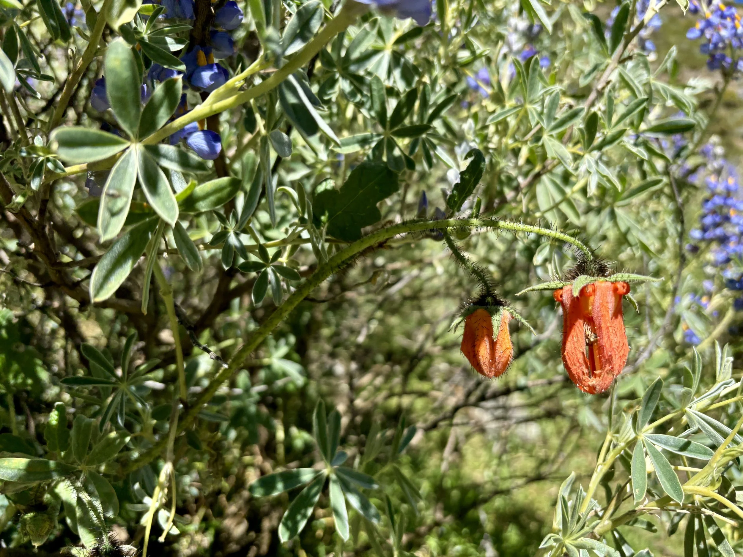
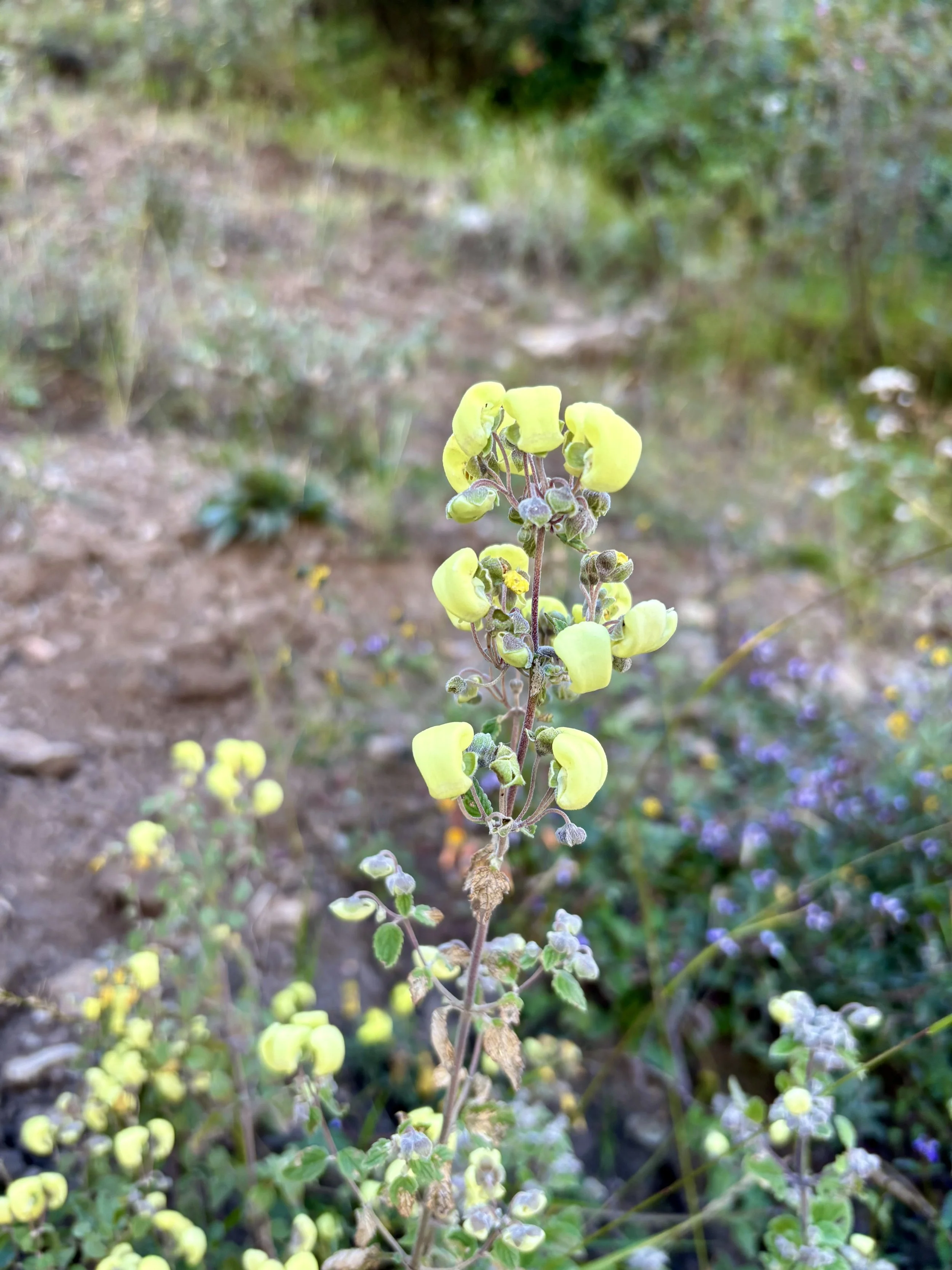
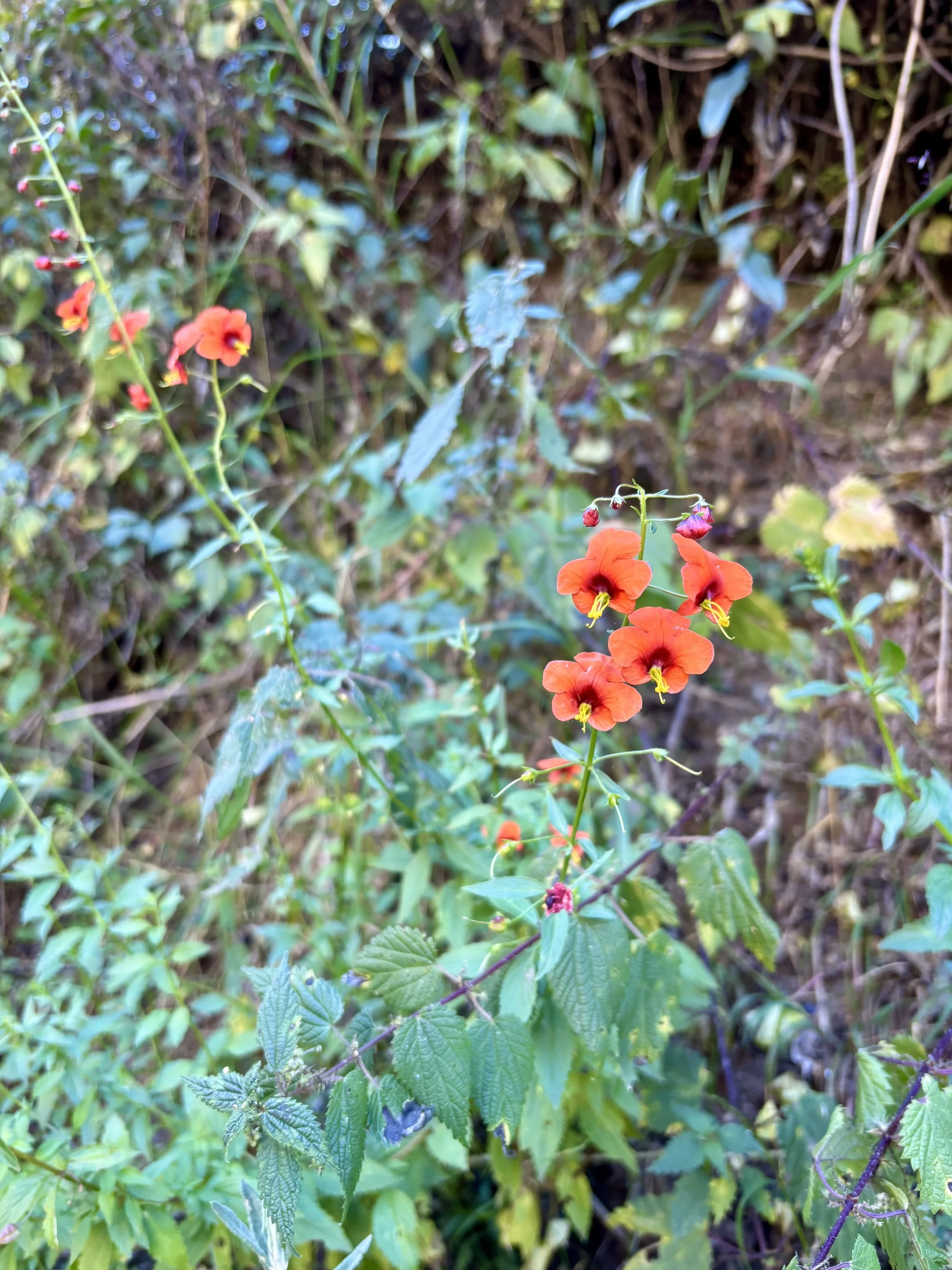
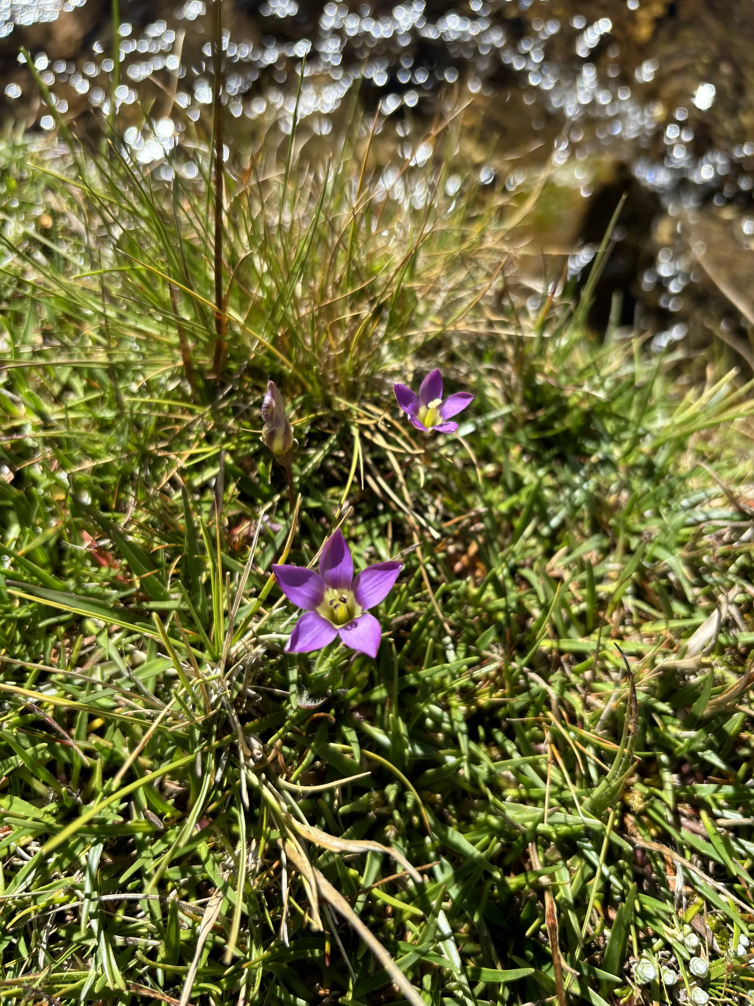
We made our way over to the second pass that was within eyesight of the first pass. At this point, we realized we would have quite a bit of time to kill before the pick up so we decided to find a quite spot with views of Rondoy and set up our chairs and enjoy the view. We got to see some more condors that day. After a while, we decided to head down to our pickup spot along the road. We enjoyed the wildflower views on the way down and found ourselves done with the trek before we realized it. We had a little more time to kill so I dunked my feet into the stream and gave them a good, cold soak. At noon, our ride showed up, and we headed back to civilization. Eating hot pizza for dinner and sleeping in a bed that night were nice, but I was already missing being on the trail. I guess it’s time to start planning my next backpacking trip!
Stats: 6.3 miles, 2500 ft of elevation gain

Conclusion
Overall, this was one of the best backpacking trips of my life. The beauty really is unmatched. Every day has some of the prettiest views you’ll ever see in your life. However, the altitude really shouldn’t be underestimated. I found myself constantly in a calorie deficit due to lack of appetite and found the quality of my sleep to be really poor overall. The stats of most days are not that impressive, but many of those days took us most of the day (some of those days were mostly off trail). I learned a lot about how my body handles higher altitudes. This is a trip I’d highly recommend, but I’d also recommend making sure you have the time to do a few acclimatization hikes out of Huaraz before starting this trek. I found this to be one of the harder backpacking trips I’ve done because of the altitude. I’d love to come back to Peru some day.
Total stats: 60.1 miles, 18,200 ft of elevation gain
Gear List
Guide Book: Peru’s Cordilleras Blanca & Huayhuash by Neil & Harriet Pike
Compass: SUUNTO M-3 Compass
Emergency Communication Device: Garmin inReach Mini 2 *requires a subscription
First Aid Kit: Adventure Medical Kit *I have added items to this kit and would recommend tailoring a medical kit to your needs
Lighter: BIC Lighter
Emergency Blanket: SOL Emergency Blanket
Shell/Rain Jacket: REI Co-op XeroDry GTX Jacket
Headlamp: Black Diamond Equipment Spot
Multi Tool: Leatherman Squirt PS4 Multi Tool
Tent: Big Agnes Copper Spur HV UL
Tent Footprint: Big Agnes Footprint for Copper Spur HV UL
Backpack: Hyperlite Mountain Gear Junction 55
Water Filter: Sawyer Squeeze Water Filtration System
Stove: MSR PocketRocket 2 Ultralight Stove
Fuel: Jetboil Jetpower Fuel
Kettle: MSR Titan Ultralight Titanium Backpacking Kettle
Water Bottle: Platypus DuoLock SoftBottle Flexible Water Bottle
Spork: Sea to Summit Alpha Light Long Spork
WAG bags for human waste: Cleanwaste WAG bags
Sleeping Pad: Sea to Summit Ether Light XT
Pillow: Sea to Summit Aeros Premium Inflatable Travel Pillow
Sleeping Bag: Western Mountaineering Ultralite 20 Degree Sleeping Bag
Shirt: Patagonia Capilene Cool Daily Hoodie
Pants: Black Diamond Womens Alpine Light Pants
Socks: Darn Tough Hiker Micro Crew Midweight Sock with Cushion
Underwear: Smartwool Intraknit Hipster Bikini
Sunglasses: Smith Lowdown Slim 2
Toothbrush: GUM Travel Toothbrush
Toothpaste: SuperBee Dentos Toothpaste Tablets
Hairbrush: Folding Hairbrush
Body Wipes: Pampers Sensitive Water Based Hypoallergenic and Unscented Baby Wipes
Trekking Poles: REI Co-op Flash Carbon Compact Trekking Poles
Camp shoes: Xero Shoes Women’s Z-trail Ev
Mug/cup: GSI Outdoors Infinity Backpacker Mug
Towel: REI Co-op Multi Towel Mini
Power Bank: Nitecore NB10000 Gen II Ultra-Slim Power Bank
Packing Cubes: Eagle Creek Packing Cubes
Chair: Helinox Chair Zero Ultralight Compact Camping Chair
Mosquito Head Net: Sea to Summit Ultra-Mesh Mosquito Head Net
Knife: LEATHERMAN Skeletool KBX Pocket Multitool with Knife and Bottle Opener