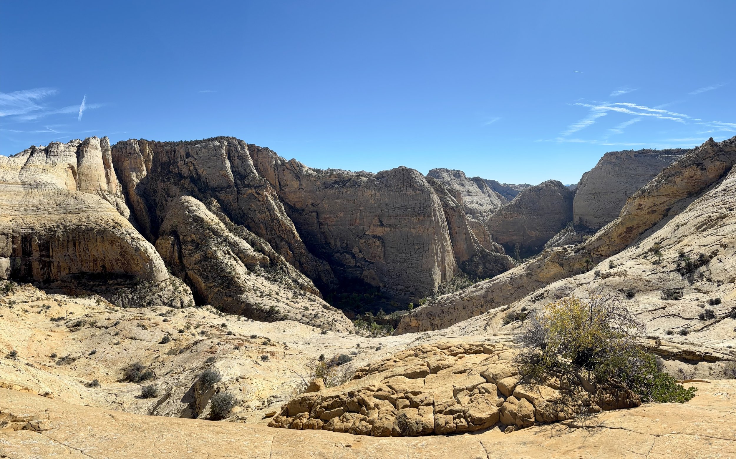
Death Hollow Backpacking Trip, Phipps-Death Hollow Outstanding Natural Area, Escalante, Utah
After having such an awesome trip in Dark Canyon the week before, Mike and I were looking to take advantage of the perfect weather window that was coming up. I’ve always been interested in doing a backpacking trip down Death Hollow in Escalante, Utah so we decided that’s what we would do. Our plan was to do a loop hike over 3 days/2 nights.
We packed up our bags and camped overnight near the town of Escalante. The next morning, we drove over to the Escalante Town Trailhead, which is where we would start and finish our loop. Our plan was to do the loop in a clockwise direction. The first day would involve hiking on the Boulder Mail Trail to the intersection with Death Hollow. The second day’s plan was to hike down Death Hollow to where it intersected with the Escalante River. On the third day, we’d follow the Escalante River upstream back to the car. That was our plan, but as we all know, plans typically change.
On our first morning, we started hiking north/northeast on the Boulder Mail Trail. There was quite a bit of rain that fell over the 4 days leading up to the trip so the Escalante River was flowing where the trail crosses it. I had read in some other blog posts that the river is not always flowing in this section. The first 1.5 miles of the trail was rolling, without any significant change in elevation. We followed Pine Creek for a little bit, which was also flowing with muddy brown water. Once the trail cut away from Pine Creek, the most tiring climbs of the trip were about to start. Over the next 2 miles, we gained about 1000 feet in elevation. Much of the trail for this section and for the day involved following cairns. There must have been hundreds of cairns marking the Boulder Mail Trail. It was nice to be able to use GPS on my phone to make sure we were on course, but the cairns were really well placed and never left us guessing which way to go. I enjoyed this day more than I expected to. The terrain was varied and the rock formations kept things interesting to look at. Thankfully, the temperature forecast for this day was a high of 65 so it was during really beautiful weather that we got to hike this section of trail. At mile 6.3, we crossed Mamie Creek which was flowing at a pretty solid pace. We hoped this didn’t mean that the flows in Death Hollow (where the Mamie ultimately flows) wouldn’t be higher than desired. There was only one way to find out.
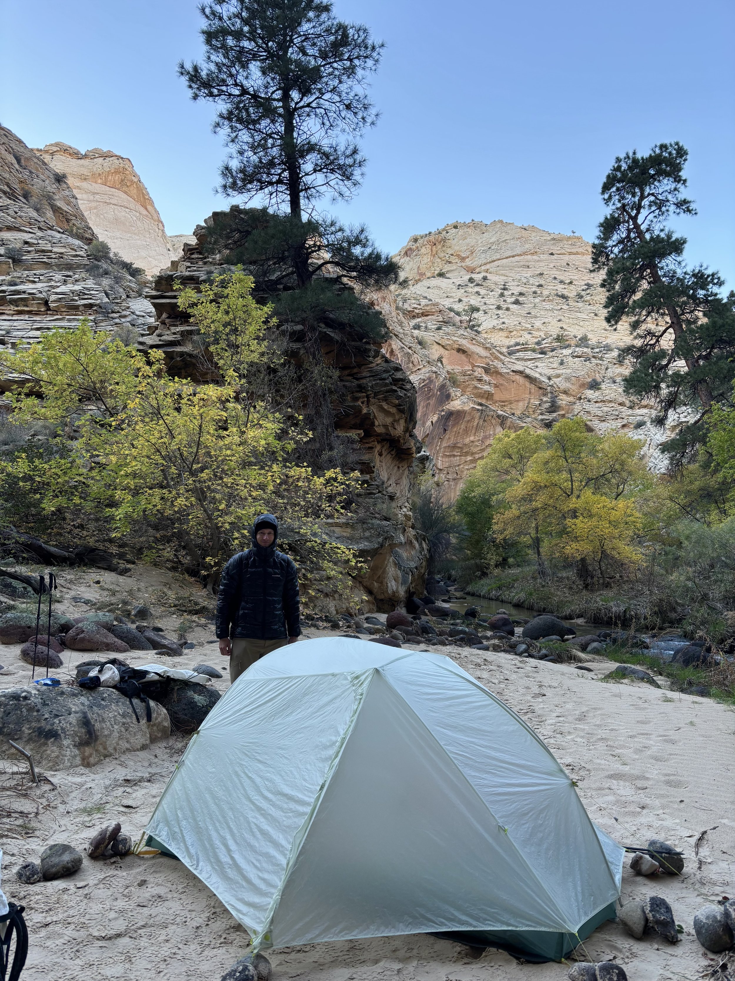
After about 7.5 miles, we started our descent into Death Hollow. Around this point, the views of the canyon really open up, and it’s a gorgeous spot to stop and eat a snack. As we descended into the canyon, we saw that the water was clear, which was a very welcome sight considering how muddy many other streams were in the area from the recent rains. We made it to the canyon bottom around 2pm and discussed if camping at that first site was the way to go. Since it was only 2pm at that point, we decided we would venture downstream a little further before setting up camp. I’m glad we did this because we ended up finding a really neat campsite. We put on our sandals and started walking down the river. We continued hiking downstream another 1-2 miles, which brought our day’s total mileage to the 10 mile range.
Right before we found our camp, we ran into a man and his dog and chatted with him for a moment. He told us that he had ran into a group of 4 earlier that day in Death Hollow who were walking upstream and back out of the canyon the way they came. They told him that they had to turn around ~1 mile from the confluence with the Escalante River because “things were getting too dangerous.” We spent some time trying to figure out exactly what that meant because the crux move of the trip seemed to be the narrows, but I felt very confident we’d be able to get through that. We realized that they must have been in the canyon during some part of the storm. I don’t like questioning other people’s choices, but choosing to be in a canyon like Death Hollow when there was up to an inch of rain in the forecast is a real head scratcher to me. Flash floods are a very real risk. My guess is that they were in the canyon when water levels were rising and perhaps the water was a muddy color where you couldn’t see the bottom. That would certainly make me uneasy. Now having completed the loop myself, I’m really not sure why they would have decided to turn around where they did. Regardless, it made us a little concerned about what conditions we would encounter the next day.
After setting up camp, I decided to do a small side hike and scramble up to top of the canyon above our campsite. The views from here got me really excited for what was to come the next day.
We headed to bed early, but I did not get a good night’s sleep like I had hoped I would. The first issue was that my sleeping pad had developed a large hole that I couldn’t find. This led to me frequently finding myself lying on the ground because my pad deflated so much. I’d then have to re-inflate the pad, which is a great way to wake yourself up instead of calming yourself down and falling back asleep. The second issue was the temperature. The lows that night were in the high 30s. I had only brought my 47 degree sleeping bag with me on the trip thinking that I would still be warm enough if I wore a few layers and my puffy jacket. I was wrong. I spent most of the night with cold feet that wouldn’t warm up. I suspect this had to do with wearing only sandals in the water that day and the water temperature being in the 50s. It was a pretty bad night’s sleep. I tried to have us sleep in a little later than usual so we wouldn’t have to put our feet back in the water until it had warmed up from that night’s lows in the 30s.
We didn’t get moving from camp until 9:45am, which I think was the right call from a temperature perspective. This day, we were both wearing neoprene socks in our trail running shoes which made our river pace faster than the day before in just sandals. We found ourselves frequently walking in the river and frequently walking on the banks along the river if it seemed faster. A lot of walking on the bank involved bushwhacking and oftentimes the river route felt like it would be faster. Based upon other reports, we were mentally prepared to encounter a lot of poison ivy. We saw almost none. I wonder if this was is due to the time of year (late October) and perhaps most of the poison ivy had died by this point. This was a very pleasant surprise. My favorite part of the day was going through the narrows, a section where the canyon’s walls get tighter and it’s mandatory to walk in the stream. For one part we even had to crawl to get through. There’s no comparison to the feeling you get when you’re walking in a canyon with walls towering hundreds of feet above you - it’s my favorite part of backpacking in canyons.
After about 7 miles, we found ourselves at the confluence with the Escalante River. Since it was only 2pm at this time, we discussed if it was worth powering through and going back to our car that day. We knew we had about 8 miles to get to the car, but expected the walking to be easier along the Escalante than in Death Hollow. With thoughts of a very deflated sleeping pad and cold feet still in the front of my mind, we decided we would skip our second planned night of camping and just head back to the car. We filtered some water and were on our way.
I really enjoyed the canyon the Escalante is in. When reading others’ trip reports, most of the focus is on Death Hollow itself, and I didn’t know what to really expect for the part along the Escalante. The canyon walls for this section were much grander than I had anticipated. The Escalante was also flowing for the entire length of the canyon (I don’t think it’s always flowing). As expected, we made good time for this section of trail and were back at the car by 5:30pm. Which meant we didn’t need to eat a dehydrated meal - a burger and shake in town were calling our names.
Overall, this backpacking trip was on of my favorite desert ones I’ve done to date. I appreciated that it was quite different from Dark Canyon the week before, but still beautiful in its own way. I found walking in the creek to be quite fun and really enjoyed the solitude that we found — we only saw 3 other people in Death Hollow when we were there. Time to plan our next canyon backpacking trip!
Day 1 Stats: 10 miles, 2100 ft of elevation gain
Day 2 Stats: 15 miles, 700 ft of elevation gain
Total Stats: 25 miles, 2800 ft of elevation gain
Disclaimer: This website uses affiliate links, meaning: at no additional cost to you, I earn a small commission if you click-through and make a purchase. As an Amazon Associate I earn from qualifying purchases. I only feature products that I believe in and use myself. Your support means the world to me and allows me to host this website. Thank you!
Gear List
Compass: SUUNTO M-3 Compass
Emergency Communication Device: Garmin inReach Mini 2 *requires a subscription
First Aid Kit: Adventure Medical Kit *I have added items to this kit and would recommend tailoring a medical kit to your needs
Lighter: BIC Lighter
Emergency Blanket: SOL Emergency Blanket
Shell/Rain Jacket: REI Co-op XeroDry GTX Jacket
Headlamp: Black Diamond Equipment Spot
Multi Tool: Leatherman Squirt PS4 Multi Tool
Tent: Big Agnes Tiger Wall Platinum
Tent Footprint: Big Agnes Accessory Footprint for Tiger Wall UL
Backpack: Hyperlite Mountain Gear Junction 55
Water Filter: Sawyer Squeeze Water Filtration System
Stove: MSR PocketRocket 2 Ultralight Stove
Fuel: Jetboil Jetpower Fuel
Kettle: MSR Titan Ultralight Titanium Backpacking Kettle
Water Bottle: Platypus DuoLock SoftBottle Flexible Water Bottle
Spork: Sea to Summit Alpha Light Long Spork
WAG bags for human waste: Cleanwaste WAG bags
Sleeping Pad: Sea to Summit Ether Light XT
Pillow: Sea to Summit Aeros Premium Inflatable Travel Pillow
Sleeping Bag: Sea to Summit Flame Women’s Ultralight Down Sleeping Bag
Shirt: Patagonia Capilene Cool Daily Hoodie
Pants: Black Diamond Womens Alpine Light Pants
Socks: Darn Tough Hiker Micro Crew Midweight Sock with Cushion
Underwear: Smartwool Intraknit Hipster Bikini
Sunglasses: Smith Lowdown Slim 2
Toothbrush: GUM Travel Toothbrush
Toothpaste: SuperBee Dentos Toothpaste Tablets
Hairbrush: Folding Hairbrush
Body Wipes: Pampers Sensitive Water Based Hypoallergenic and Unscented Baby Wipes
Trekking Poles: REI Co-op Flash Carbon Compact Trekking Poles
Camp shoes: Xero Shoes Women’s Z-trail Ev
Mug/cup: GSI Outdoors Infinity Backpacker Mug
Towel: REI Co-op Multi Towel Mini
Power Bank: Nitecore NB10000 Gen II Ultra-Slim Power Bank
Packing Cubes: Eagle Creek Packing Cubes
Chair: Helinox Chair Zero Ultralight Compact Camping Chair
Mosquito Head Net: Sea to Summit Ultra-Mesh Mosquito Head Net
Knife: LEATHERMAN Skeletool KBX Pocket Multitool with Knife and Bottle Opener


