Koch Peak Hike, Lee Metcalf Wilderness, Madison Range, Big Sky, Montana

If you’re looking for a hike full of solitude and one where you are rewarded for your efforts at the top, Koch Peak is a hike you should be considering. Mike and I headed out on the Taylor Falls Trail from the trailhead on a Monday morning in late August. It was the first time I’ve ever considered turning around less than a mile into the hike and heading back to our car. Why? It had rained the day before and didn’t yet have a chance to dry out. This led to the overgrown trail being extremely wet, particularly the long grasses that lean out over the trail. Normally I wouldn’t mind being a little wet, but the car thermometer said 35 degrees Fahrenheit when we left it that morning. Which meant all of that moisture was 35 degrees. We were quickly totally soaked from mid-thigh through to our feet, and we were genuinely concerned about being able to keep our toes warm enough. At 0.7 miles into the hike, there is a mandatory stream crossing. Really the last thing we wanted to do at that point was get even more wet considering we were already worried about staying warm enough. Should we go back to the car or ford the creek? Ultimately, we decided to cross the creek and see how we were feeling a half mile later. I’m glad we didn’t turn around because the creek actually ended up being warmer than the air and so it didn’t make our feet any colder! It did guarantee they’d be wet for a while though (pretty much the whole day).
With this decision behind us, we continued down the Taylor Falls Trail and eventually turned right onto Tumbledown Trail. The trail remained pretty wet and muddy for 3-4 miles, something to consider if you’re ever looking to do this trail after a rainstorm. Once we hit Tumble Basin and the lake in the basin, the trail ended. Time to start the fun part of the hike.
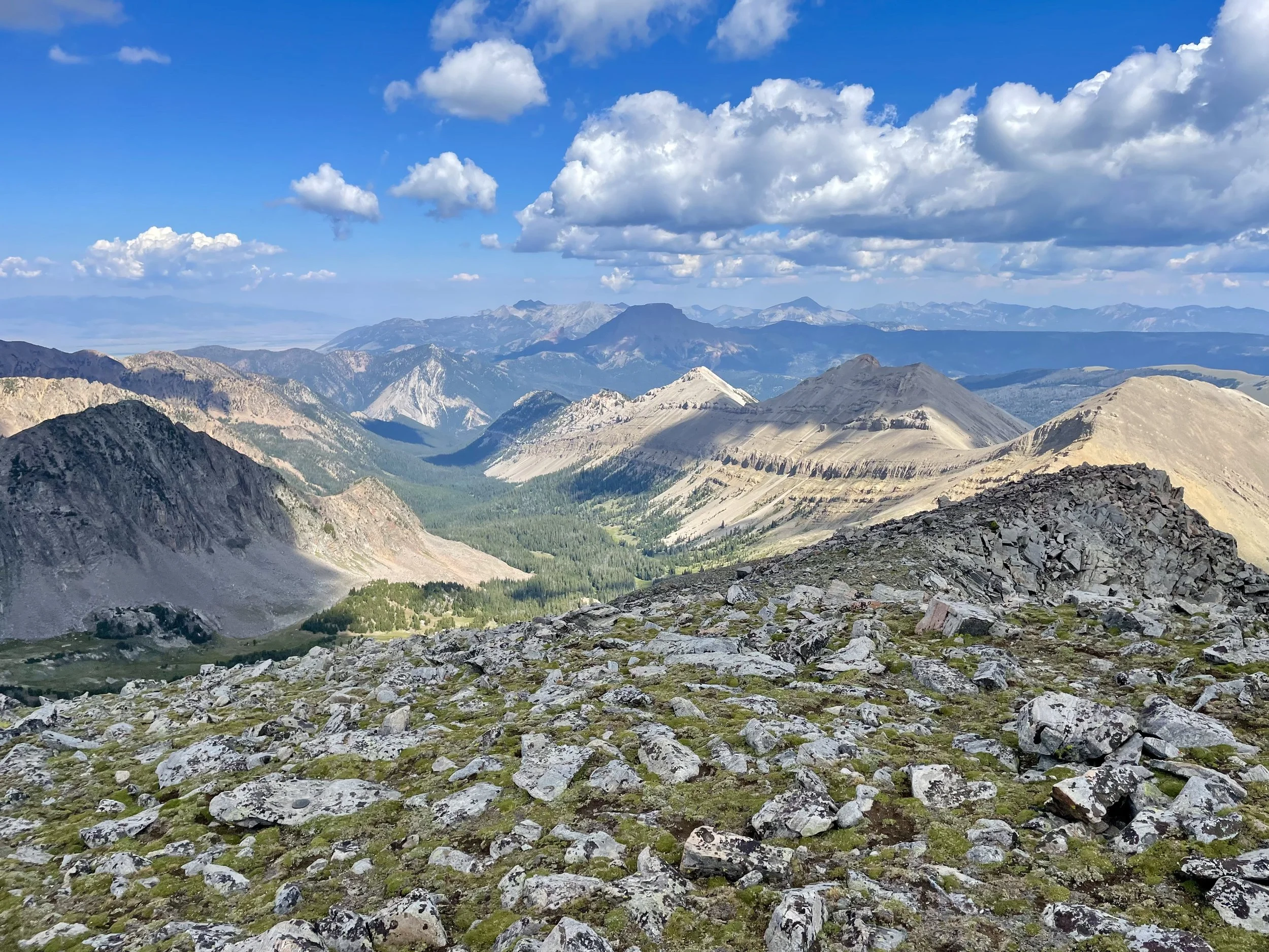
We went up and around the lake and ended in some scree fields that were pretty easily navigated. We continued south until we were able to start going west towards the saddle that’s south of the peak. When we got to the base of the south face, it looked much more intimidating than the hike ended up being. Most of the rock ended up being pretty sturdy, and we were at the summit before we realized it. I really enjoyed the 360 degree views from this summit. In one direction we could make out Big Sky Resort and in the other direction we had views of the entire Madison Range. We hadn’t seen anyone the whole day, and it made me put the Madison Range on my list of places to go backpacking one day.
After taking a break at the summit to enjoy the views, we headed back down the way we came. On the way out we ran into 3 other hikers that had started much later than us and said they didn’t get wet at all on the hike other than the stream crossing. Maybe we should have started a bit later, although I never like to be on peaks much later than noon. None of the hikers we encountered were going all the way to the peak so they had the luxury of waiting for things to dry out. The hike ended up being a little longer than we were expecting at 14 miles and 4500 ft of elevation gain, but I sure am happy we didn’t turn around at the stream crossing. It was another great day in the mountains.
Total stats: 14 miles, 4500 ft vert.