Backpacking the Sawtooth Wilderness, Stanley, Idaho

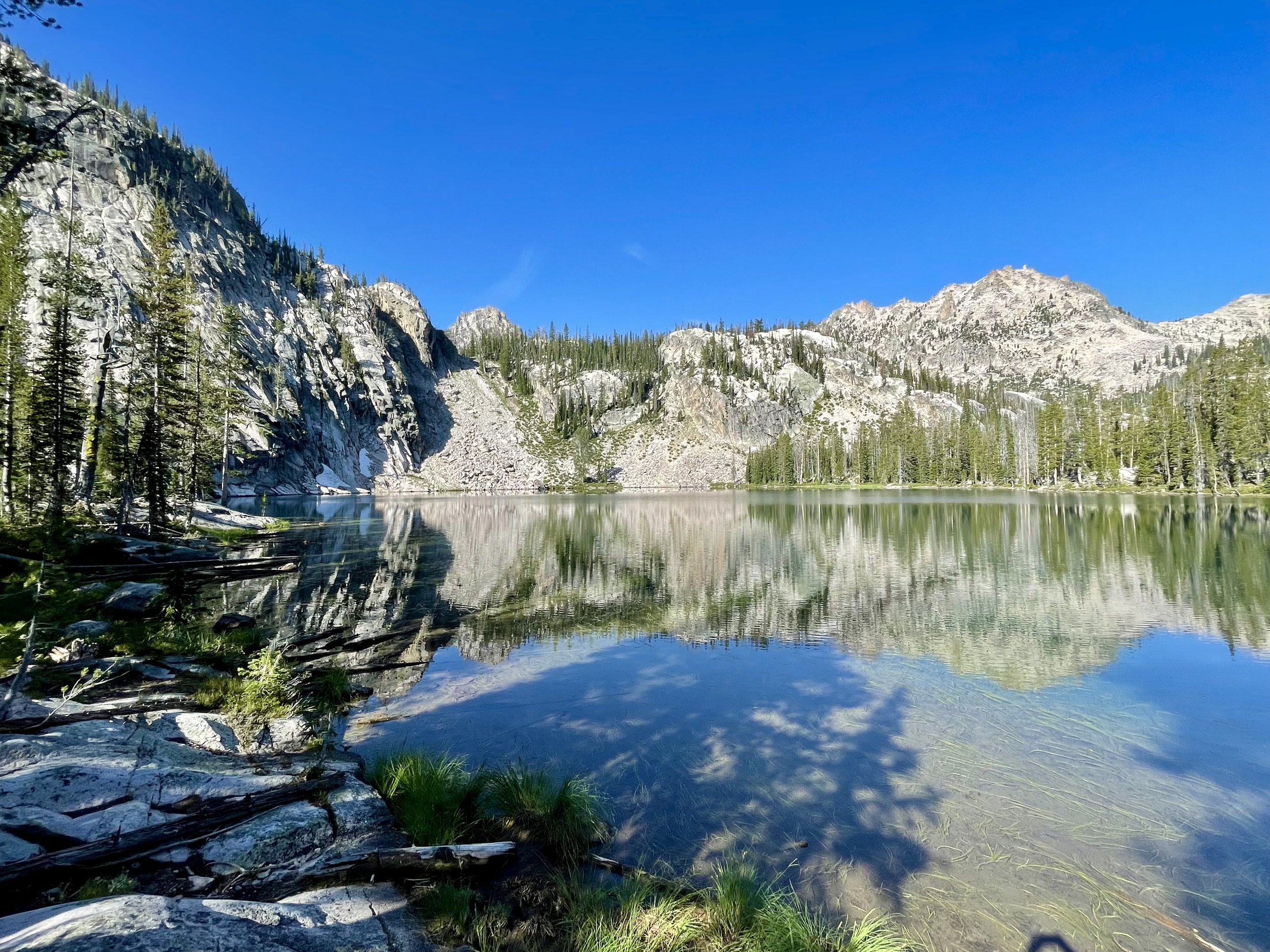
Morning reflection on Baron Lake
Disclaimer: This website uses affiliate links, meaning: at no additional cost to you, I earn a small commission if you click-through and make a purchase. As an Amazon Associate I earn from qualifying purchases. I only feature products that I believe in and use myself. Your support means the world to me and allows me to host this website. Thank you!
The Sawtooth Wilderness was one of the Wilderness Areas that was high on my bucket list to check out this summer. With wildfire smoke impacting most of Canada, Washington, and Montana, it was an easy decision to head to Idaho to do a 6 day/5 night backpacking trip in the Sawtooths where the air quality was looking great.
Mike and I set out from the Grandjean Trailhead on a Tuesday morning. There were probably ~20 other cars in the parking lot. Our goal was to do a loop hike that involved a couple of days of off trail exploration. To give you a sense of what this loop would look like, our campsites were on Baron Lake, Blue Rock Lake, Lake Kathryn, Edna Lake, and the South Fork of the Payette River. Originally, we had intended to spend a night camped at Lake Ingeborg and have it be a 6 night trip, but the weather forecast caused us to abort those plans and skip camping at that lake, driving us to have a 19 mile day on day 5. The whole trip was gorgeous. Let’s jump into the details.
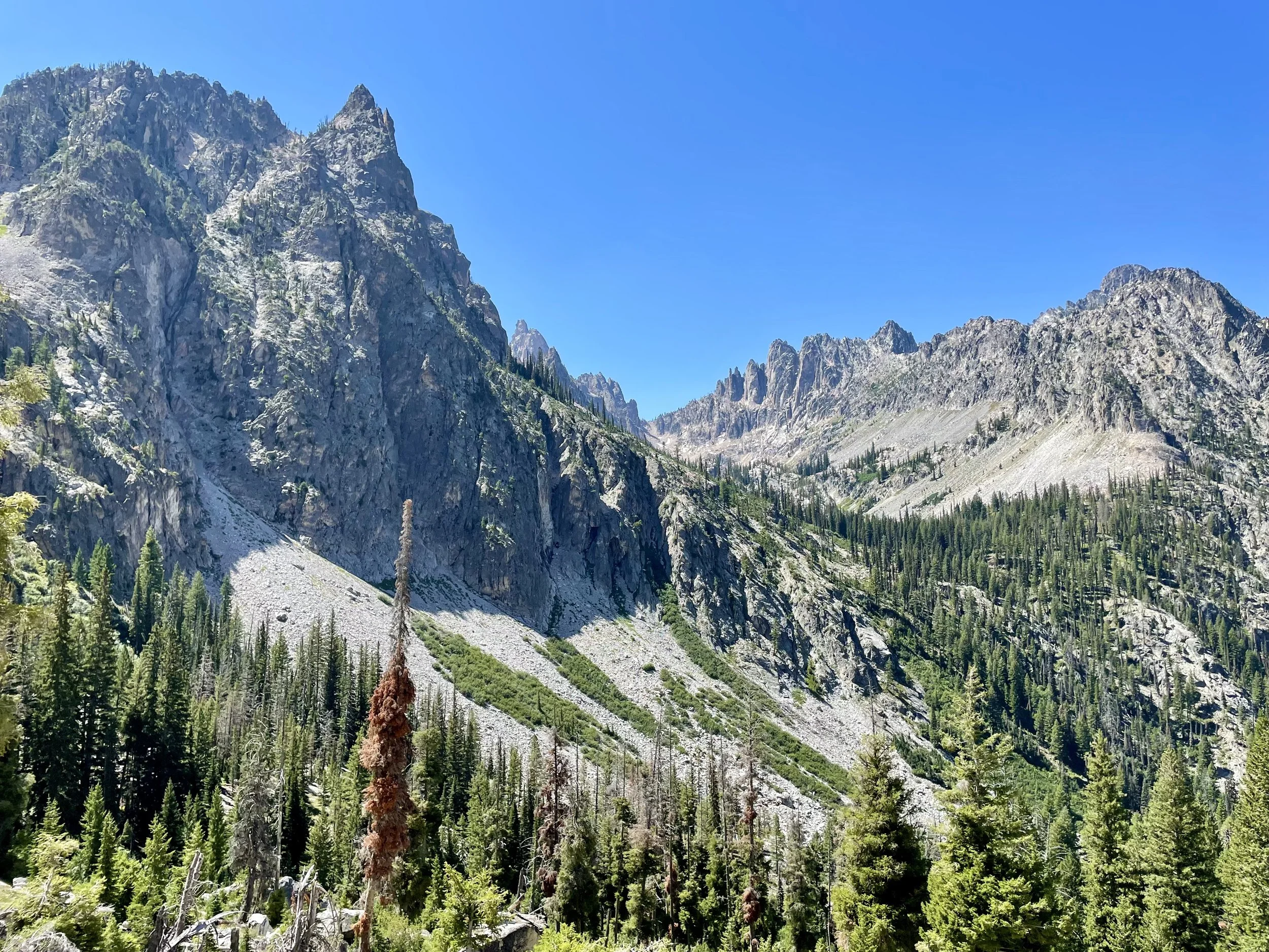
As I mentioned, we left the Grandjean Trailhead around 9am on a Tuesday morning and headed up the Redfish Creek-Baron Creek Trail. This was our first backpacking trip in the Sawtooths, and we were very surprised at how hot the temperature was. It was easily in the mid 80s by noon and there were many sections of trail that didn’t have any shade. We were quickly sweating profusely. I had low expectations for this trail from a views perspective as I had been thinking about it as a trail that would just get us into the heart of the Sawtooth Wilderness, but I was pleasantly surprised by the scenery throughout. The switchbacks by Baron Creek Falls provided particularly beautiful views. After sweating for most of the day, we finally made it to Baron Lake where we decided to set up camp. We didn’t hesitate to jump in the lake and cool off as well. This was one of my favorite lakes of the trip. With the warm temperature, we slept without our tent fly on that evening and enjoyed being able to see the stars the whole night.
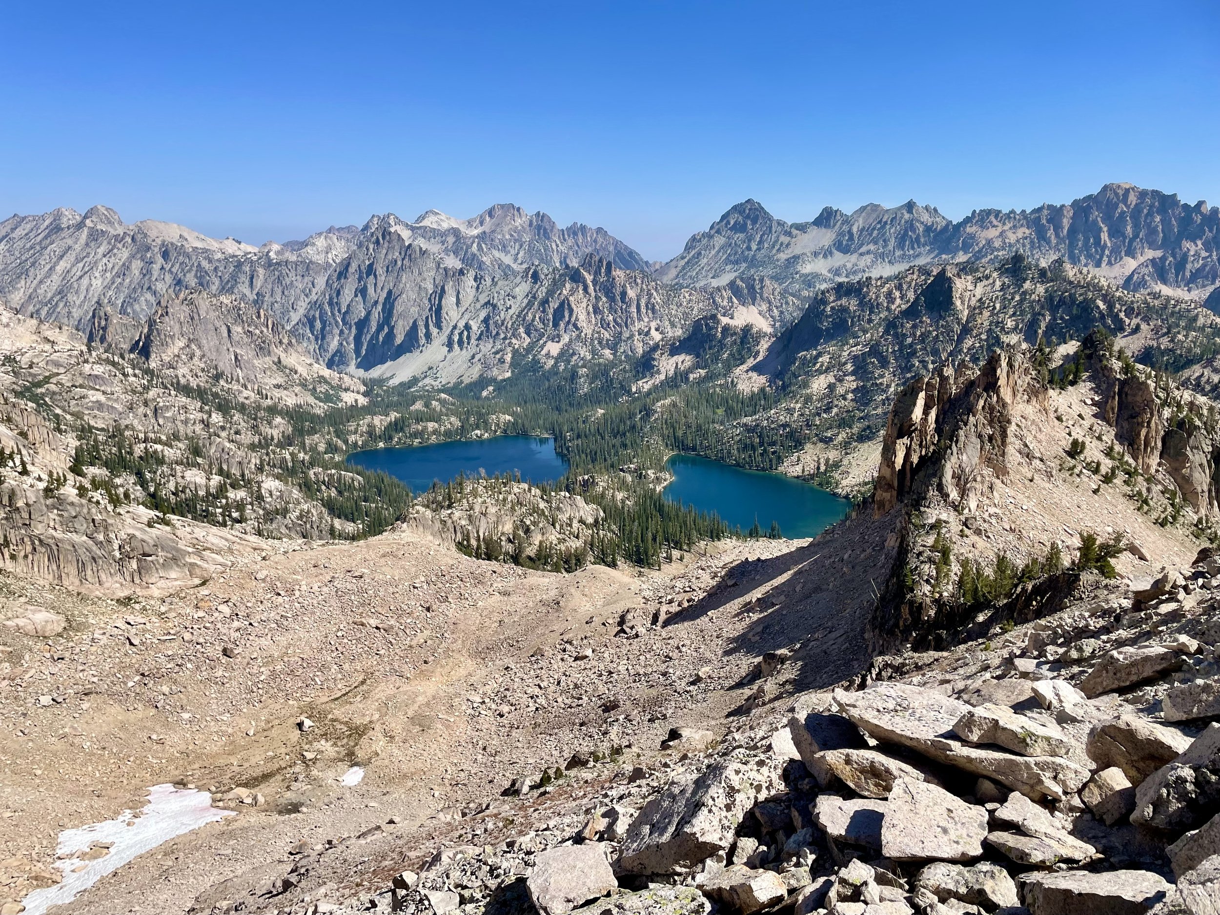
View of Baron and Upper Baron Lakes
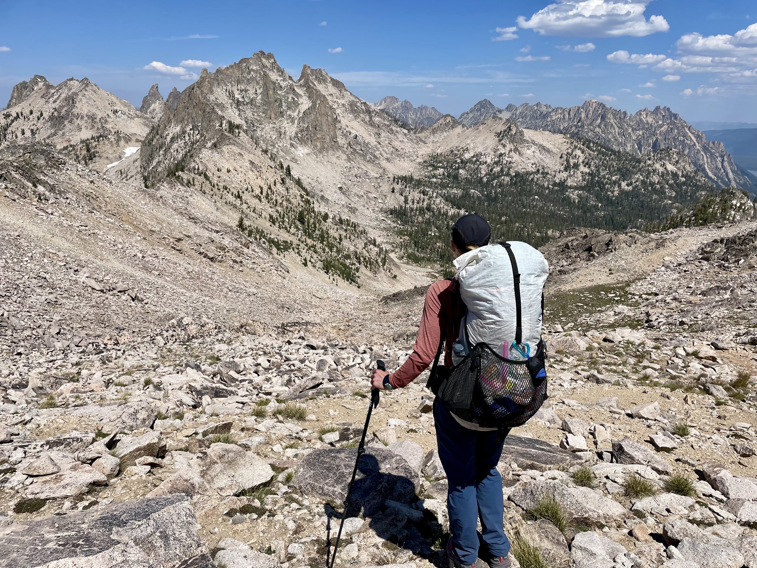
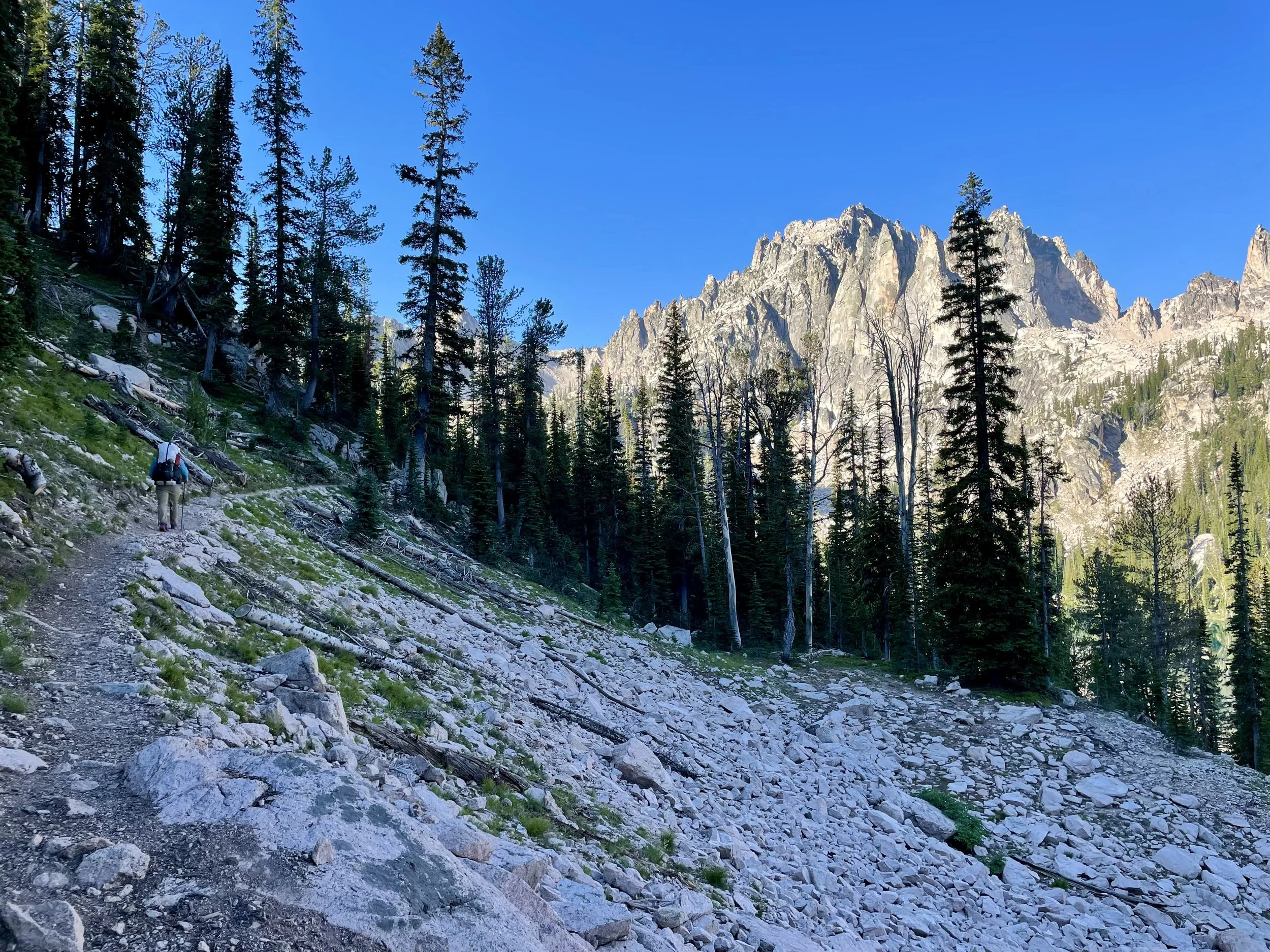
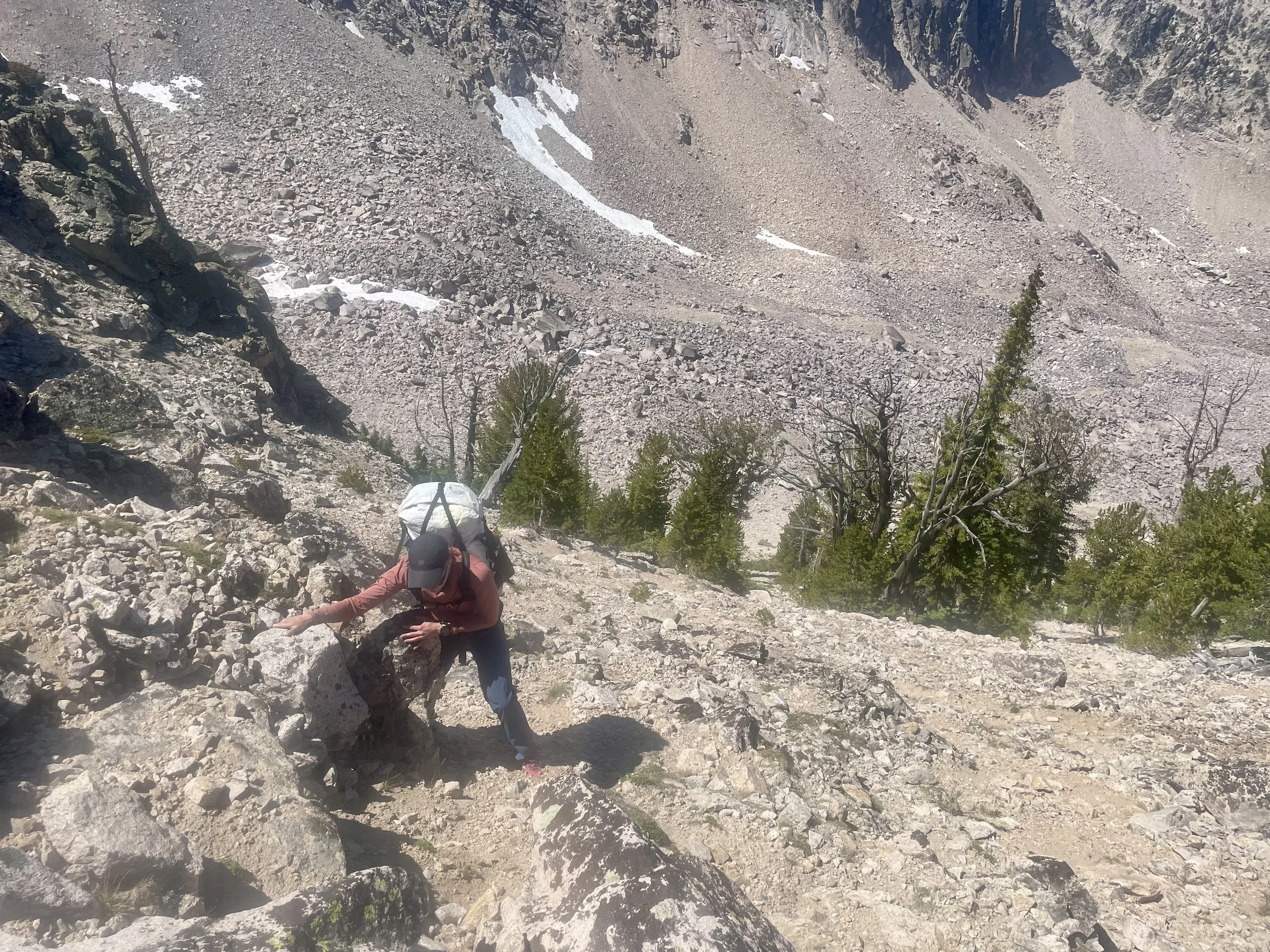
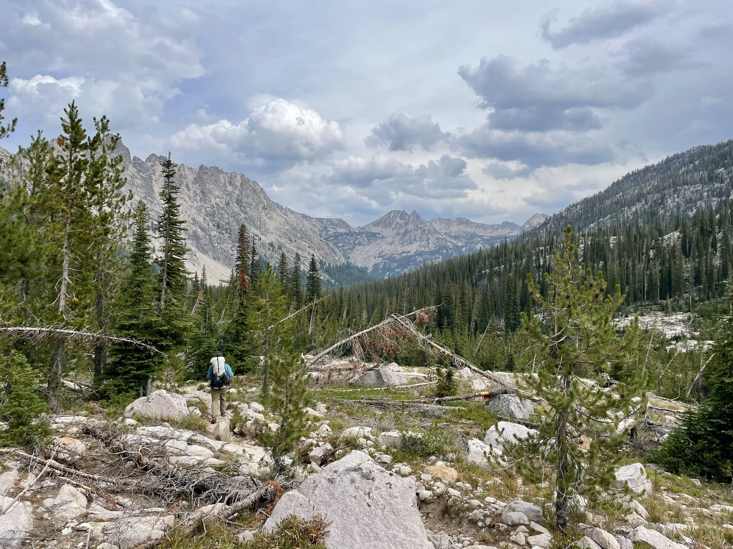
The following morning we woke up around sunrise, hoping to beat some of the heat that day. That plan didn’t work, but it was still nice to get moving early. We hiked up to Upper Baron Lake which was breathtaking and made me wish we had tried to camp somewhere around that lake instead simply because the views were so jaw dropping. Once gaining the pass, we started descending towards Alpine Lake. Before hitting the lake, we turned off the trail to start our off-trail part of the trip. The off-trail hiking we ended up doing was much steeper and more exposed than I had been expecting. I’m honestly not sure if I would have added in this off trail section if I had fully known what we were getting in to. If you are considering hiking the off trail portion of the trip that we did, you must be very comfortable with off-trail navigation, comfortable with exposure, and comfortable scrambling, particularly in very loose dirt/scree. If you’ve never hiked off-trail before, this would not be the route to start with. With that all said, we headed up towards Old Monte Verita where we found a climbers trail that would take us down to Warbonnet and Little Warbonnet Lakes. The views from this trail were fantastic, but we were definitely in a no fall zone the entire time. Warbonnet and Little Warbonnet Lakes were quite beautiful with Mayan Temple and Packrat Peaks standing over them. Once we got to Feather Lakes, the terrain became difficult to navigate. Between Feather Lakes and Blue Rock Lake, there was a never ending amount of ~5-10 foot cliff bands that needed to be navigated around. Looking at the topo map, we had expected this to be an easy park of the trek, but it ended up being one of the more frustrating ones because of all of the dead ends we found that ended in a cliff. After a lot of navigation, we finally made it to Blue Rock Lake, which was thankfully worth the effort. We were the only ones at the lake that night (we may have been the only ones in the whole drainage), and we enjoyed another dip in the lake followed by a nice quiet evening.
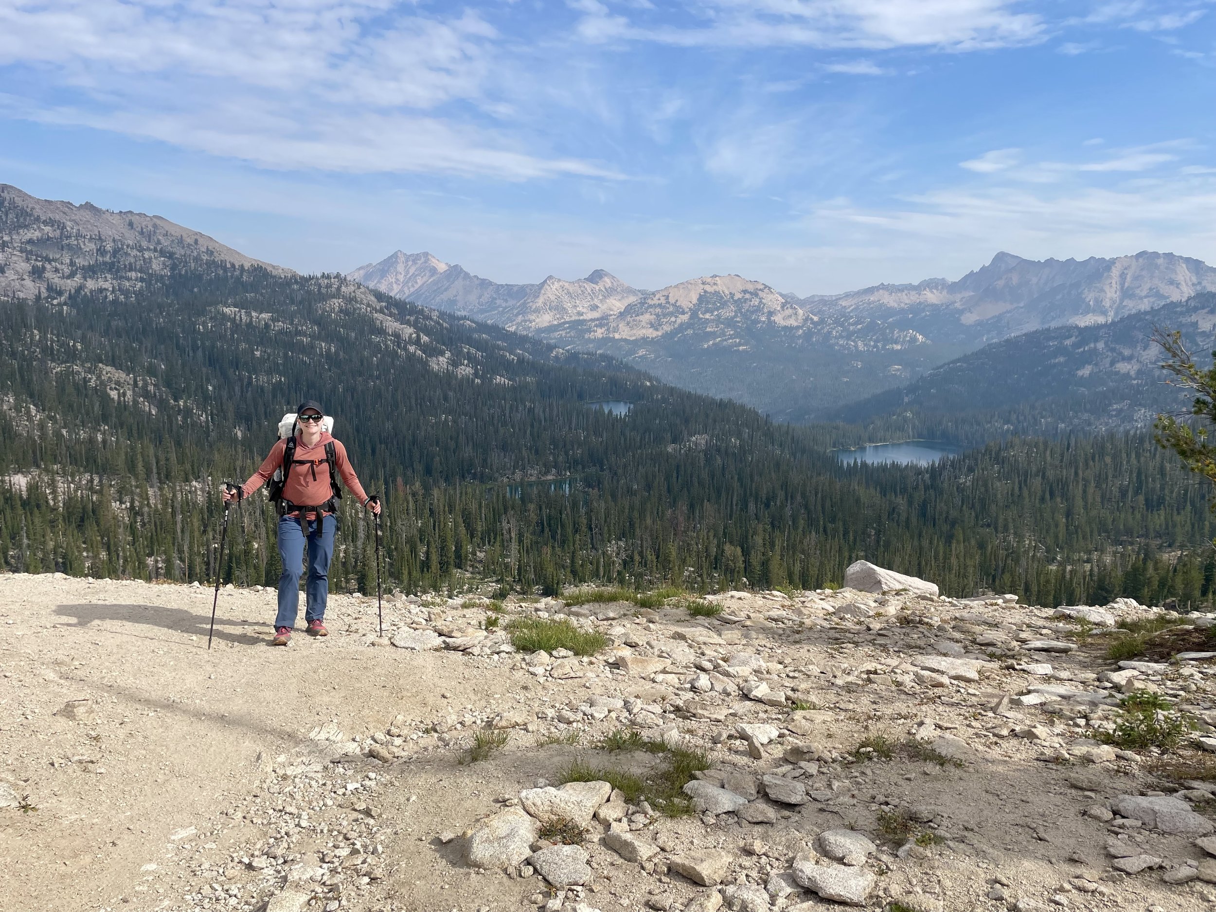
At the top of the pass between Packrat Lake and Lake Kathryn
The next morning we set out on the next leg of the off-trail journey that would bring us to Lake Kathryn. Leaving Blue Rock Lake felt like a continuation of the day before with cliff bands waiting for us right from the start followed by some big talus fields. We slowly made our way to McWillards Lake followed by Oreamnos Lake. Both lakes were pretty, but I was happy with our decision to camp where we did the night before. Once we hit Oreamnos Lake, we turned and followed the drainage up to Packrat Lake. This part also required more navigation skills than one would expect from looking at the topo. Packrat Lake was a beautiful shade of blue, and one of my favorite lakes of the trip. We stopped for a lunch break to take in views of La Fiamma and Mount Underhill. After our break, we headed up the talus field that would take us over to Lake Kathryn. The pass we ended up taking was one of the worst passes I’ve ever gone over. The dirt/scree would not support your weight and you’d find yourself sliding back down the slope. We found ourselves literally scrambling on our hands and knees to get over the pass, and I was exceptionally happy when we finally made it to the top. I don’t ever need to go over that pass again, and I’m not sure I’d recommend it to others. Lake Kathryn, on the other hand, was my favorite lake of the trip. We once again had the lake all to ourselves and had a good chunk of the afternoon to go for another swim and relax and read. To frame how slow and tedious the hiking was that day, it took us 5.5 hours to go 3.9 miles. For comparison, it took us 8 hours to go 19.1 miles on Day 5, which was all on trail. If you are traveling off trail in the Sawtooths, don’t expect to be setting any speed records.
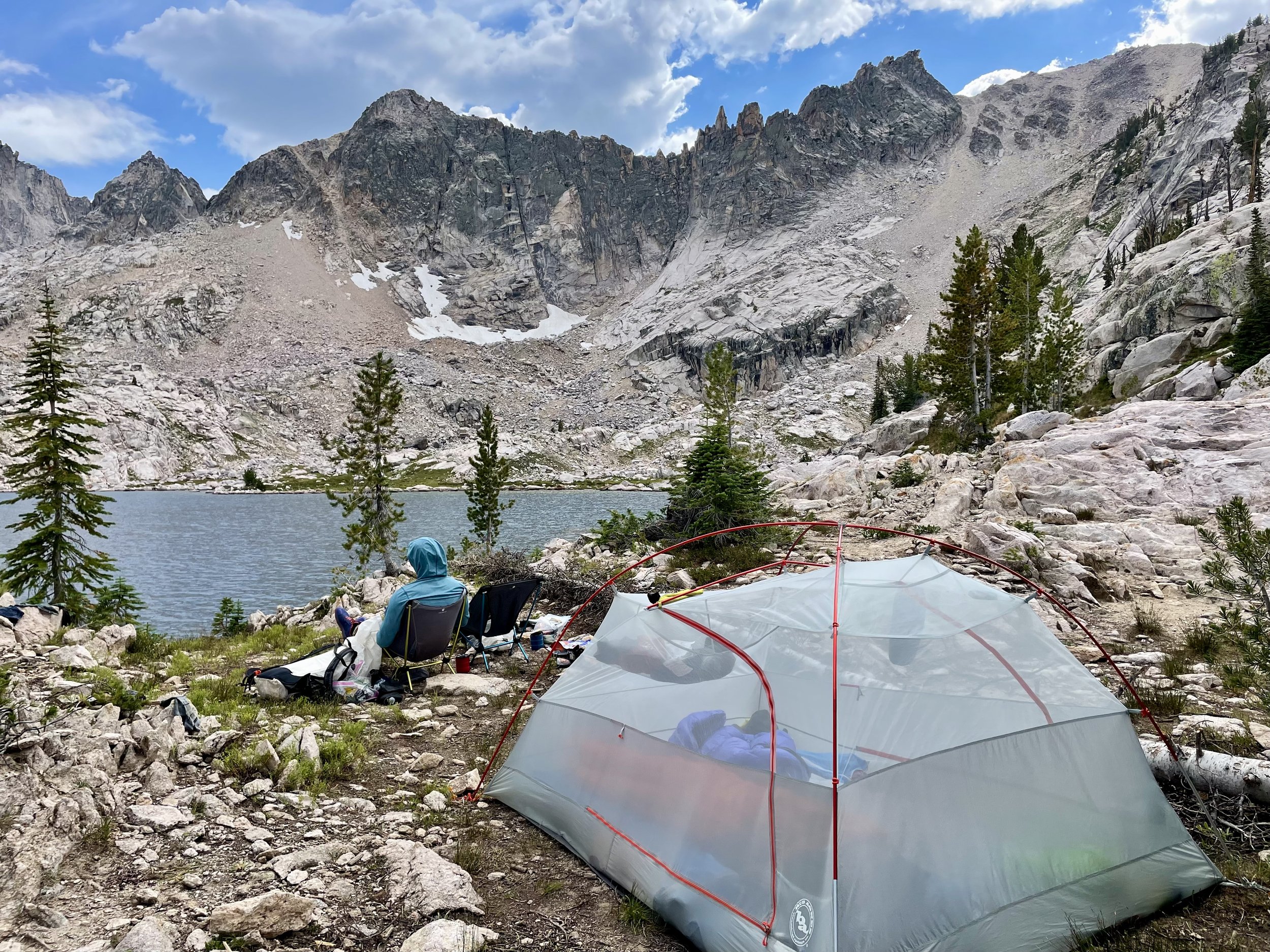
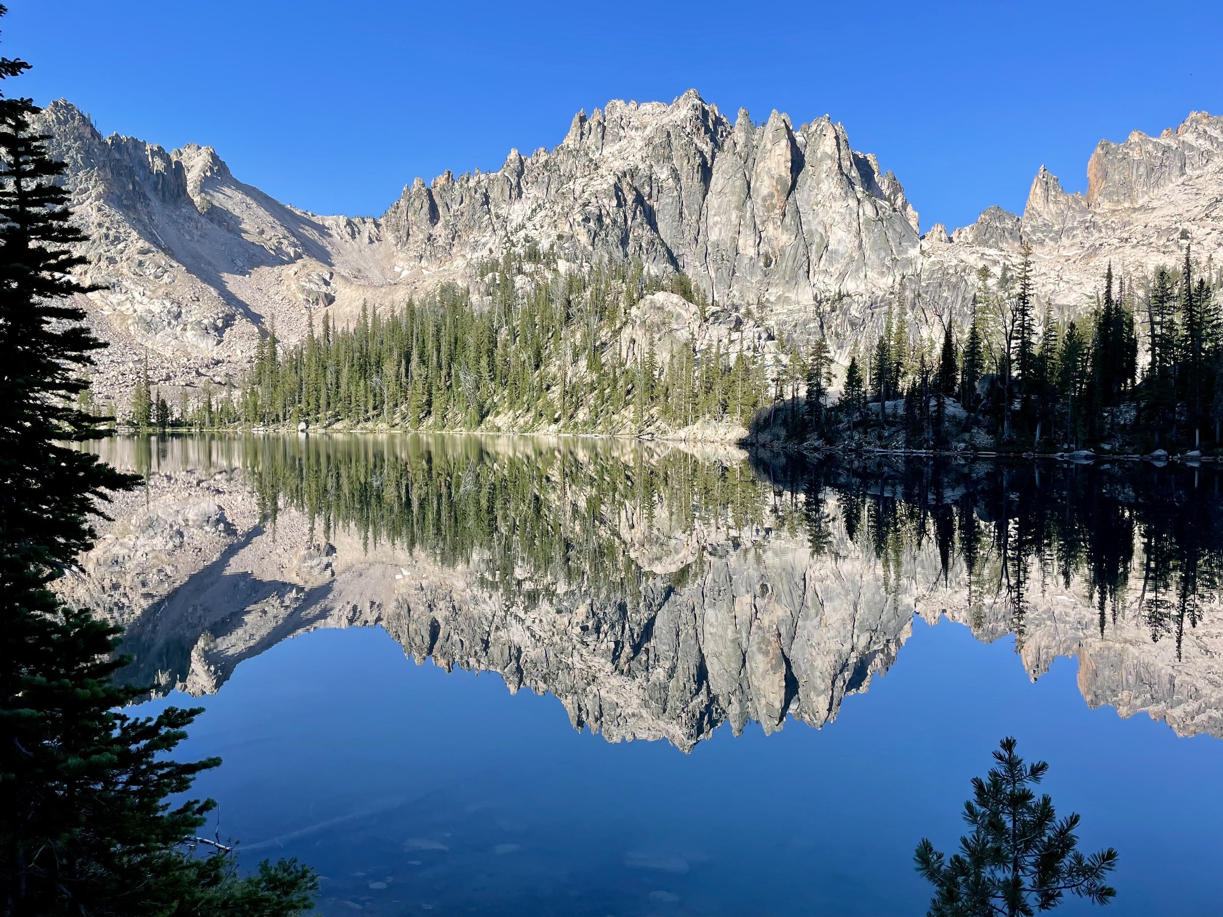
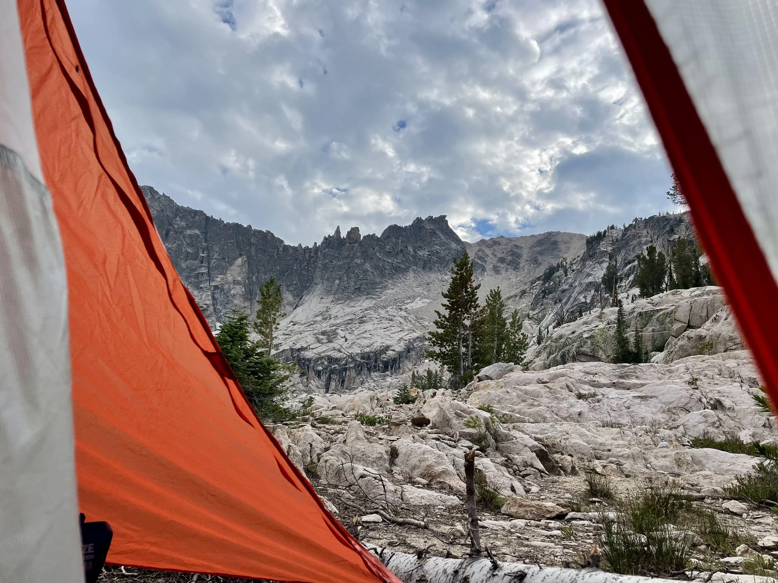
Camp at Lake Kathryn
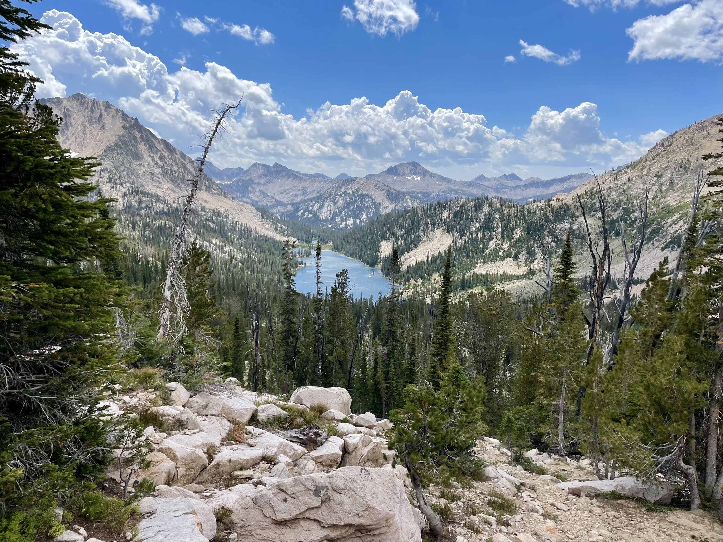
The following day we were excited to get back on trail after a full few days of off-trail adventures. We took a gully full of boulders down to Upper Redfish Lakes and from there headed down the drainage to ultimately hit the Mount Cramer Trail. Thankfully the terrain was easier to navigate that day and getting back on a smooth trail was extremely welcome. We passed all three Cramer Lakes, which were the busiest lakes of the trip. I really enjoyed the views from the pass below Mount Cramer and over to Hidden Lake. Hidden Lake was quite beautiful and I wished we had an extra night to camp there, but I guess we’ll have to save that for the next trip. We decided to set up camp on Lake Edna, which was the fourth lake of the trip we took a dip in.
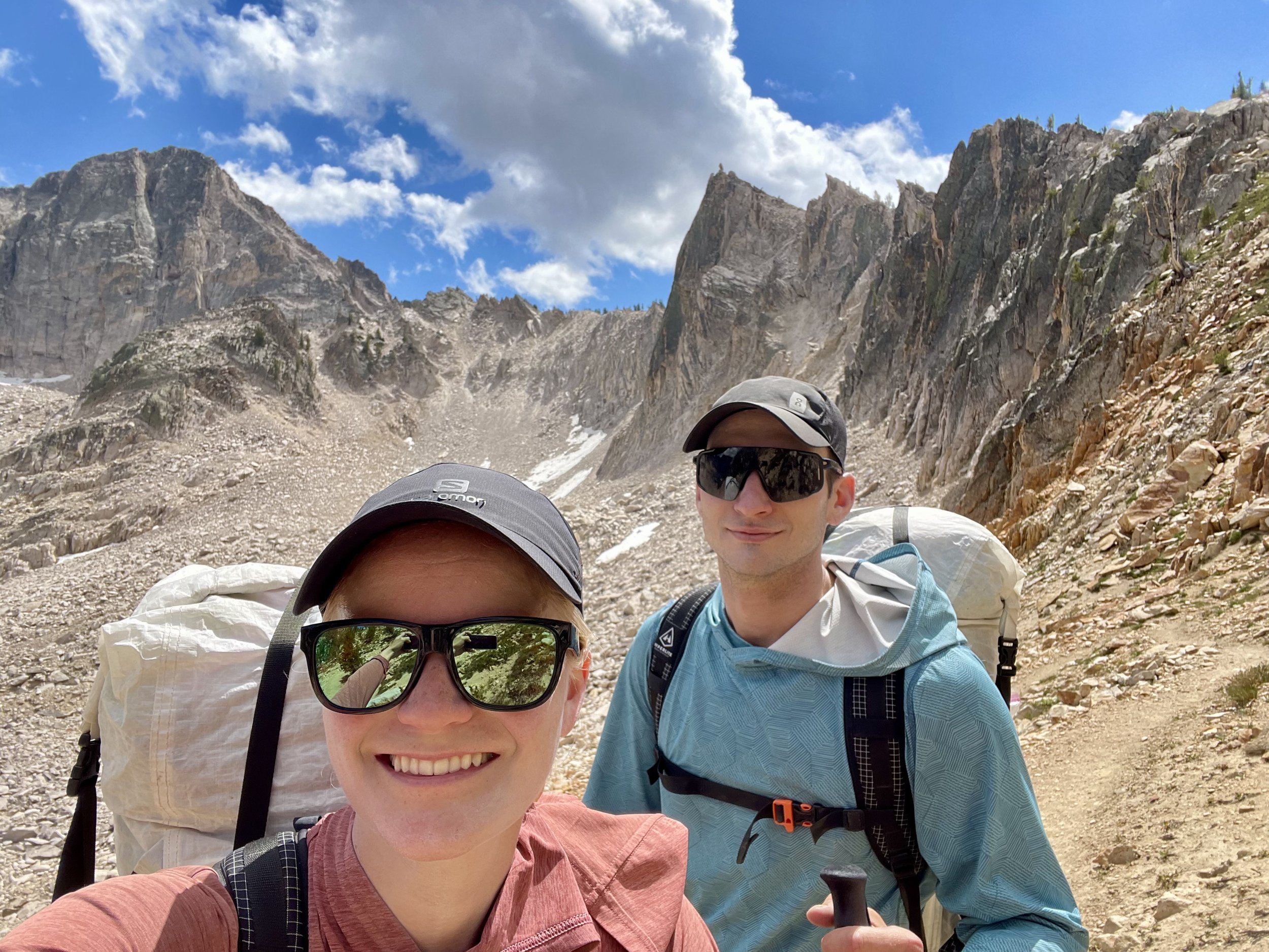
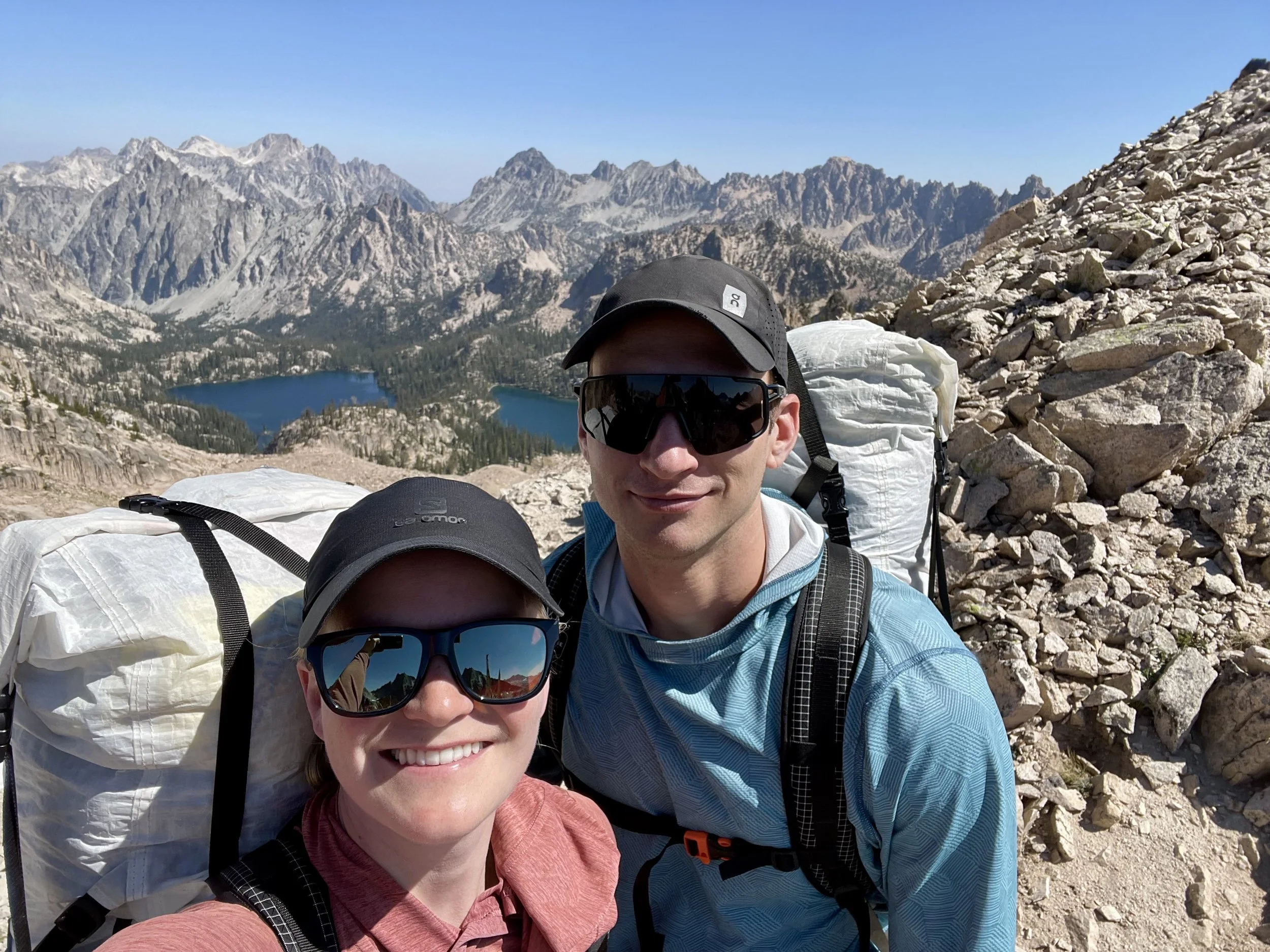
Nearing the top of the pass between Cramer Lakes and Hidden Lake
The next morning, we continued on our loop past Vernon Lake and Ardeth Lake. We then headed down to Spangle Lake where I updated the weather forecast on my Garmin inReach Mini. I hadn’t updated the forecast in a few days so we were shocked when the forecast called for a 100% chance of heavy rain the following day and day after. As I had mentioned, we were planning to camp at Lake Ingeborg that night, but with the forecast for 48 hours of rain, we made the decision to cut the trip a night short and put in a long day towards the car while the weather was still nice. So we passed Lake Ingeborg without stopping and headed down into the drainage where you can find Benedict Creek. We then turned left at the intersection with the South Fork of the Payette River and continued to follow the river down. After spending the last 30 mins of the day in rain, we decided it was time to find a campsite. My feet were ready for a break after 19 miles anyway. We found a nice site next to the river, wolfed down some dinner between rain showers, and headed to bed.
The following morning we decided to wake up at 4:30am to start the remaining 9 miles back to the car. The forecast was calling for a 100% chance of rain by 11am (up from 0% at 5am) so we figured we’d trade some dry miles for a few hours of sleep. Our plan mostly worked, but it did start raining on us around mile 5. At least we had made it halfway through our hike that day at that point. We made it back to our car without any incidents other than being soaking wet.
Overall, I really enjoyed this trip. Much of the off-trail part of the trip was Type 2 fun while we were experiencing it, but it did bring us to some beautiful, remote lakes. Our navigation skills were put to the test. If you are looking for a loop to do in the Sawtooth Wilderness, the one we did should be worth a consideration!
Total Stats: 61 miles, 12,900 vert.
Day 1: 11.4 miles, 3600 vert.
Day 2: 5.9 miles, 2000 vert.
Day 3: 3.9 miles, 2000 vert.
Day 4: 11.3 miles, 2700 vert.
Day 5: 19.1 miles, 2000 vert.
Day 6: 9.4 miles, 600 vert.


Gear List
Map: Sawtooth Map
Compass: SUUNTO M-3 Compass
Emergency Communication Device: Garmin inReach Mini 2 *requires a subscription
First Aid Kit: Adventure Medical Kit *I have added items to this kit and would recommend tailoring a medical kit to your needs
Lighter: BIC Lighter
Emergency Blanket: SOL Emergency Blanket
Shell/Rain Jacket: REI Co-op XeroDry GTX Jacket
Headlamp: Black Diamond Equipment Spot
Multi Tool: Leatherman Squirt PS4 Multi Tool
Tent: Big Agnes Copper Spur HV UL
Tent Footprint: Big Agnes Footprint for Copper Spur HV UL
Backpack: Hyperlite Mountain Gear Junction 55
Water Filter: Sawyer Squeeze Water Filtration System
Stove: MSR PocketRocket 2 Ultralight Stove
Fuel: Jetboil Jetpower Fuel
Kettle: MSR Titan Ultralight Titanium Backpacking Kettle
Water Bottle: Platypus DuoLock SoftBottle Flexible Water Bottle
Spork: Sea to Summit Alpha Light Long Spork
WAG bags for human waste: Cleanwaste WAG bags
Sleeping Pad: Sea to Summit Ether Light XT
Pillow: Sea to Summit Aeros Premium Inflatable Travel Pillow
Sleeping Bag: Western Mountaineering Ultralite 20 Degree Sleeping Bag
Shirt: Patagonia Capilene Cool Daily Hoodie
Pants: Black Diamond Womens Alpine Light Pants
Socks: Darn Tough Hiker Micro Crew Midweight Sock with Cushion
Underwear: Smartwool Intraknit Hipster Bikini
Sunglasses: Smith Lowdown Slim 2
Toothbrush: GUM Travel Toothbrush
Toothpaste: SuperBee Dentos Toothpaste Tablets
Hairbrush: Folding Hairbrush
Body Wipes: Pampers Sensitive Water Based Hypoallergenic and Unscented Baby Wipes
Trekking Poles: REI Co-op Flash Carbon Compact Trekking Poles
Camp shoes: Xero Shoes Women’s Z-trail Ev
Mug/cup: GSI Outdoors Infinity Backpacker Mug
Towel: REI Co-op Multi Towel Mini
Power Bank: Nitecore NB10000 Gen II Ultra-Slim Power Bank
Packing Cubes: Eagle Creek Packing Cubes
Chair: Helinox Chair Zero Ultralight Compact Camping Chair
Mosquito Head Net: Sea to Summit Ultra-Mesh Mosquito Head Net
Knife: LEATHERMAN Skeletool KBX Pocket Multitool with Knife and Bottle Opener