Backpacking the High Uintas Wilderness, Evanston, Utah

Mike descending towards Red Castle Lake
Disclaimer: This website uses affiliate links, meaning: at no additional cost to you, I earn a small commission if you click-through and make a purchase. As an Amazon Associate I earn from qualifying purchases. I only feature products that I believe in and use myself. Your support means the world to me and allows me to host this website. Thank you!
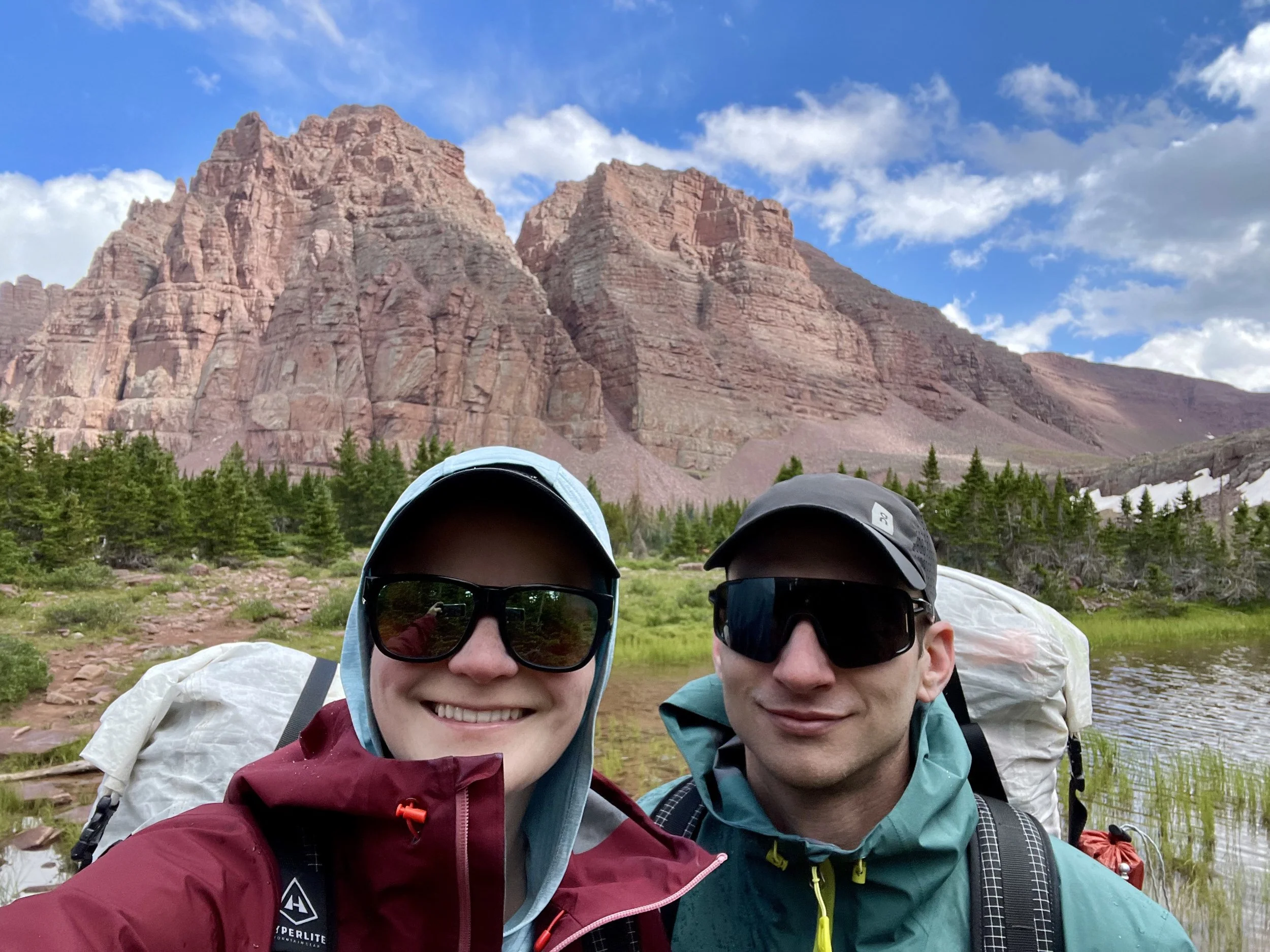
When one first thinks about going on a Utah backpacking trip, deserts and slot canyons are what typically come to mind. However, the High Uintas Wilderness should not be overlooked during those summer months when most of Southern Utah is too hot for most of us to go on a backpacking trip. Last week Mike and I went on our first backpacking trip to the High Uintas Wilderness, and it exceeded our expectations. The mountains looked like a perfect combination of Utah’s Canyonlands National Park and Colorado’s Rocky Mountain National Park. With many high mountain passes, high alpine lakes, and mountains looming over 13,000 feet, this is a great Wilderness Area to go on a grand adventure, which is exactly what we did.
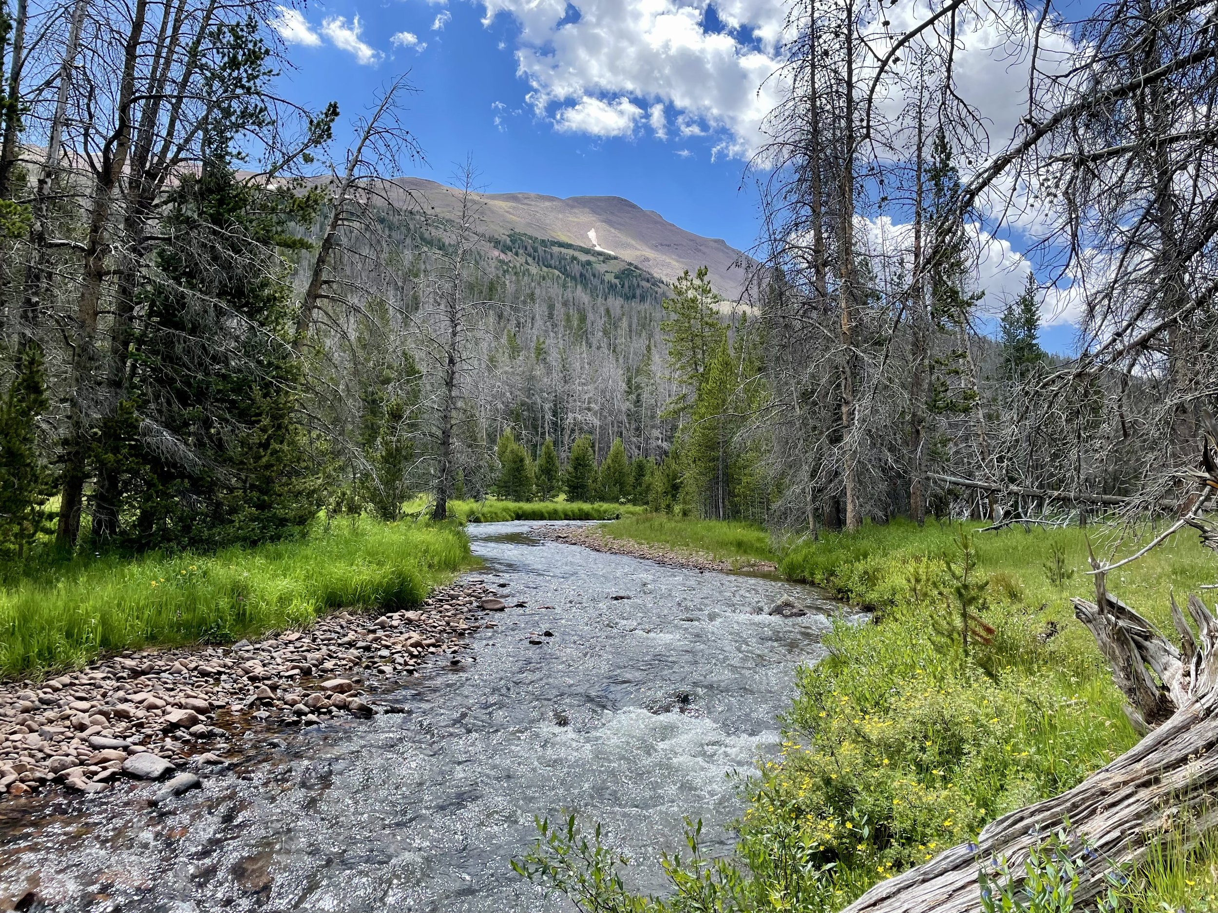
We started our trip from the East Fork Blacks Fork Trailhead (what a mouthful). We parked on a Sunday and there were about 7 other cars in the lot. We set out down the East Fork Blacks Fork trail with an ambitious goal to make it to Dead Horse Lake by that evening. What we weren’t expecting was how swampy this trail was going to be. Many sections of the first 7 miles of the trail felt like a bog where every step you took was squishy and wet and you hoped your shoe would come back out with your foot. I had several steps where my shoe completely disappeared in the mud. Add in several stream crossings, and we both had some very wet feet at the end of the day. The first 7-8 miles of the day were certainly the worst, but we found wet/swampy areas in different places throughout the day. This made for slower going than expected. Having never done a trip to the Uintas before, I’m not sure if it was so wet because of the record snow year Utah had this winter or if that is typical of the range. The swampy trails were not exclusive to this day and hopping around on rocks trying to keep our feet dry was certainly the theme of the trip.
As we started gaining elevation that first day, darker clouds started rolling in during the late morning. We quickened our pace. As we came to treeline, Mount Slovenia and Wasatch Mountain loomed in front of us and gave us our first real taste of the beautiful views we’d have over the following days. We decided the storm clouds might hold off just long enough for us to make it over Red Knob Pass and down into the basin that would take us to Dead Horse Lake. As we started descending over the pass, we were greeted with our first of many hail storms of the trip. The clouds got even darker, and we saw our first bolts of lightning, accompanied by some loud thunder. At this point the safest option was to continue the way we were going and we practically ran down the steep side of Red Knob to make it to treeline. Of course, just as we hit treeline the hail stopped. We regrouped and continued the last few miles to Dead Horse Lake, hoping we would be able to set up camp before the next storm rolled in. By some miracle, minutes after we set up our tent, we heard a few drops of rain that were then followed by a quick storm. For the rest of the evening, dark clouds alternated with blue sky and we didn’t venture far from the tent. With this lake being on the Uinta Highline Trail, I expected to be sharing it with some other backpackers, but we were lucky enough to have the lake all to ourselves that night and hadn’t seen one other soul all day.
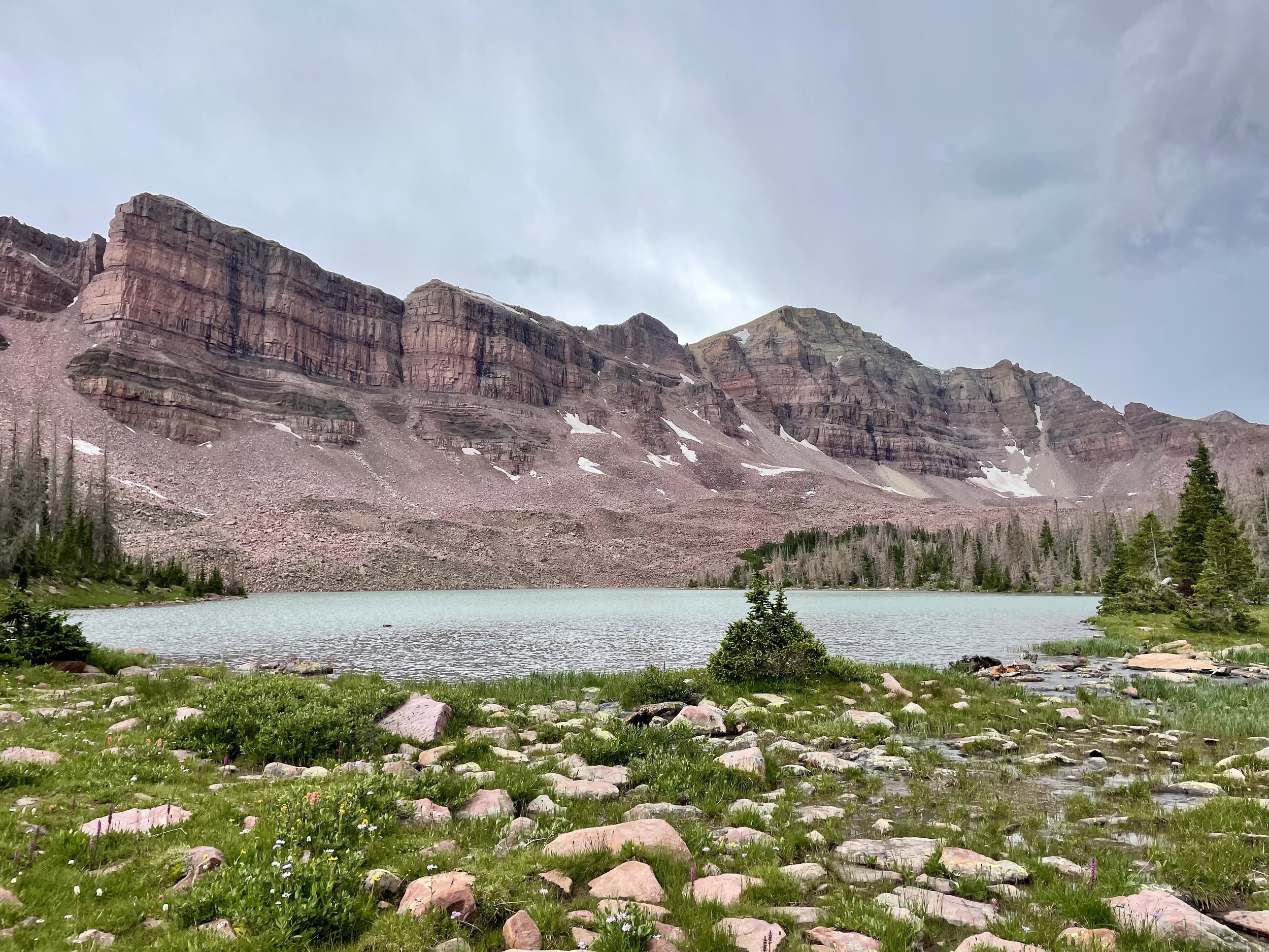
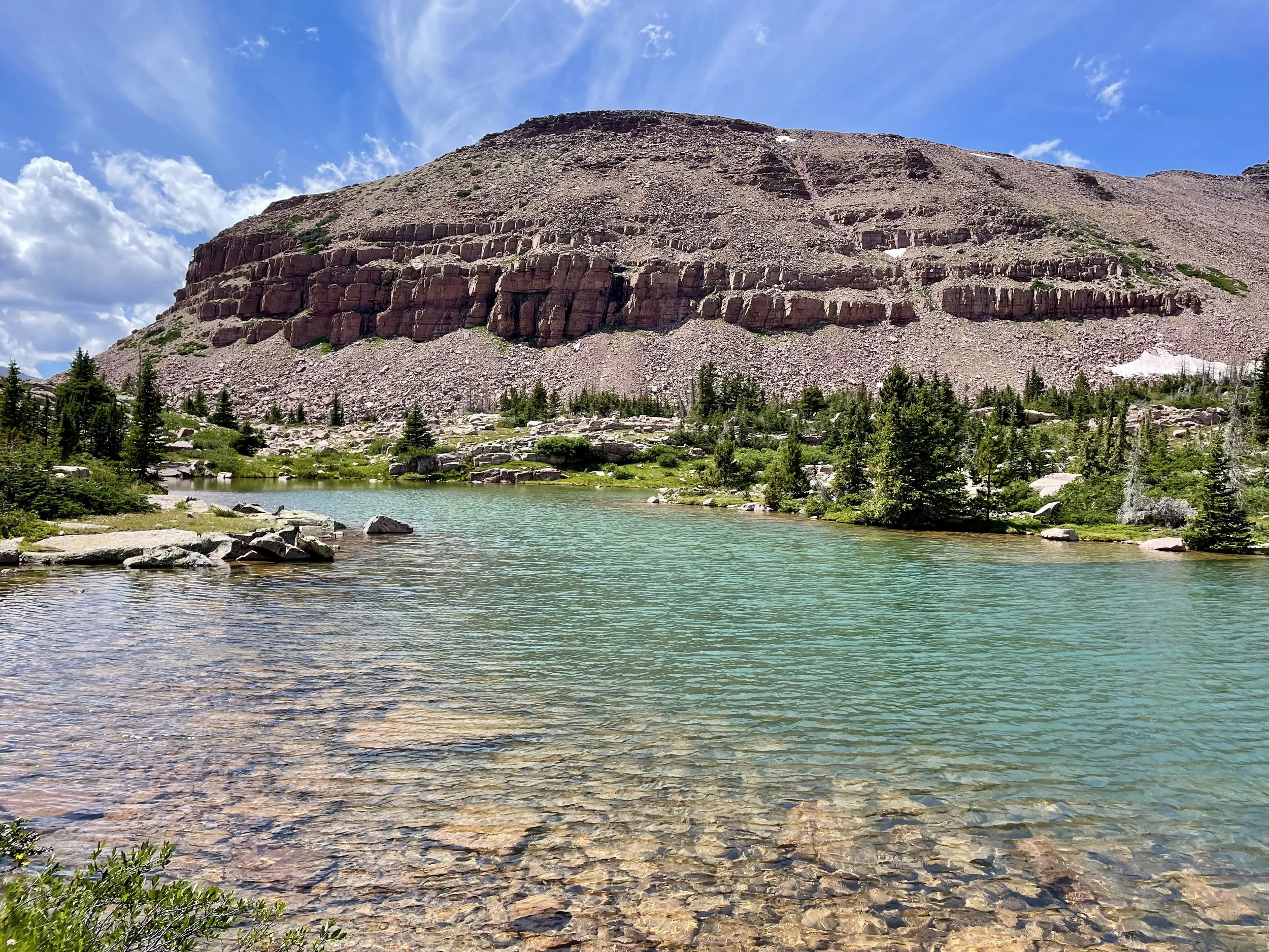
Dead Horse Lake
Our original plan for the next day and been to take Dead Horse Pass to the Ledge Lake trail and up to Cleveland Pass, but after how exhausting the first day was due to all of the swamps, we were a little concerned about having swampy feet again for what would be another long day. So we decided to eliminate that leg of the trip and head back up Red Knob Pass in the morning and take the Uinta Highline Trail toward Lambert Meadow and set up camp somewhere before Porcupine Pass. We woke up early as we didn’t know what the weather would bring that day - the forecast was for a 20% chance of rain, but that’s what it also was for the day before when we saw hail and rain. We made it up and over Red Knob Pass in much better weather and were able to stop to take in the views this time. The views in all directions were stunning. We only saw one other person that day who was thru hiking the Uinta Highline Trail. We had much better weather all day and set up camp around treeline before Porcupine Pass.
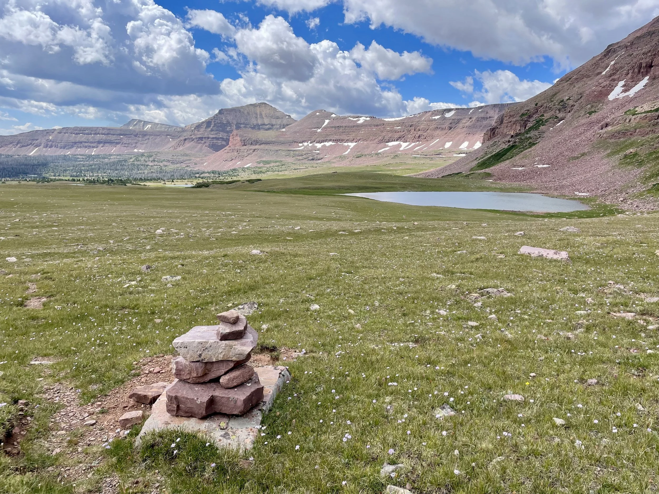
That night, I updated the weather forecast on my Garmin InReach Mini, and the weather forecast for the following day had changed to a 60% of chance of rain and lightning starting at 8am and lasting through the day from a previous forecast of sun. This was a big concern for us as our plan was to head over an off-trail above treeline pass that would take us into the Red Castle Lake drainage. We would be above treeline for quite some time and after the thunder and lightning we got caught in the first day above treeline, we didn’t want to push our luck. We decided what we would do was wake up at 4am and update the weather forecast and make our decision then. At 4am, the weather forecast suggested only a 40% chance of rain and lightning at 8am and that it would go down to 0% by 3pm. We decided the best course of action would be to sleep in and get a late start to better time when we’d be exposed on the pass to be in the afternoon instead of the morning. We fell back asleep and woke up a few hours later, had a leisurely breakfast, and updated the weather again. At this point it was 10 am and we hadn’t seen any rain. The new forecast was for no rain all day. The weather changes so quickly in this range! This was our green light so we headed out for the pass that would take us into the Red Castle drainage. After several miles of hiking, we made it to the top of the pass, and had what initially looked like a fairly easy descent to the lakes. We were slightly wrong about that. Once we got further down, we realized that there were many little cliff bands that the topo map just didn’t pick up. We ended up hitting a couple of dead ends until we figured out the right way to make it through the cliff maze down to the lake. During this maze stage of the day, we were suddenly in the middle of another hailstorm. And then another hailstorm followed by another. I think it’s the most I’ve been hailed on in one trip. When we got down to the lake, we were greeted by over 10 people fishing. This was a shock to our systems as we had only seen 1 person in the last 2.5 days. We decided to keep heading down to find a campsite near Lower Red Castle Lake. The views on this day were some of my favorite. I can understand why that drainage is so popular. Unsurprisingly, we were greeted with another hailstorm as we approached the lower lake. We set up camp and headed to bed quite early as the adrenaline of that day wore off.
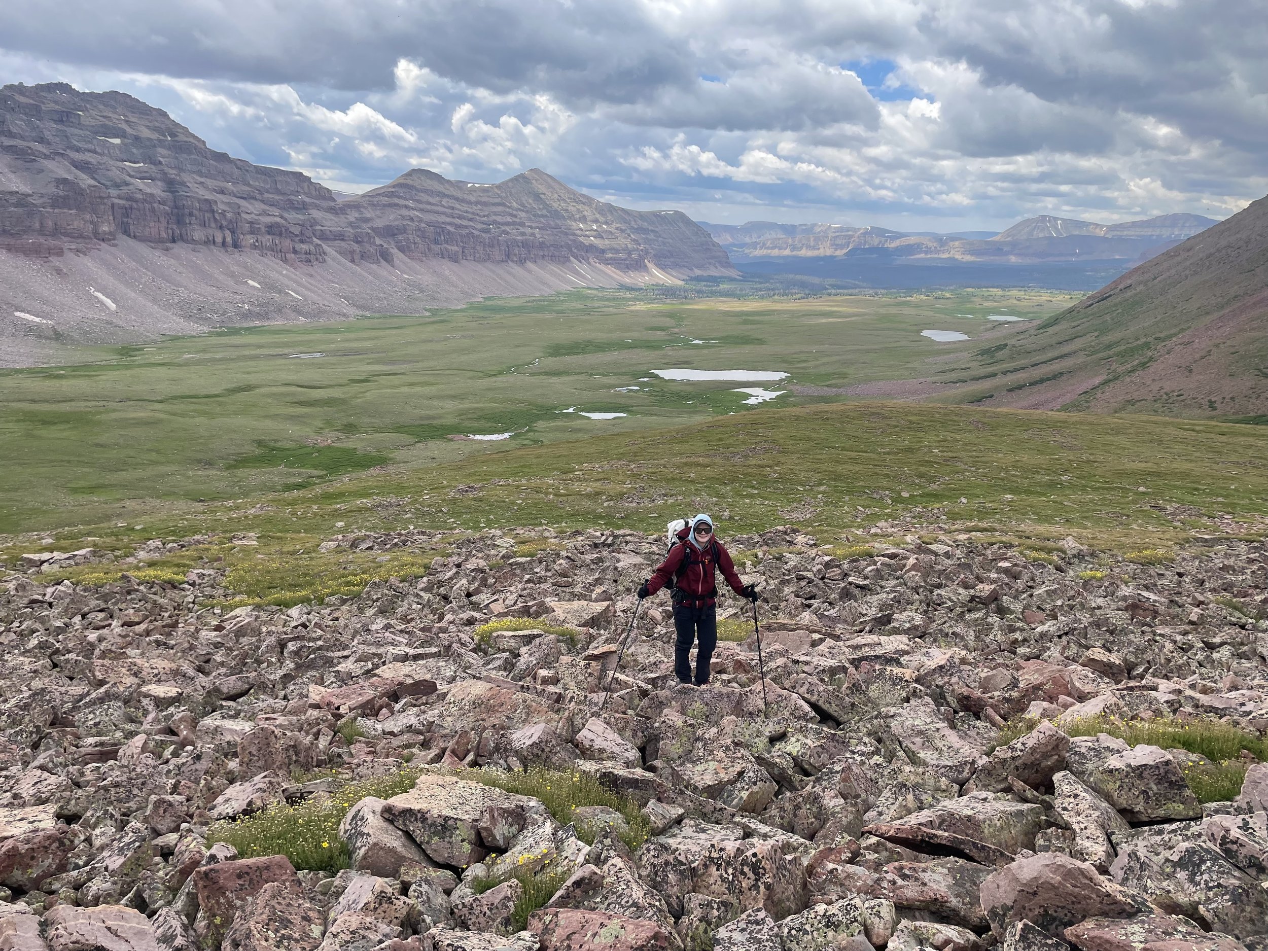
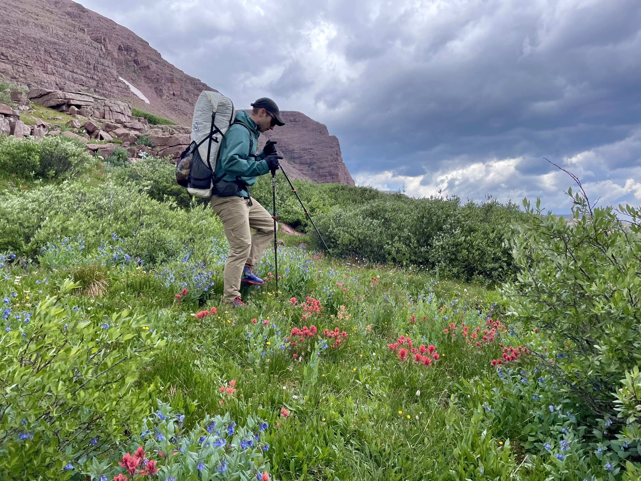
Krista heading up the pass that would take us to Red Castle Lakes
The following morning, we woke up early with hopes of making it back to the car by lunchtime. We packed up our gear and set out on the trail. The day started out with a decently long ascent that took us to the top of a wide, open ridge. On this ridge, we were greeted by hundreds of sheep, which was not what we were expecting. We had over a mile to walk on this ridge, which inadvertently turned into sheep herding as they just “ran away” from us by continuing to run down the trail the same direction we were going instead of running away a different direction. It was pretty entertaining. We finally made it through all of the sheep and started our descent back to the car. This descent felt particularly long, with a lot of sharp switchbacks in the last few miles of the day. My knees were ready for a break by the time we got back to the car. It was another great day to end a wonderful trip. We can’t wait to plan our next one in the Uintas.
Total stats: 45.6 miles, 9100 vert.
Day 1: 15 miles, 3450 vert.
Day 2: 13 miles, 2800 vert.
Day 3: 6.6 miles, 1400 vert.
Day 4: 11 miles, 1450 vert.


Gear List
Map: High Uintas Wilderness Map
Compass: SUUNTO M-3 Compass
Emergency Communication Device: Garmin inReach Mini 2 *requires a subscription
First Aid Kit: Adventure Medical Kit *I have added items to this kit and would recommend tailoring a medical kit to your needs
Lighter: BIC Lighter
Emergency Blanket: SOL Emergency Blanket
Shell/Rain Jacket: REI Co-op XeroDry GTX Jacket
Headlamp: Black Diamond Equipment Spot
Multi Tool: Leatherman Squirt PS4 Multi Tool
Tent: Big Agnes Copper Spur HV UL
Tent Footprint: Big Agnes Footprint for Copper Spur HV UL
Backpack: Hyperlite Mountain Gear Junction 55
Water Filter: Sawyer Squeeze Water Filtration System
Stove: MSR PocketRocket 2 Ultralight Stove
Fuel: Jetboil Jetpower Fuel
Kettle: MSR Titan Ultralight Titanium Backpacking Kettle
Water Bottle: Platypus DuoLock SoftBottle Flexible Water Bottle
Spork: Sea to Summit Alpha Light Long Spork
WAG bags for human waste: Cleanwaste WAG bags
Sleeping Pad: Sea to Summit Ether Light XT
Pillow: Sea to Summit Aeros Premium Inflatable Travel Pillow
Sleeping Bag: Western Mountaineering Ultralite 20 Degree Sleeping Bag
Shirt: Patagonia Capilene Cool Daily Hoodie
Pants: Black Diamond Womens Alpine Light Pants
Socks: Darn Tough Hiker Micro Crew Midweight Sock with Cushion
Underwear: Smartwool Intraknit Hipster Bikini
Sunglasses: Smith Lowdown Slim 2
Toothbrush: GUM Travel Toothbrush
Toothpaste: SuperBee Dentos Toothpaste Tablets
Hairbrush: Folding Hairbrush
Body Wipes: Pampers Sensitive Water Based Hypoallergenic and Unscented Baby Wipes
Trekking Poles: REI Co-op Flash Carbon Compact Trekking Poles
Camp shoes: Xero Shoes Women’s Z-trail Ev
Mug/cup: GSI Outdoors Infinity Backpacker Mug
Towel: REI Co-op Multi Towel Mini
Power Bank: Nitecore NB10000 Gen II Ultra-Slim Power Bank
Packing Cubes: Eagle Creek Packing Cubes
Chair: Helinox Chair Zero Ultralight Compact Camping Chair
Mosquito Head Net: Sea to Summit Ultra-Mesh Mosquito Head Net
Knife: LEATHERMAN Skeletool KBX Pocket Multitool with Knife and Bottle Opener